
SEVERE TROPICAL STORM SIONY (ATSANI) ADVISORY NO. 07Issued at: 7:00 PM PhT (11:00 GMT) Thursday, 05 November 2020
Next update: 7:00 AM PhT (23:00 GMT) Friday, 06 November 2020 |
|
|---|---|
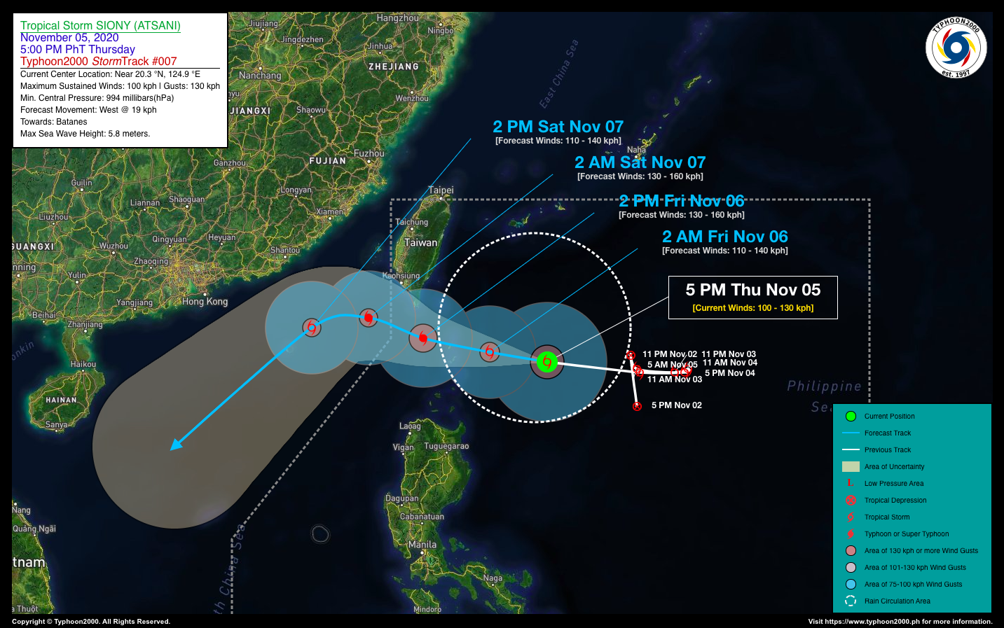
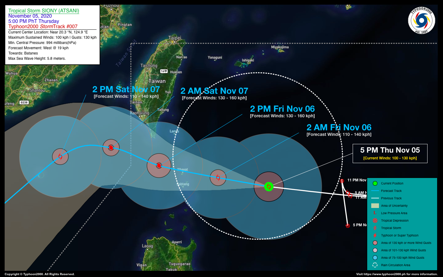
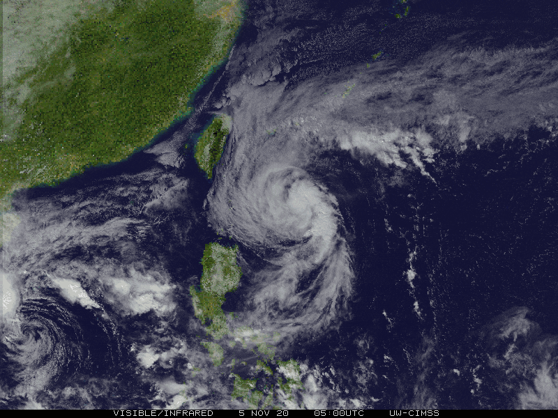
| Current Status & Outlook | Severe Tropical Storm SIONY (ATSANI) continues to move westward closer to the Batanes Island Group…expected to pass over or very close to the northern island of Itbayat tomorrow morning.
24-hr Outlook: STS SIONY (ATSANI) is forecast to maintain its westerly track with a slight bend to the north at a forward speed of 19 km/hr, and could become a minimal Typhoon (Category 1) on or before it passes the Batanes Group by tomorrow morning or noontime. After passing over the said island group, this storm is expected to move out of the norhwestern border of the Philippine Area of Responsibility (PAR) by tomorrow, Friday evening. |
| Where is SIONY (ATSANI)? | As of 5:00 PM PhT today, November 05…0900 GMT:
|
| How strong is it? | Maximum Sustained Winds (1-min avg): 100 kph near the center…Gustiness: 130 kph. |
| Past Movement (06 hrs) | West @ 17 kph, towards Batanes-Babuyan Island Group |
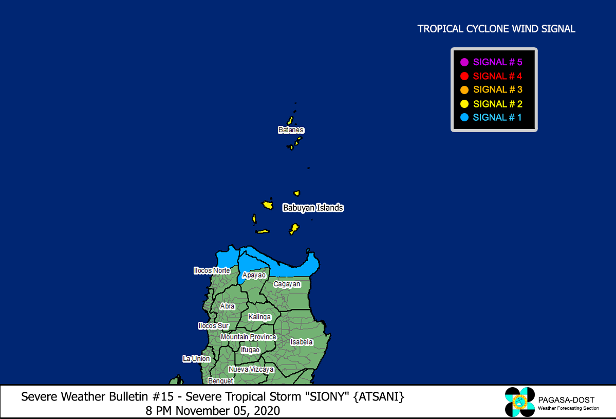
| Potential Philippine Landfall Area(s) |
|
| What Philippine areas will be directly affected? | Heavy to Extreme Rainfall (50 mm to >100 mm expected for 24 hrs):
Damaging Winds (gusts of more than 100 km/hr expected):
|
| Potential Storm Surge/Coastal Flooding Areas+ |
+Waves of 3 meters in height is expected in storm surge-prone areas, particularly in coastal areas on where the Tropical Cyclone is headed. Kindly visit the PAGASA Storm Surge Updates for more details. |
| 2-Day Forecast Outlook Summary** |
**Important Note: Please be reminded that the Forecast Outlook changes every 6 hours, and the Day 2 and 3 Forecast Track have an average error of 100 and 250 km respectively… while the wind speed forecast error, averages 35 km/hr per day. Therefore, a turn to the left or right of its future track and changes in its wind speed must be anticipated from time to time. |
| Other Storm’s Meteorological Information |
|
| Information based on data collected by Typhoon2000 (T2k) shall not be taken as official data. Weather information broadcasted and distributed by PAGASA remains as official data. Typhoon2000 (T2k) shall not be responsible for the private use and reliance of its weather information. | |
Issued by: David Michael V. Padua for Typhoon2000 (T2K)
PAGASA TROPICAL CYCLONE WIND SIGNAL
Image/Screenshot Source: DOST-PAGASA (http://pubfiles.pagasa.dost.


