

TYPHOON QUINTA (MOLAVE) ADVISORY NO. 11 [FINAL]Issued at: 7:00 AM PhT (23:00 GMT) Tuesday, 27 October 2020
|
|
|---|---|
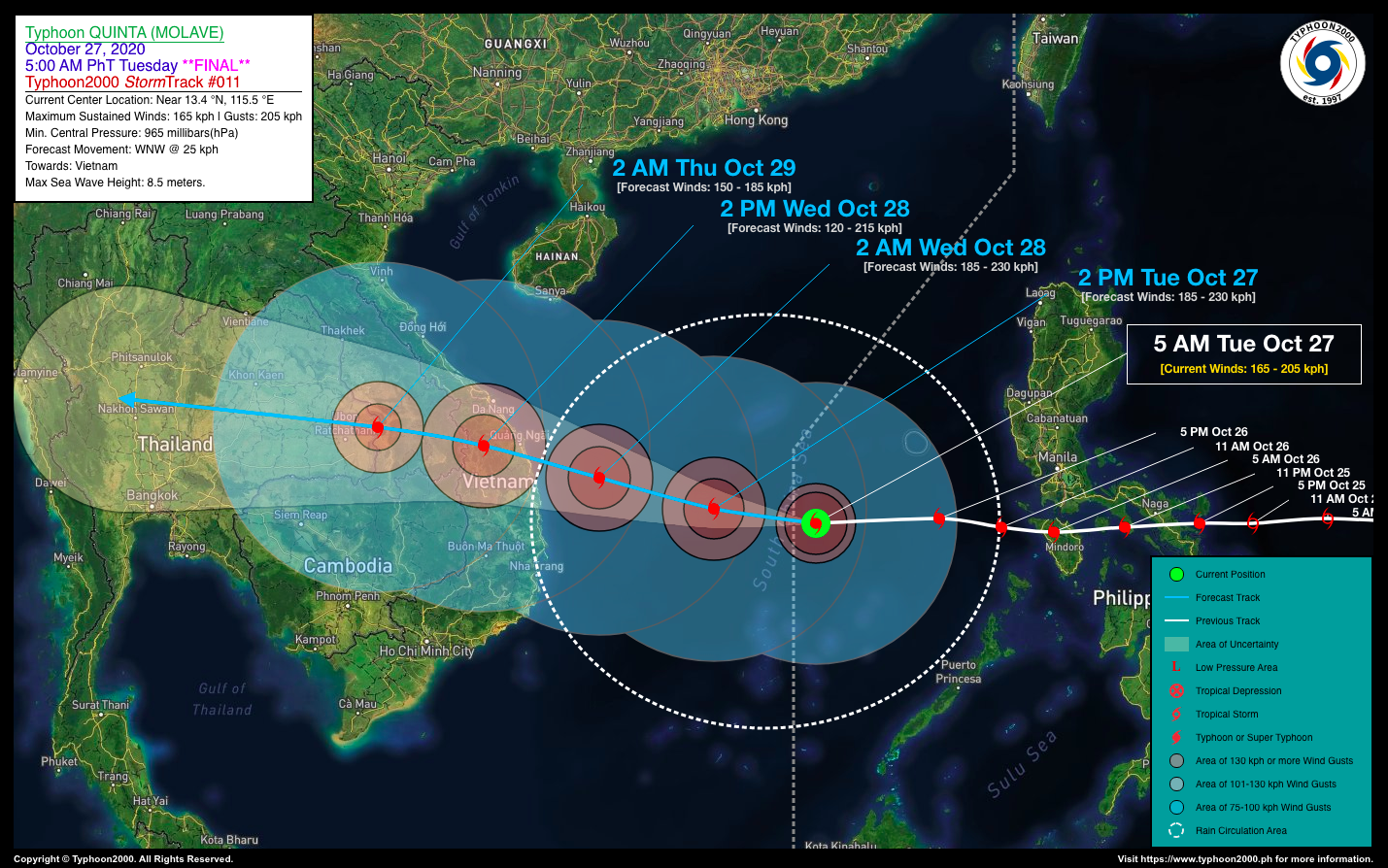
| Current Status & Outlook | Typhoon QUINTA (MOLAVE) is about to move out of the Philippine Area of Reponsibility (PAR) as it races towards Vietnam with powerful Category 2 sustained winds of 165 kph…eyeing to reach Category 3 later.
*This is the Final Advisory on this Tropical Cyclone. 24-hr Outlook: TY QUINTA (MOLAVE) is forecast to turn west-northwestward with of 25 km/hr, and could become a Category 3 this morning. Further intensification is likely as it approaches the shoreline of Central Vietnam tomorrow morning. |
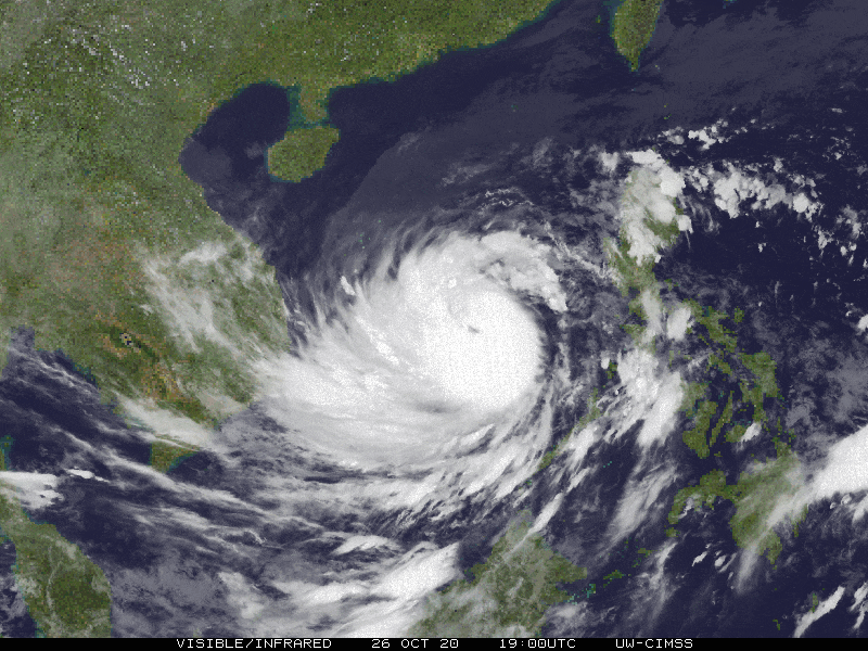
| Where is QUINTA (MOLAVE)? | As of 5:00 AM PhT today, October 27…2100 GMT. The eye was located over the West Philippine Sea, approaching the PAR line (near 13.4°N 115.5°E), about 500 km west of Lubang Island, Occidental Mindoro or 608 km west-southwest of Metro Manila. |
| How strong is it? | Maximum Sustained Winds (1-min avg): 165 kph near the center…Gustiness: 205 kph. |
| Past Movement (06 hrs) | West @ 25 kph, towards the Vietnam |
| Potential Philippine Landfall Area(s) |
|
| What Philippine areas will be directly affected? | Heavy to Extreme Rains (50 mm to >100 mm expected in 24 hrs):
Damaging Winds (gusts of more than 100 km/hr expected):
|
| Potential Storm Surge / Coastal Flooding Areas+ |
+Waves of 3 meters in height is expected in storm surge-prone areas, particularly in coastal areas on where the Tropical Cyclone is headed. Kindly visit the PAGASA Storm Surge Updates for more details. |
| 2-Day Forecast Outlook Summary** |
**Important Note: Please be reminded that the Forecast Outlook changes every 6 hours, and the Day 2 and 3 Forecast Track have an average error of 100 and 250 km respectively… while the wind speed forecast error, averages 35 km/hr per day. Therefore, a turn to the left or right of its future track and changes in its wind speed must be anticipated from time to time. |
| Other Storm’s Meteorological Information |
|
| Information based on data collected by Typhoon2000 (T2k) shall not be taken as official data. Weather information broadcasted and distributed by PAGASA remains as official data. Typhoon2000 (T2k) shall not be responsible for the private use and reliance of its weather information. | |
Issued by: David Michael V. Padua for Typhoon2000 (T2K)
PAGASA TROPICAL CYCLONE WIND SIGNAL
:: None ::
Image Source: DOST-PAGASA (http://pubfiles.pagasa.dost.


