


SEVERE TROPICAL STORM PAENG (NALGAE) ADVISORY NO. 08Issued at: 9:00 AM PhT (01:00 GMT) Saturday, 29 October 2022
Next update: 3:00 PM PhT (07:00 GMT) Saturday, 29 October 2022 |
|
|---|---|
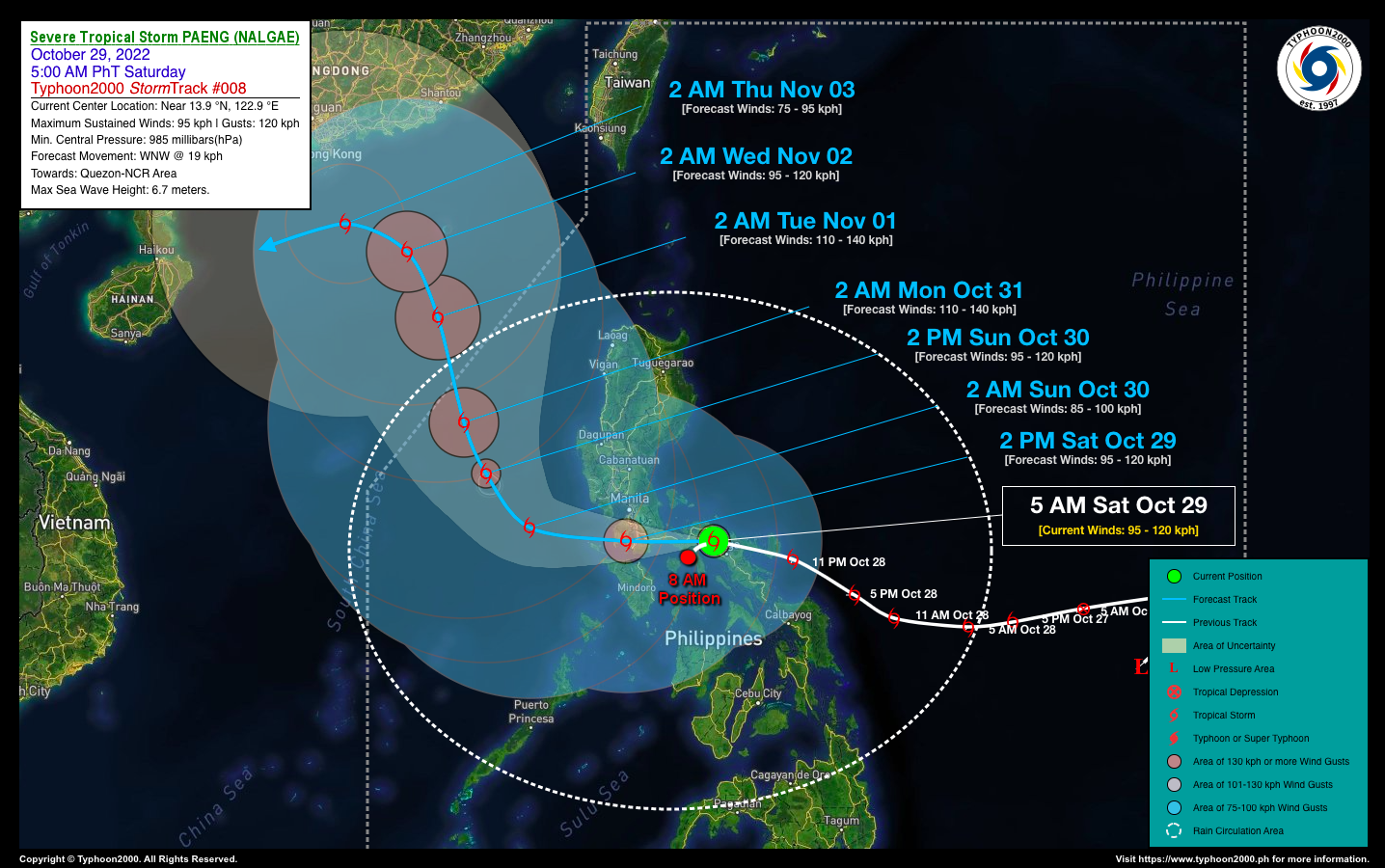
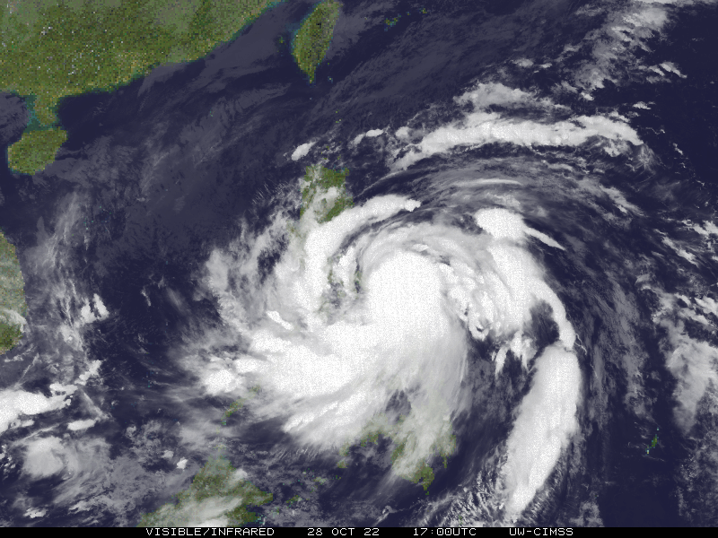
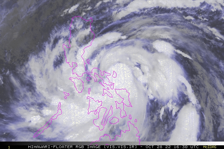
| Current Status & Outlook | Severe Tropical Storm PAENG (NALGAE) has undergone a trochoidal track across Northern Camarines Sur, sparing Metro Naga and nearby areas of wind damage…now accelerating fast towards Marinduque, after traversing Camarines Norte and Bondoc Peninsula.
The Typhoon2000 Automated Weather Station based in Naga City has recorded the lowest barometric readings of 983.6 hPa at 3:43 AM (19:43 GMT) which matches the TC classification/category of PAENG. The highest wind gust observed by this station was at 63 kph blowing from the Southeast at 5:40 AM (21:40 GMT). 24-hr Outlook: STS PAENG is forecast to resume moving west-northwest with a decreased forward speed of 19 km/hr, as it traverses Marinduque this morning. By 2 PM this afternoon, Paeng might be in the vicinity of Batangas and will be out into the West Philippine Sea tomorrow morning. The storm’s large rainbands and trough will continue to bring isolated to occasional rains & thunderstorms with gusty winds (30-60 kph) across Luzon, becoming more frequent and stormy across Bicol Region, Southern Tagalog Provinces, Visayas, MiMaRoPa, & Sulu Archipelago today. The risk of floods and landslides is currently at medium to high. |
| Where is PAENG? | As of 8:00 AM PhT today, October 29…0000 GMT:
|
| How strong is it? | Maximum Sustained Winds (1-min avg): 95 kph near the center…Gustiness: 120 kph. |
| Past Movement (06 hrs) | West @ 33 kph, towards Marinduque-Batangas-Mindoro Area. |
| Potential Philippine Major Landfall Area(s) |
|
| What Philippine areas will be directly affected? | Heavy to Extreme Rainfall (50 mm to >100 mm expected for 24 hrs):
Damaging Winds (gusts of more than 100 km/hr expected):
|
| Potential Storm Surge/Coastal Flooding Areas+ |
+Waves of 1 to 2 meters in height are expected in storm surge-prone areas, particularly in coastal areas where the Tropical Cyclone is headed. Kindly visit the PAGASA Storm Surge Updates for more details. |
| 2-Day Forecast Outlook Summary** |
**Important Note: Please be reminded that the Forecast Outlook changes every 6 hours, and the Day 2 and 3 Forecast Track have an average error of 100 and 250 km respectively… while the wind speed forecast error, averages 35 km/hr per day. Therefore, a turn to the left or right of its future track and changes in its wind speed must be anticipated from time to time. |
| Other Storm’s Meteorological Information |
|
| Disclaimer: Information based on data collected by Typhoon2000 (T2k) shall not be taken as official data. Weather information broadcasted and distributed by PAGASA remains as official data. Typhoon2000 (T2k) shall not be responsible for the private use and reliance of its weather information. | |
Issued by: David Michael V. Padua for Typhoon2000 (T2k)
Typhoon2000 (T2K) Integrated Multi-Agency Tracks

For more info visit: http://www.typhoon2000.ph/multi/?name=NALGAE
PAGASA TROPICAL CYCLONE WIND SIGNAL
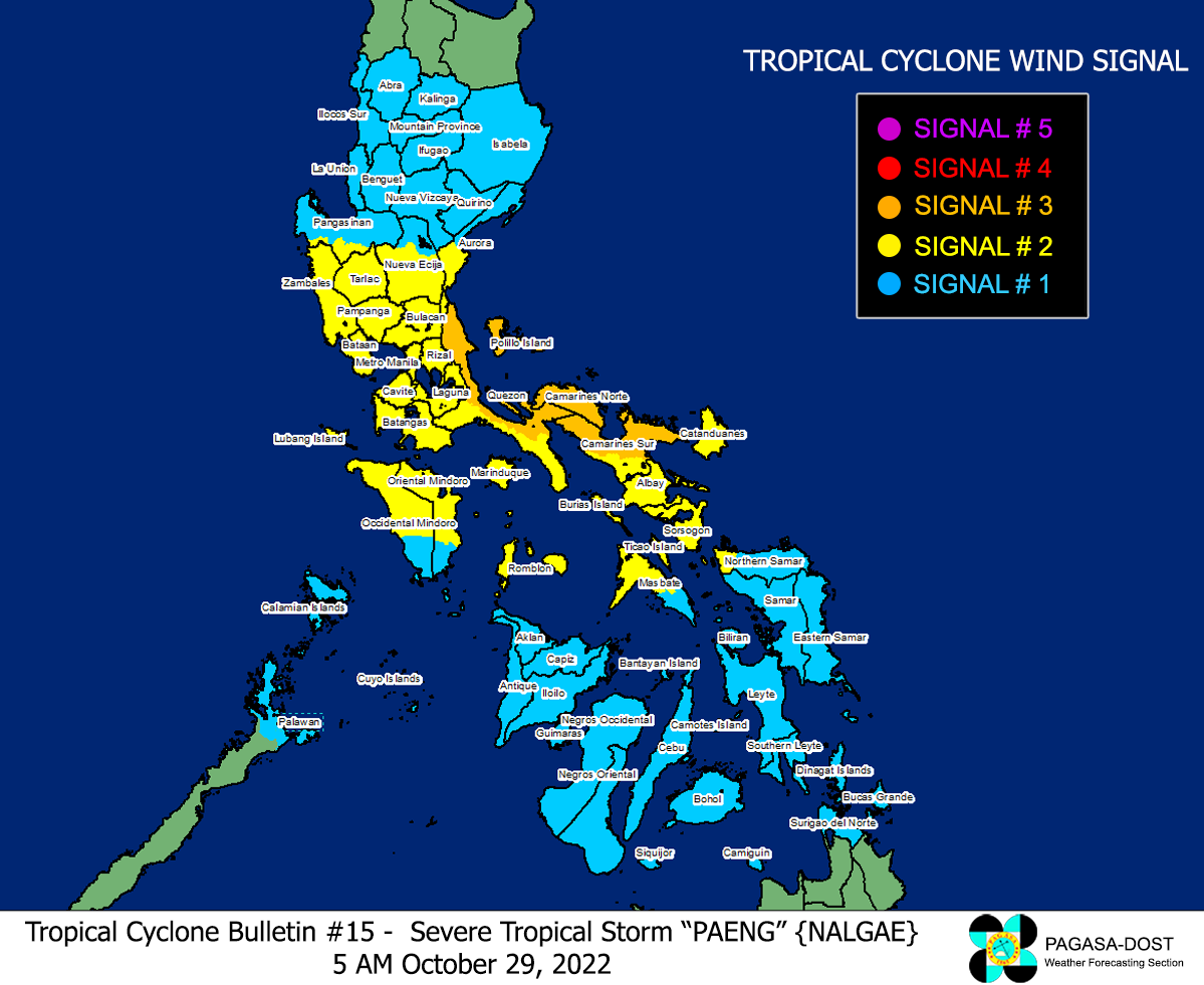
Image/Screenshot Source: DOST-PAGASA (https://bagong.pagasa.dost.gov.ph/tropical-cyclone/severe-weather-bulletin)


