
TROPICAL STORM NENENG (NESAT) ADVISORY NO. 04Issued at: 2:00 AM PhT (18:00 GMT) Sunday, 16 October 2022
Next update: 8:00 AM PhT (00:00 GMT) Sunday, 16 October 2022 |
|
|---|---|
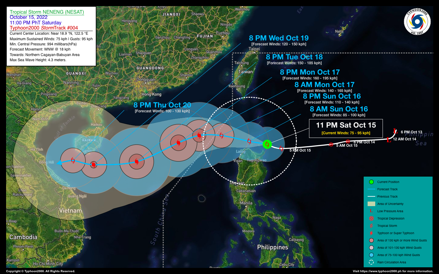
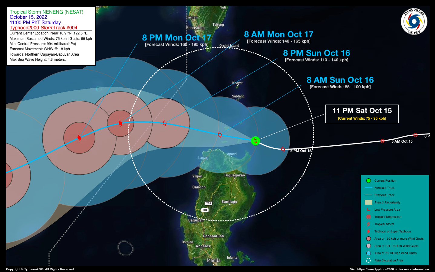
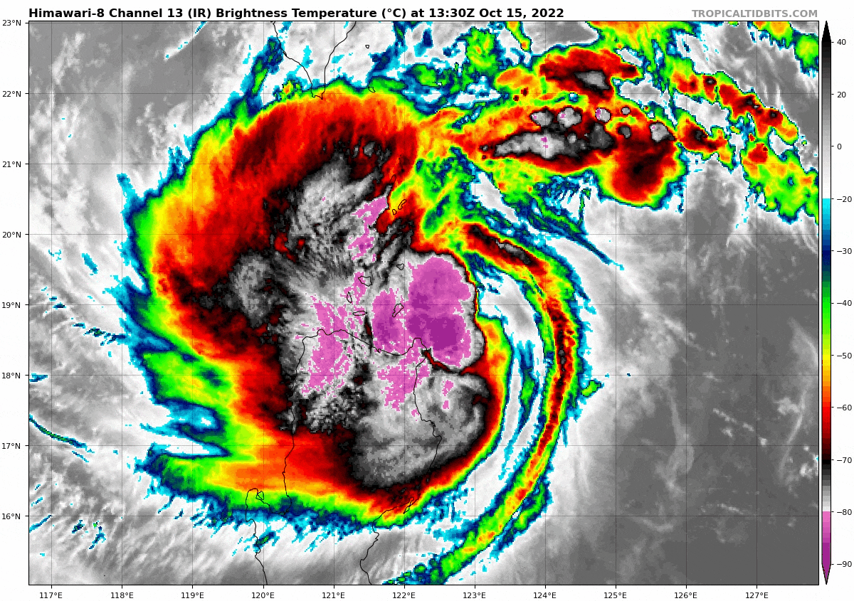
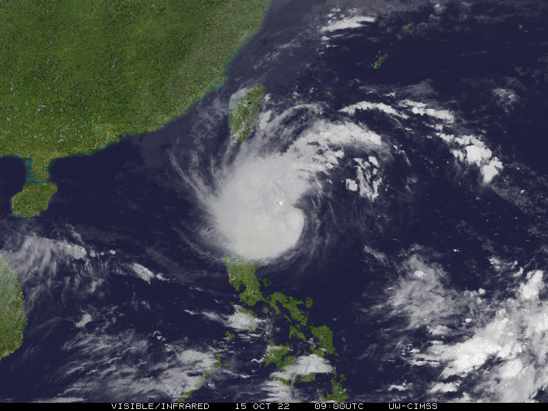
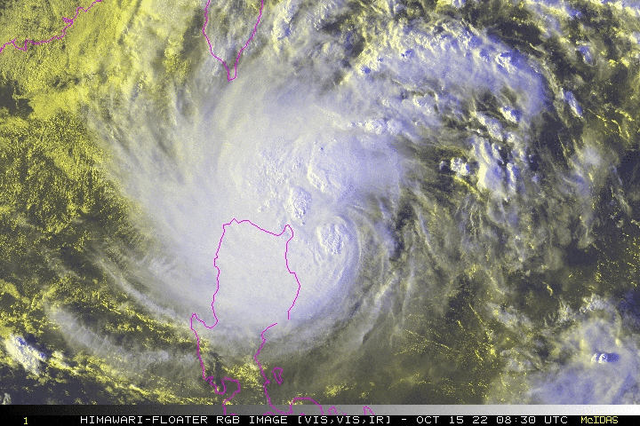
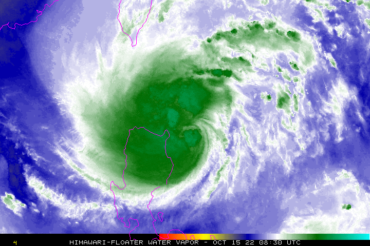
| Current Status & Outlook | The core of Tropical Storm NENENG (NESAT) is now passing to the north of Santa Ana, Cagayan as it gained more strength while turning slightly west-northwestward across the Balintang Channel. It is expected to cross the Babuyan Island Group this morning before passing close to the north of Ilocos Norte in the afternoon. Intense rainbands with tropical storm force-winds of up to 95 km/hr will be felt along Northern Cagayan, Babuyan Island Group, and Ilocos Norte today.
24-hr Outlook: TS NENENG is forecast to continue intensifying, becoming a Severe Tropical Storm (STS) this afternoon, while moving west-northwest across the northern coastal waters of Cagayan & Ilocos Norte, with a forward speed of 17 km/hr. Its western & southern rainbands will continue to spread across Northern Luzon, where flood-threatening rainfall and gusty winds of up to 75 km/hr will be felt today. |
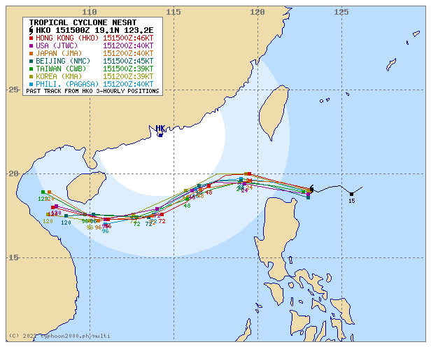
| Where is NENENG (NESAT)? | As of 11:00 PM PhT last night, October 15…1500 GMT:
|
| How strong is it? | Maximum Sustained Winds (1-min avg): 75 kph near the center…Gustiness: 95 kph. |
| Past Movement (06 hrs) | West-Northwest @ 18 kph, towards the Babuyan Island Group. |
| Potential Philippine Major Landfall Area(s) |
|
| What Philippine areas will be directly affected? | Heavy to Extreme Rainfall (50 mm to >100 mm expected for 24 hrs):
Damaging Winds (gusts of more than 100 km/hr expected):
|
| Potential Storm Surge/Coastal Flooding Areas+ |
+Waves of 2 meters in height are expected in storm surge-prone areas, particularly in coastal areas where the Tropical Cyclone is headed. Kindly visit the PAGASA Storm Surge Updates for more details. |
| 3-Day Forecast Outlook Summary** |
**Important Note: Please be reminded that the Forecast Outlook changes every 6 hours, and the Day 2 and 3 Forecast Track have an average error of 100 and 250 km respectively… while the wind speed forecast error, averages 35 km/hr per day. Therefore, a turn to the left or right of its future track and changes in its wind speed must be anticipated from time to time. |
| Other Storm’s Meteorological Information |
|
| Disclaimer: Information based on data collected by Typhoon2000 (T2k) shall not be taken as official data. Weather information broadcasted and distributed by PAGASA remains as official data. Typhoon2000 (T2k) shall not be responsible for the private use and reliance of its weather information. | |
Issued by: David Michael V. Padua for Typhoon2000 (T2k)
Typhoon2000 (T2K) Integrated Multi-Agency Tracks
For complete details, visit: http://www.typhoon2000.ph/multi/?name=NESAT
PAGASA TROPICAL CYCLONE WIND SIGNAL

Image/Screenshot Source: DOST-PAGASA (https://bagong.pagasa.dost.gov.ph/tropical-cyclone/severe-weather-bulletin)


