

SEVERE TROPICAL STORM MARING (KOMPASU) ADVISORY NO. 07 [FINAL]Issued at: 1:00 PM PhT (05:00 GMT) Tuesday, 12 October 2021
|
|
|---|---|
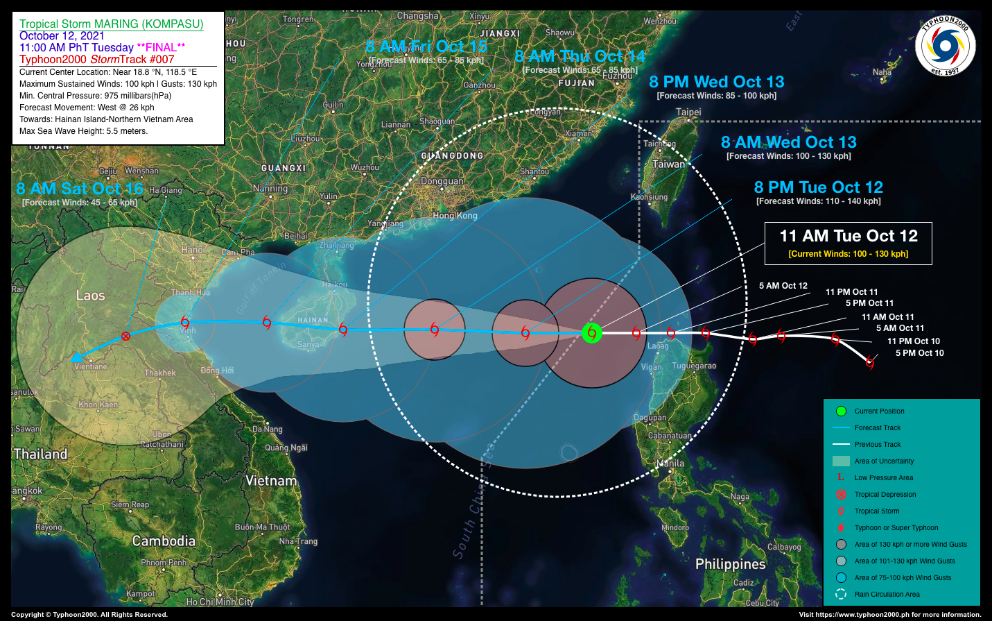
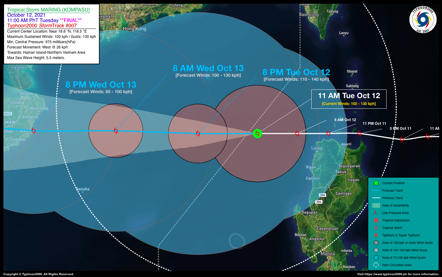
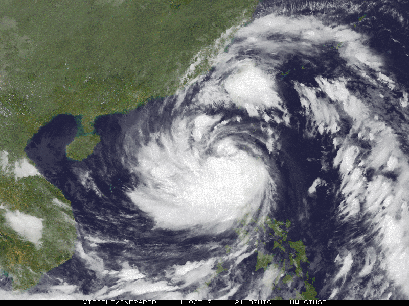
| Current Status & Outlook | Severe Tropical Storm MARING (KOMPASU) has quickly moved out of the Philippine Area of Responsibility (PAR) as it heads towards Hainan Island-Northern Vietnam Area. Its large eastern rainbands will continue to bring rainfall across the western sections of Luzon.
*This is the Final Advisory on this Tropical Cyclone. 24-hr Outlook: STS MARING (KOMPASU) is forecast to maintain its westerly course at a speed of 26 km/hr, and will intensify slightly within the next 12 hours. The core of STS MARING is expected to move into the South China Sea tonight and will be approaching the coastal waters of Hainan Island by tomorrow afternoon (Oct 13). The presence of this large Tropical Cyclone will continue to enhance the Southwest Monsoon (Habagat) bringing cloudy skies with passing “on-and-off” monsoon rains with possible Severe Thunderstorms and gusty winds of 30-60 kph across Central & Southern Luzon including Metro Manila, MiMaRoPa, Sulu Archipelago, Visayas, & Western Mindanao today. The effect of this monsoon weather will be more frequent along the western sections with rough seas across the archipelago. Improving weather conditions will be expected in the next couple of days. |
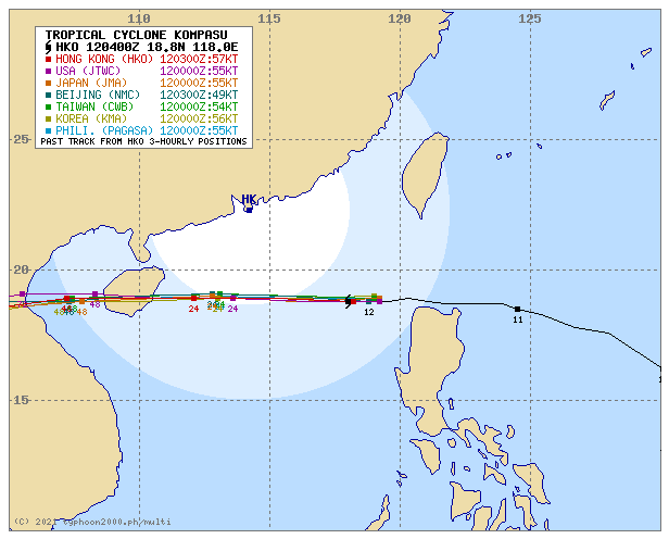
| Where is MARING (KOMPASU)? | As of 12:00 PM PhT today, October 12…0400 GMT:
|
| How strong is it? | Maximum Sustained Winds (1-min avg): 100 kph near the center…Gustiness: 130 kph. |
| Past Movement (06 hrs) | West @ 22 kph, towards Hainan Island and Northern Vietnam. |
| Potential Philippine Landfall Area(s) |
|
| What Philippine areas will be directly affected? | Heavy to Extreme Rainfall (50 mm to >100 mm expected for 24 hrs):
Damaging Winds (gusts of more than 100 km/hr expected):
|
| Potential Storm Surge/Coastal Flooding Areas+ |
+Waves of 1 to 2 meters in height are expected in storm surge-prone areas, particularly in coastal areas where the Tropical Cyclone is headed. Kindly visit the PAGASA Storm Surge Updates for more details. |
| 2-Day Forecast Outlook Summary** |
**Important Note: Please be reminded that the Forecast Outlook changes every 6 hours, and the Day 2 and 3 Forecast Track have an average error of 100 and 250 km respectively… while the wind speed forecast error, averages 35 km/hr per day. Therefore, a turn to the left or right of its future track and changes in its wind speed must be anticipated from time to time. |
| Other Storm’s Meteorological Information |
|
| Information based on data collected by Typhoon2000 (T2k) shall not be taken as official data. Weather information broadcasted and distributed by PAGASA remains as official data. Typhoon2000 (T2k) shall not be responsible for the private use and reliance of its weather information. | |
Issued by: David Michael V. Padua for Typhoon2000 (T2K)
Typhoon2000 (T2K) Integrated Multi-Agency Tracks
PAGASA TROPICAL CYCLONE WIND SIGNAL
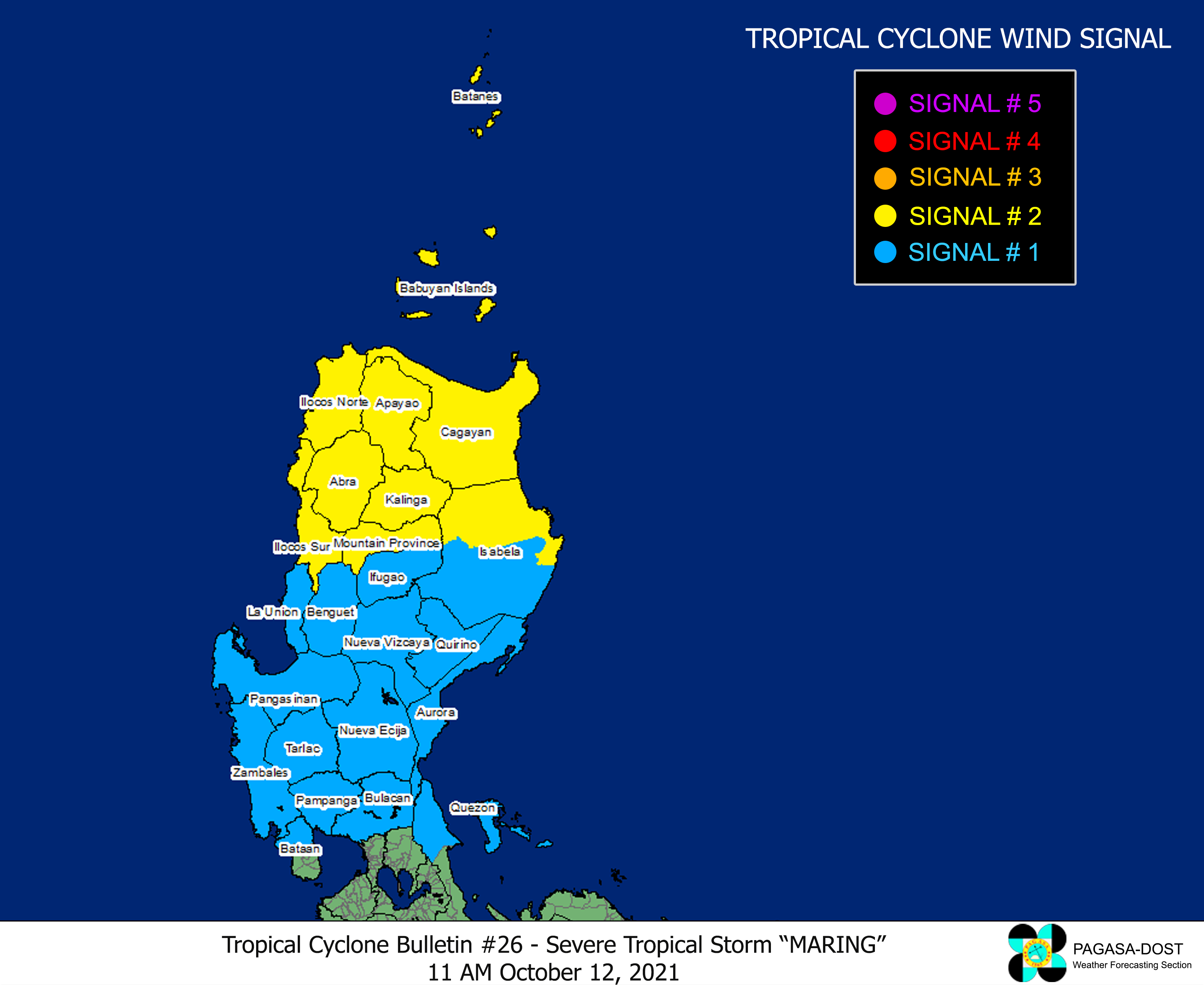
Image/Screenshot Source: DOST-PAGASA (http://bagong.pagasa.dost.gov.ph/tropical-cyclone-bulletin-iframe)


