
SUPER TYPHOON KIKO (CHANTHU) ADVISORY NO. 02Issued at: 7:00 AM PhT (23:00 GMT) Thursday, 09 September 2021
Next update: 7:00 PM PhT (11:00 GMT) Thursday, 09 September 2021 |
|
|---|---|
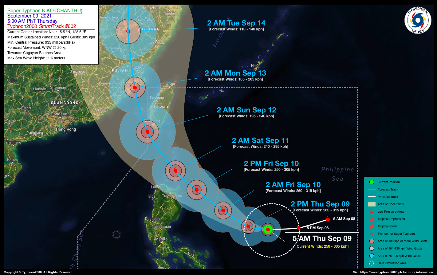
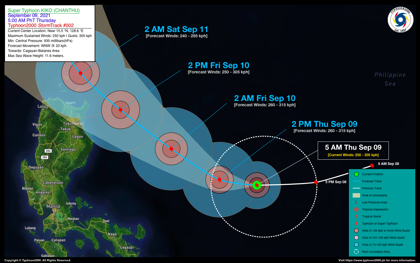
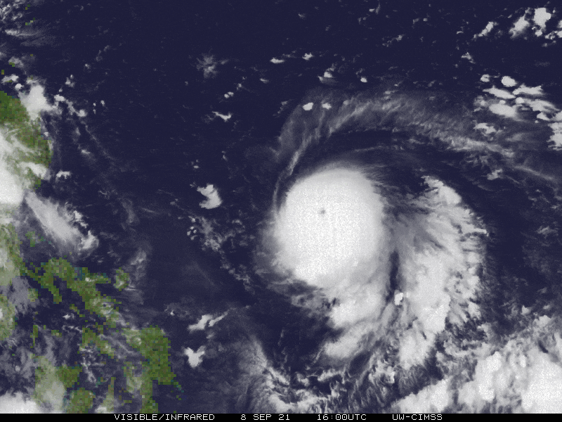
| Current Status & Outlook | Super Typhoon KIKO (CHANTHU) has turned westward during the past 6 hours and weakened slightly while its core undergoes an Eyewall Replacement Cycle (ERC) as depicted on the latest CIMSS-MIMIC data run. This howler remains a serious threat to Cagayan and Batanes Provinces, and is likely to approach the area on Friday and Saturday.
24-hr Outlook: STY KIKO (CHANTHU) is forecast to re-intensify back to to Category 5 status upon the completion of its ERC…and will turn more west-northwestward across the Philippine Sea at a forward speed of 20 km/hr, with winds increasing back to 260 km/hr. |
| Where is KIKO (CHANTHU)? | As of 5:00 AM PhT today, September 09…2100 GMT:
|
| How strong is it? | Maximum Sustained Winds (1-min avg): 250 kph near the center…Gustiness: 305 kph. |
| Past Movement (06 hrs) | West @ 22 kph, across the Central Philippine Sea. |
| Potential Philippine Landfall Area(s) |
|
| What Philippine areas will be directly affected? | Heavy to Extreme Rainfall (50 mm to >100 mm expected for 24 hrs):
Damaging Winds (gusts of more than 100 km/hr expected):
|
| Potential Storm Surge/Coastal Flooding Areas+ |
+Waves of 2 to 6 meters in height is expected in storm surge-prone areas, particularly in coastal areas on where the Tropical Cyclone is headed. Kindly visit the PAGASA Storm Surge Updates for more details. |
| 3-Day Forecast Outlook Summary** |
**Important Note: Please be reminded that the Forecast Outlook changes every 6 hours, and the Day 2 and 3 Forecast Track have an average error of 100 and 250 km respectively… while the wind speed forecast error, averages 35 km/hr per day. Therefore, a turn to the left or right of its future track and changes in its wind speed must be anticipated from time to time. |
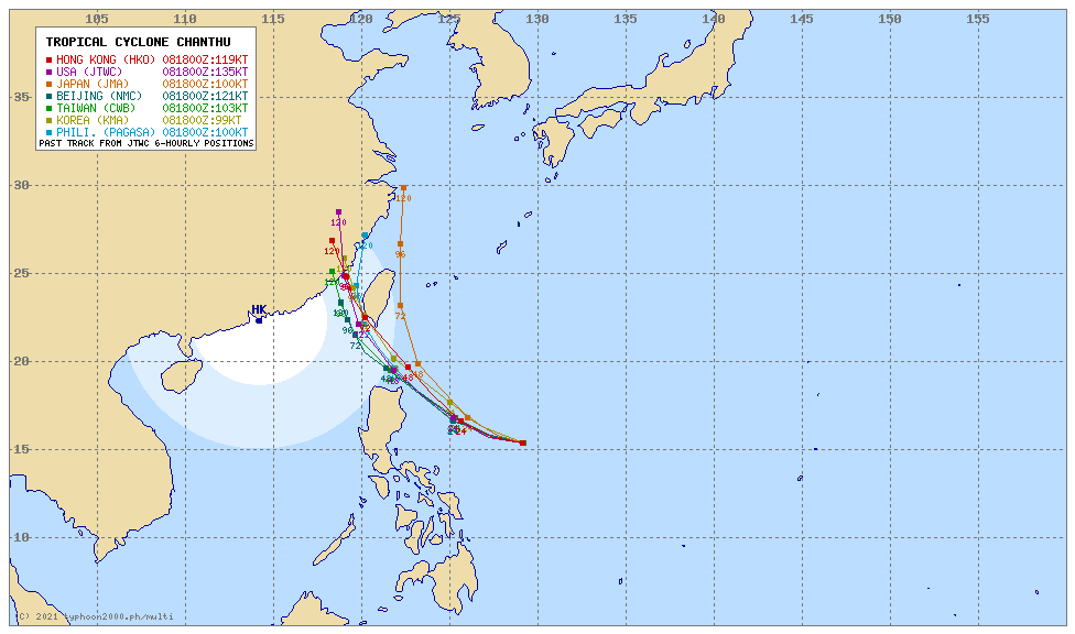
| Other Storm’s Meteorological Information |
|
| Information based on data collected by Typhoon2000 (T2k) shall not be taken as official data. Weather information broadcasted and distributed by PAGASA remains as official data. Typhoon2000 (T2k) shall not be responsible for the private use and reliance of its weather information. | |
Issued by: David Michael V. Padua for Typhoon2000 (T2K)
Typhoon2000 (T2K) Integrated Multi-Agency Tracks
PAGASA TROPICAL CYCLONE WIND SIGNAL

Image/Screenshot Source: DOST-PAGASA (http://bagong.pagasa.dost.gov.ph/tropical-cyclone-bulletin-iframe/2)


