

TYPHOON KARDING (NORU) ADVISORY NO. 10Issued at: 8:00 PM PhT (12:00 GMT) Sunday, 25 September 2022
Next update: 2:00 AM PhT (18:00 GMT) Monday, 26 September 2022 |
|
|---|---|
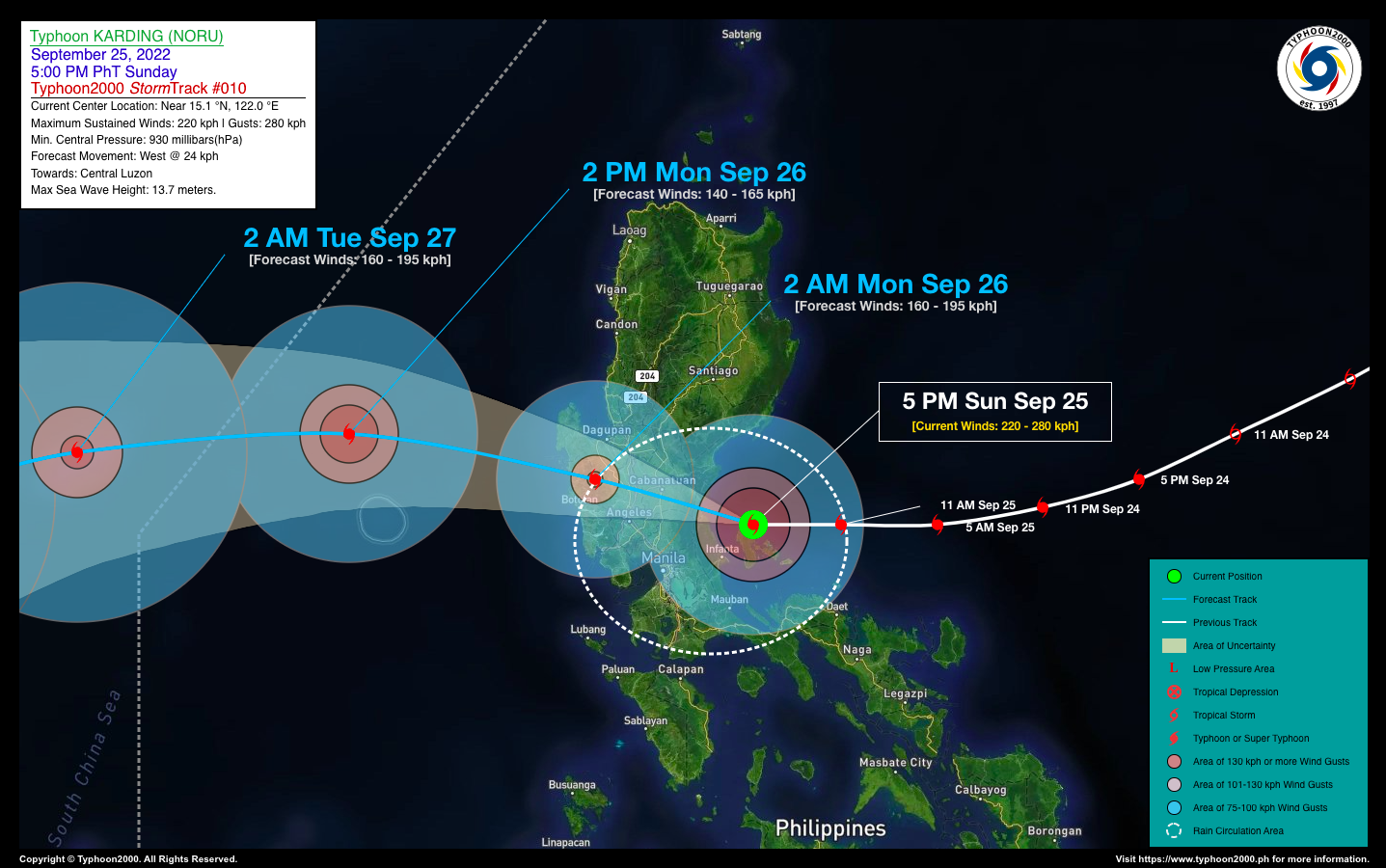
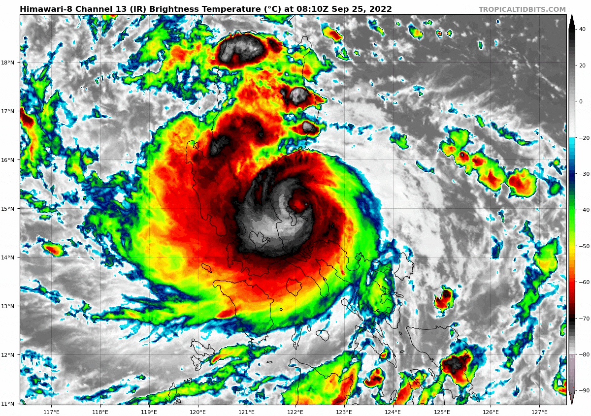
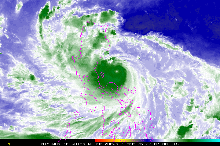
| Current Status & Outlook | Super Typhoon KARDING [NORU] has been downgraded to a Category 4 Typhoon (TY) after passing along the northern coastal waters of Polillo Island Group…now inching closer to the coastal waters of Dingalan Bay in Southern Aurora. The core (eye + eyewall) is about to make landfall along the Boundary of Aurora and Quezon/Dingalan Bay (or somewhere between the towns of General Nakar and Dingalan) between 7 to 9 PM tonight.
Residents living along the path of this howler must be fully prepared as the core is expected to begin crossing Central Luzon tonight. Please take all necessary precautions. 24-hr Outlook: TY KARDING is forecast to weaken further as it turns west-northwestward at an accelerated forward speed of 24 km/hr. The core (eye + eyewall) of this howler will start to cross the provinces of Central Luzon via Nueva Ecija, Northern Bulacan, Northern Pampanga, Tarlac, & Zambales tonight through early tomorrow morning. At around 2AM tomorrow morning, KARDING is forecast to be in the vicinity of Zambales Mountains, near Masinloc and will then emerge over the West Philippine Sea with decreased winds of 160 kph (Category 2). Meanwhile, Metro Manila and the rest of CaLaBaRZon will be under the typhoon’s inner bands, where gusty winds of 75 to 100 km/hr will be expected during its closest approach to the area tonight (approx. 8-11PM). Meanwhile, this typhoon will continue to enhance the Southwest Monsoon (Habagat) and bring occasional rains and thunderstorms across Bicol Region, MiMaRoPa, Sulu Archipelago, Visayas and Western Mindanao beginning tonight through tomorrow (Sept 26). |
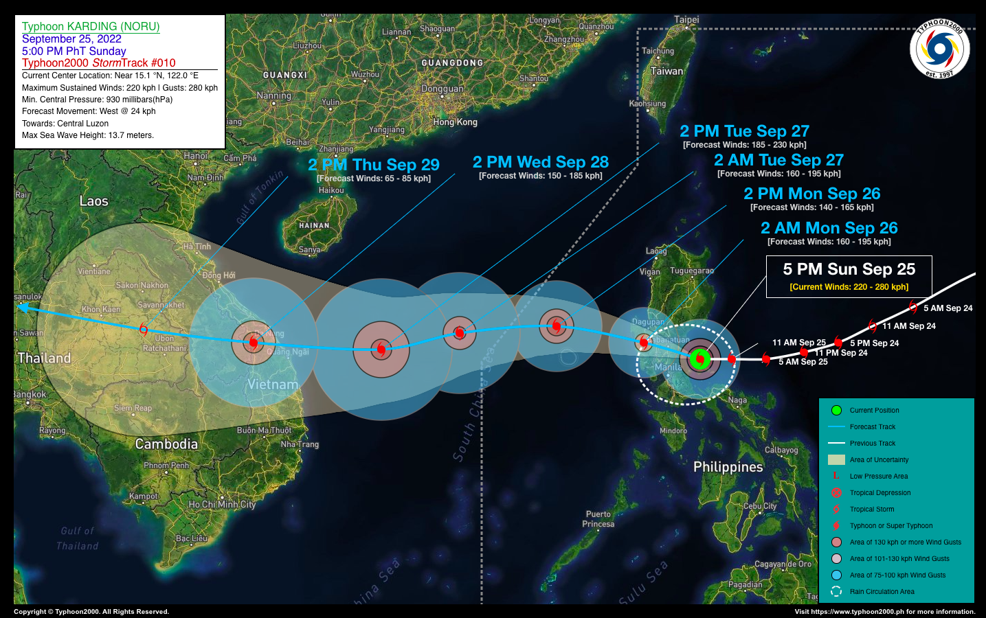
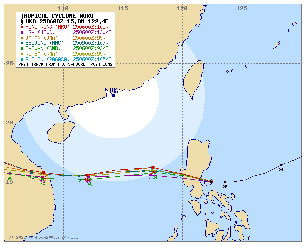
| Where is KARDING (NORU)? | As of 5:00 PM PhT today, September 25…0900 GMT:
|
| How strong is it? | Maximum Sustained Winds (1-min avg): 220 kph near the center…Gustiness: 280 kph. |
| Past Movement (06 hrs) | West @ 18 kph, towards Southern Aurora & Central Luzon. |
| Potential Philippine Major Landfall Area(s) |
|
| What Philippine areas will be directly affected? | Heavy to Extreme Rainfall (50 mm to >100 mm expected for 24 hrs):
Damaging Winds (gusts of more than 100 km/hr expected):
|
| Potential Storm Surge/Coastal Flooding Areas+ |
+Waves of 2 to 6 meters in height are expected in storm surge-prone areas, particularly in coastal areas where the Tropical Cyclone is headed. Kindly visit the PAGASA Storm Surge Updates for more details. |
| 2-Day Forecast Outlook Summary** |
**Important Note: Please be reminded that the Forecast Outlook changes every 6 hours, and the Day 2 and 3 Forecast Track have an average error of 100 and 250 km respectively… while the wind speed forecast error, averages 35 km/hr per day. Therefore, a turn to the left or right of its future track and changes in its wind speed must be anticipated from time to time. |
| Other Storm’s Meteorological Information |
|
| Information based on data collected by Typhoon2000 (T2k) shall not be taken as official data. Weather information broadcasted and distributed by PAGASA remains as official data. Typhoon2000 (T2k) shall not be responsible for the private use and reliance of its weather information. | |
Issued by: David Michael V. Padua for Typhoon2000 (T2k)
Typhoon2000 (T2K) Integrated Multi-Agency Tracks
PAGASA TROPICAL CYCLONE WIND SIGNAL

Image/Screenshot Source: DOST-PAGASA (https://bagong.pagasa.dost.gov.ph/tropical-cyclone/severe-weather-bulletin)


