
TROPICAL STORM KARDING (NORU) ADVISORY NO. 04Issued at: 8:00 AM PhT (00:00 GMT) Saturday, 24 September 2022
Next update: 2:00 PM PhT (06:00 GMT) Saturday, 24 September 2022 |
|
|---|---|
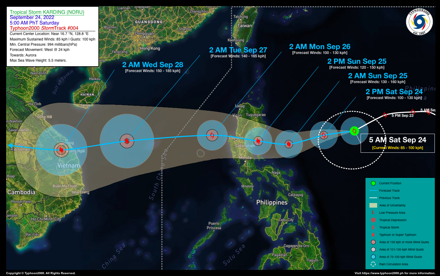
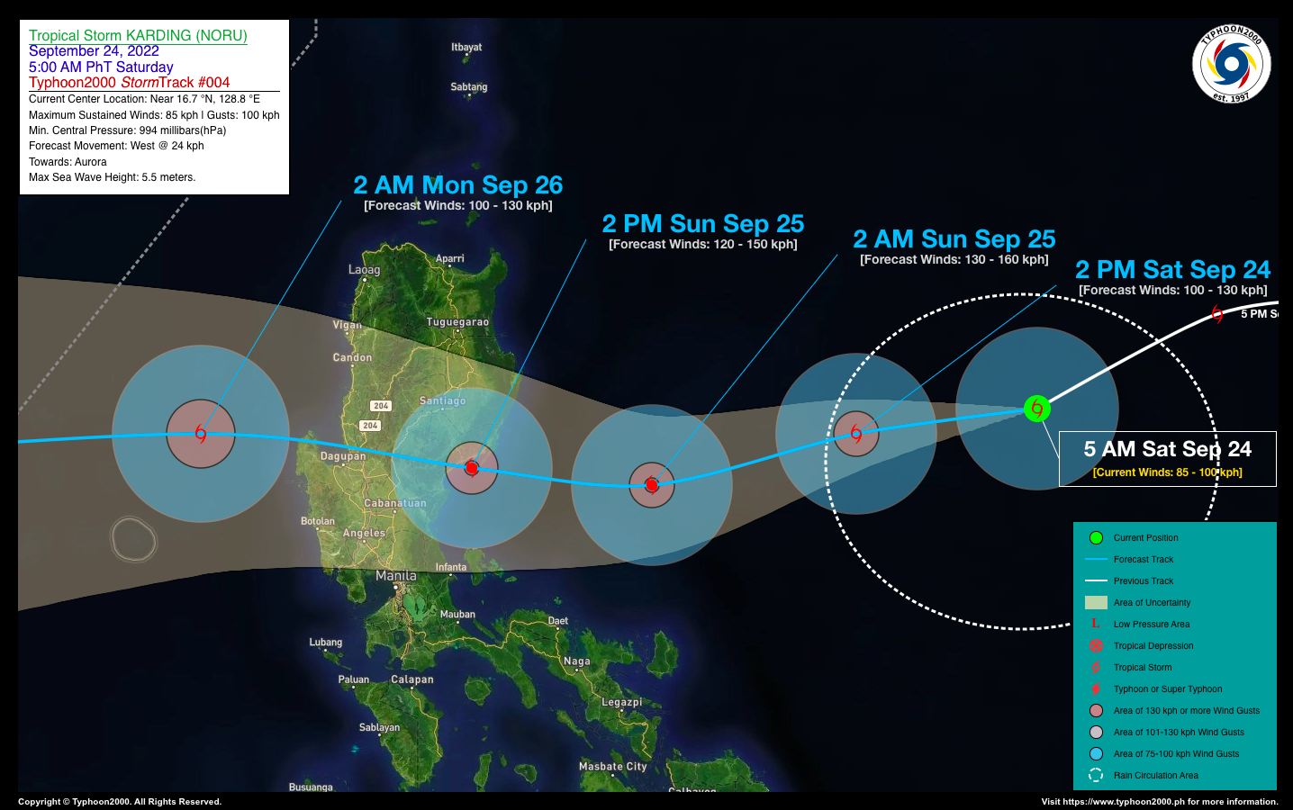
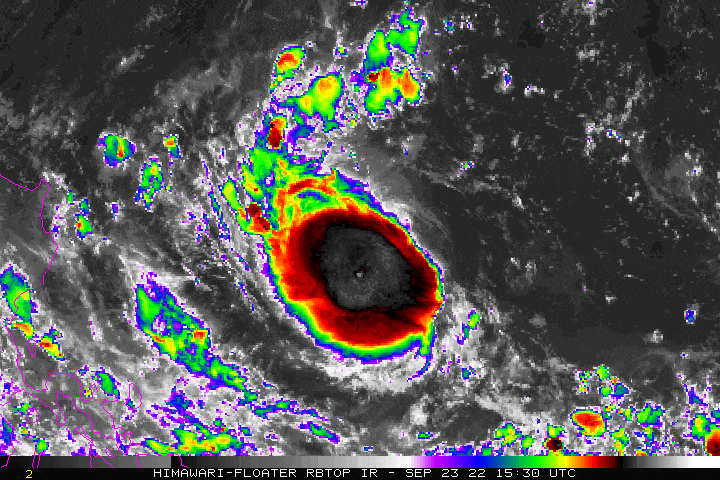
| Current Status & Outlook | Tropical Storm (TS) KARDING [NORU] has started to intensify rapidly while moving more to the west-southwest across the Philippine Sea. Its forecast track has not changed during the past 12 hours, therefore threatening the eastern portions of Central & Northern Luzon particularly Aurora, Northern Quezon and Isabela.
24-hr Outlook: TS KARDING is forecast to intensify further, becoming a Severe Tropical Storm (STS) later today, and into a Typhoon by early tomorrow morning while moving west to west-southwest at an accelerated forward speed of 24 km/hr. Due to the smaller size of this system, its outer rainbands will start to affect the eastern coastal areas of Northern Quezon and Aurora beginning tomorrow morning. Meanwhile, this storm will enhance the Southwest Monsoon (Habagat) and bring occasional rains and thunderstorms across Southern Luzon, MiMaRoPa, Sulu Archipelago, Visayas and Western Mindanao beginning tomorrow through Monday (Sept 26). |
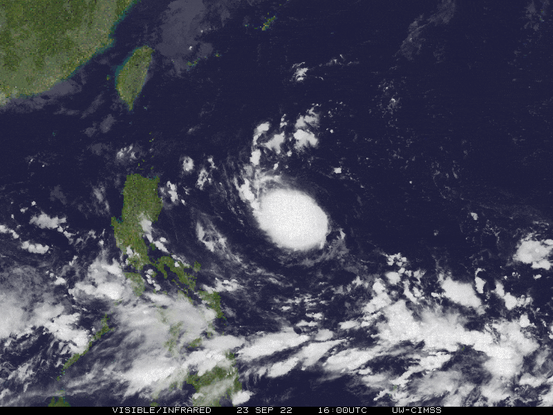
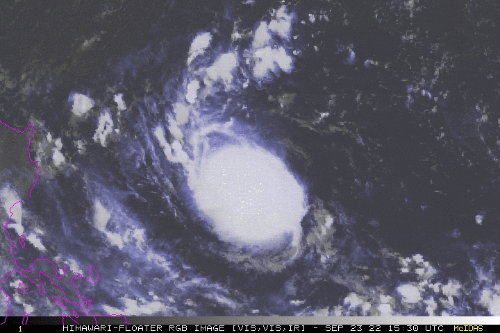
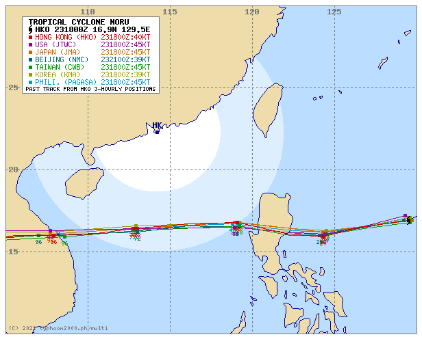
| Where is KARDING (NORU)? | As of 5:00 AM PhT today, September 24…2100 GMT:
|
| How strong is it? | Maximum Sustained Winds (1-min avg): 85 kph near the center…Gustiness: 100 kph. |
| Past Movement (06 hrs) | West-Southwest @ 21 kph, towards Aurora. |
| Potential Philippine Major Landfall Area(s) |
|
| What Philippine areas will be directly affected? | Heavy to Extreme Rainfall (50 mm to >100 mm expected for 24 hrs):
Damaging Winds (gusts of more than 100 km/hr expected):
|
| Potential Storm Surge/Coastal Flooding Areas+ |
+Waves of 2 to 3 meters in height are expected in storm surge-prone areas, particularly in coastal areas where the Tropical Cyclone is headed. Kindly visit the PAGASA Storm Surge Updates for more details. |
| 3-Day Forecast Outlook Summary** |
**Important Note: Please be reminded that the Forecast Outlook changes every 6 hours, and the Day 2 and 3 Forecast Track have an average error of 100 and 250 km respectively… while the wind speed forecast error, averages 35 km/hr per day. Therefore, a turn to the left or right of its future track and changes in its wind speed must be anticipated from time to time. |
| Other Storm’s Meteorological Information |
|
| Information based on data collected by Typhoon2000 (T2k) shall not be taken as official data. Weather information broadcasted and distributed by PAGASA remains as official data. Typhoon2000 (T2k) shall not be responsible for the private use and reliance of its weather information. | |
Issued by: David Michael V. Padua for Typhoon2000 (T2k)
Typhoon2000 (T2K) Integrated Multi-Agency Tracks
PAGASA TROPICAL CYCLONE WIND SIGNAL

Image/Screenshot Source: DOST-PAGASA (https://bagong.pagasa.dost.gov.ph/tropical-cyclone/severe-weather-bulletin)


