
TYPHOON JENNY (KOINU) ADVISORY NO. 12. [Final]Issued at: 8:00 PM PhT (12:00 GMT) Thursday, 05 Oct 2023
|
|
|---|---|
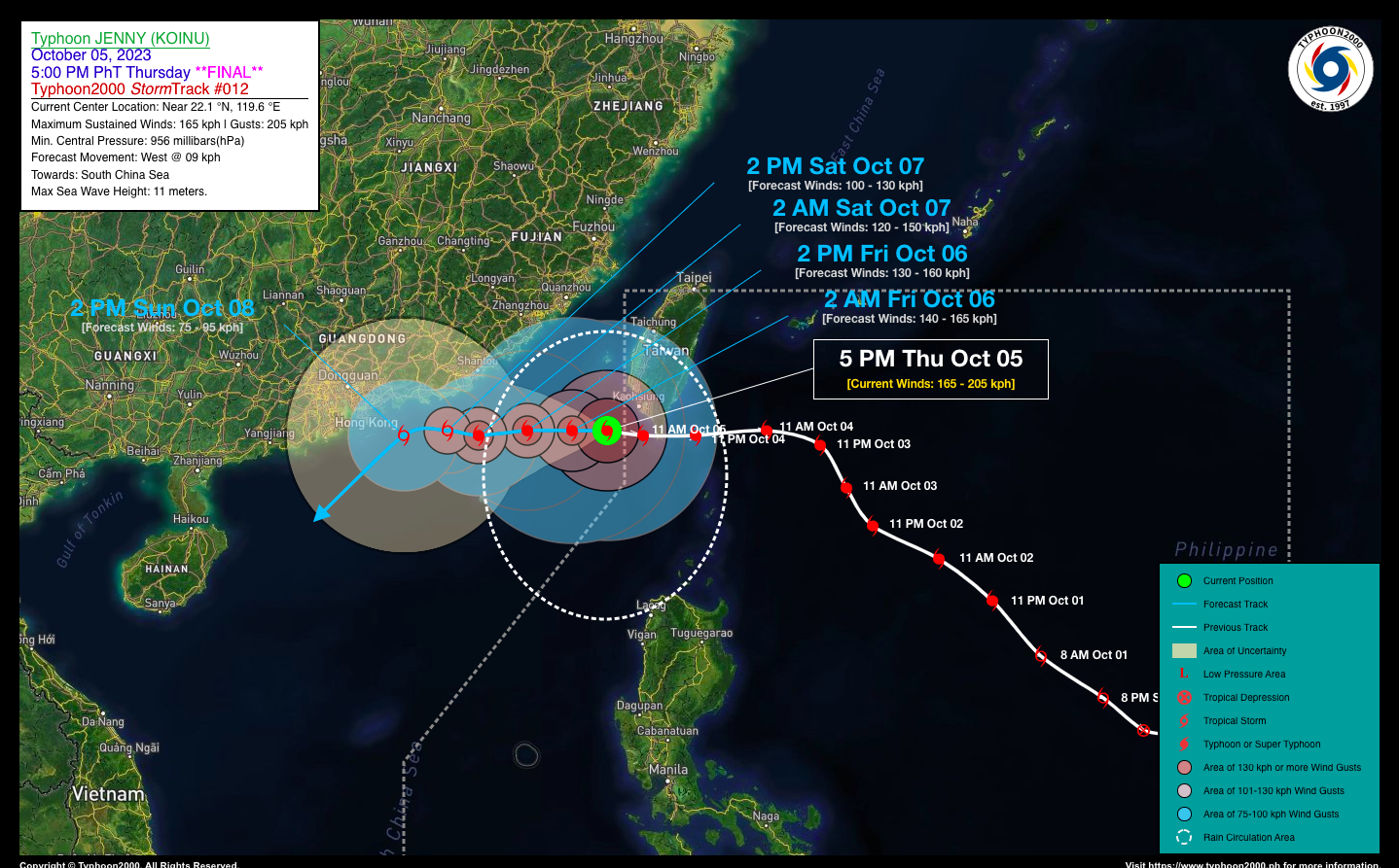
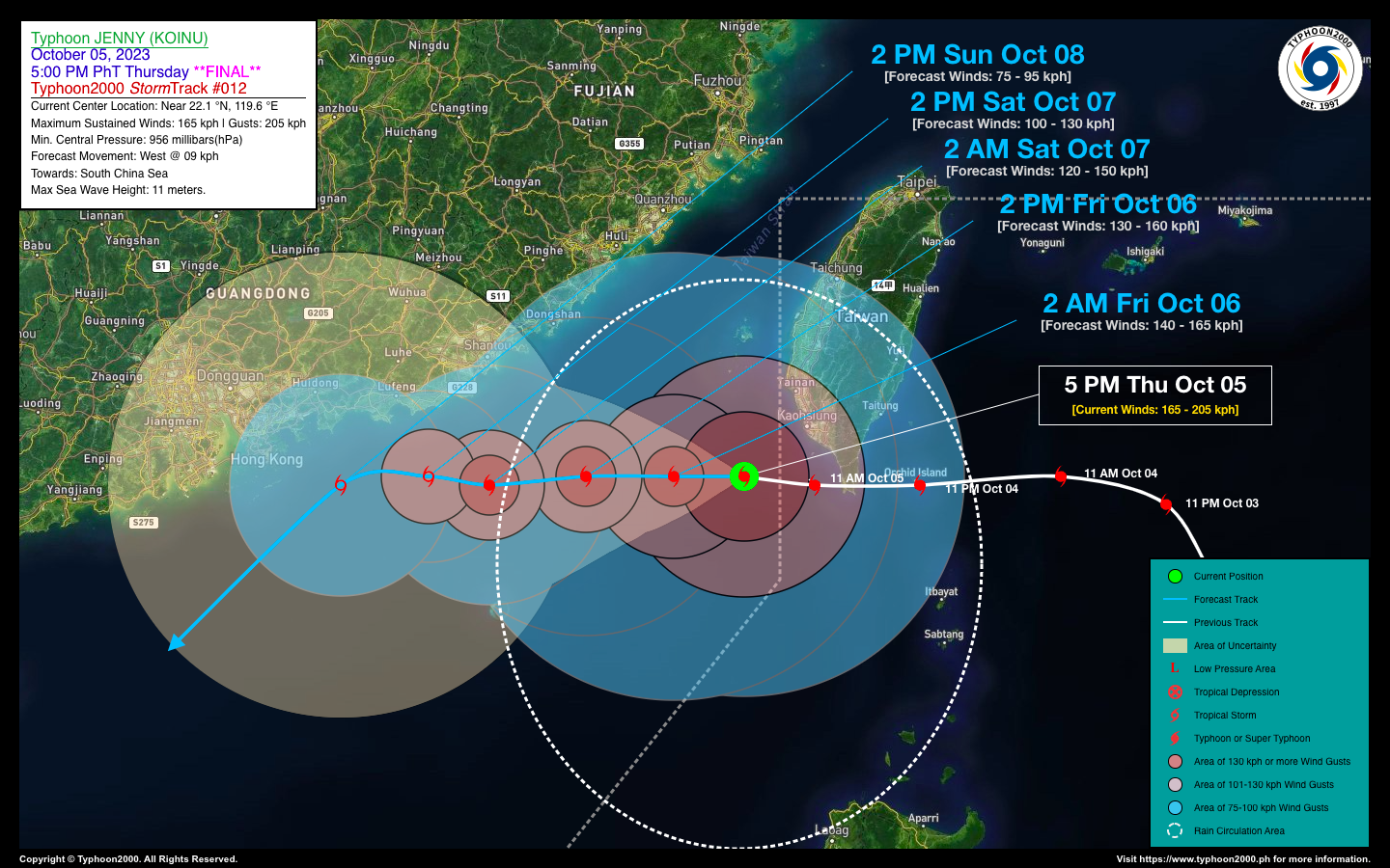
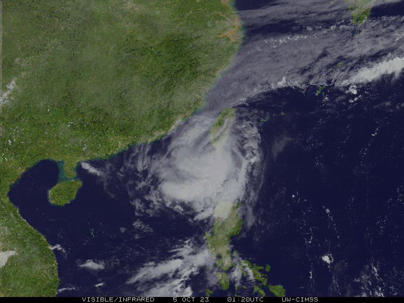
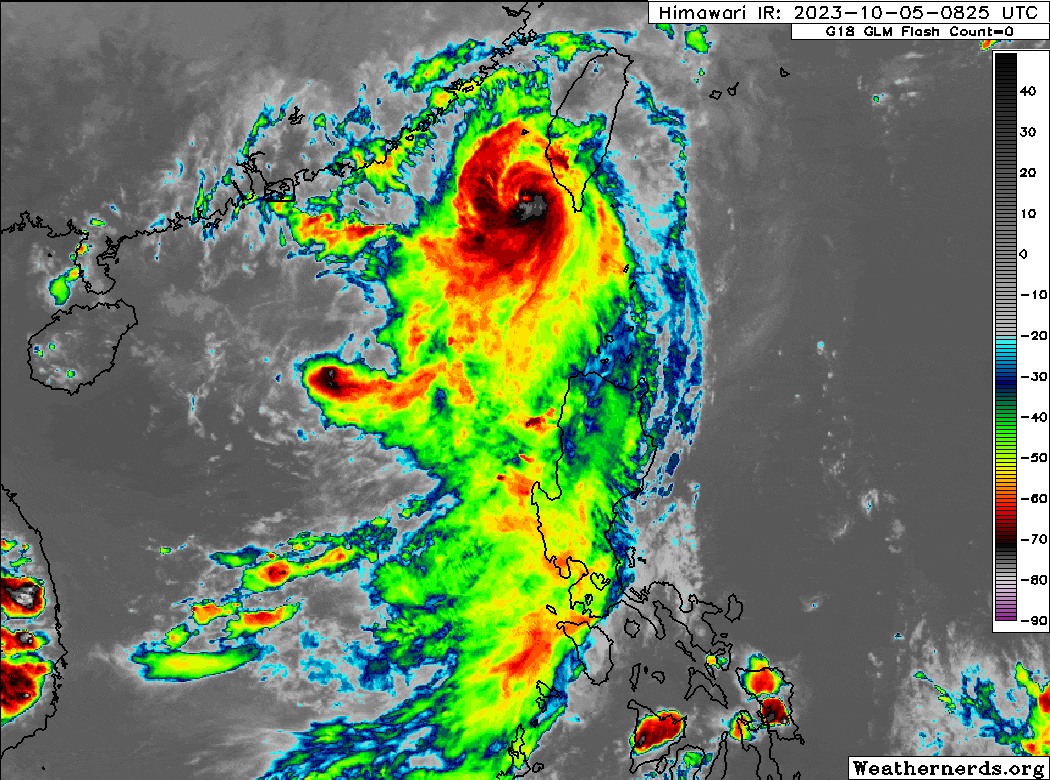
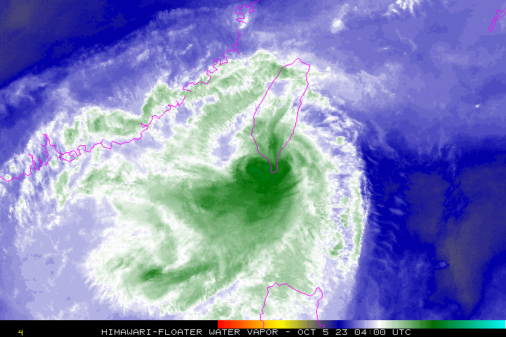
| Current Status & Outlook | Typhoon JENNY (KOINU) has left the Philippine Area of Responsibility (PAR) as it continues to weaken while moving westward over the South China Sea. Improving weather conditions will be expected tomorrow across Extreme Northern Luzon.
*This is the Final Advisory on this weather system. 48-hr Outlook: TY JENNY is forecast to maintain its slow westerly track for the next two days, and will continue losing strength due to strong upper-level winds and decreased Oceanic Heat Content (OHC). On Saturday afternoon (Oct 7), JENNY will be downgraded to a Severe Tropical Storm (STS) as it moves along the coastal waters of Guangdong Province, China, just to the east of Hong Kong. Meanwhile, the departure of TY JENNY will pave the way for much improved weather conditions across Luzon this weekend, as the Southwesterly Windflow weakens despite the usual localized thunderstorms expected during the afternoons or evenings. |
| Where is JENNY (KOINU)? | As of 5:00 PM PhT today, October 05…0900 GMT:
|
| How strong is it? | Maximum Sustained Winds (1-min avg): 165 kph near the center…Gustiness: 205 kph. |
| Past Movement (06 hrs) | West @ 14 kph, towards the Coastal Waters of Southern China. |
| Potential Philippine Major Landfall Area(s) |
|
| What Philippine areas will be directly affected? | Heavy to Extreme Rainfall (50 mm to >100 mm expected for 24 hrs):
Damaging Winds (gusts of more than 100 km/hr expected):
|
| Potential Storm Surge/Coastal Flooding Areas+ |
+Waves of greater than 2 meters in height are expected in storm surge-prone areas, particularly in coastal areas where the Tropical Cyclone is headed. Kindly visit the PAGASA Storm Surge Updates for more details. |
| 2-Day Forecast Outlook Summary** |
**Important Note: Please be reminded that the Forecast Outlook changes every 6 hours, and the Day 2 and 3 Forecast Track have an average error of 100 and 250 km respectively… while the wind speed forecast error, averages 35 km/hr per day. Therefore, a turn to the left or right of its future track and changes in its wind speed must be anticipated from time to time. |
| Other Storm’s Meteorological Information |
|
| Disclaimer: Information based on data collected by Typhoon2000 (T2k) shall not be taken as official data. Weather information broadcasted and distributed by PAGASA remains as official data. Typhoon2000 (T2k) shall not be responsible for the private use and reliance of its weather information. | |
Issued by: David Michael V. Padua for Typhoon2000 (T2k)
Typhoon2000 (T2K) Integrated Multi-Agency Tracks
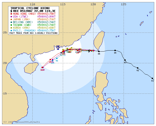
For more info visit: (http://www.typhoon2000.ph/multi/?name=KOINU)
PAGASA TROPICAL CYCLONE WIND SIGNAL
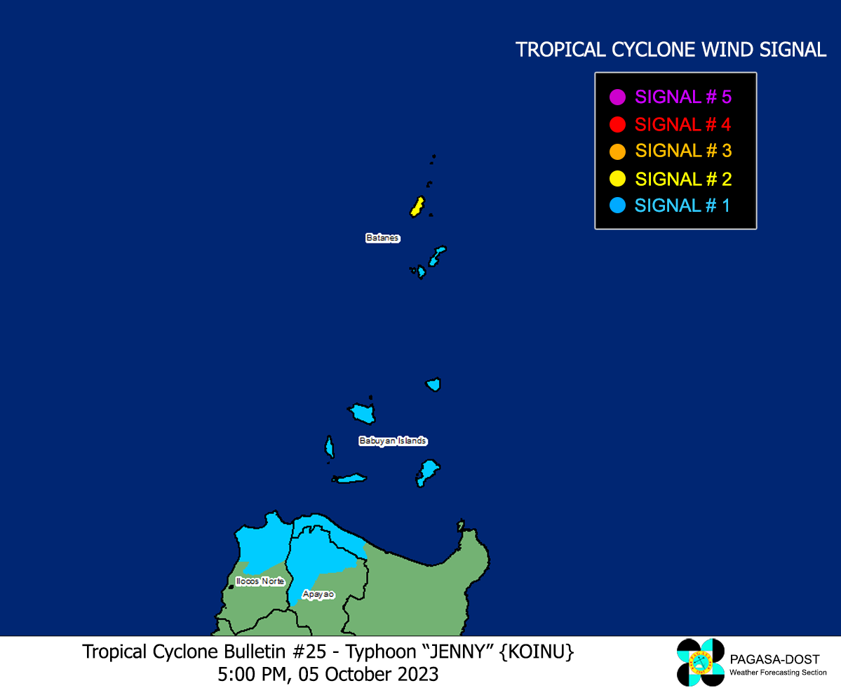
Image/Screenshot Source: DOST-PAGASA (https://bagong.pagasa.dost.gov.ph/tropical-cyclone/severe-weather-bulletin)


