


TYPHOON JENNY (KOINU) ADVISORY NO. 07Issued at: 2:00 PM PhT (06:00 GMT) Tuesday, 03 Oct 2023
Next update: 2:00 AM PhT (18:00 GMT) Wednesday, 04 Oct 2023 |
|
|---|---|
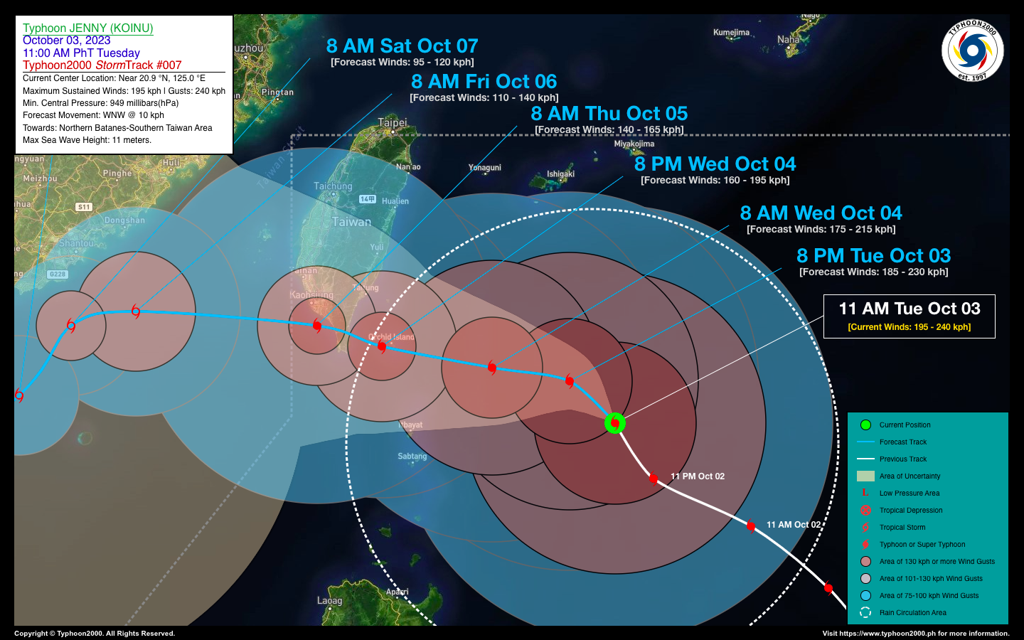
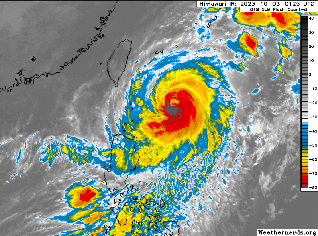
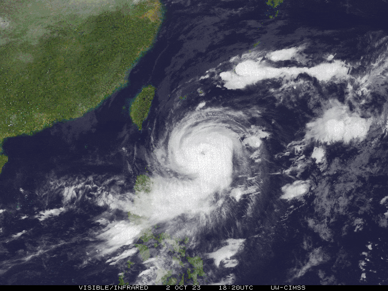
| Current Status & Outlook | Typhoon JENNY (KOINU) has weakened slightly as it encounters unfavorable atmospheric conditions aloft, as it moves north-northwest slowly towards Northern Batanes-Southern Taiwan Area. Its outer rainbands are starting to shrink as it continues to spread across Extreme Northern Luzon.
48-hr Outlook: TY JENNY is forecast to pass approx. 150-200 km north of Batanes Group tomorrow afternoon (Oct 4). Its estimated wind speed is expected to diminish further to 160-165 kph (Cat 2) within the next 12 to 36 hours as dry-air entrainment and increasing upper-level winds aka. Wind shear continues to affect the typhoon. Then, it will pass over or close to Orchid Island early tomorrow evening, before making landfall over Southern Taiwan by early Thursday morning. By mid-morning Thursday (Oct 05), Jenny will then emerge along the coastal waters just south of Kaohsiung City as it moves out of the Philippine Area of Responsibility (PAR). During this outlook, the western & southern inner rainbands of JENNY will be spreading across the Batanes Group of Islands where Tropical Storm-Force Winds of 75-100 kph will be felt beginning Wednesday until early Thursday morning (Oct 05). Meanwhile, the presence of TY JENNY’s Trough (aka. Extension) and the weakening Southwest Monsoon (Habagat) will continue to bring overcast skies with isolated to scattered to at times occasional rain showers and severe thunderstorms across Northern & Central Luzon incl. NCR, MiMaRoPa, Sulu Archipelago, & Western Visayas today through Thursday (Oct 05). It will be more frequent during the afternoon or evening. Please take all necessary precautions against flash floods and landslides incl. lahars that will be brought about by these systems. |
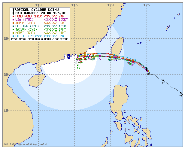
| Where is JENNY (KOINU)? | As of 11:00 AM PhT today, October 03…0300 GMT:
|
| How strong is it? | Maximum Sustained Winds (1-min avg): 195 kph near the center…Gustiness: 240 kph. |
| Past Movement (06 hrs) | North-Northwest @ 12 kph, towards Northern Batanes-Southern Taiwan Area. |
| Potential Philippine Major Landfall Area(s) |
|
| What Philippine areas will be directly affected? | Heavy to Extreme Rainfall (50 mm to >100 mm expected for 24 hrs):
Damaging Winds (gusts of more than 100 km/hr expected):
|
| Potential Storm Surge/Coastal Flooding Areas+ |
+Waves of greater than 2 meters in height are expected in storm surge-prone areas, particularly in coastal areas where the Tropical Cyclone is headed. Kindly visit the PAGASA Storm Surge Updates for more details. |
| 3-Day Forecast Outlook Summary** |
**Important Note: Please be reminded that the Forecast Outlook changes every 6 hours, and the Day 2 and 3 Forecast Track have an average error of 100 and 250 km respectively… while the wind speed forecast error, averages 35 km/hr per day. Therefore, a turn to the left or right of its future track and changes in its wind speed must be anticipated from time to time. |
| Other Storm’s Meteorological Information |
|
| Disclaimer: Information based on data collected by Typhoon2000 (T2k) shall not be taken as official data. Weather information broadcasted and distributed by PAGASA remains as official data. Typhoon2000 (T2k) shall not be responsible for the private use and reliance of its weather information. | |
Issued by: David Michael V. Padua for Typhoon2000 (T2k)
Typhoon2000 (T2K) Integrated Multi-Agency Tracks
For more info visit: (http://www.typhoon2000.ph/multi/?name=KOINU)
PAGASA TROPICAL CYCLONE WIND SIGNAL

Image/Screenshot Source: DOST-PAGASA (https://bagong.pagasa.dost.gov.ph/tropical-cyclone/severe-weather-bulletin)


