

SEVERE TROPICAL STORM FLORITA (MA-ON) ADVISORY NO. 05Issued at: 8:00 AM PhT (00:00 GMT) Tuesday, 23 August 2022
Next update: 2:00 PM PhT (06:00 GMT) Tuesday, 23 August 2022 |
|
|---|---|
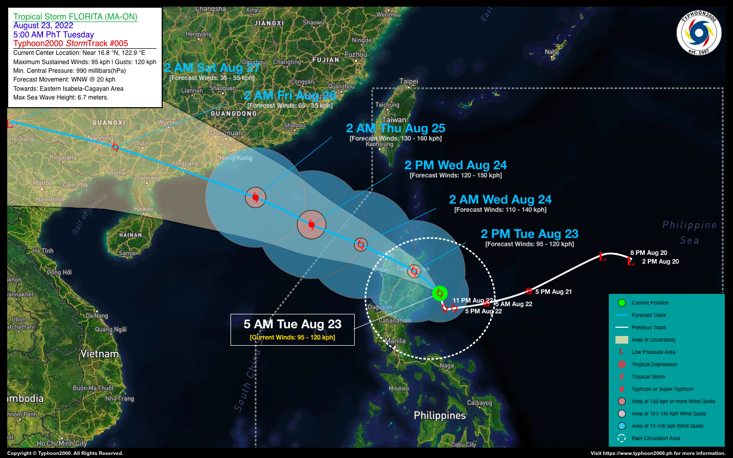
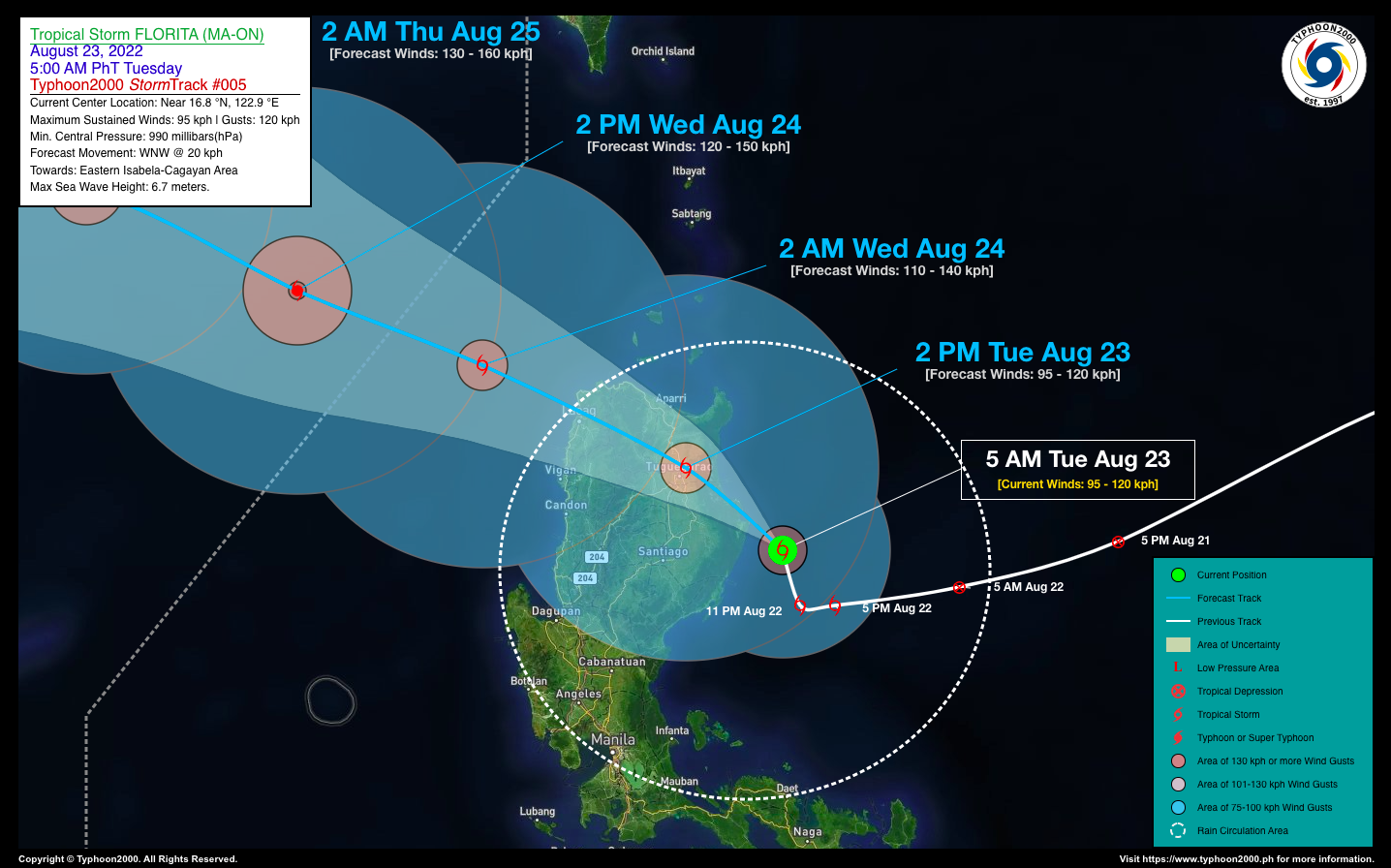
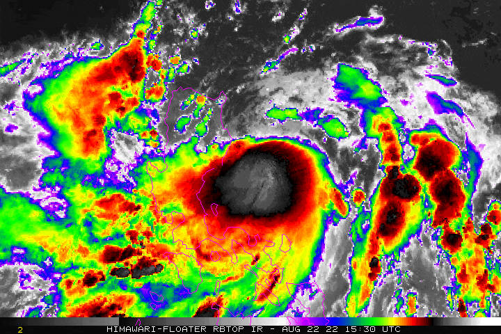
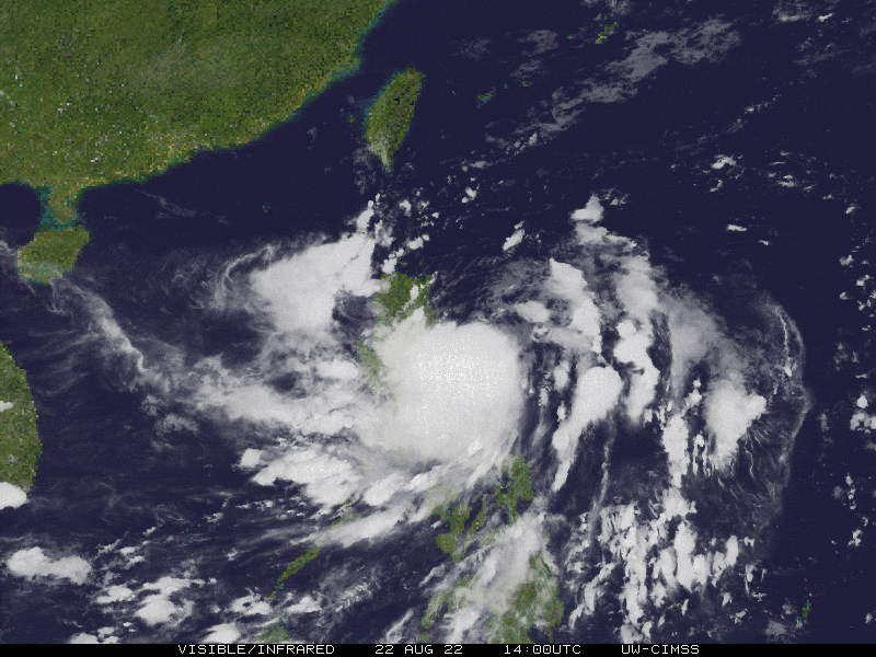
| Current Status & Outlook | FLORITA (MA-ON) has been upgraded into a Severe Tropical Storm (STS) and is about to make landfall over Northern Cagayan within the next few hours…now brushing the coastal areas of Eastern Isabela and Northern Cagayan.
24-hr Outlook: STS FLORITA (MA-ON) is forecast to cross Northern Cagayan, passing very close to Tuguegarao City this afternoon, and will traverse Kalinga, Apayao and Ilocos Norte tonight. By early tomorrow morning, FLORITA will emerge over the West Philippine Sea and intensify. Its rainbands will bring heavy to extreme rainfall and gusty winds across much of Northern Luzon and some portions of Central Luzon within the next 24 to 36 hours. Life-threatening flash floods and landslides are likely to occur during the storm’s passage. Please take all necessary precautions. Meanwhile, its trough or extension together with the enhanced Southwest Monsoon (Habagat) will continue to bring scattered to occasional rains with severe thunderstorms across the Whole of Luzon including Metropolitan Manila, MiMaRoPa, Visayas, & Western Mindanao today. Risk of flooding and landslides will be Medium to High. |
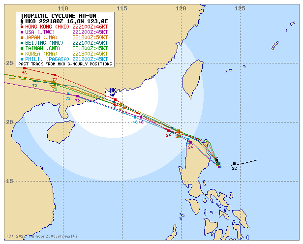
| Where is FLORITA (MA-ON)? | As of 5:00 AM PhT today, August 23…2100 GMT:
|
| How strong is it? | Maximum Sustained Winds (1-min avg): 95 kph near the center…Gustiness: 120 kph. |
| Past Movement (06 hrs) | North-Northwest @ 12 kph, towards the Coastal Areas of Eastern Isabela & Northern Cagayan. |
| Potential Philippine Major Landfall Area(s) |
|
| What Philippine areas will be directly affected? | Heavy to Extreme Rainfall (50 mm to >100 mm expected for 24 hrs):
Damaging Winds (gusts of more than 100 km/hr expected):
|
| Potential Storm Surge/Coastal Flooding Areas+ |
+Waves of 1 to 3 meters in height are expected in storm surge-prone areas, particularly in coastal areas where the Tropical Cyclone is headed. Kindly visit the PAGASA Storm Surge Updates for more details. |
| 3-Day Forecast Outlook Summary** |
**Important Note: Please be reminded that the Forecast Outlook changes every 6 hours, and the Day 2 and 3 Forecast Track have an average error of 100 and 250 km respectively… while the wind speed forecast error, averages 35 km/hr per day. Therefore, a turn to the left or right of its future track and changes in its wind speed must be anticipated from time to time. |
| Other Storm’s Meteorological Information |
|
| Information based on data collected by Typhoon2000 (T2k) shall not be taken as official data. Weather information broadcasted and distributed by PAGASA remains as official data. Typhoon2000 (T2k) shall not be responsible for the private use and reliance of its weather information. | |
Issued by: David Michael V. Padua for Typhoon2000 (T2k)
Typhoon2000 (T2K) Integrated Multi-Agency Tracks
PAGASA TROPICAL CYCLONE WIND SIGNAL
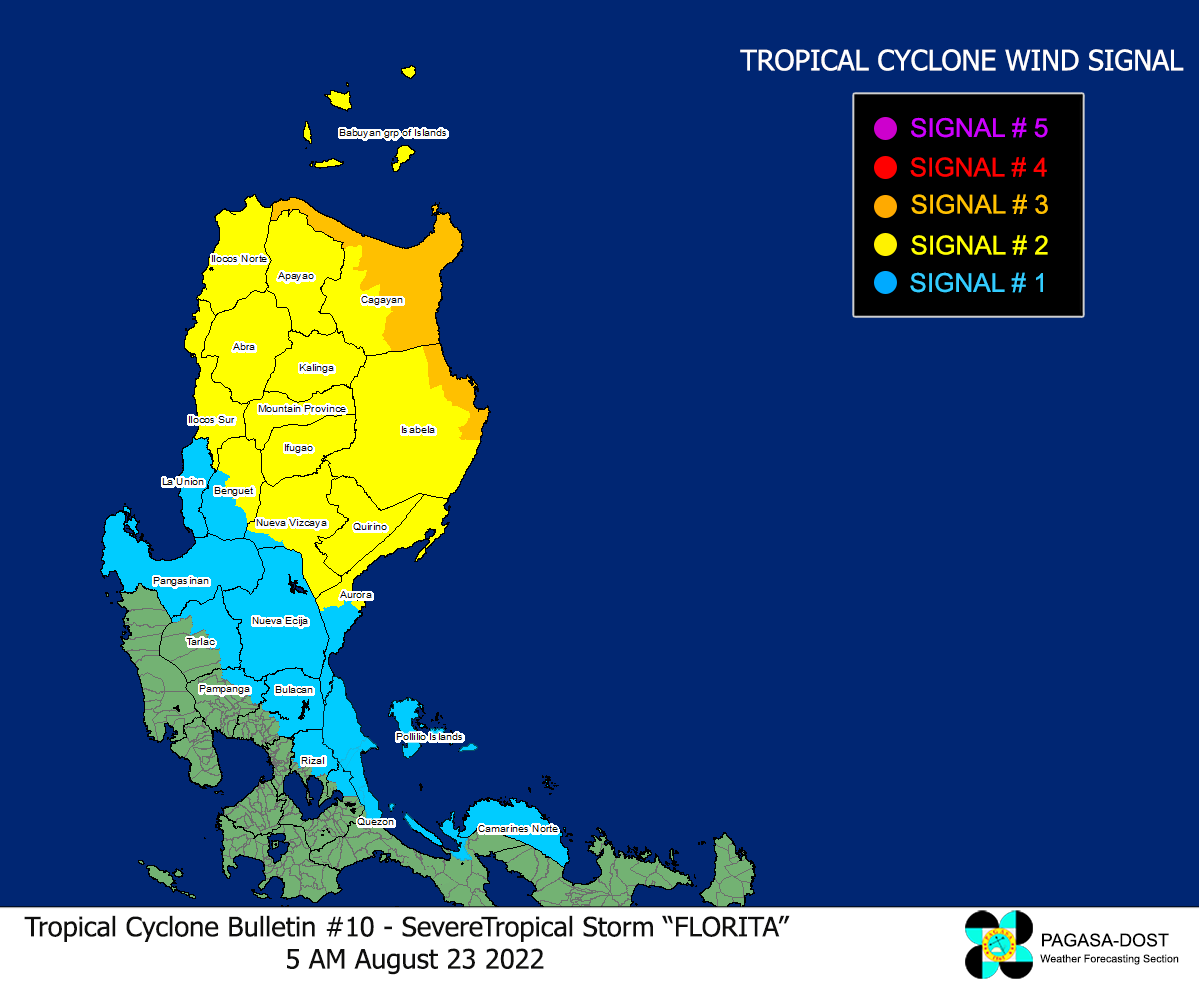
Image/Screenshot Source: DOST-PAGASA (https://bagong.pagasa.dost.gov.ph/tropical-cyclone/severe-weather-bulletin)


