
TROPICAL DEPRESSION EMONG ADVISORY NO. 04Issued at: 7:00 PM PhT (11:00 GMT) Monday, 05 July 2021
Next update: 7:00 AM PhT (23:00 GMT) Tuesday, 06 July 2021 |
|
|---|---|
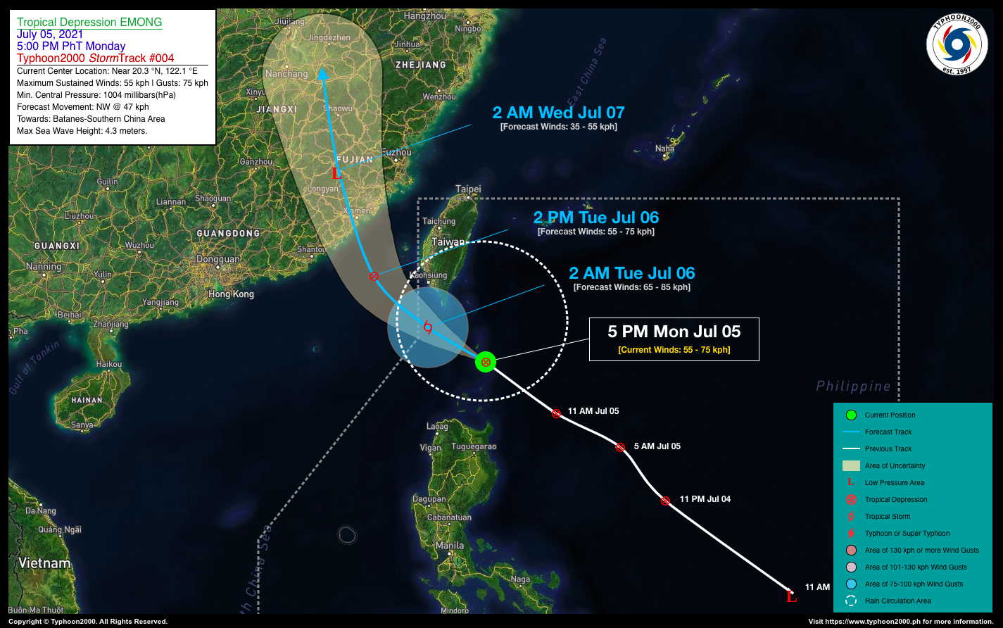
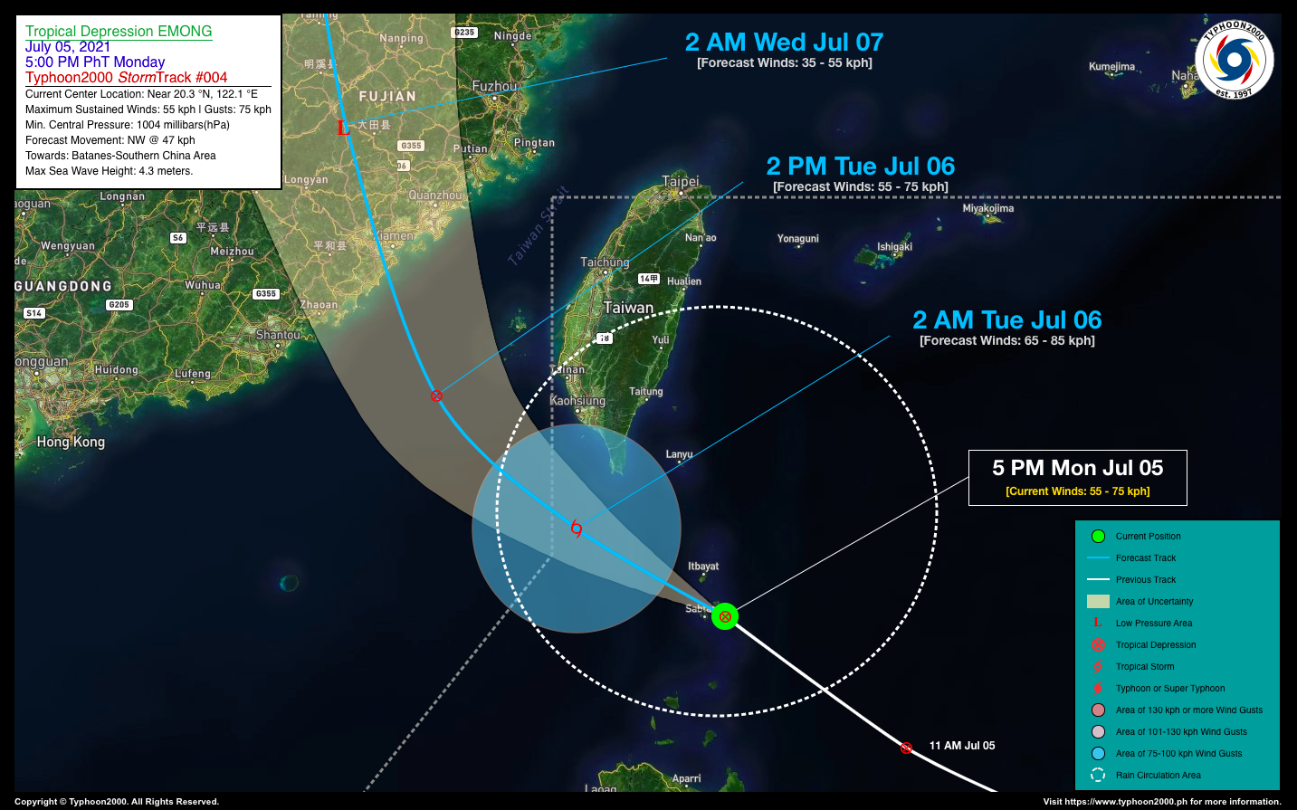
| Current Status & Outlook | Tropical Depression (TD) EMONG has accelerated northwestward and is now traversing the Batanes Group of Islands…passing very close to Basco.
24-hr Outlook: TD EMONG is forecast to slightly intensify briefly into a Tropical Storm (TS) later tonight or early tomorrow morning, before weakening back to TD status. It will continue moving northwestward across the western part of the Bashi Channel by early tomorrow morning at a decreased forward speed of 22 km/hr – exiting the northwestern border of the Philippine Area of Responsibility (PAR). By tomorrow afternoon, EMONG will be approaching the southern coast of Fujian Province as a dissipating system, before making landfall near Xiamen, China tomorrow evening. |
| Where is EMONG? | As of 5:00 PM PhT today, July 05…0900 GMT:
|
| How strong is it? | Maximum Sustained Winds (1-min avg): 55 kph near the center…Gustiness: 75 kph. |
| Past Movement (06 hrs) | Northwest @ 47 kph, towards the Batanes & Southern China Area |
| Potential Philippine Landfall Area(s) |
|
| What Philippine areas will be directly affected? | Heavy to Extreme Rainfall (50 mm to >100 mm expected for 24 hrs):
Damaging Winds (gusts of more than 100 km/hr expected):
|
| Potential Storm Surge/Coastal Flooding Areas+ |
+Waves of 3 meters in height is expected in storm surge-prone areas, particularly in coastal areas on where the Tropical Cyclone is headed. Kindly visit the PAGASA Storm Surge Updates for more details. |
| 2-Day Forecast Outlook Summary** |
**Important Note: Please be reminded that the Forecast Outlook changes every 6 hours, and the Day 2 and 3 Forecast Track have an average error of 100 and 250 km respectively… while the wind speed forecast error, averages 35 km/hr per day. Therefore, a turn to the left or right of its future track and changes in its wind speed must be anticipated from time to time. |
| Other Storm’s Meteorological Information |
|
| Information based on data collected by Typhoon2000 (T2k) shall not be taken as official data. Weather information broadcasted and distributed by PAGASA remains as official data. Typhoon2000 (T2k) shall not be responsible for the private use and reliance of its weather information. | |
Issued by: David Michael V. Padua for Typhoon2000 (T2K)
Typhoon2000 (T2K) Integrated Multi-Agency Tracks
:: None yet. Will be available once RSMC’s Tokyo Typhoon Center (JMA) upgrades it into a Tropical Storm ::
PAGASA TROPICAL CYCLONE WIND SIGNAL
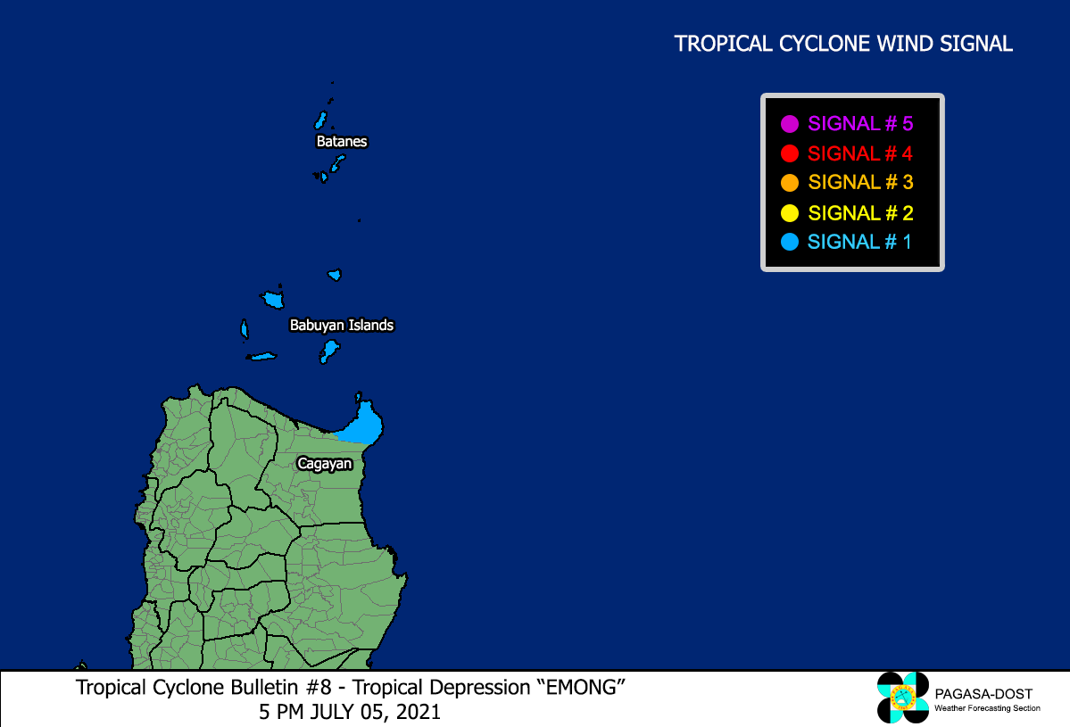
Image/Screenshot Source: DOST-PAGASA (http://pubfiles.pagasa.dost.


