

TYPHOON EGAY (DOKSURI) ADVISORY NO. 02Issued at: 2:00 PM PhT (06:00 GMT) Monday, 24 July 2023
Next update: 8:00 PM PhT (12:00 GMT) Monday, 24 July 2023 |
|
|---|---|
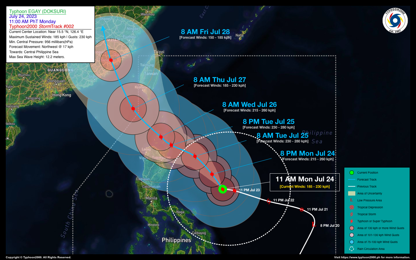
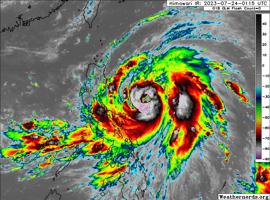
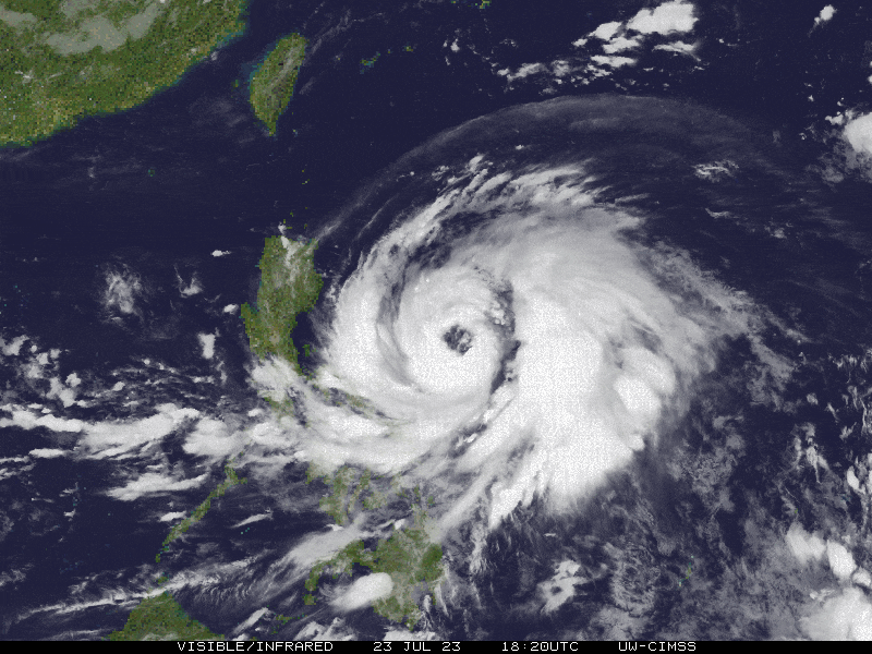
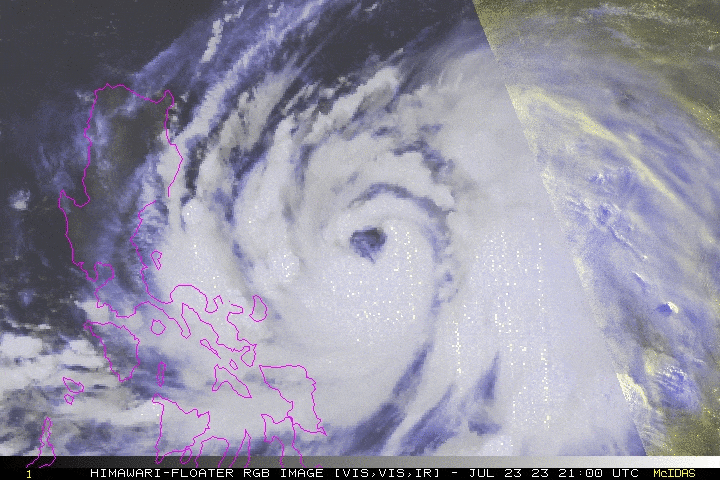
| Current Status & Outlook | Typhoon (TY) EGAY {DOKSURI} has maintained its Rapid Intensification (RI) process as it approaches the 200-kph mark. Its western-outer rainbands continue to spread across Bicol Region and Eastern Visayas, and has reached the coastal areas of Cagayan Valley. Its track has slowly shifted towards the northwest, endangering Northern Luzon particularly Cagayan-Babuyan-Batanes Area.
48-hr Outlook: TY EGAY (DOKSURI) is forecast to continue its RI and could reach or break the Super Typhoon threshold of 240 kph (1-min avg) within the next 12 to 24 hours – as it moves over warm oceanic heat content and very favorable upper-level atmospheric environment. Its forecast track will turn more towards the WNW, and will enter the coastal waters of Northern Cagayan on Tuesday evening (July 25), and traverse the Babuyan Group of Islands by early or mid-morning of Wednesday (July 26). The presence of TY EGAY (DOKSURI) will enhance the Southwest Monsoon (Habagat) across Visayas, MiMaRoPa, and Luzon today through Thursday (July 27). Scattered to Occasional “On-&-Off” rain showers and Severe Thunderstorms will be expected across these areas especially during the afternoon and evening. Please take all necessary precautions against floods, landslides incl. lahars, storm surges, and high winds brought about by these systems. |
| Where is EGAY (DOKSURI)? | As of 11:00 AM PhT Today, July 24…0300 GMT:
|
| How strong is it? | Maximum Sustained Winds (1-min avg): 185 kph near the center…Gustiness: 230 kph. |
| Past Movement (06 hrs) | West-Northwest @ 10 kph, towards Northern Cagayan-Babuyan-Batanes Area. |
| Potential Philippine Major Landfall Area(s) |
|
| What Philippine areas will be directly affected? | Heavy to Extreme Rainfall (50 mm to >100 mm expected for 24 hrs):
Damaging Winds (gusts of more than 100 km/hr expected):
|
| Potential Storm Surge/Coastal Flooding Areas+ |
+Waves of 3 to 5 meters in height are expected in storm surge-prone areas, particularly in coastal areas where the Tropical Cyclone is headed. Kindly visit the PAGASA Storm Surge Updates for more details. |
| 3-Day Forecast Outlook Summary** |
**Important Note: Please be reminded that the Forecast Outlook changes every 6 hours, and the Day 2 and 3 Forecast Track have an average error of 100 and 250 km respectively… while the wind speed forecast error, averages 35 km/hr per day. Therefore, a turn to the left or right of its future track and changes in its wind speed must be anticipated from time to time. |
| Other Storm’s Meteorological Information |
|
| Disclaimer: Information based on data collected by Typhoon2000 (T2k) shall not be taken as official data. Weather information broadcasted and distributed by PAGASA remains as official data. Typhoon2000 (T2k) shall not be responsible for the private use and reliance of its weather information. | |
Issued by: David Michael V. Padua for Typhoon2000 (T2k)
Typhoon2000 (T2K) Integrated Multi-Agency Tracks
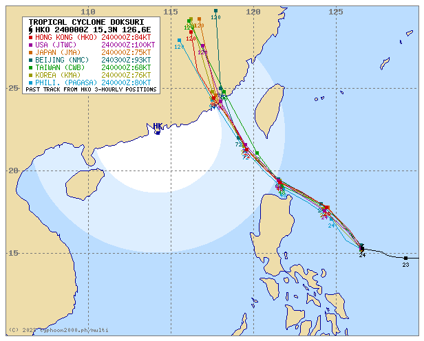
For more info visit: (http://www.typhoon2000.ph/multi/?name=DOKSURI)
PAGASA TROPICAL CYCLONE WIND SIGNAL
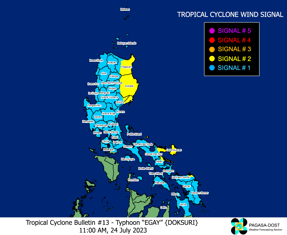
Image/Screenshot Source: DOST-PAGASA (https://bagong.pagasa.dost.gov.ph/tropical-cyclone/severe-weather-bulletin)


