
TROPICAL DEPRESSION CRISING ADVISORY NO. 04Issued at: 7:00 AM PhT (23:00 GMT) Friday, 14 May 2021
Next update: 1:00 PM PhT (05:00 GMT) Friday, 14 May 2021 |
|
|---|---|
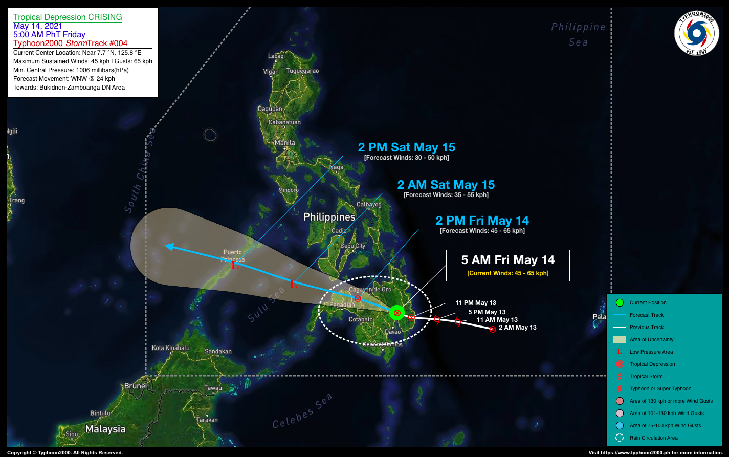
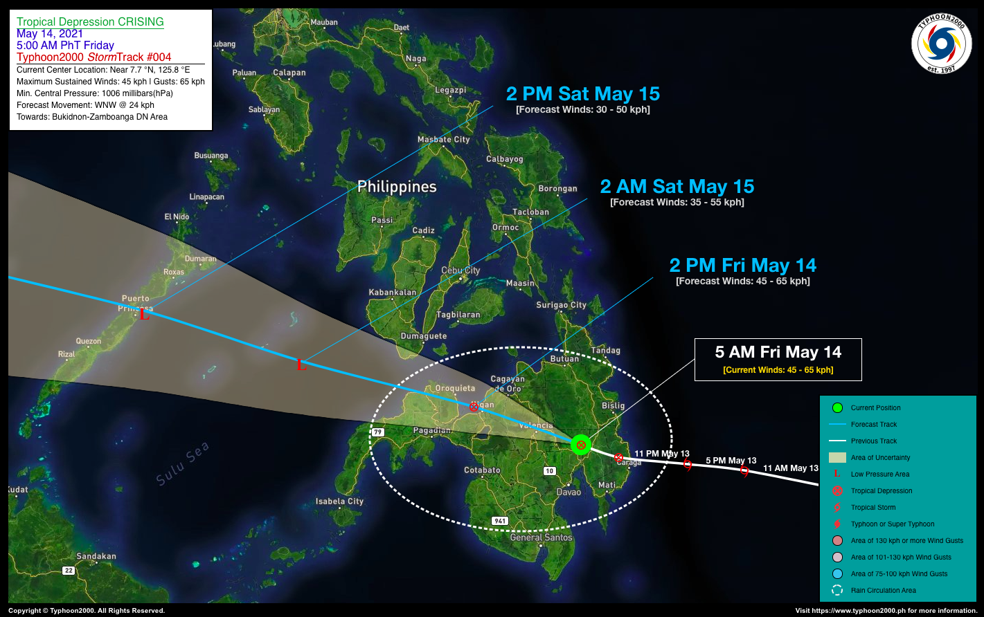
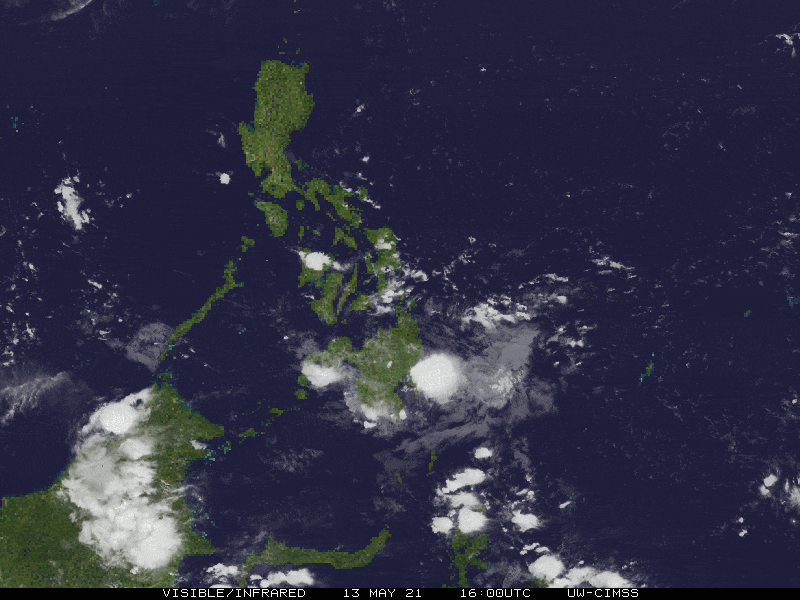
| Current Status & Outlook | Tropical Depression (TD) CRISING continues to decay as it weakens further, losing more of its cloud convection while moving slowly across the rugged terrain of Davao Region…likely to be downgraded into a Tropical Disturbance (LPA) later today.
This depression including its trough will continue to bring scattered to widespread rains with severe thunderstorms and squalls across most parts of Mindanao today. 24-hr Outlook: TD CRISING is forecast to move west-northwestward across Mindanao at an increased forward speed of 24 km/hr and will continue losing strength. It will traverse the provinces of Bukidnon, the northern part of Lanao Provinces, Misamis Occidental, & the northern portion of Zamboanga Del Norte today – between this morning until the evening. By early tomorrow morning (Sat), CRISING will just be an LPA emerging over the Sulu Sea, passing close to the south of Cagayancillo Island. |
| Where is CRISING? | As of 5:00 AM PhT today, May 14…2100 GMT:
|
| How strong is it? | Maximum Sustained Winds (1-min avg): 45 kph near the center…Gustiness: 65 kph. |
| Past Movement (06 hrs) | West @ 12 kph, towards Bukidnon-Northern Lanao Area. |
| Potential Philippine Landfall Area(s) |
|
| What Philippine areas will be directly affected? | Heavy to Extreme Rainfall (50 mm to >100 mm expected for 24 hrs):
Damaging Winds (gusts of more than 100 km/hr expected):
|
| Potential Storm Surge/Coastal Flooding Areas+ |
+Waves of 3 meters in height is expected in storm surge-prone areas, particularly in coastal areas on where the Tropical Cyclone is headed. Kindly visit the PAGASA Storm Surge Updates for more details. |
| 1-Day Forecast Outlook Summary** |
**Important Note: Please be reminded that the Forecast Outlook changes every 6 hours, and the Day 2 and 3 Forecast Track have an average error of 100 and 250 km respectively… while the wind speed forecast error, averages 35 km/hr per day. Therefore, a turn to the left or right of its future track and changes in its wind speed must be anticipated from time to time. |
| Other Storm’s Meteorological Information |
|
| Information based on data collected by Typhoon2000 (T2k) shall not be taken as official data. Weather information broadcasted and distributed by PAGASA remains as official data. Typhoon2000 (T2k) shall not be responsible for the private use and reliance of its weather information. | |
Issued by: David Michael V. Padua for Typhoon2000 (T2K)
Typhoon2000 (T2K) Integrated Multi-Agency Tracks
:: None ::
PAGASA TROPICAL CYCLONE WIND SIGNAL

Image/Screenshot Source: DOST-PAGASA (http://pubfiles.pagasa.dost.


