

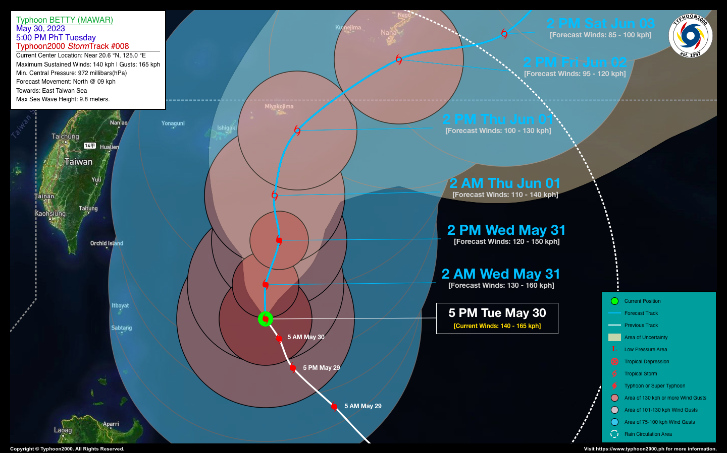

TYPHOON BETTY (MAWAR) ADVISORY NO. 08Issued at: 8:00 PM PhT (12:00 GMT) Tuesday, 30 May 2023
Next update: 8:00 AM PhT (00:00 GMT) Wednesday, 31 May 2023 |
|
|---|---|
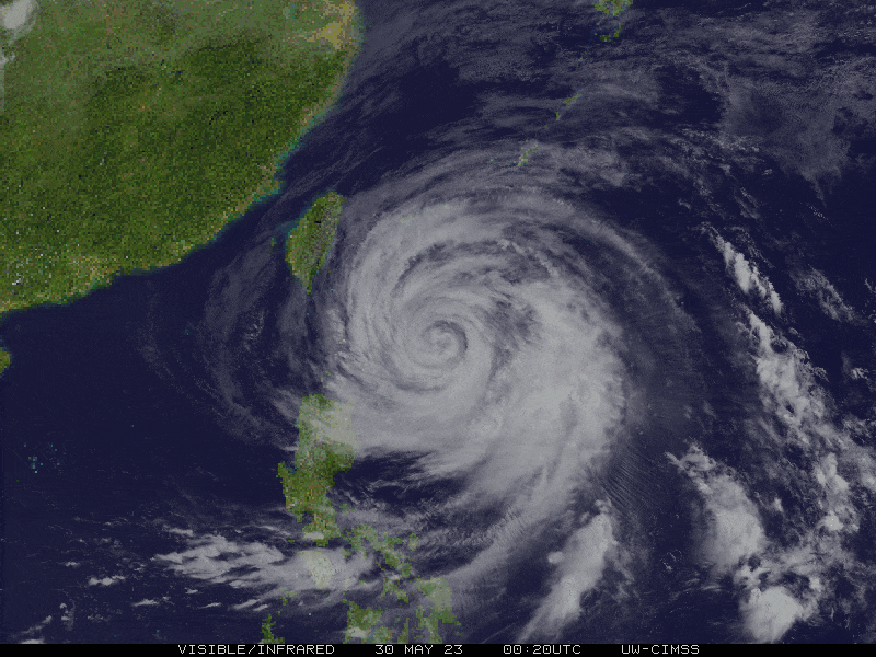
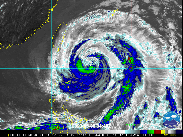
| Current Status & Outlook | Typhoon (TY) BETTY {MAWAR} has weakened further and remained almost stationary well to the east of Batanes. Its 1,200-km large circulation continues to affect Northern Luzon with Gale-Force to Tropical Storm-Force Winds accompanied with some patches of occasional rain showers.
48-hr Outlook: TY BETTY (MAWAR) is forecast to move northward with a slow forward speed of 7 to 11 kph through Thursday afternoon (June 01). The system will be downgraded into a Severe Tropical Storm (STS) throughout the outlook period with forecast 1-min. sustained winds of 110 kph or less. Tropical Storm-Force Winds gusting from 75 to 100 kph will prevail along Batanes-Babuyan Island Group today. The presence of this typhoon will enhance the Southwest Monsoon (Habagat) and bring occasional rains with thunderstorms along the western sections of Visayas and MiMaRoPa. Residents living in hazard-prone areas must take all necessary precautions against floods and landslides along the above-mentioned areas. |
| Where is BETTY (MAWAR)? | As of 5:00 PM PhT today, May 30…0900 GMT:
|
| How strong is it? | Maximum Sustained Winds (1-min avg): 140 kph near the center…Gustiness: 165 kph. |
| Past Movement (06 hrs) | Northwest @ 03 kph, across the North Philippine Sea. |
| Potential Philippine Major Landfall Area(s) |
|
| What Philippine areas will be directly affected? | Heavy to Extreme Rainfall (50 mm to >100 mm expected for 24 hrs):
Damaging Winds (gusts of more than 100 km/hr expected):
|
| Potential Storm Surge/Coastal Flooding Areas+ |
+Waves of 3 meters in height are expected in storm surge-prone areas, particularly in coastal areas where the Tropical Cyclone is headed. Kindly visit the PAGASA Storm Surge Updates for more details. |
| 3-Day Forecast Outlook Summary** |
**Important Note: Please be reminded that the Forecast Outlook changes every 6 hours, and the Day 2 and 3 Forecast Track have an average error of 100 and 250 km respectively… while the wind speed forecast error, averages 35 km/hr per day. Therefore, a turn to the left or right of its future track and changes in its wind speed must be anticipated from time to time. |
| Other Storm’s Meteorological Information |
|
| Disclaimer: Information based on data collected by Typhoon2000 (T2k) shall not be taken as official data. Weather information broadcasted and distributed by PAGASA remains as official data. Typhoon2000 (T2k) shall not be responsible for the private use and reliance of its weather information. | |
Issued by: David Michael V. Padua for Typhoon2000 (T2k)
Typhoon2000 (T2K) Integrated Multi-Agency Tracks
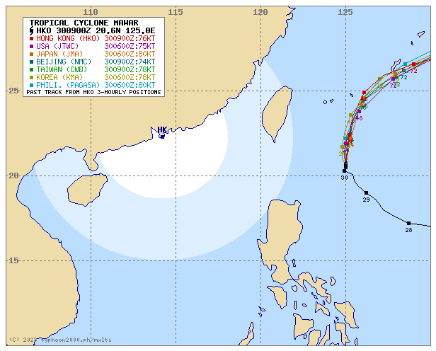
For more info visit: (http://www.typhoon2000.ph/multi/?name=MAWAR)
PAGASA TROPICAL CYCLONE WIND SIGNAL
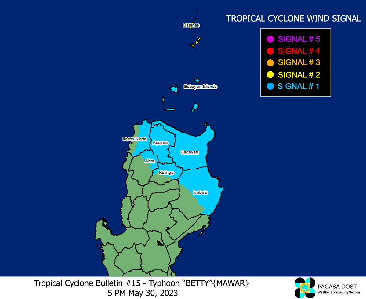
Image/Screenshot Source: DOST-PAGASA (https://bagong.pagasa.dost.gov.ph/tropical-cyclone/severe-weather-bulletin)


