

TYPHOON BETTY (MAWAR) ADVISORY NO. 04Issued at: 8:00 PM PhT (12:00 GMT) Sunday, 28 May 2023
Next update: 8:00 AM PhT (00:00 GMT) Monday, 29 May 2023 |
|
|---|---|
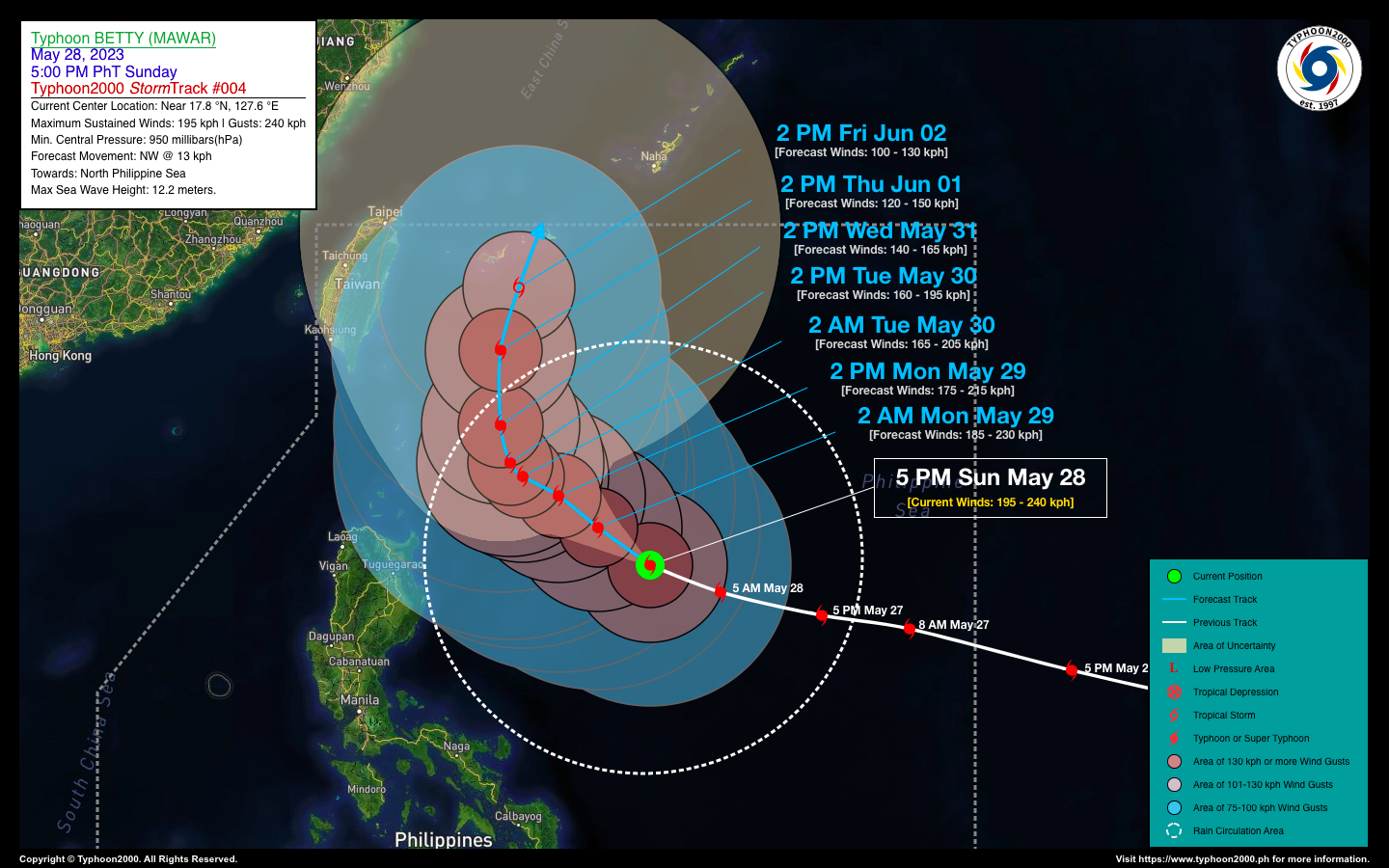
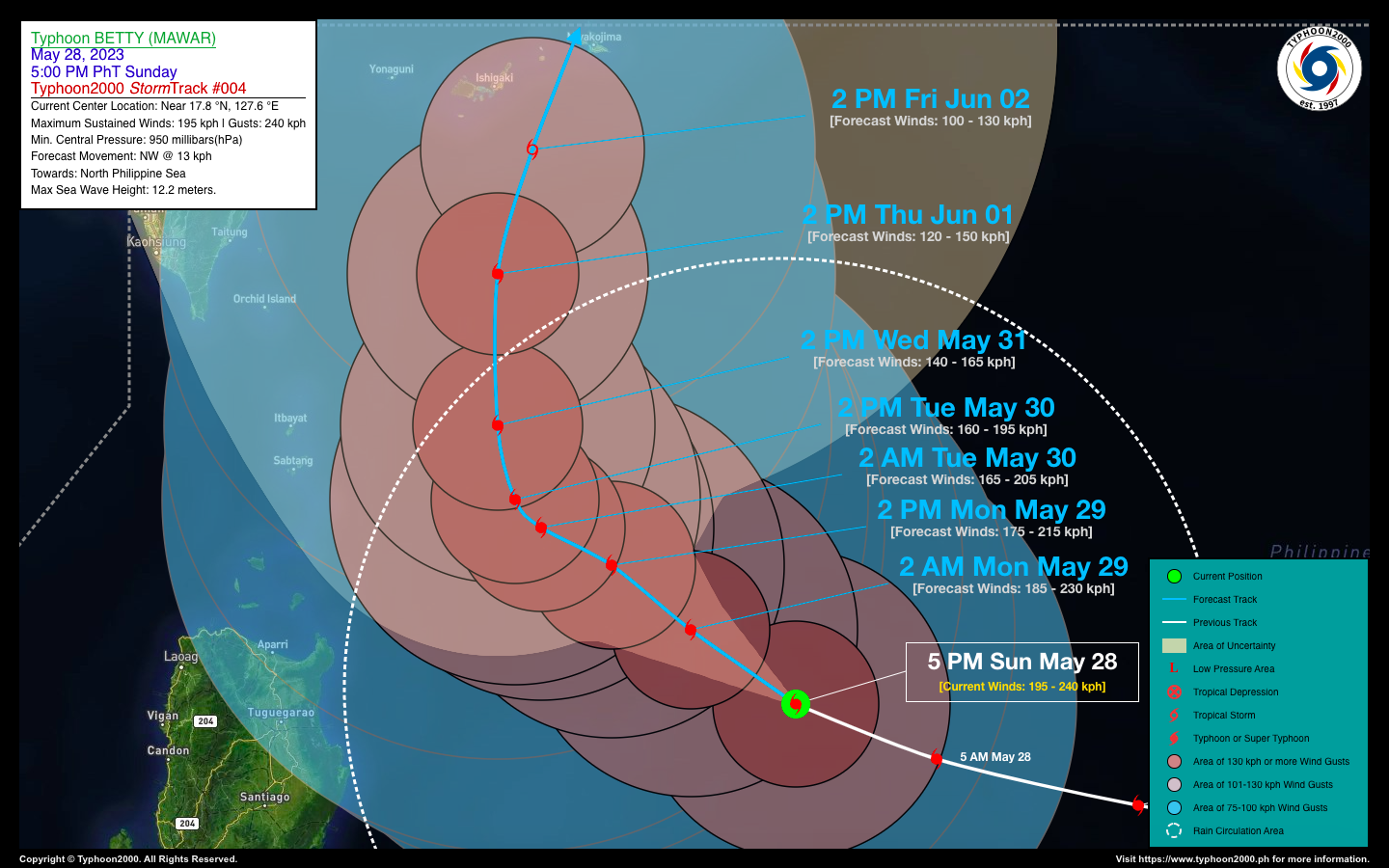
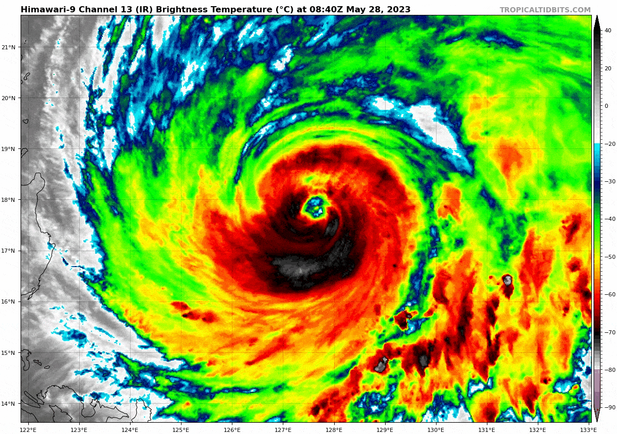
| Current Status & Outlook | Typhoon (TY) BETTY {MAWAR} has weakened further as it moves into an area of cooler sea surface temperatures beneath the system [26°-27°C]. The overall circulation of the typhoon has become larger [about 1,300 km in diameter] while moving closer to Extreme Northern Luzon. Outer rainbands of Betty will start to spread across Northern Luzon tomorrow, bringing rains and thunderstorms over the area.
48-hr Outlook: TY BETTY (MAWAR) is forecast to move northwest slowly with a decreased forward speed from 14 to 05 km/hr through Tuesday afternoon (May 30). The system will likewise continue losing strength and could become just a strong minimal Typhoon (Category 2) on Tuesday afternoon with forecast 1-min. sustained winds of 160 kph. Tropical Storm Force Winds gusting from 75 to 100 kph will be expected along the eastern sections of Cagayan Valley Region beginning late Monday night through Tuesday. The presence of this typhoon will continue to enhance the Southwest Monsoon (Habagat) and bring much needed rainfall across the agricultural farmlands of Western Luzon, MiMaRoPa, Visayas, and Mindanao tonight until next weekend. Meanwhile, residents living in hazard-prone areas must take all necessary precautions against floods and landslides along the above-mentioned areas. |
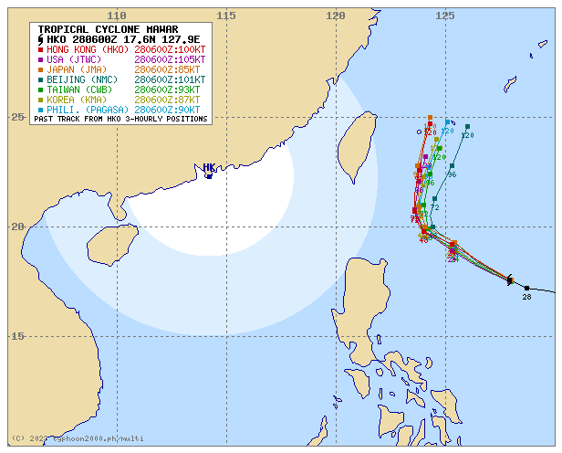
| Where is BETTY (MAWAR)? | As of 5:00 PM PhT today, May 28…0900 GMT:
|
| How strong is it? | Maximum Sustained Winds (1-min avg): 195 kph near the center…Gustiness: 240 kph. |
| Past Movement (06 hrs) | West-Northwest @ 14 kph, towards the North Philippine Sea. |
| Potential Philippine Major Landfall Area(s) |
|
| What Philippine areas will be directly affected? | Heavy to Extreme Rainfall (50 mm to >100 mm expected for 24 hrs):
Damaging Winds (gusts of more than 100 km/hr expected):
|
| Potential Storm Surge/Coastal Flooding Areas+ |
+Waves of 3 meters in height are expected in storm surge-prone areas, particularly in coastal areas where the Tropical Cyclone is headed. Kindly visit the PAGASA Storm Surge Updates for more details. |
| 3-Day Forecast Outlook Summary** |
**Important Note: Please be reminded that the Forecast Outlook changes every 6 hours, and the Day 2 and 3 Forecast Track have an average error of 100 and 250 km respectively… while the wind speed forecast error, averages 35 km/hr per day. Therefore, a turn to the left or right of its future track and changes in its wind speed must be anticipated from time to time. |
| Other Storm’s Meteorological Information |
|
| Disclaimer: Information based on data collected by Typhoon2000 (T2k) shall not be taken as official data. Weather information broadcasted and distributed by PAGASA remains as official data. Typhoon2000 (T2k) shall not be responsible for the private use and reliance of its weather information. | |
Issued by: David Michael V. Padua for Typhoon2000 (T2k)
Typhoon2000 (T2K) Integrated Multi-Agency Tracks
PAGASA TROPICAL CYCLONE WIND SIGNAL
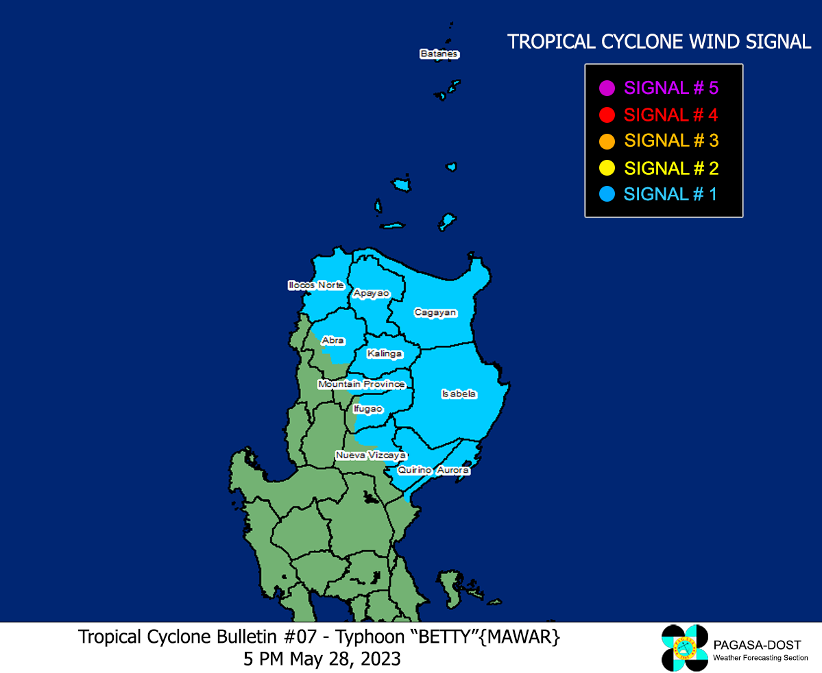
Image/Screenshot Source: DOST-PAGASA (https://bagong.pagasa.dost.gov.ph/tropical-cyclone/severe-weather-bulletin)


