

TROPICAL DEPRESSION AURING (DUJUAN) ADVISORY NO. 10Issued at: 7:00 AM PhT (23:00 GMT) Monday, 22 February 2021
Next update: 7:00 PM PhT (11:00 GMT) Monday, 22 February 2021 |
|
|---|---|
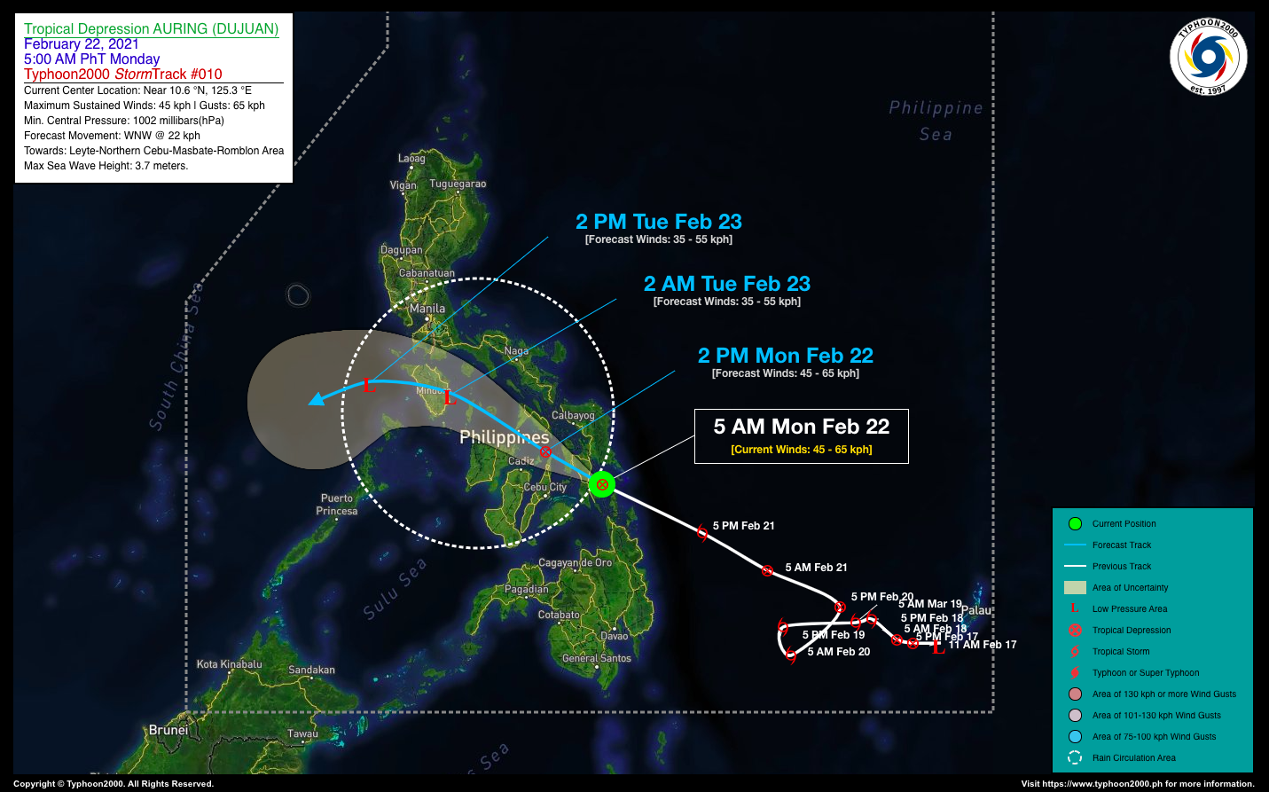
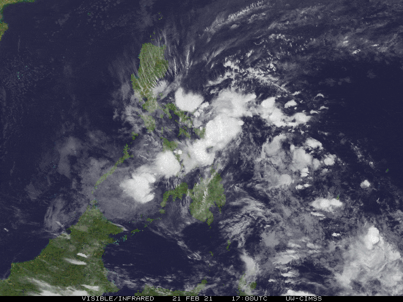
| Current Status & Outlook | AURING (DUJUAN) has weakened once again into a Tropical Depression (TD) as it begins to cross Leyte and the northern parts of Visayas. This system will start to decay upon crossing the rugged terrain of Visayas today.
Meanwhile, its rainbands together with the enhanced Northeast Monsoon (Amihan) will continue to bring rains and thunderstorms across Visayas, Bicol Region, MiMaRoPa, and CaLaBaRZon including Metro Manila today. 24-hr Outlook: TD AURING (DUJUAN) is forecast to decay into a Tropical Disturbance (LPA) once the system reaches Romblon-Mindoro Area later tonight, and will continue moving WNW-ward at a decreased forward speed of 22 kph. It will be in the vicinity of Oriental Mindoro by early tomorrow morning (Tue Feb 23). |
| Where is AURING (DUJUAN)? | As of 5:00 AM PhT today, February 22…2100 GMT:
|
| How strong is it? | Maximum Sustained Winds (1-min avg): 45 kph near the center…Gustiness: 65 kph. |
| Past Movement (06 hrs) | West-Northwest @ 25 kph, towards Sibuyan Sea-Romblon Area. |
| Potential Philippine Landfall Area(s) |
|
| What Philippine areas will be directly affected? | Heavy to Extreme Rainfall (50 mm to >100 mm expected for 24 hrs):
Damaging Winds (gusts of more than 100 km/hr expected):
|
| Potential Storm Surge/Coastal Flooding Areas+ |
+Waves of 3 meters in height is expected in storm surge-prone areas, particularly in coastal areas on where the Tropical Cyclone is headed. Kindly visit the PAGASA Storm Surge Updates for more details. |
| 1-Day Forecast Outlook Summary** |
**Important Note: Please be reminded that the Forecast Outlook changes every 6 hours, and the Day 2 and 3 Forecast Track have an average error of 100 and 250 km respectively… while the wind speed forecast error, averages 35 km/hr per day. Therefore, a turn to the left or right of its future track and changes in its wind speed must be anticipated from time to time. |
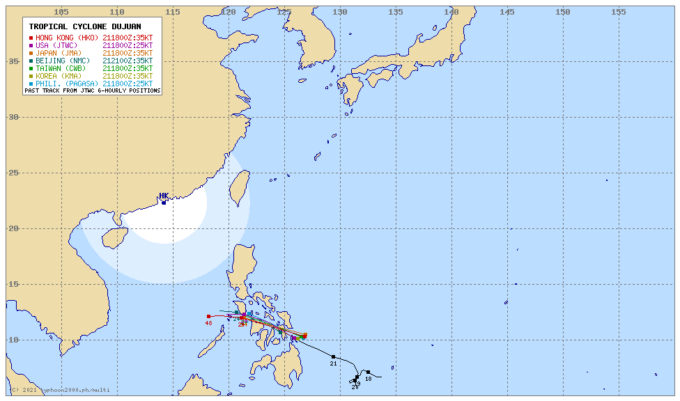
| Other Storm’s Meteorological Information |
|
| Information based on data collected by Typhoon2000 (T2k) shall not be taken as official data. Weather information broadcasted and distributed by PAGASA remains as official data. Typhoon2000 (T2k) shall not be responsible for the private use and reliance of its weather information. | |
Issued by: David Michael V. Padua for Typhoon2000 (T2K)
Typhoon2000 (T2K) Integrated Multi-Agency Tracks
 For more info: http://www.typhoon2000.ph/multi/?name=DUJUAN
PAGASA TROPICAL CYCLONE WIND SIGNAL
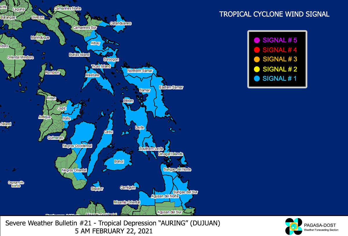 Image/Screenshot Source: DOST-PAGASA (http://pubfiles.pagasa.dost.


