
TYPHOON JULIAN (KRATHON) ADVISORY NO. 05Issued at: 12:00 AM PhT (16:00 GMT) Monday, 30 Sept 2024
Next update: 12:00 PM PhT (04:00 GMT) Monday, 30 Sept 2024 |
|
|---|---|
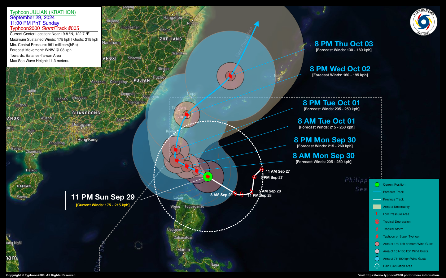
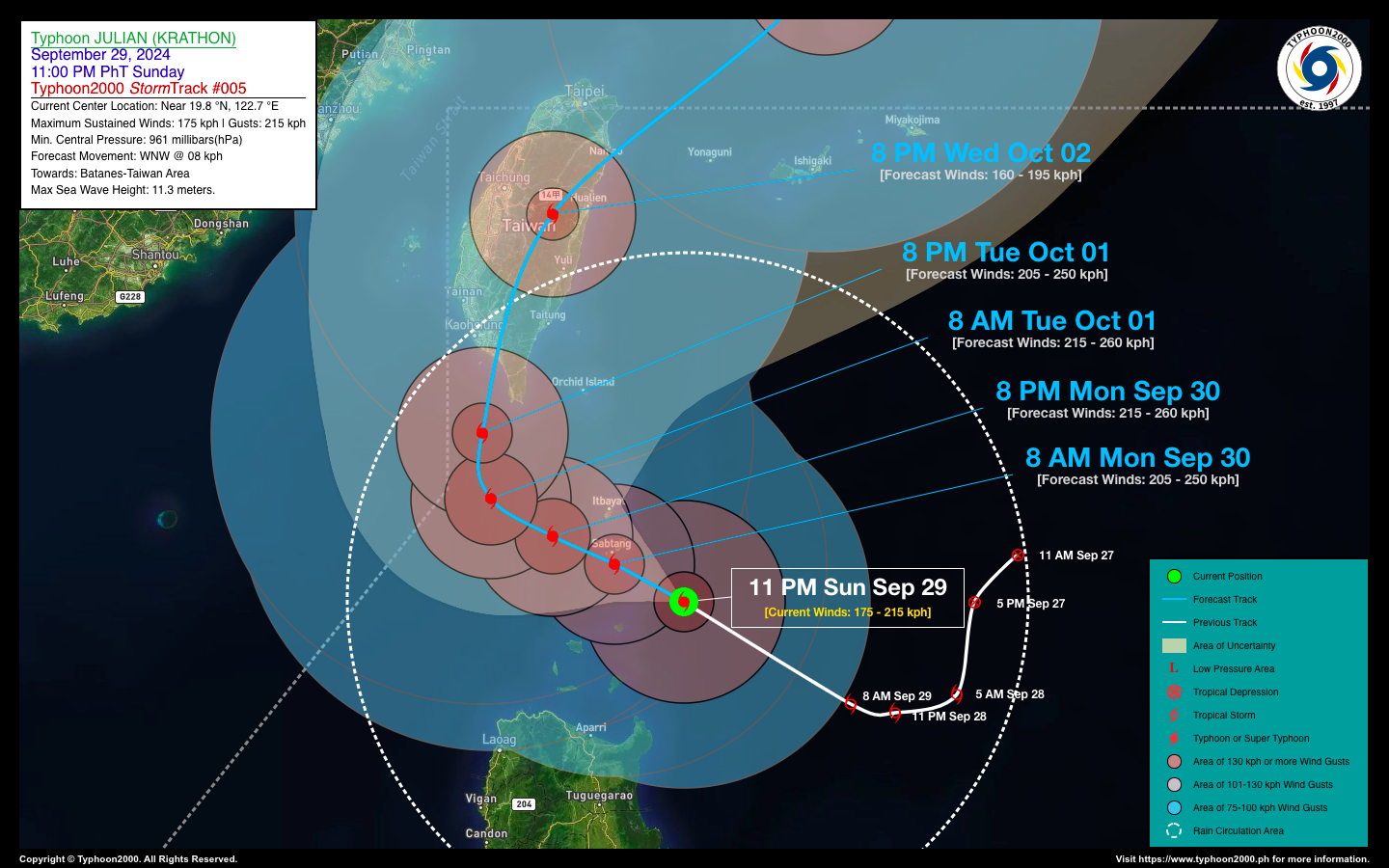
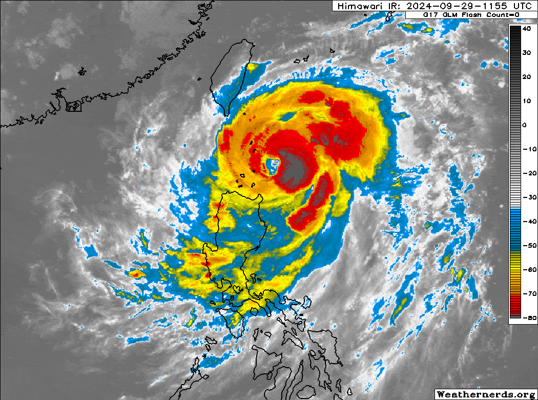
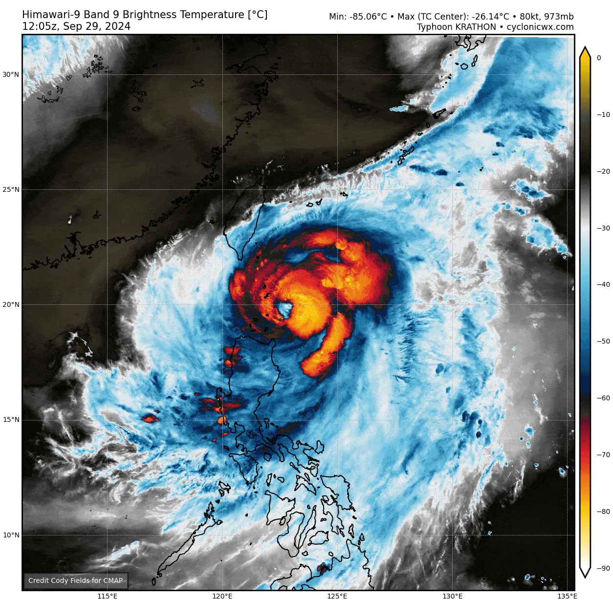
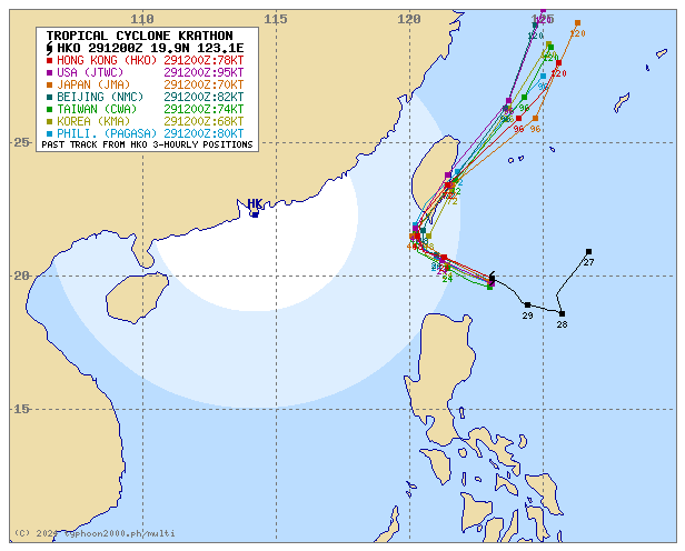
| Current Status & Outlook | Typhoon JULIAN (KRATHON) has rapidly intensified over the past 12 hours while slightly accelerating west-northwestward. It is now entering the coastal waters near Sabtang and the Batan Islands in Batanes. The typhoon’s core is expected to pass over the Batanes Group later this morning, earlier than initially anticipated. Violent wind gusts exceeding 150 km/h are expected in the area this morning.
48-hr Outlook: Typhoon JULIAN is expected to maintain its west-northwest track and speed over the next 12 to 36 hours as it moves along the western coastal waters of Batanes. It may rapidly intensify into a Category 4 typhoon, with winds potentially reaching 215 km/h later tonight. By Tuesday evening (Oct 1), Julian is forecast to take a sharp northerly turn toward southern Taiwan. The storm’s western and southern rainbands will continue to bring cloudy skies, occasional rains, thunderstorms, and gusty winds to the Ilocos and Cagayan Valley regions, as well as northern parts of the Cordillera Administrative Region (CAR), from today through Tuesday. |
| Where is JULIAN (KRATHON)? | As of 11:00 PM PhT last night, Sept 29…1500 GMT:
|
| How strong is it? | Maximum Sustained Winds (1-min avg): 175 kph near the center…Gustiness: 215 kph. |
| Past Movement (06 hrs) | West-Northwest @ 15 kph, towards the Batanes & Taiwan Area. |
| Potential Philippine Major Landfall Area(s) |
|
| What Philippine areas will be directly affected? | Heavy to Extreme Rainfall (50 mm to >100 mm expected for 24 hrs):
Damaging Winds (gusts of >100 km/hr expected):
|
| Potential Storm Surge/Coastal Flooding Areas+ |
+Waves of 3 meters or more in height are expected in storm surge-prone areas, particularly in coastal areas where the Tropical Cyclone is headed. Kindly visit the PAGASA Storm Surge Updates or at the PDF version of the latest PAGASA Tropical Cyclone Bulletin for more details. |
| 3-Day Forecast Outlook Summary** |
**Important Note: Please be reminded that the Forecast Outlook changes every 6 hours, and the Day 2 and 3 Forecast Track have an average error of 100 and 250 km respectively… while the wind speed forecast error, averages 35 km/hr per day. Therefore, a turn to the left or right of its future track and changes in its wind speed must be anticipated from time to time. |
| Other Storm’s Meteorological Information |
|
| Disclaimer: Information based on data collected by Typhoon2000 (T2k) shall not be taken as official data. Weather information broadcasted and distributed by PAGASA remains as official data. Typhoon2000 (T2k) shall not be responsible for the private use and reliance of its weather information. | |
Issued by: David Michael V. Padua for Typhoon2000 (T2k)
Typhoon2000 (T2K) Integrated Multi-Agency Tracks
For more info visit: (http://www.typhoon2000.ph/multi/?name=KRATHON)
PAGASA TROPICAL CYCLONE WIND SIGNAL
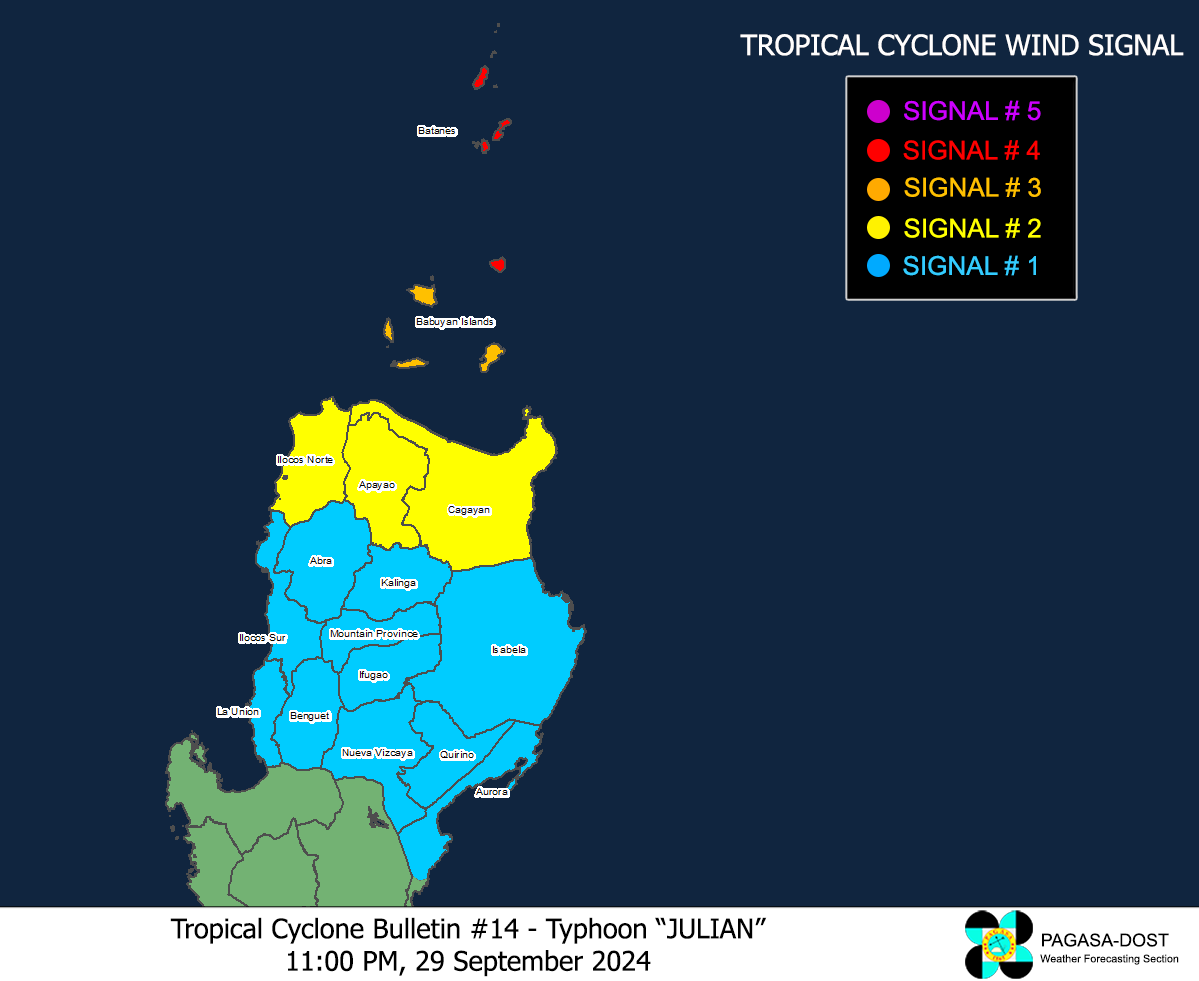
Image/Screenshot Source: DOST-PAGASA (https://www.pagasa.dost.gov.ph/tropical-cyclone/severe-weather-bulletin)


