
SUPER TYPHOON MAWAR STORMWATCH NO. 01Issued at: 1:00 AM PhT (17:00 GMT) Friday, 26 May 2023
Next update: 1:00 AM PhT (17:00 GMT) Saturday, 26 May 2023 |
|
|---|---|
| Current Status and Outlook |
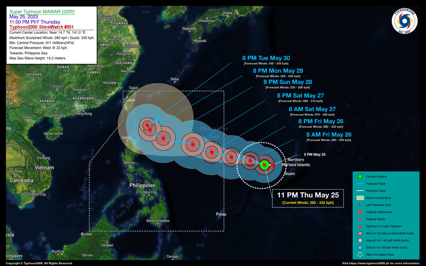
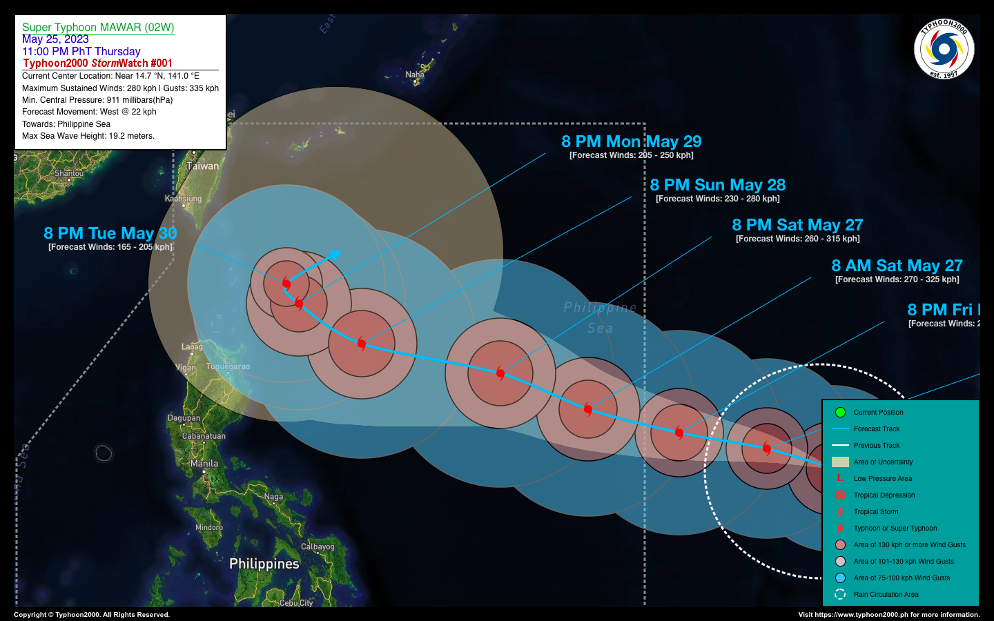
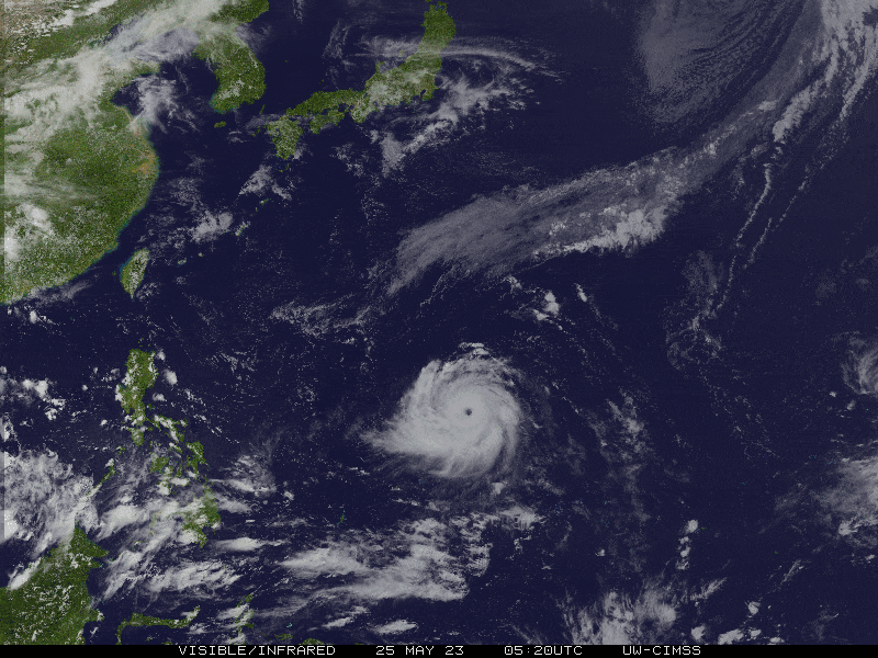
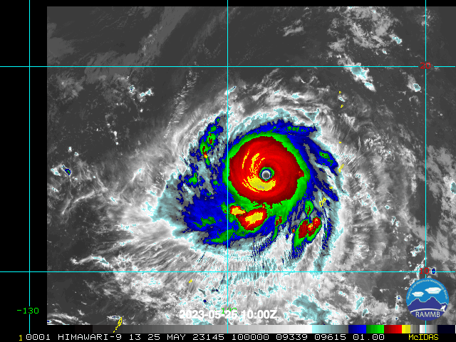
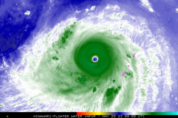
The Extremely Catastrophic Super Typhoon (STY) MAWAR which passed over Guam-Rota Area along Southern Marianas 36 hours ago, has started to bend more westward and accelerated towards the eastern part of the Philippine Sea…expected to enter the Philippine Area of Responsibility (PAR) later tonight or early Saturday morning. This super cyclone is still far away to directly affect any part of the country. However, the accompanying Monsoon Trough situated along Southern Luzon, MiMaRoPa, Visayas & Mindanao will bring isolated overcast skies with isolated to scattered rain showers & severe thunderstorms across the area. |
| Where is MAWAR? | As of 11:00 PM PhT last night, May 25…1500 GMT:
|
| How strong is it? | Maximum Sustained Winds (1-min avg): 280 kph near the center…Gustiness: 335 kph. |
| Past Movement (06 hrs) | West @ 22 kph, across the Western Pacific Ocean. |
| Forecast Highlights |
|
| This StormWatch is valid for the next 24 hours. However, in the event that the cyclone has entered PAR, the 12 or 6 hourly Tropical Cyclone Advisories will commence.
Information based on data collected by Typhoon2000 (T2k) shall not be taken as official data. Weather information broadcasted and distributed by PAGASA remains as official data. Typhoon2000 (T2k) shall not be responsible for the private use and reliance of its weather information. |
|
Issued by: David Michael V. Padua for Typhoon2000 (T2K)
PAGASA TROPICAL CYCLONE WIND SIGNAL
:: None Yet.
Image/Screenshot Source: DOST-PAGASA ()


