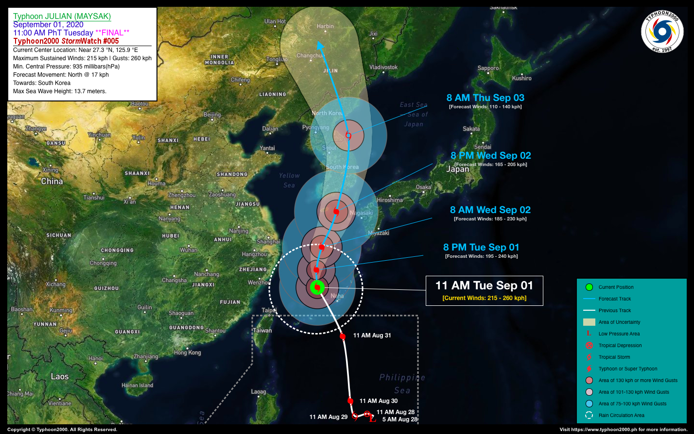
TYPHOON JULIAN (MAYSAK) STORMWATCH NO. 05 [FINAL]Issued at: 1:00 PM PhT (05:00 GMT) Tuesday, 01 September 2020
|
|
|---|---|
| Current Status and Outlook |
JULIAN (MAYSAK) is now a powerful Category 4 Typhoon as it moves away from Okinawa-Ryukyus Area…seriously heading towards South Korea, with possible landfall late tomorrow evening (Sept 02) or early Thursday morning (Sept 03). Since the typhoon already moved out of the Philippine Area of Responsibility (PAR) last night, this will be the final stormwatch on this Tropical Cyclone. *This typhoon will continue to slightly enhance the Southwesterly Surface Windflow (Weak Habagat) and bring some cloudy skies with isolated to scattered rain showers and thunderstorms across the western sections of Luzon. |
| Where is JULIAN (MAYSAK)? | As of 11:00 AM PhT today, September 01…0300 GMT. The eye was located over the East China Sea (near 27.3°N 125.9°E), about 223 km northwest of Okinawa, Japan or 851 km north-northeast of Basco, Batanes. |
| How strong is it? | Maximum Sustained Winds (1-min avg): 215 kph near the center…Gustiness: 260 kph. |
| Past Movement (06 hrs) | North-Northwest @ 15 kph, towards South Korea. |
| Forecast Highlights |
|
| Information based on data collected by Typhoon2000 (T2k) shall not be taken as official data. Weather information broadcasted and distributed by PAGASA remains as official data. Typhoon2000 (T2k) shall not be responsible for the private use and reliance of its weather information. | |
Issued by: David Michael V. Padua for T2K


