
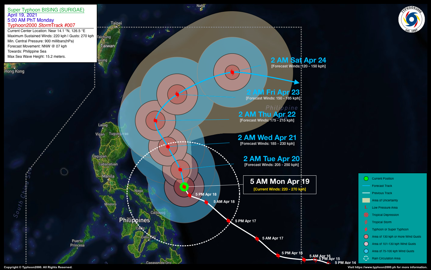
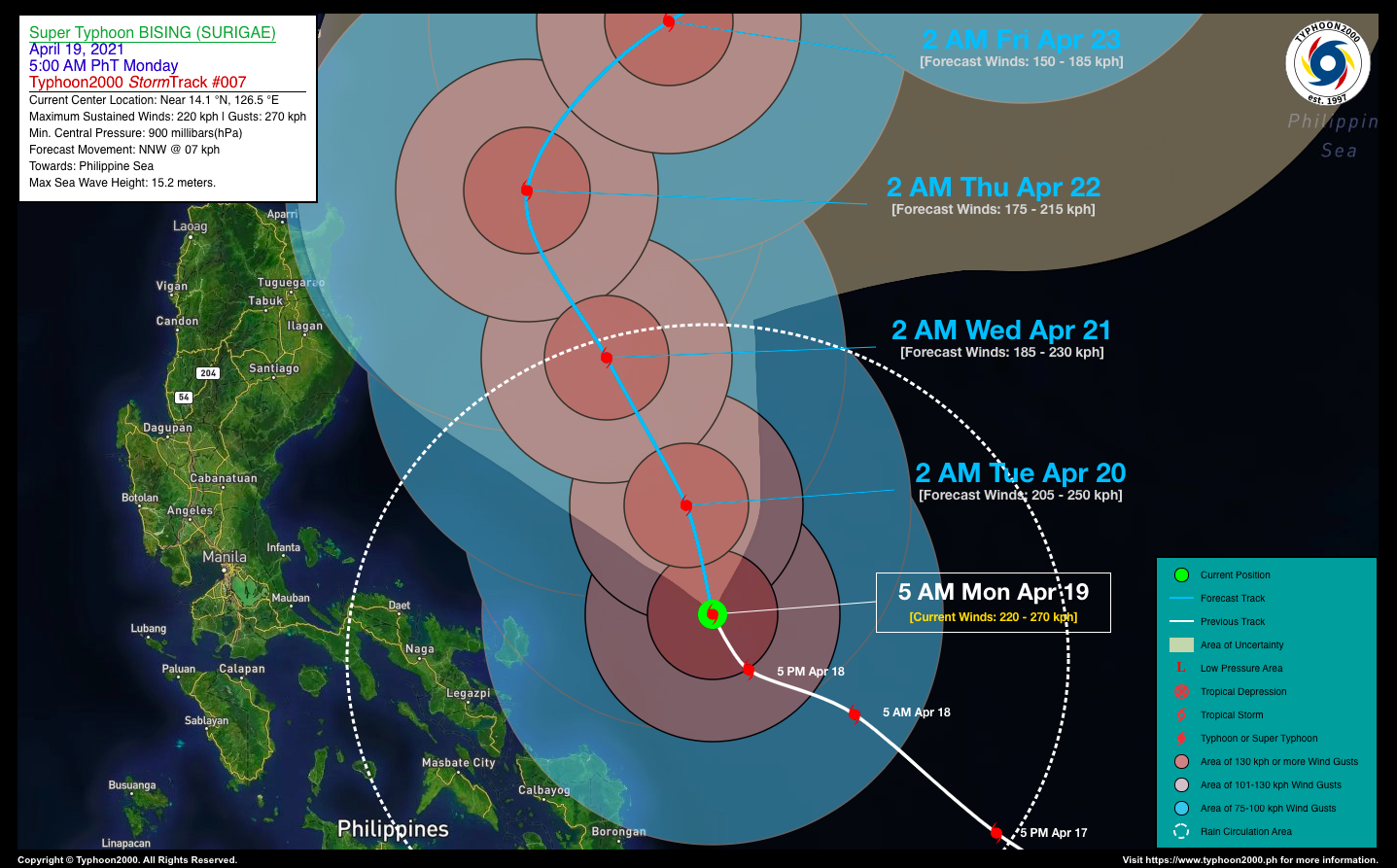
TYPHOON BISING (SURIGAE) ADVISORY NO. 07Issued at: 7:00 AM PhT (23:00 GMT) Monday, 19 April 2021
Next update: 7:00 PM PhT (11:00 GMT) Monday, 19 April 2021 |
|
|---|---|
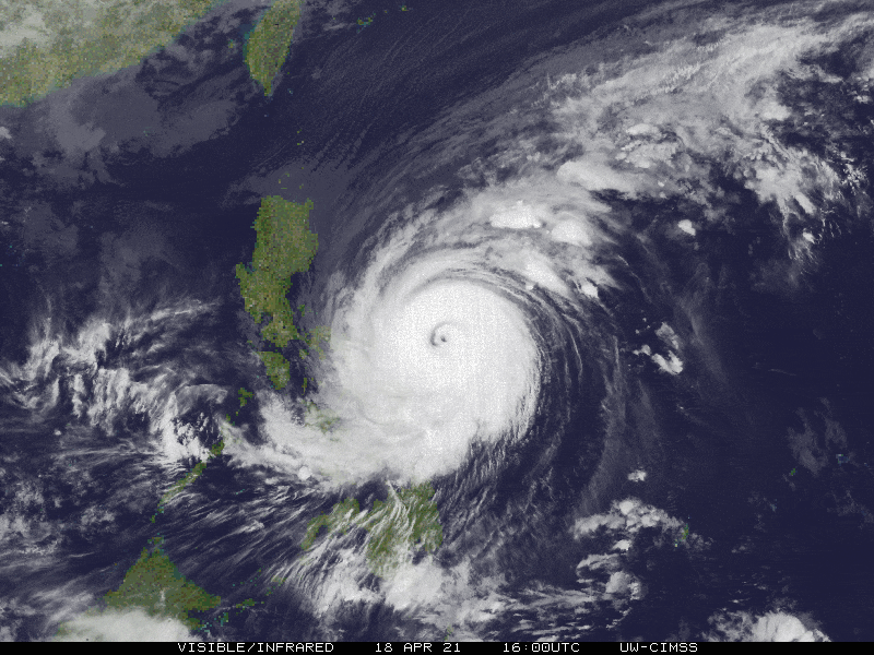
| Current Status & Outlook | BISING (SURIGAE) no longer a Super Typhoon (STY) after it weakened further overnight…now moving slowly north-northwestward across the Philippine Sea, east-northeast of Bicol Region.
This typhoon will still bring occasional rains with severe thunderstorms and gusty winds across Samar and Bicol Provinces including Bondoc Peninsula (Quezon) today. Meanwhile, its Trough will continue to bring cloudy skies with scattered rain showers and thunderstorms across the Visayas. 24-hr Outlook: TY BISING (SURIGAE) is forecast to continue moving north-northwestward slowly at a speed of 07 km/hr and will remain over the mid-western part of the Central Philippine Sea. This cyclone will continue to weaken, becoming a Category 3 TY within the next 12 to 24 hours. |
| Where is BISING (SURIGAE)? | As of 5:00 AM PhT today, April 19…2100 GMT:
|
| How strong is it? | Maximum Sustained Winds (1-min avg): 220 kph near the center…Gustiness: 270 kph. |
| Past Movement (06 hrs) | North-Northwest @ 07 kph, across the Philippine Sea |
| Potential Philippine Landfall Area(s) |
|
| What Philippine areas will be directly affected? | Heavy to Extreme Rainfall (50 mm to >100 mm expected for 24 hrs):
Damaging Winds (gusts of more than 100 km/hr expected):
|
| Potential Storm Surge/Coastal Flooding Areas+ |
+Waves of 3 to 5 meters in height is expected in storm surge-prone areas, particularly in coastal areas on where the Tropical Cyclone is headed. Kindly visit the PAGASA Storm Surge Updates for more details. |
| 3-Day Forecast Outlook Summary** |
**Important Note: Please be reminded that the Forecast Outlook changes every 6 hours, and the Day 2 and 3 Forecast Track have an average error of 100 and 250 km respectively… while the wind speed forecast error, averages 35 km/hr per day. Therefore, a turn to the left or right of its future track and changes in its wind speed must be anticipated from time to time. |
| Other Storm’s Meteorological Information |
|
| Information based on data collected by Typhoon2000 (T2k) shall not be taken as official data. Weather information broadcasted and distributed by PAGASA remains as official data. Typhoon2000 (T2k) shall not be responsible for the private use and reliance of its weather information. | |
Issued by: David Michael V. Padua for Typhoon2000 (T2K)
Typhoon2000 (T2K) Integrated Multi-Agency Tracks
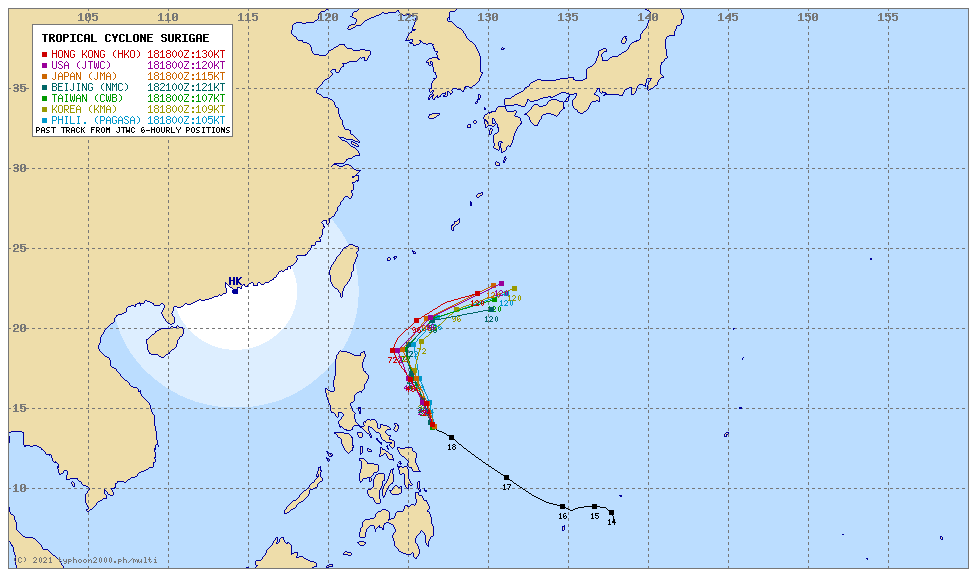 For more info: http://www.typhoon2000.ph/multi/?name=SURIGAE
PAGASA TROPICAL CYCLONE WIND SIGNAL
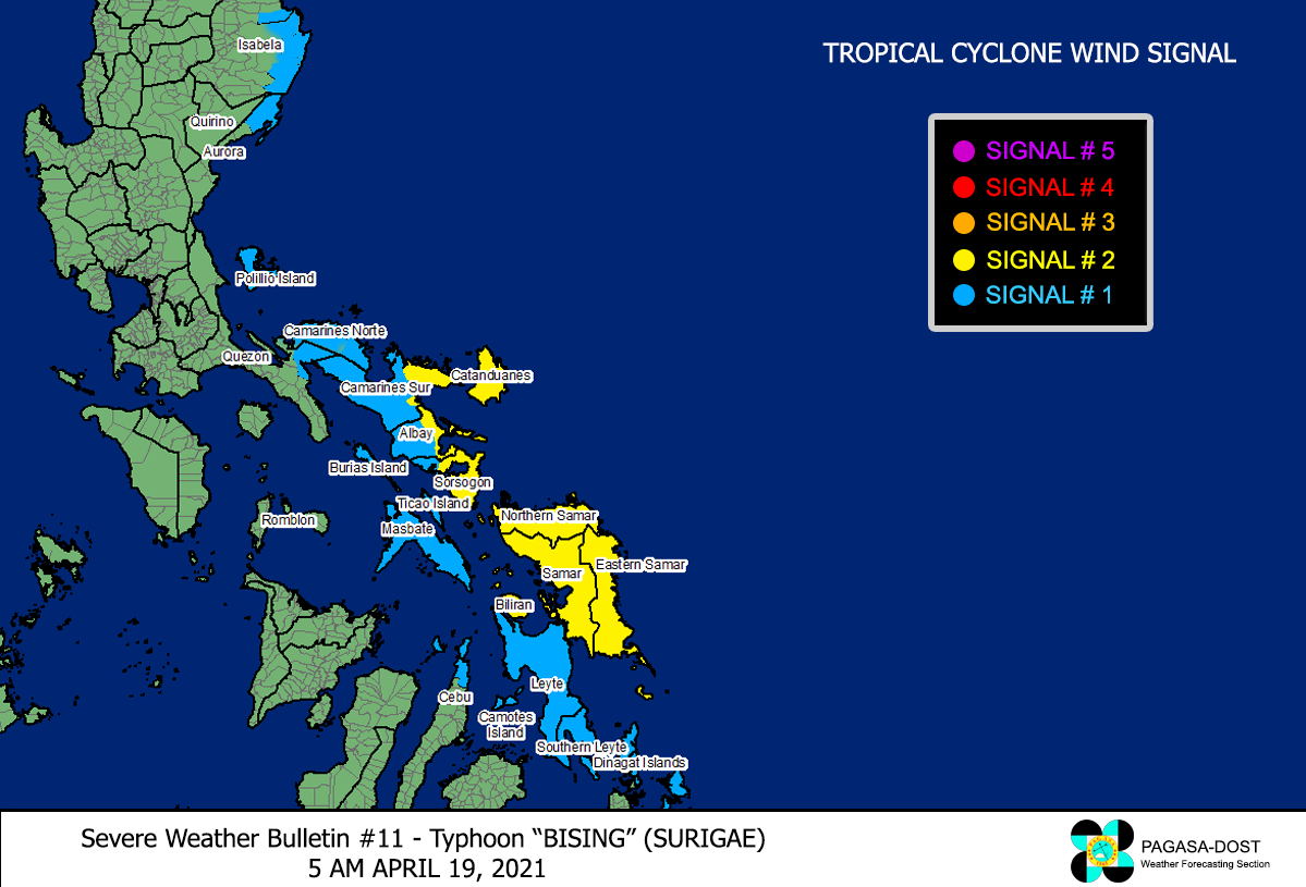
Image/Screenshot Source: DOST-PAGASA (https://pubfiles.pagasa.dost.gov.ph/tamss/weather/signals_bising.png)


