SEVERE TROPICAL STORM CHEDENG (GUCHOL) STORMWATCH NO. 01Issued at: 2:00 AM PhT (18:00 GMT) Thursday, 08 June 2023
Next update: 2:00 AM PhT (18:00 GMT) Friday, 09 June 2023 |
|
|---|---|
| Current Status and Outlook |
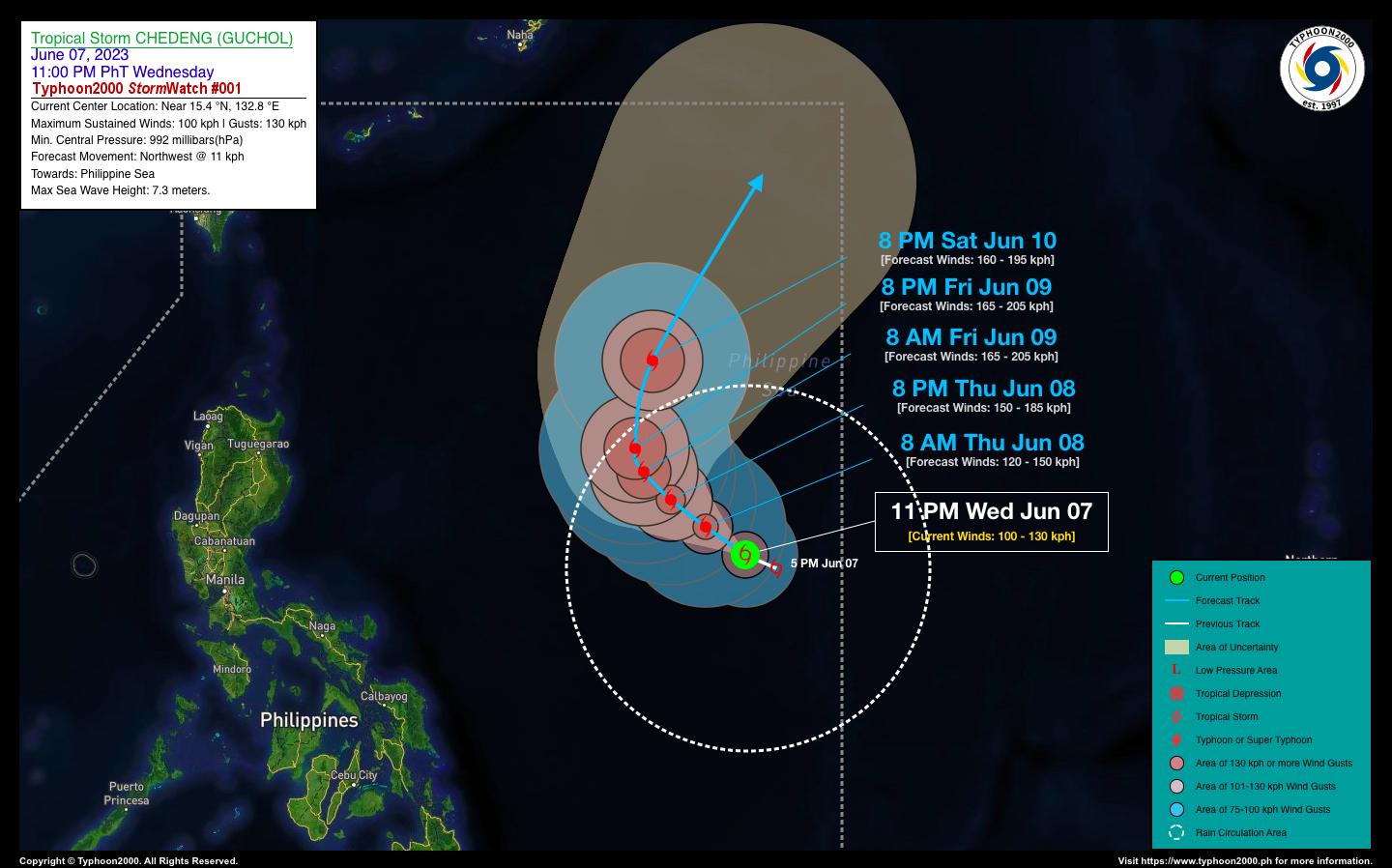
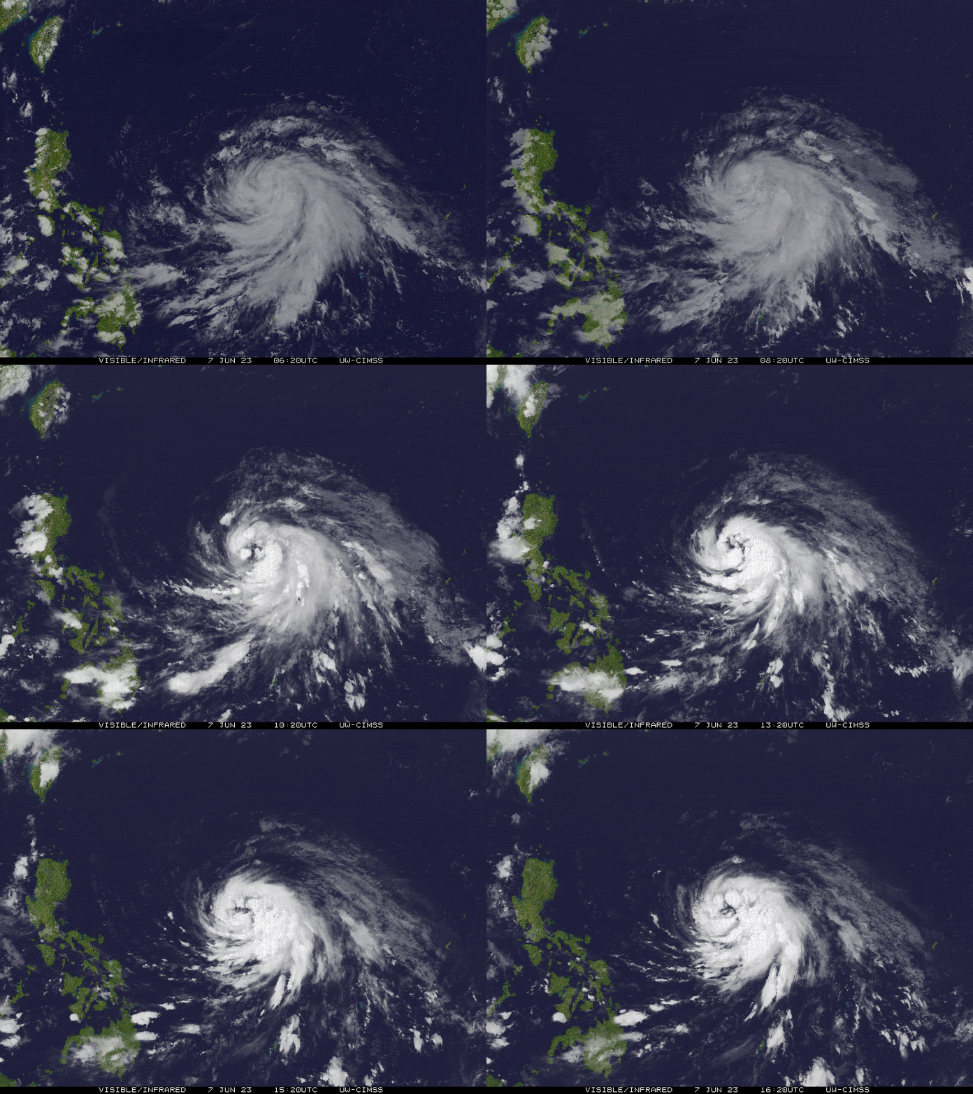
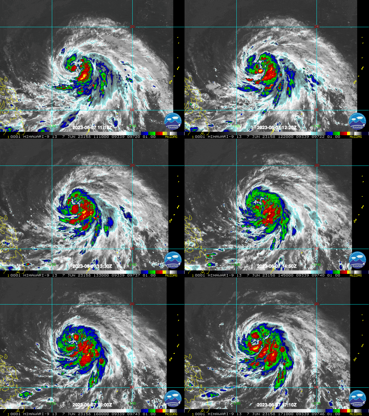
The intensifying Tropical Cyclone over the open waters of the Philippine Sea continues to track on a west-northwest motion. CHEDENG with the global name GUCHOL has reached Severe Tropical Storm (STS) classification as it rapidly strenthens…likely to become a Typhoon later today. This storm is far away to directly affect any part of the country. However, the Southwest Monsoon (Habagat) may be enhanced by Chedeng and bring scattered to occasional rains and thunderstorms across the western sections of the country this weekend. |
| Where is CHEDENG (GUCHOL)? | As of 11:00 PM PhT last night, June 07…1500 GMT:
|
| How strong is it? | Maximum Sustained Winds (1-min avg): 100 kph near the center…Gustiness: 130 kph. |
| Past Movement (06 hrs) | West-Northwest @ 14 kph, across the Philippine Sea. |
| Forecast Highlights |
|
| This StormWatch is valid for the next 24 hours.
Information based on data collected by Typhoon2000 (T2k) shall not be taken as official data. Weather information broadcasted and distributed by PAGASA remains as official data. Typhoon2000 (T2k) shall not be responsible for the private use and reliance of its weather information. |
|
Issued by: David Michael V. Padua for Typhoon2000 (T2K)
PAGASA TROPICAL CYCLONE WIND SIGNAL
:: None Yet.
Image/Screenshot Source: DOST-PAGASA ()


