
TROPICAL DEPRESSION 22W (Pre-ROLLY) ADVISORY NO. 01Issued at: 8:00 PM PhT (12:00 GMT) Wednesday, 28 October 2020
Next update: 7:00 AM PhT (23:00 GMT) Thursday, 29 October 2020 |
|
|---|---|
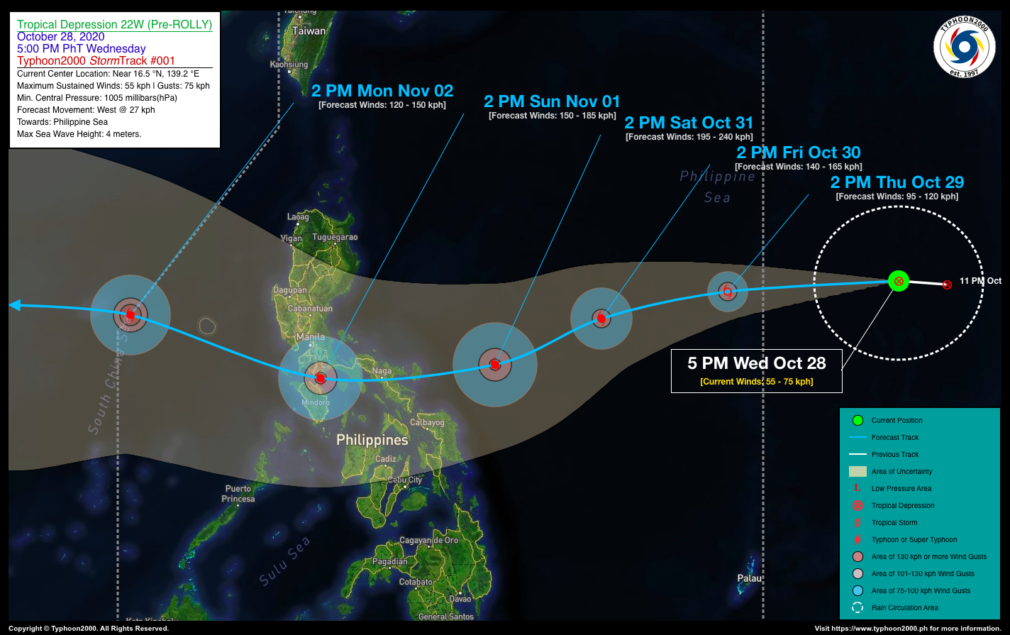
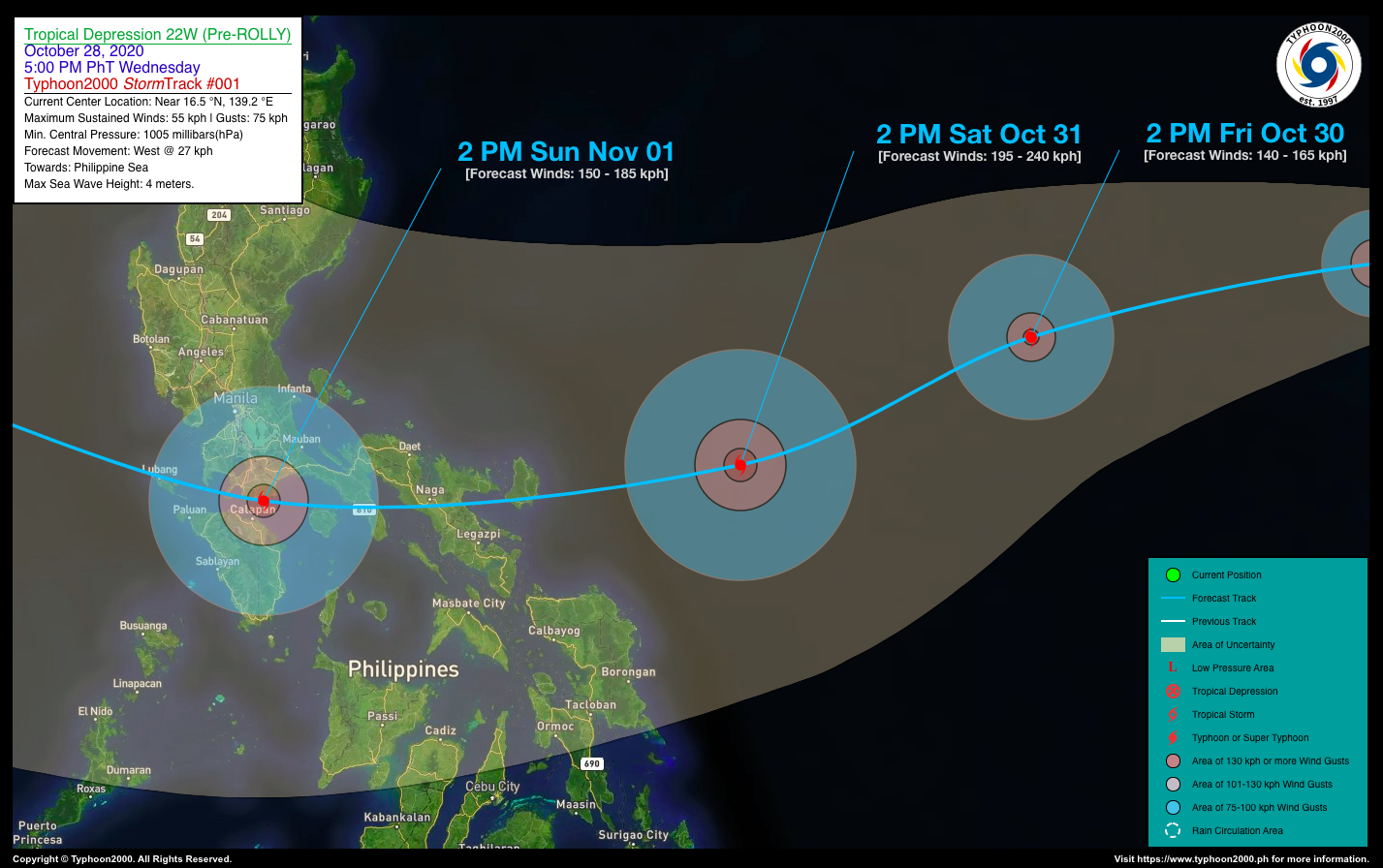
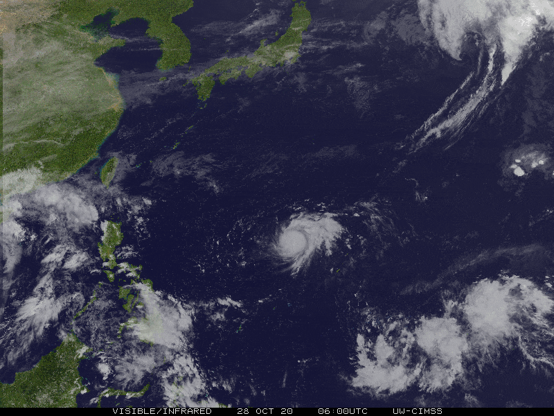
| Current Status & Outlook | Tropical Depression 22W (Pre-ROLLY) intensifying over the Western Pacific Ocean as it moves west to west-northwest…expected to enter the Philippine Area of Responsibility (PAR) tomorrow.
24-hr Outlook: TD 22W is forecast to rapidly become a Tropical Storm (TS) later tonight or early tomorrow morning, and as a Severe Tropical Storm (STS) tomorrow afternoon. It shall move westward with an increased forward speed of 27 km/hr towards eastern portion of the Central Philippine Sea. |
| Where is 22W? | As of 5:00 PM PhT today, October 28…0900 GMT:
|
| How strong is it? | Maximum Sustained Winds (1-min avg): 55 kph near the center…Gustiness: 75 kph. |
| Past Movement (06 hrs) | West-Southwest @ 18 kph, towards Philippine Sea |
| Potential Philippine Landfall Area(s) |
|
| What Philippine areas will be directly affected? | Heavy to Extreme Rains (50 mm to >100 mm expected in 24 hrs):
Damaging Winds (gusts of more than 100 km/hr expected):
|
| Potential Storm Surge/Coastal Flooding Areas+ |
+Waves of 3 meters in height is expected in storm surge-prone areas, particularly in coastal areas on where the Tropical Cyclone is headed. Kindly visit the PAGASA Storm Surge Updates for more details. |
| 3-Day Forecast Outlook Summary** |
**Important Note: Please be reminded that the Forecast Outlook changes every 6 hours, and the Day 2 and 3 Forecast Track have an average error of 100 and 250 km respectively… while the wind speed forecast error, averages 35 km/hr per day. Therefore, a turn to the left or right of its future track and changes in its wind speed must be anticipated from time to time. |
| Other Storm’s Meteorological Information |
|
| Information based on data collected by Typhoon2000 (T2k) shall not be taken as official data. Weather information broadcasted and distributed by PAGASA remains as official data. Typhoon2000 (T2k) shall not be responsible for the private use and reliance of its weather information. | |
Issued by: David Michael V. Padua for Typhoon2000 (T2K)
PAGASA TROPICAL CYCLONE WIND SIGNAL
:: None ::
Image Source: DOST-PAGASA (http://pubfiles.pagasa.dost.


