TROPICAL STORM RAI STORMWATCH NO. 02Issued at: 7:00 PM PhT (11:00 GMT) Monday, 13 December 2021
Next update: 7:00 PM PhT (11:00 GMT) Tuesday, 14 December 2021 |
|
|---|---|
| Current Status and Outlook |
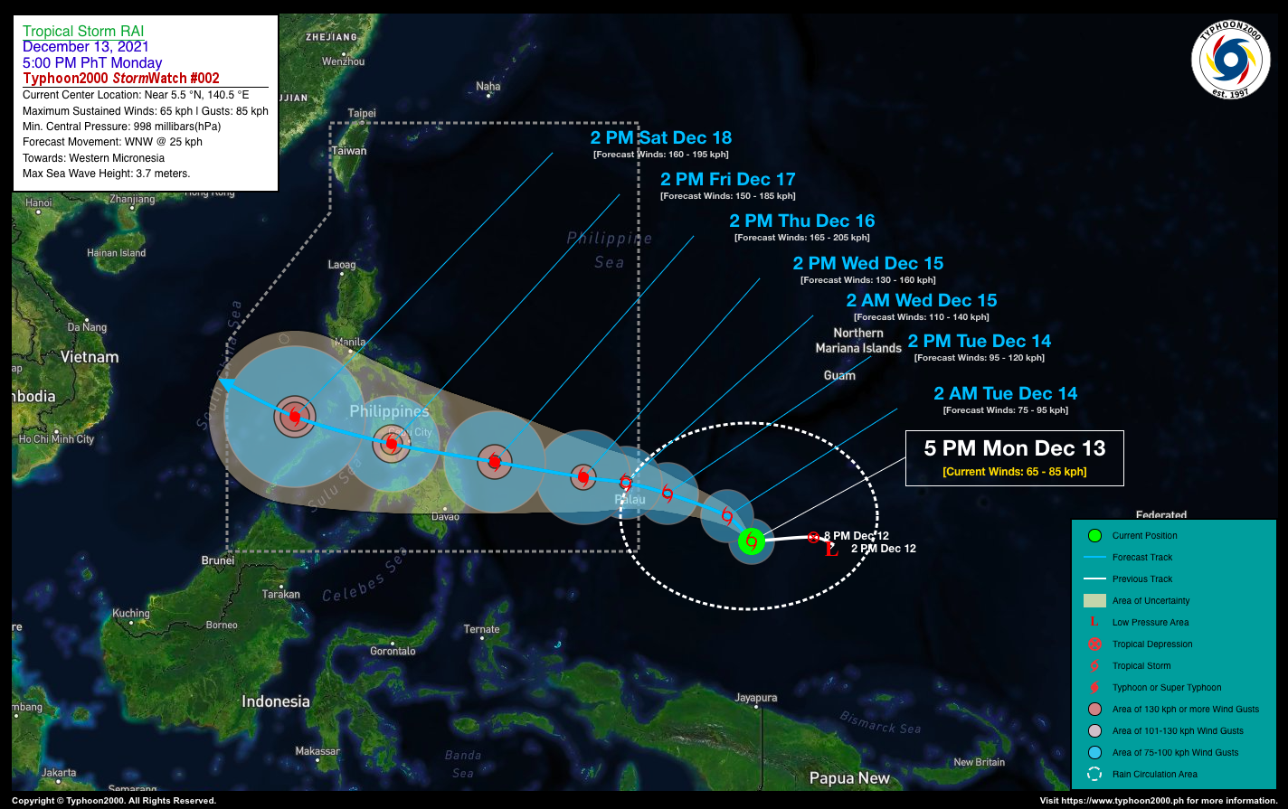
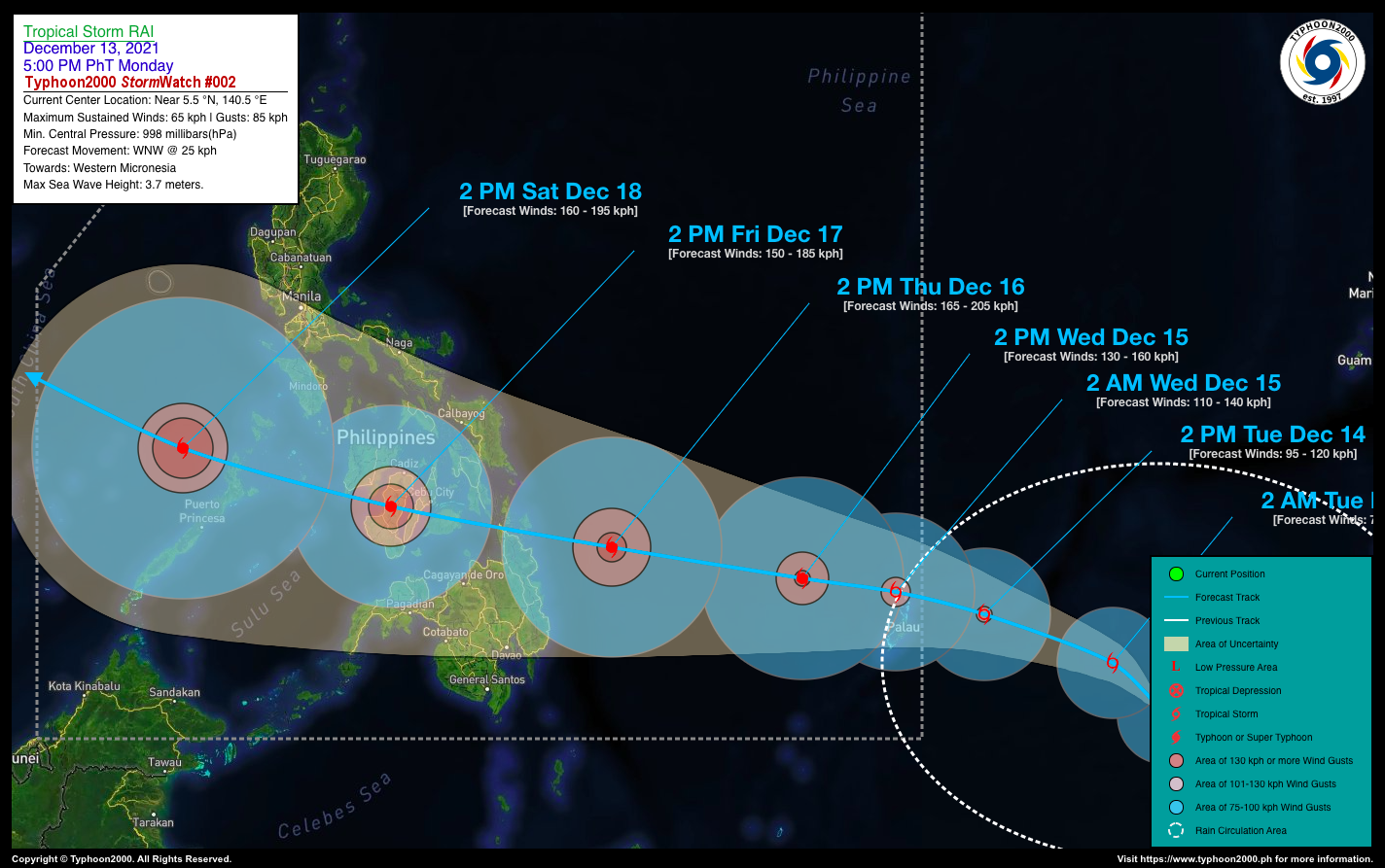
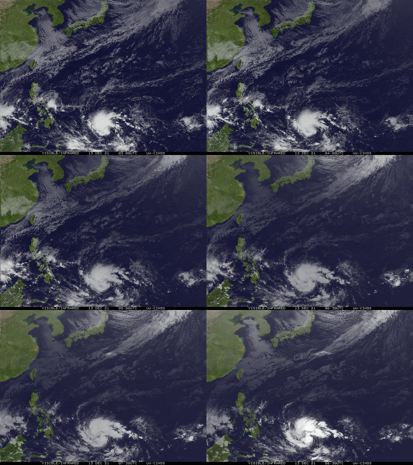
The Tropical Depression (TD) over Western Micronesia has strengthened into a Tropical Storm. (TS), and is now named internationally as “RAI” – known as the Stone money of Yap State. Contributed by Micronesia. The storm is currently moving towards the Philippine Sea. TS RAI is forecast to continue intensifying within the next 24 hours, becoming a Severe Tropical Storm (STS) by tomorrow afternoon. It will enter the Philippine Area of Responsibility (PAR) by late tomorrow evening (Dec 14), and may traverse Northern Caraga-Visayas-Palawan Area on Thursday evening through Saturday morning (Dec 16-18) as a potentially dangerous Typhoon. |
| Where is TS RAI? | As of 5:00 PM PhT today, December 13…0900 GMT:
|
| How strong is it? | Maximum Sustained Winds (1-min avg): 65 kph near the center…Gustiness: 85 kph. |
| Past Movement (06 hrs) | West-Northwest @ 18 kph, towards the Western Micronesia. |
| Forecast Highlights |
|
| This StormWatch is valid for the next 24 hours.
Information based on data collected by Typhoon2000 (T2k) shall not be taken as official data. Weather information broadcasted and distributed by PAGASA remains as official data. Typhoon2000 (T2k) shall not be responsible for the private use and reliance of its weather information. |
|
Issued by: David Michael V. Padua for Typhoon2000 (T2K)


