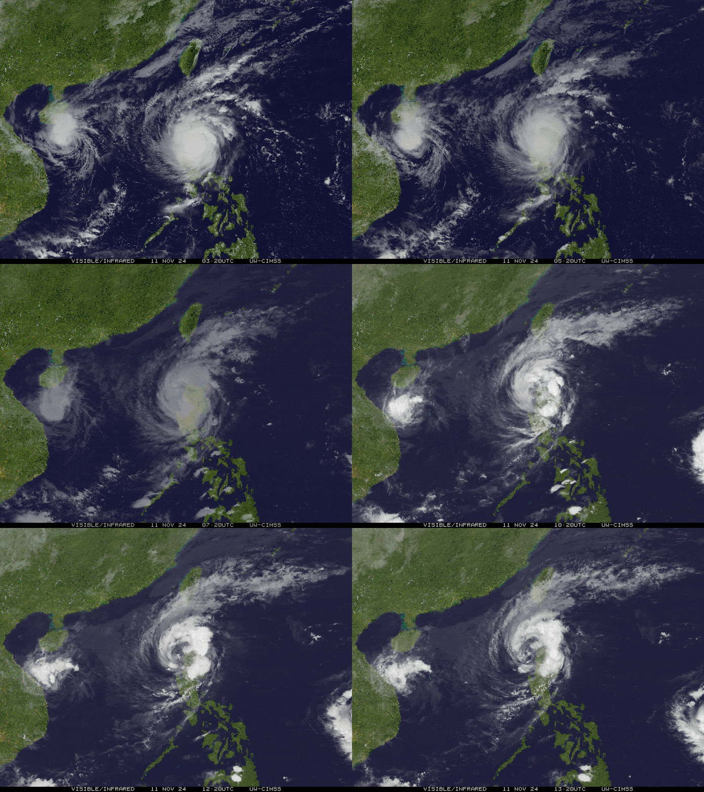
SEVERE TROPICAL STORM NIKA (TORAJI) ADVISORY NO. 05 [Final]Issued at: 10:00 PM PhT (14:00 GMT) Monday, 11 Nov 2024
|
|
|---|---|
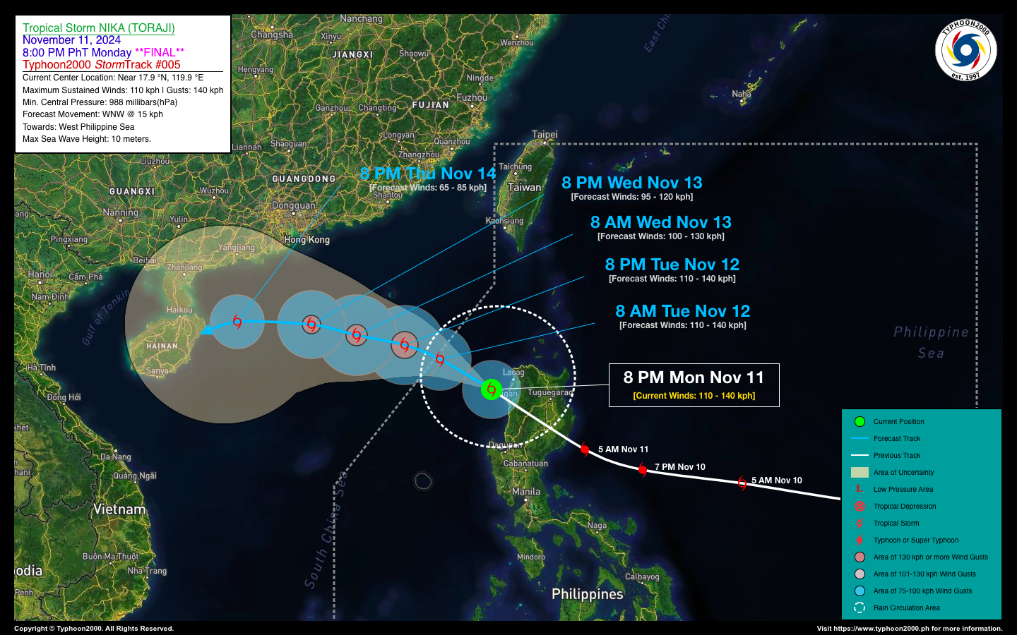
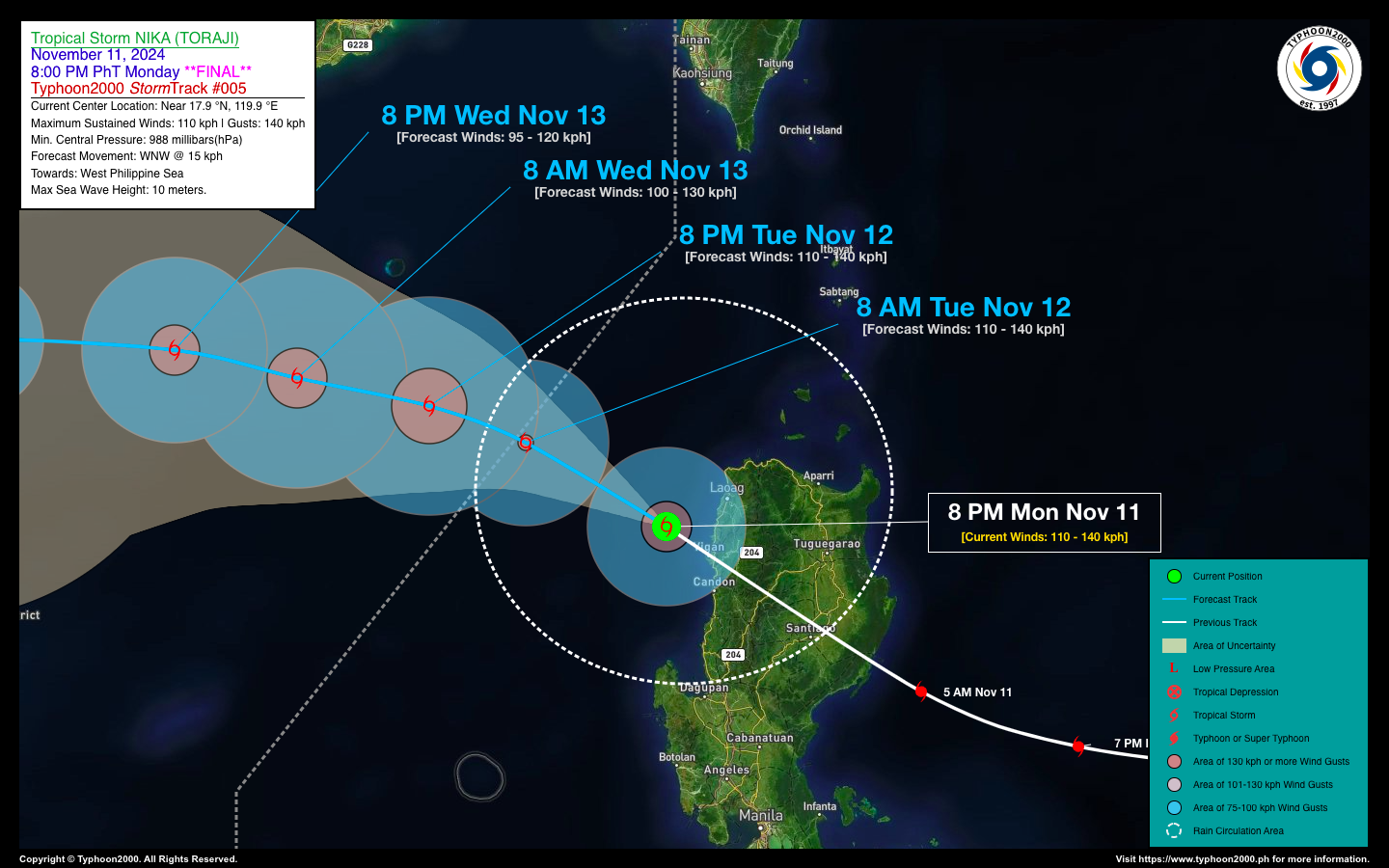
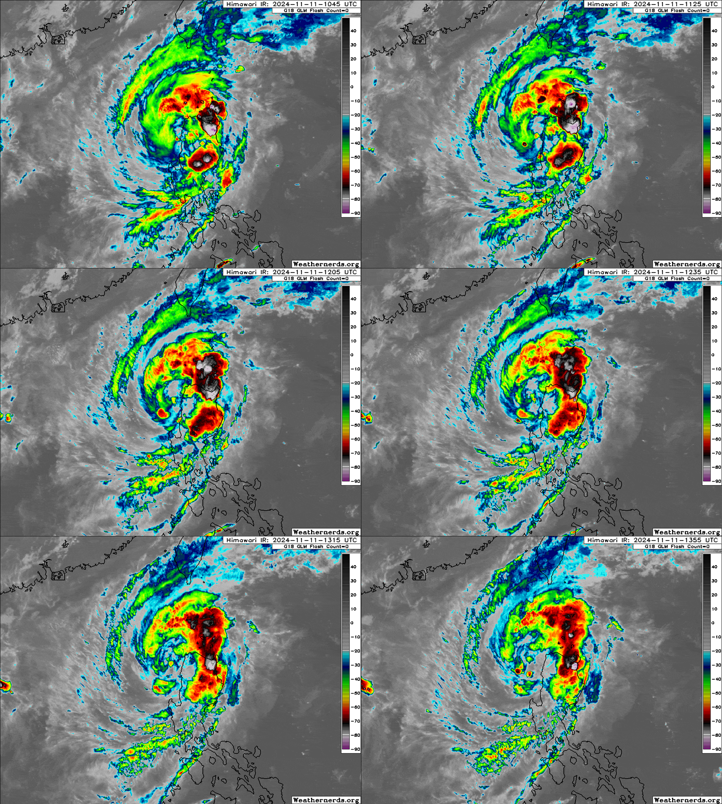
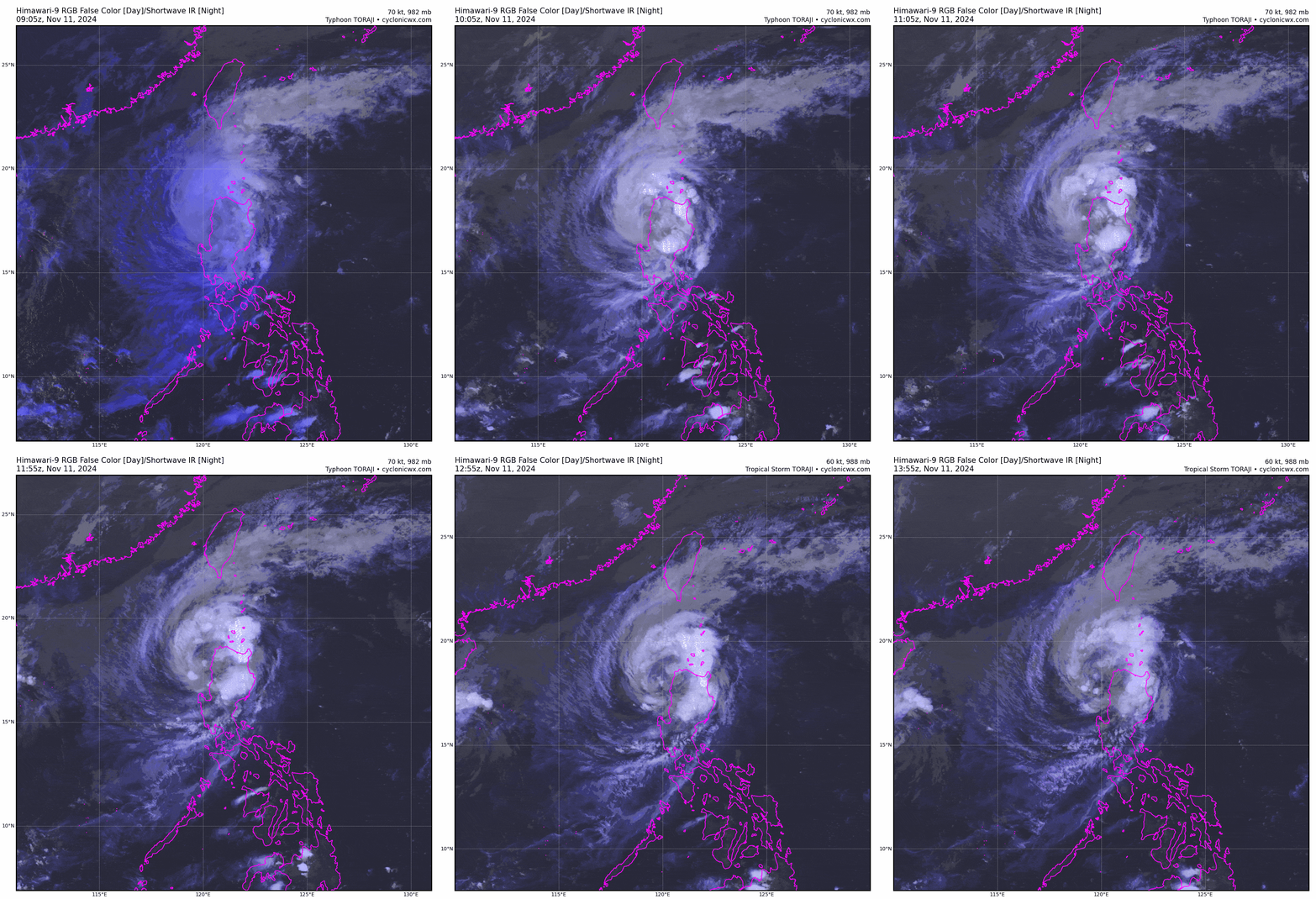
| Current Status & Outlook | Typhoon NIKA (TORAJI) has emerged over the coast of Ilocos Sur and has weakened to a Severe Tropical Storm after crossing the rugged terrain of Northern Luzon.
*This is the final advisory on the Philippines’ 13th tropical cyclone of the 2024 Season. 24-hr Outlook: Severe Tropical Storm NIKA is expected to exit the Philippine Area of Responsibility (PAR) by tomorrow morning, continuing its northwest to west-northwest track across the South China Sea. By tomorrow evening, Nika is forecasted to slow down while maintaining its northwesterly movement. Meanwhile, one of the two tropical cyclones currently outside the Philippine Area of Responsibility, located east of the Bicol Region, is expected to enter by tomorrow morning and will be locally named ‘OFEL.’ The first advisory will be released tomorrow morning (Nov 12). |
| Where is NIKA (TORAJI)? | As of 8:00 PM PhT today, Nov 11…1200 GMT:
|
| How strong is it? | Maximum Sustained Winds (1-min avg): 110 kph near the center…Gustiness: 140 kph. |
| Past Movement (06 hrs) | NW @ 26 kph, towards South China Sea. |
| Potential Philippine Major Landfall Area(s) |
|
| What Philippine areas will be directly affected? | Heavy to Extreme Rainfall (50 mm to >100 mm expected for 24 hrs):
Damaging Winds (gusts of more than 100 km/hr expected): |
| Potential Storm Surge/Coastal Flooding Areas+ |
+Waves of more than 3 meters in height are expected in storm surge-prone areas, particularly in coastal areas where the Tropical Cyclone is headed. Kindly visit the PAGASA Storm Surge Updates for more details. |
| 1-Day Forecast Outlook Summary** |
**Important Note: Please be reminded that the Forecast Outlook changes every 6 hours, and the Day 2 and 3 Forecast Track have an average error of 100 and 250 km respectively… while the wind speed forecast error, averages 35 km/hr per day. Therefore, a turn to the left or right of its future track and changes in its wind speed must be anticipated from time to time. |
| Other Storm’s Meteorological Information |
|
| Disclaimer: Information based on data collected by Typhoon2000 (T2k) shall not be taken as official data. Weather information broadcasted and distributed by PAGASA remains as official data. Typhoon2000 (T2k) shall not be responsible for the private use and reliance of its weather information. | |
Issued by: David Michael V. Padua for Typhoon2000 (T2k)
Typhoon2000 (T2K) Integrated Multi-Agency Tracks
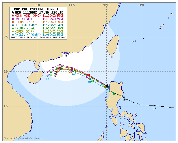
For more info visit: (http://www.typhoon2000.ph/multi/?name=TORAJI)
PAGASA TROPICAL CYCLONE WIND SIGNAL
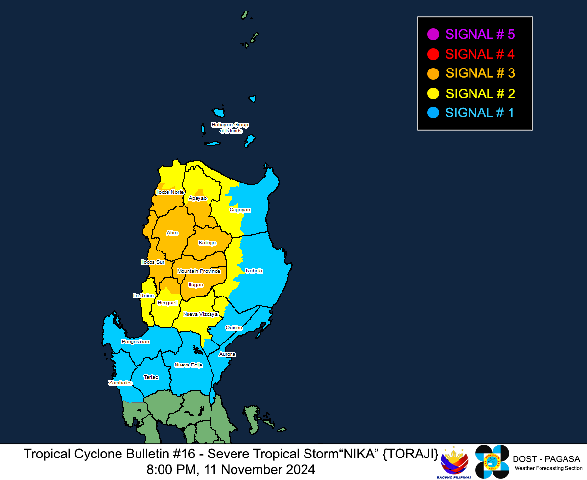
Image/Screenshot Source: DOST-PAGASA (https://www.pagasa.dost.gov.ph/tropical-cyclone/severe-weather-bulletin)

