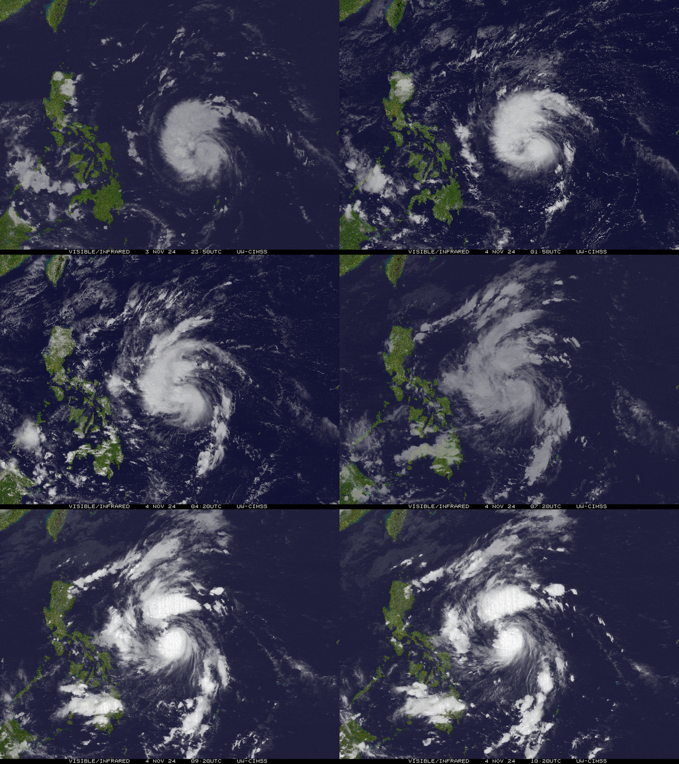
SEVERE TROPICAL STORM MARCE (YINXING) STORMWATCH NO. 02Issued at: 8:00 PM PhT (12:00 GMT) Monday, 04 Nov 2024
Next update: 8:00 PM PhT (12:00 GMT) Tuesday, 05 Nov 2024 or earlier |
|
|---|---|
| Current Status and Outlook |
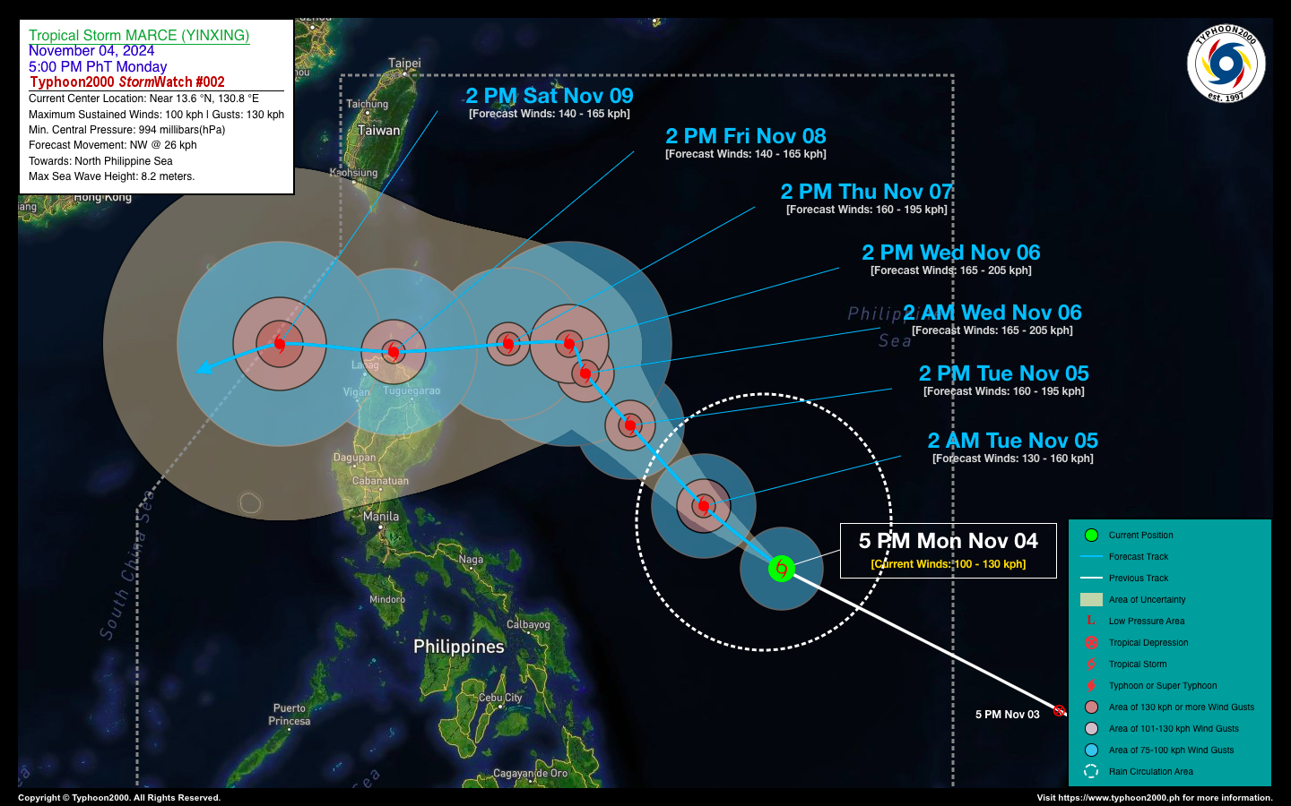
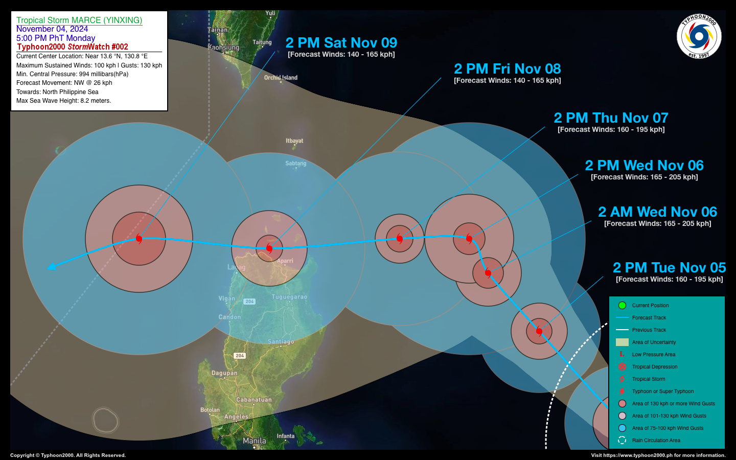
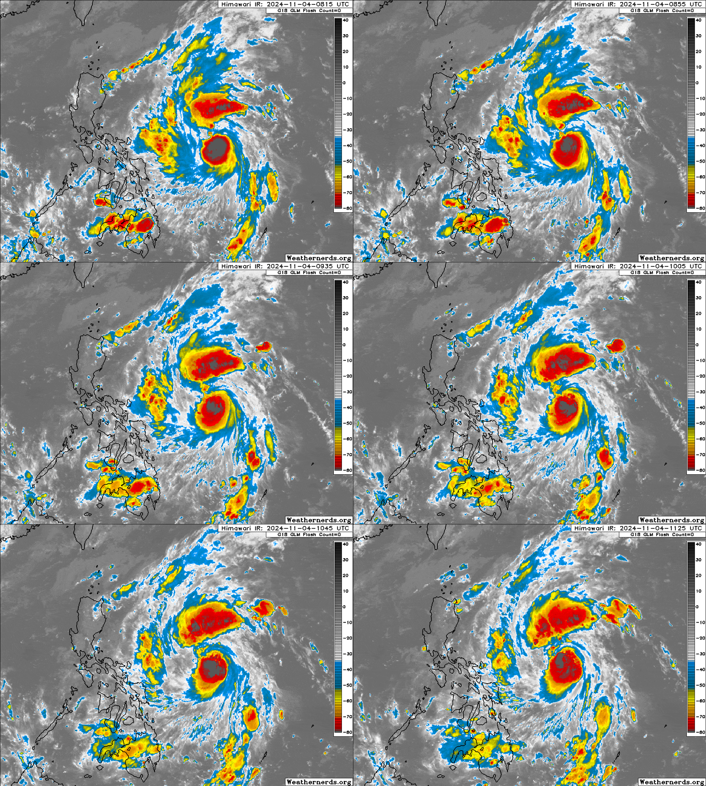
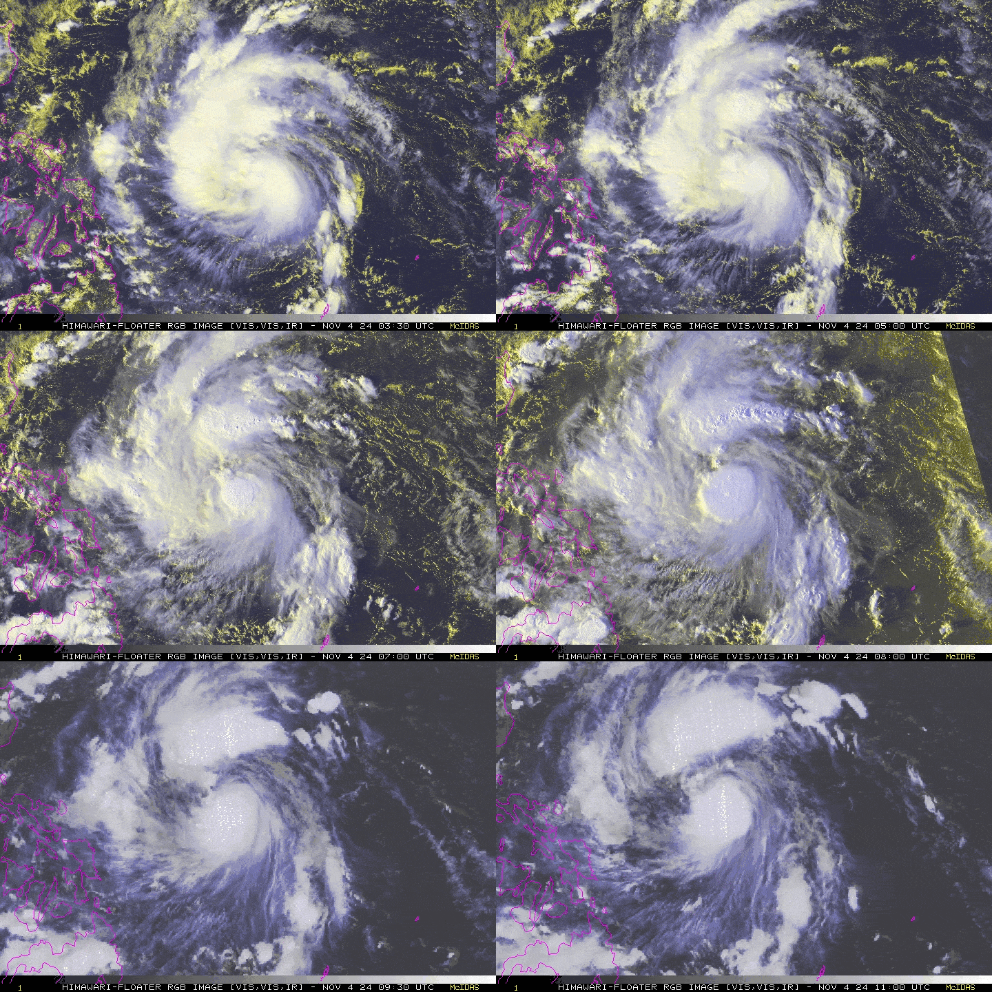
Tropical Depression 24W entered the Philippine Area of Responsibility (PAR) early this morning and has rapidly intensified while moving swiftly across the Philippine Sea. It has developed into a fully-fledged Severe Tropical Storm, locally named “MARCE” and globally referred to as “YINXING,” which is the name of a type of Chinese tree. This system is forecast to pose a threat to Extreme Northern Luzon, particularly the Northern Cagayan, Ilocos Norte, and Babuyan Islands areas, this weekend (November 8). |
| Where is MARCE (YINGXING? | As of 5:00 PM PhT today, November 04…0900 GMT:
|
| How strong is it? | Maximum Sustained Winds (1-min avg): 100 kph near the center…Gustiness: 130 kph. |
| Past Movement (06 hrs) | West-Northwest @ 37 kph, towards the North Philippine Sea. |
| Forecast Highlights |
|
| This StormWatch is valid for the next 24 hours.
Information based on data collected by Typhoon2000 (T2k) shall not be taken as official data. Weather information broadcasted and distributed by PAGASA remains as official data. Typhoon2000 (T2k) shall not be responsible for the private use and reliance of its weather information. |
|
Issued by: David Michael V. Padua for Typhoon2000 (T2K)
Typhoon2000 (T2K) Integrated Multi-Agency Tracks
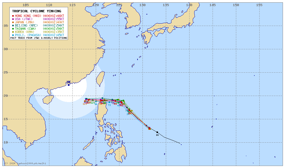
For more info visit: (http://www.typhoon2000.ph/multi/?name=YINXING)
PAGASA TROPICAL CYCLONE WIND SIGNAL
:: No Wind Signals Yet.
Image/Screenshot Source: DOST-PAGASA (https://bagong.pagasa.dost.gov.ph/tropical-cyclone/severe-weather-bulletin)

