
TROPICAL DISTURBANCE (LPA) 93W STORMWATCH NO. 02Issued at: 8:00 PM PhT (12:00 GMT) Thursday, 23 May 2024
Next update: 8:00 PM PhT (12:00 GMT) Friday, 24 May 2024 |
|
|---|---|
| Current Status and Outlook |
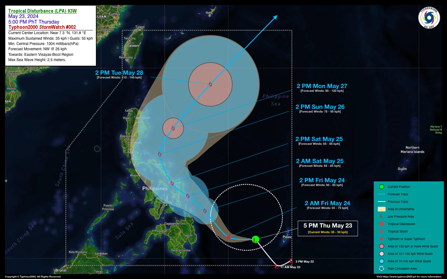
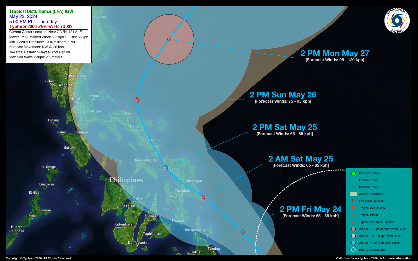
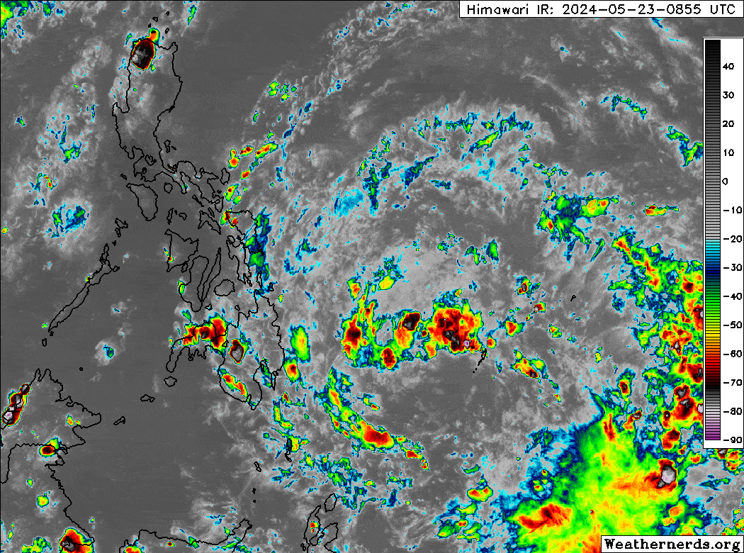
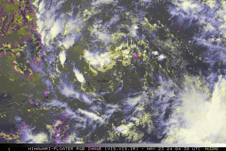
Tropical Disturbance (LPA) 93W has maintained its strength while slowly organizing over the Philippine Sea. It remains a threat to Eastern Visayas and Bicol Region. The latest forecast shows the system intensifying into a Tropical Depression (TD) within the next 24 hours, with a possible landfall over Eastern Samar on Saturday morning. It will then traverse Samar Island before moving across the Bicol Region late Saturday through Sunday. This LPA could produce life-threatening floods and landslides along its path due to high Oceanic Heat Content (OHC) over the coastal waters of Eastern Visayas and Bicol Region. Residents must take all necessary precautions for this upcoming rain event. |
| Where is LPA 93W? | As of 5:00 PM PhT today, May 23…0900 GMT:
|
| How strong is it? | Maximum Sustained Winds (1-min avg): 35 kph near the center…Gustiness: 55 kph. |
| Past Movement (06 hrs) | Northwest @ 26 kph, towards Eastern Visayas & Bicol Region. |
| Forecast Highlights |
|
| This StormWatch is valid for the next 24 hours.
Information based on data collected by Typhoon2000 (T2k) shall not be taken as official data. Weather information broadcasted and distributed by PAGASA remains as official data. Typhoon2000 (T2k) shall not be responsible for the private use and reliance of its weather information. |
|
Issued by: David Michael V. Padua for Typhoon2000 (T2K)


