
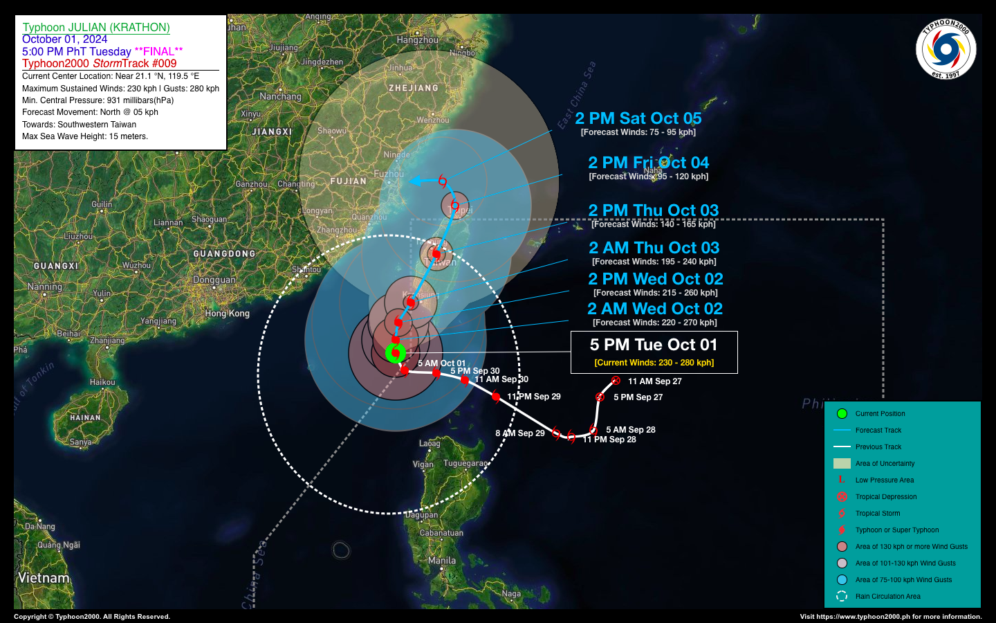
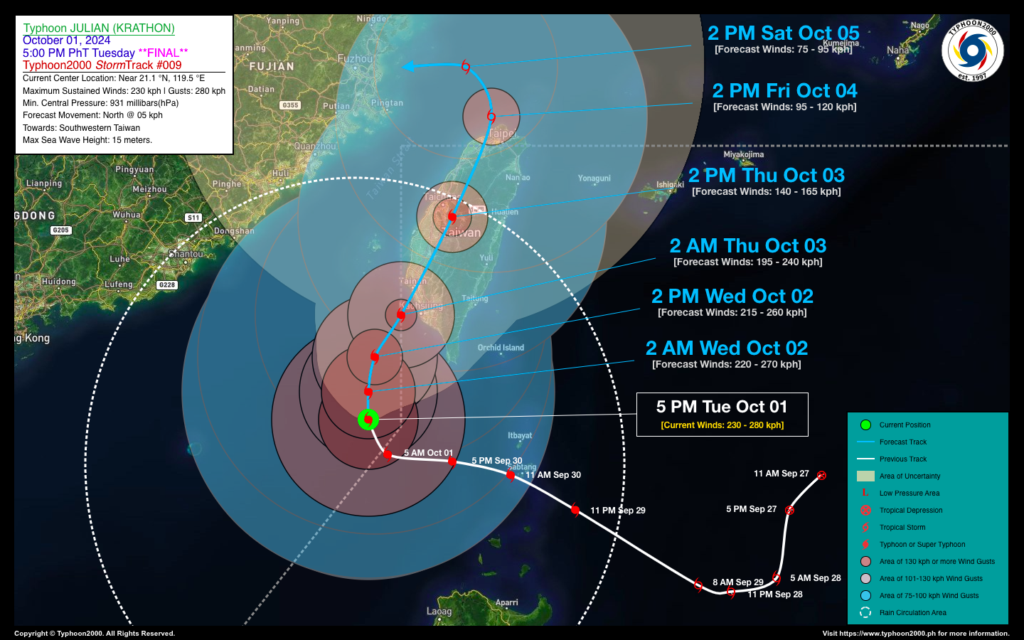
TYPHOON JULIAN (KRATHON) ADVISORY NO. 09 {FINAL}Issued at: 8:00 PM PhT (12:00 GMT) Tuesday, 01 Oct 2024
|
|
|---|---|
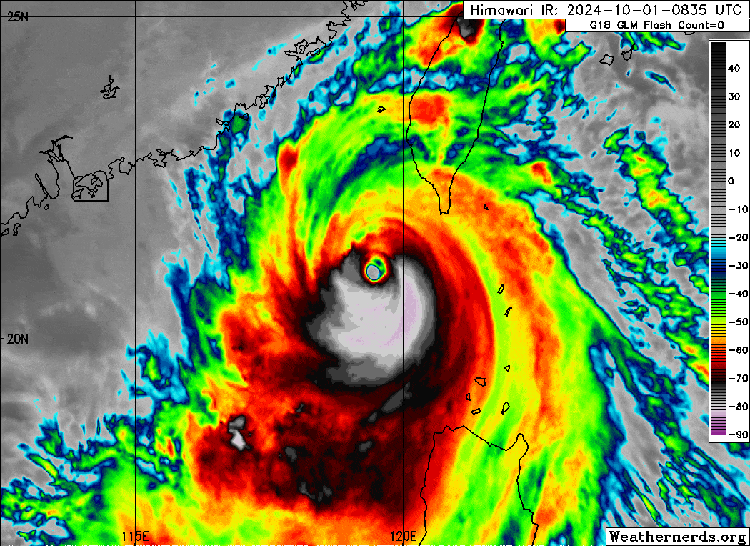
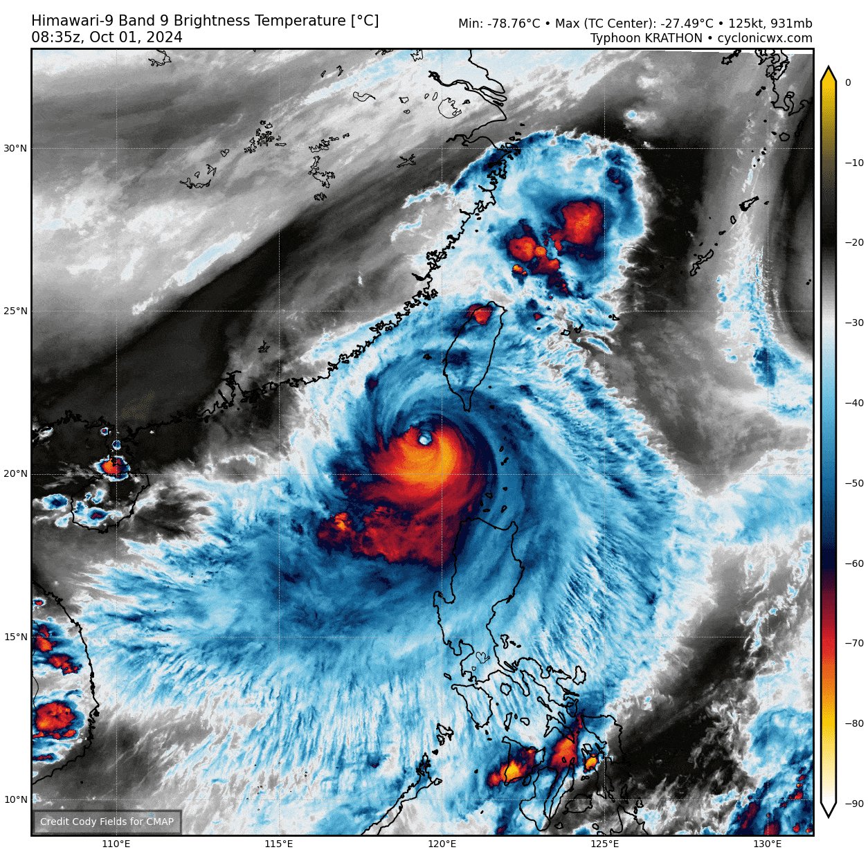
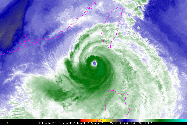
| Current Status & Outlook | Super Typhoon JULIAN (KRATHON) has been downgraded to a typhoon as it begins moving slowly northward over the western part of the Bashi Channel, heading generally toward Southwestern Taiwan. Since the system is now outside the Philippine Area of Responsibility (PAR), this will be the final advisory for this tropical cyclone.
48-hr Outlook: Typhoon JULIAN is forecast to track north to north-northeast over the next 24 hours and will re-enter the PAR early Thursday morning (October 3). The storm is expected to make landfall in Southwestern Taiwan by Thursday morning and will weaken rapidly into a Category 1 typhoon after crossing the island’s rugged terrain. The typhoon’s eastern and southeastern rainbands are expected to clear the Batanes-Calayan Islands and Ilocos Region by tomorrow (October 2). |
| Where is JULIAN (KRATHON)? | As of 5:00 PM PhT today, Oct 01…0900 GMT:
|
| How strong is it? | Maximum Sustained Winds (1-min avg): 230 kph near the center…Gustiness: 280 kph. |
| Past Movement (06 hrs) | North @ 07 kph, towards Southwestern Taiwan. |
| Potential Philippine Major Landfall Area(s) |
|
| What Philippine areas will be directly affected? | Heavy to Extreme Rainfall (50 mm to >100 mm expected for the next 24 to 48 hrs):
Damaging Winds (3-sec. wind gusts of >100 km/hr expected):
|
| Potential Storm Surge/Coastal Flooding Areas+ |
+Waves of 3 meters or more in height are expected in storm surge-prone areas, particularly in coastal areas where the Tropical Cyclone is headed. Kindly visit the PAGASA Storm Surge Updates or at the PDF version of the latest PAGASA Tropical Cyclone Bulletin for more details. |
| 3-Day Forecast Outlook Summary** |
**Important Note: Please be reminded that the Forecast Outlook changes every 6 hours, and the Day 2 and 3 Forecast Track have an average error of 100 and 250 km respectively… while the wind speed forecast error, averages 35 km/hr per day. Therefore, a turn to the left or right of its future track and changes in its wind speed must be anticipated from time to time. |
| Other Storm’s Meteorological Information |
|
| Disclaimer: Information based on data collected by Typhoon2000 (T2k) shall not be taken as official data. Weather information broadcasted and distributed by PAGASA remains as official data. Typhoon2000 (T2k) shall not be responsible for the private use and reliance of its weather information. | |
Issued by: David Michael V. Padua for Typhoon2000 (T2k)
Typhoon2000 (T2K) Integrated Multi-Agency Tracks
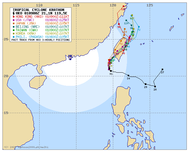
For more info visit: (http://www.typhoon2000.ph/multi/?name=KRATHON)
PAGASA TROPICAL CYCLONE WIND SIGNAL
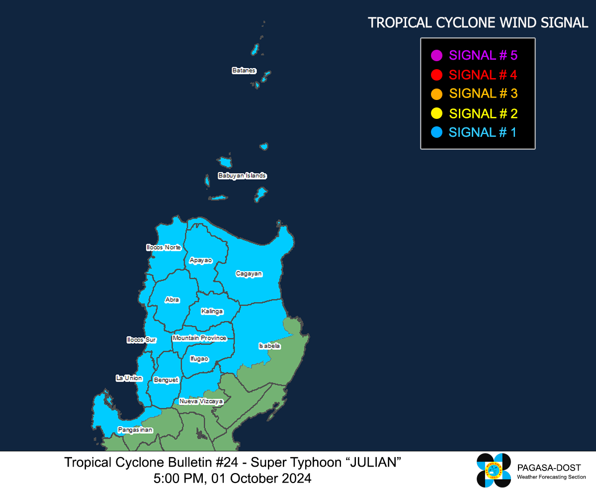
Image/Screenshot Source: DOST-PAGASA (https://www.pagasa.dost.gov.ph/tropical-cyclone/severe-weather-bulletin)


