

TROPICAL DEPRESSION IGME STORMWATCH NO. 02 (FINAL)Issued at: 8:00 PM PhT (12:00 GMT) Saturday, 21 Sept 2024
|
|
|---|---|
| Current Status and Outlook |
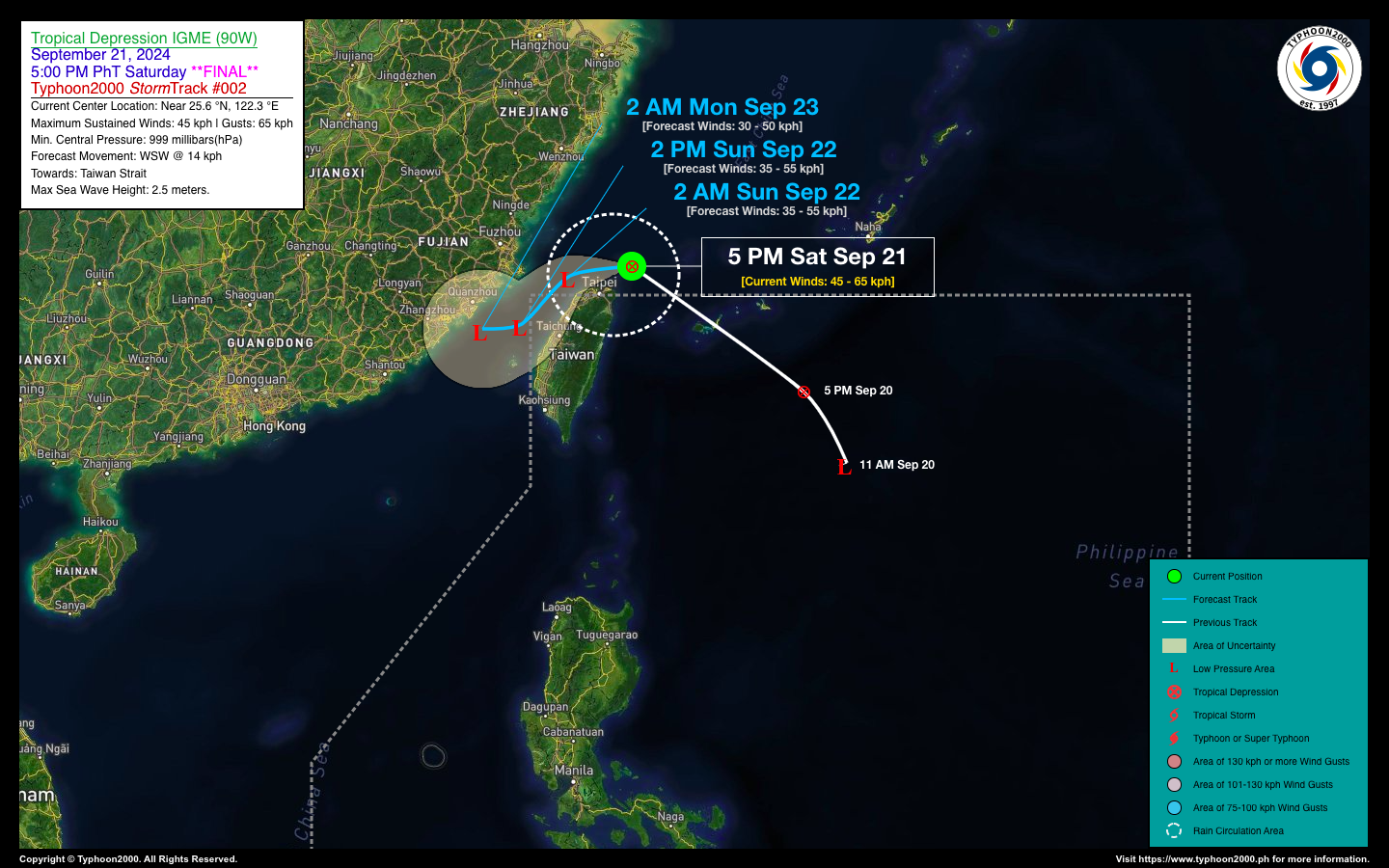
Tropical Depression IGME has moved out of the Philippine Area of Responsibility (PAR) this morning and is no longer posing a threat to the country. The system is forecast to move slowly west-southwestward across the Taiwan Strait and dissipate within the next 24 to 36 hours. This is the Final Stormwatch on TD IGME. Meanwhile, the enhancement of the Southwest Monsoon (Habagat) across Western Luzon will start to weaken, and weather conditions are expected to improve starting tomorrow, Sept 22. |
| Where is IGME? | As of 5:00 PM PhT today, September 21…0900 GMT:
|
| How strong is it? | Maximum Sustained Winds (1-min avg): 45 kph near the center…Gustiness: 65 kph. |
| Past Movement (06 hrs) | West @ 08 kph, towards Taiwan Strait. |
| Forecast Highlight |
|
| This StormWatch is valid for the next 24 hours.
Information based on data collected by Typhoon2000 (T2k) shall not be taken as official data. Weather information broadcasted and distributed by PAGASA remains as official data. Typhoon2000 (T2k) shall not be responsible for the private use and reliance of its weather information. |
|
Issued by: David Michael V. Padua for Typhoon2000 (T2K)
PAGASA TROPICAL CYCLONE WIND SIGNAL
:: Now lowered
Image/Screenshot Source: DOST-PAGASA (https://bagong.pagasa.dost.gov.ph/tropical-cyclone/severe-weather-bulletin)


