
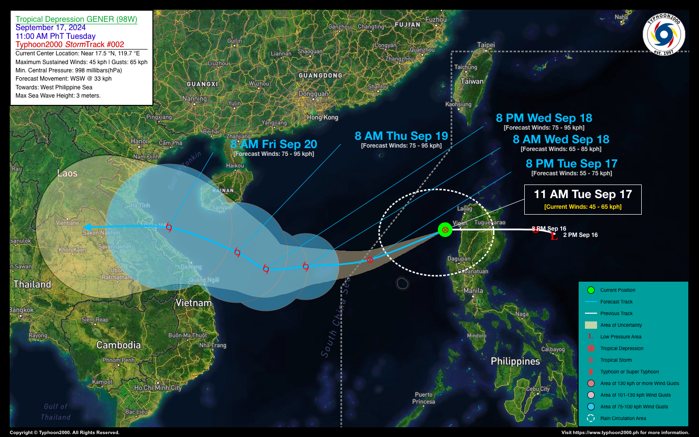
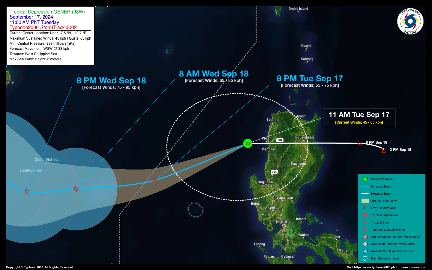
TROPICAL DEPRESSION GENER STORMWATCH NO. 02Issued at: 2:00 PM PhT (06:00 GMT) Tuesday, 17 Sept 2024
Next update: 2:00 PM PhT (06:00 GMT) Wednesday, 18 Sept 2024 |
|
|---|---|
| Current Status and Outlook |
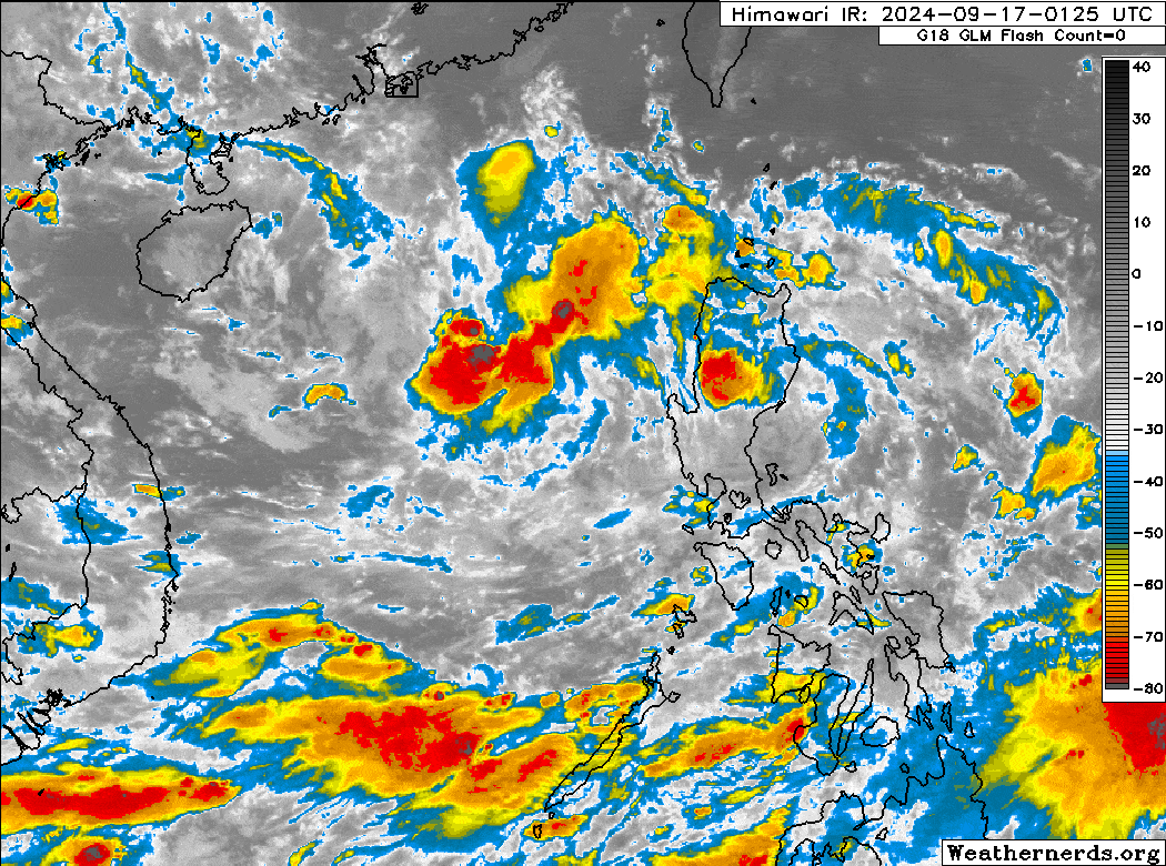
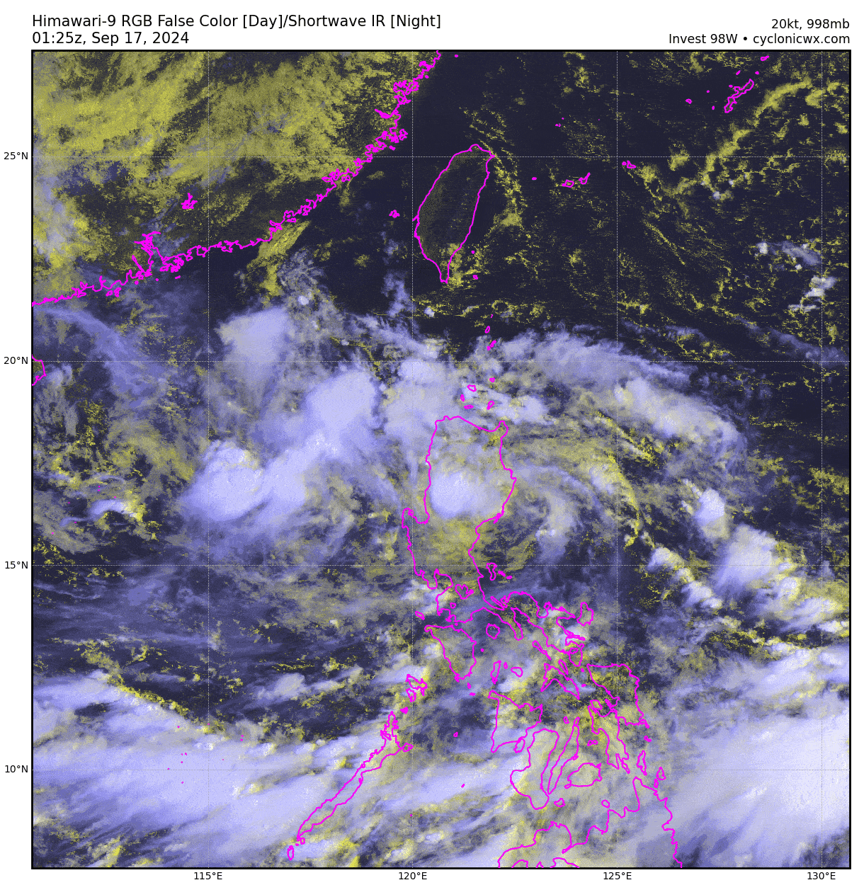
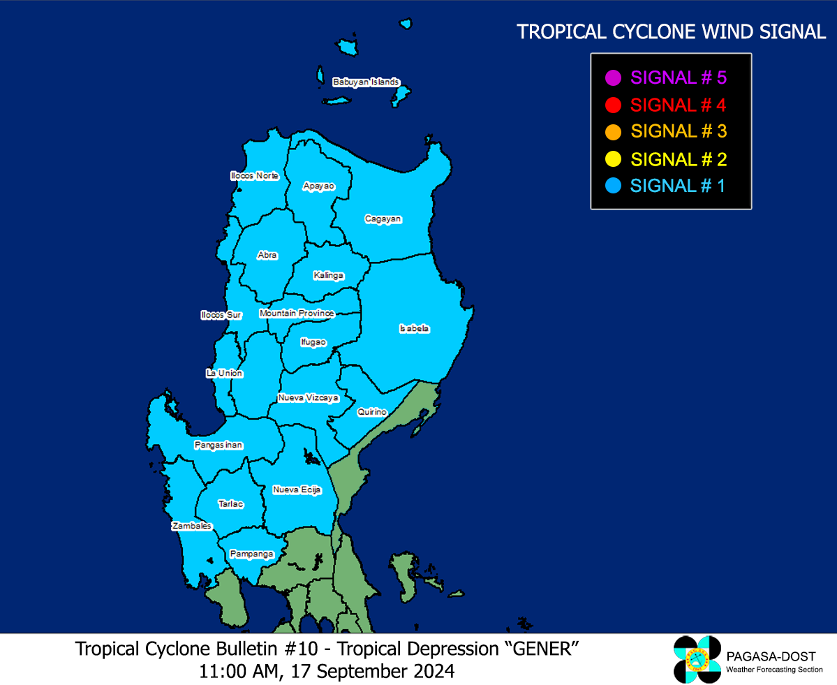
Tropical Depression GENER has emerged over the West Philippine Sea after quickly traversing the rugged terrain of Northern Luzon. Its circulation remains somewhat disorganized, making it difficult to pinpoint the exact low-level center and hindering the full development of its rainbands. However, as GENER moves over the warm waters of the West Philippine and South China Seas, it is expected to consolidate and likely exit the Philippine Area of Responsibility (PAR) later tonight or early Wednesday morning (September 18). Meanwhile, the combined influence of Tropical Depression GENER and Tropical Storm PULUSAN will continue to enhance the Southwest Monsoon (Habagat). This will result in occasional rain showers and gusty winds reaching up to 60 kilometers per hour across the western sections of the country through Wednesday, September 18. |
| Where is GENER? | As of 11:00 AM PhT today, September 17…0300 GMT:
|
| How strong is it? | Maximum Sustained Winds (1-min avg): 45 kph near the center…Gustiness: 65 kph. |
| Past Movement (06 hrs) | West @ 34 kph, towards the West Philippine & South China Seas |
| Forecast Highlights |
|
| This StormWatch is valid for the next 12 hours.
Information based on data collected by Typhoon2000 (T2k) shall not be taken as official data. Weather information broadcasted and distributed by PAGASA remains as official data. Typhoon2000 (T2k) shall not be responsible for the private use and reliance of its weather information. |
|
Issued by: David Michael V. Padua for Typhoon2000 (T2K)
PAGASA TROPICAL CYCLONE WIND SIGNAL
Image/Screenshot Source: DOST-PAGASA (https://bagong.pagasa.dost.gov.ph/tropical-cyclone/severe-weather-bulletin)


