
TROPICAL DEPRESSION GENER STORMWATCH NO. 01Issued at: 11:45 PM PhT (15:45 GMT) Monday, 16 Sept 2024
Next update: 8:00 AM PhT (00:00 GMT) Tuesday, 17 Sept 2024 |
|
|---|---|
| Current Status and Outlook |
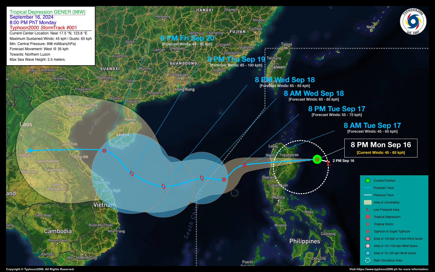
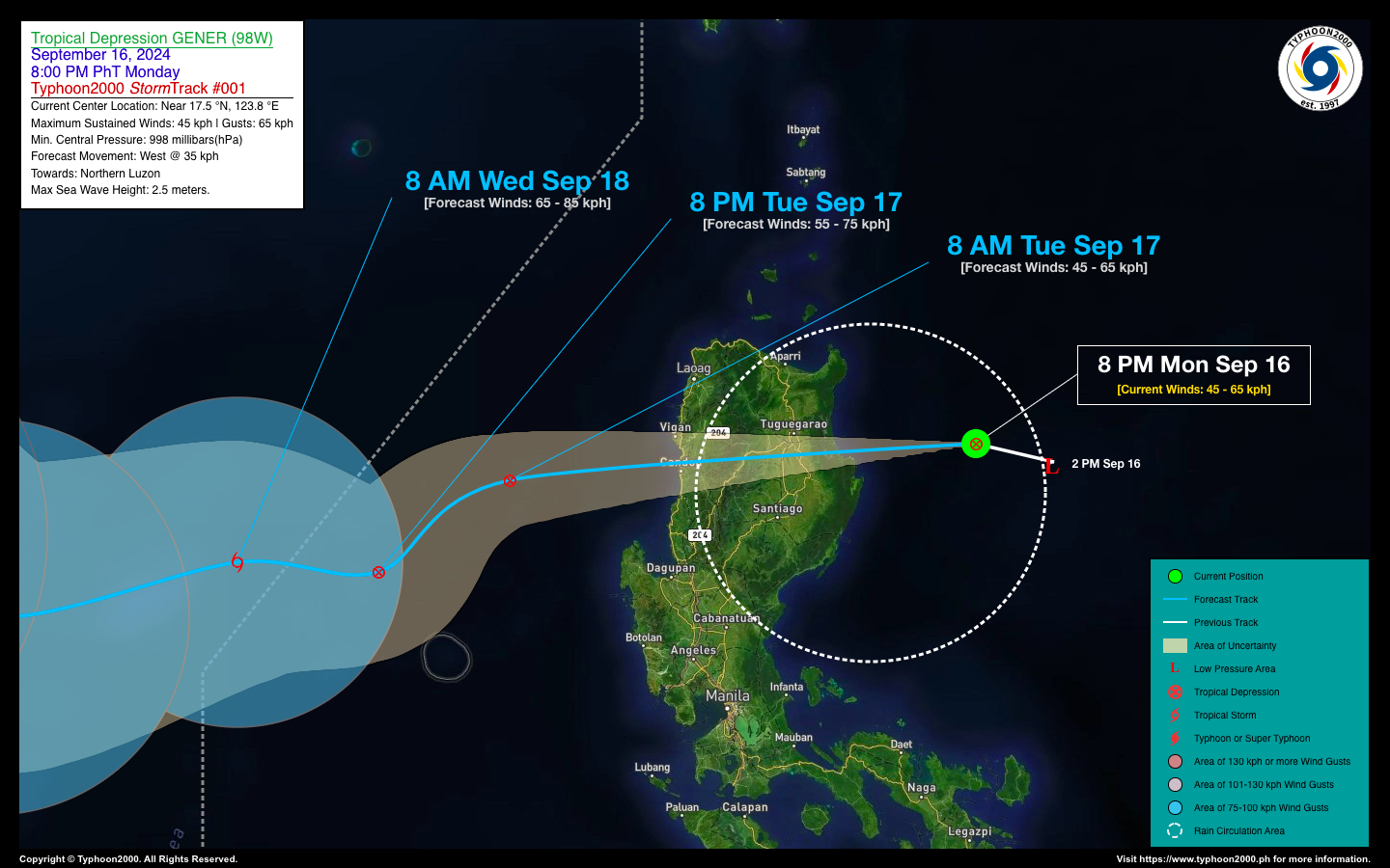
Tropical Disturbance 98W, located east of Cagayan Valley, has intensified into Tropical Depression GENER. The depression is expected to make landfall in Northern Luzon within the next several hours, bringing with it heavy rainfall. Displaced rainbands will spread across Northern and portions of Central Luzon, leading to rainfall accumulations of 50-200 millimeters within the next 12 to 24 hours. By tomorrow morning, the center of Gener is projected to emerge along the coastal waters of the Ilocos Region as it undergoes reorganization over the West Philippine Sea. Meanwhile, the combined influence of Tropical Depression Gener and Tropical Storm Pulasan will continue to enhance the Southwest Monsoon (Habagat). This will result in occasional rain showers and gusty winds reaching up to 60 kilometers per hour across the western sections of the country through Wednesday, September 18. |
| Where is GENER? | As of 8:00 PM PhT today, September 16…1200 GMT:
|
| How strong is it? | Maximum Sustained Winds (1-min avg): 45 kph near the center…Gustiness: 65 kph. |
| Past Movement (06 hrs) | West-Northwest @ 16 kph, towards the Northern Luzon |
| Forecast Highlights |
|
| This StormWatch is valid for the next 24 hours.
Information based on data collected by Typhoon2000 (T2k) shall not be taken as official data. Weather information broadcasted and distributed by PAGASA remains as official data. Typhoon2000 (T2k) shall not be responsible for the private use and reliance of its weather information. |
|
Issued by: David Michael V. Padua for Typhoon2000 (T2K)
PAGASA TROPICAL CYCLONE WIND SIGNAL
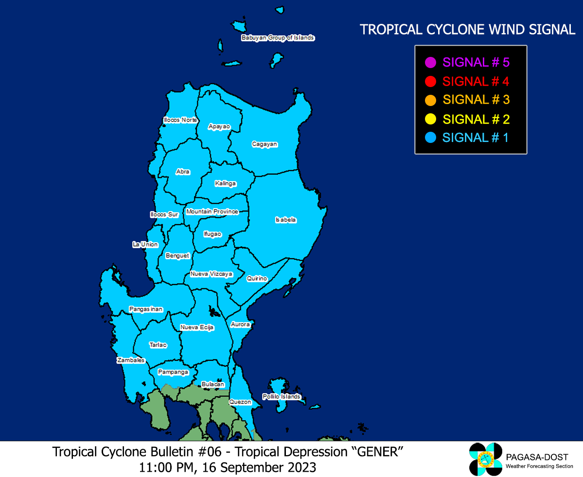
Image/Screenshot Source: DOST-PAGASA (https://bagong.pagasa.dost.gov.ph/tropical-cyclone/severe-weather-bulletin)


