
SEVERE TROPICAL STORM ENTENG (YAGI) ADVISORY NO. 08 {Final}Issued at: 8:00 AM PhT (00:00 GMT) Wednesday, 04 Sept 2024
|
|
|---|---|
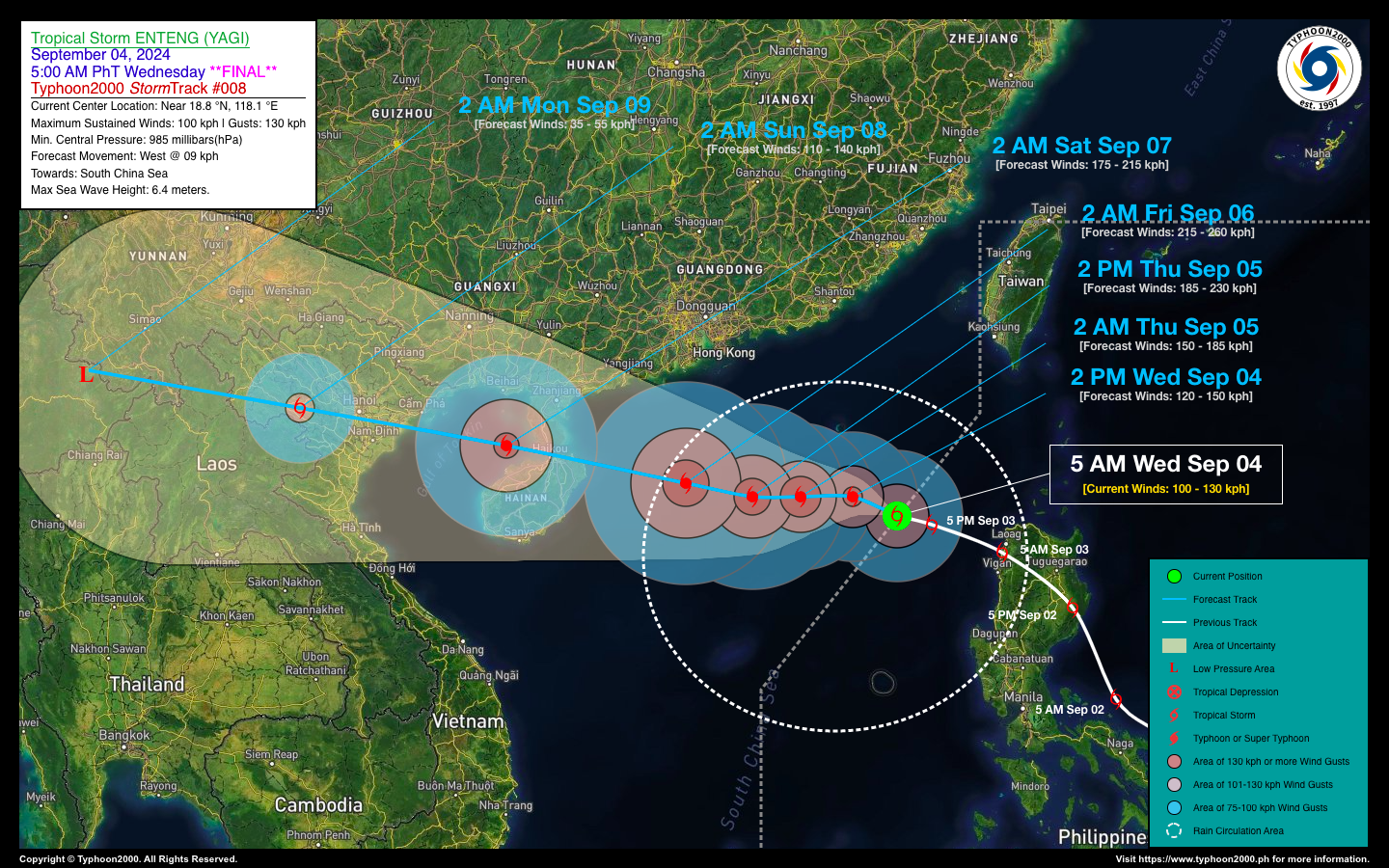
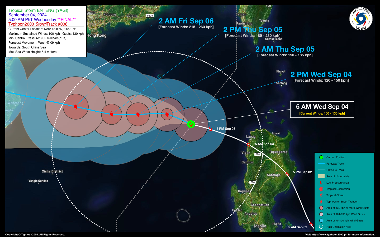
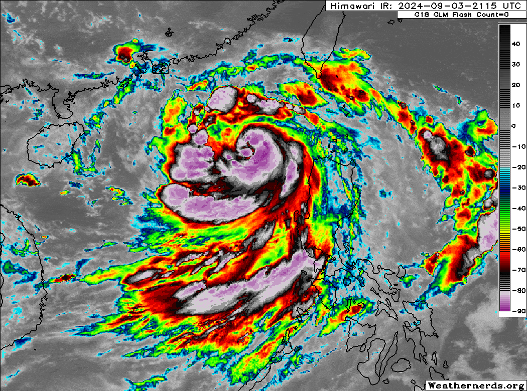
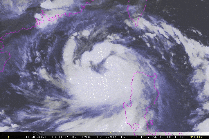
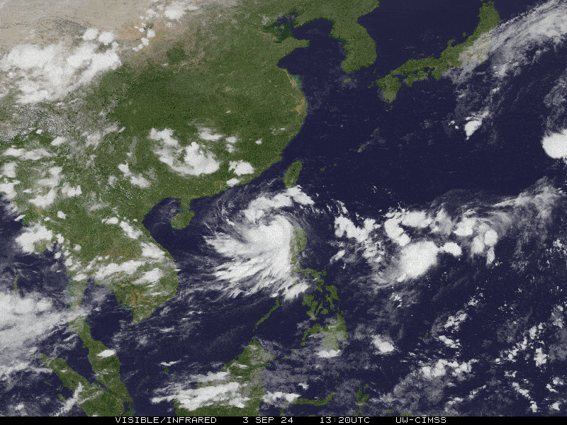
| Current Status & Outlook | Tropical Storm ENTENG (YAGI) has moved out of the Philippine Area of Responsibility (PAR) while continuing to intensify. It has now become a Severe Tropical Storm as it moves slowly westward towards the Hainan Island-Leizhou Peninsula area. Its eastern outer rainbands, combined with the Southwest Monsoon flow, will continue to affect the Ilocos Region, bringing intermittent rains and gusty winds. Weather conditions in these areas are expected to improve over the weekend.
48-hr Outlook: STS ENTENG is expected to rapidly intensify within the next two days and could become a Category 4 on Friday Sept 06 as it approaches the coastal waters of Hainan Island, while moving slowly, westward. The expansive circulation of Severe Tropical Storm (STS) ENTENG, combined with the intensified Southwest Monsoon (Habagat), will continue to bring intermittent rains and gusty winds to western Luzon, including the National Capital Region (NCR), MIMAROPA, and Panatag Shoal, through tomorrow. Residents are urged to take precautions against potential flash floods, landslides, and lahars resulting from these weather conditions. *This will be the Final Advisory on the country’s 5th Tropical Cyclone of 2024. |
| Where is ENTENG (YAGI)? | As of 5:00 AM today, Sept 04…2100 GMT:
|
| How strong is it? | Maximum Sustained Winds (1-min avg): 100 kph near the center…Gustiness: 130 kph. |
| Past Movement (06 hrs) | West @ 09 kph, towards Hainan Island-Leizhou Peninsula (China). |
| Potential Philippine Major Landfall Area(s) |
|
| What Philippine areas will be directly affected? | Heavy to Extreme Rainfall (50 mm to >100 mm expected for 24 hrs):
Damaging Winds (gusts of more than 100 km/hr expected):
|
| Potential Storm Surge/Coastal Flooding Areas+ |
+Waves of 3 meters in height are expected in storm surge-prone areas, particularly in coastal areas where the Tropical Cyclone is headed. Kindly visit the PAGASA Storm Surge Updates for more details. |
| 3-Day Forecast Outlook Summary** |
**Important Note: Please be reminded that the Forecast Outlook changes every 6 hours, and the Day 2 and 3 Forecast Track have an average error of 100 and 250 km respectively… while the wind speed forecast error, averages 35 km/hr per day. Therefore, a turn to the left or right of its future track and changes in its wind speed must be anticipated from time to time. |
| Other Storm’s Meteorological Information |
|
| Disclaimer: Information based on data collected by Typhoon2000 (T2k) shall not be taken as official data. Weather information broadcasted and distributed by PAGASA remains as official data. Typhoon2000 (T2k) shall not be responsible for the private use and reliance of its weather information. | |
Issued by: David Michael V. Padua for Typhoon2000 (T2k)
Typhoon2000 (T2K) Integrated Multi-Agency Tracks
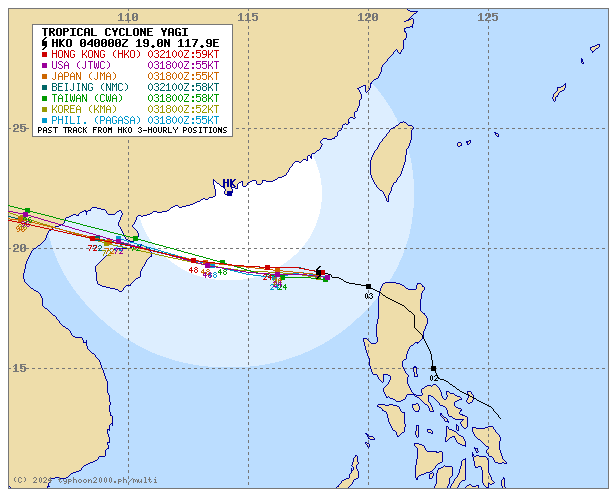
For more info visit: (http://www.typhoon2000.ph/multi/?name=YAGI)
PAGASA TROPICAL CYCLONE WIND SIGNAL
:: All Storm Wind Signals are now lifted.
Image/Screenshot Source: DOST-PAGASA (https://www.pagasa.dost.gov.ph/tropical-cyclone/severe-weather-bulletin)


