
TROPICAL STORM ENTENG (YAGI) ADVISORY NO. 07Issued at: 8:00 PM PhT (12:00 GMT) Tuesday, 03 Sept 2024
Next update: 8:00 AM PhT (00:00 GMT) Wednesday, 04 Sept 2024 |
|
|---|---|
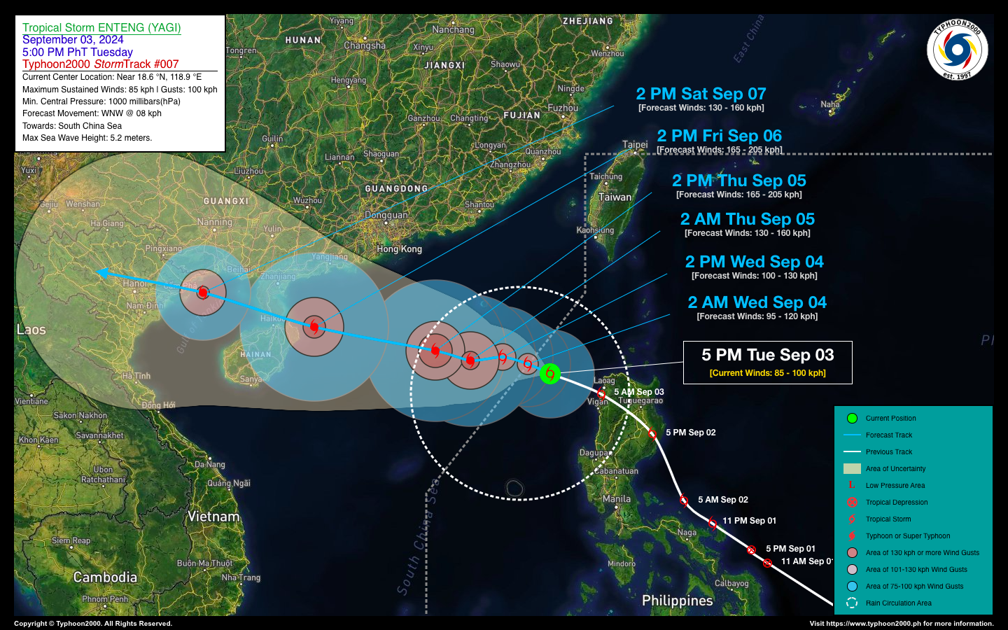
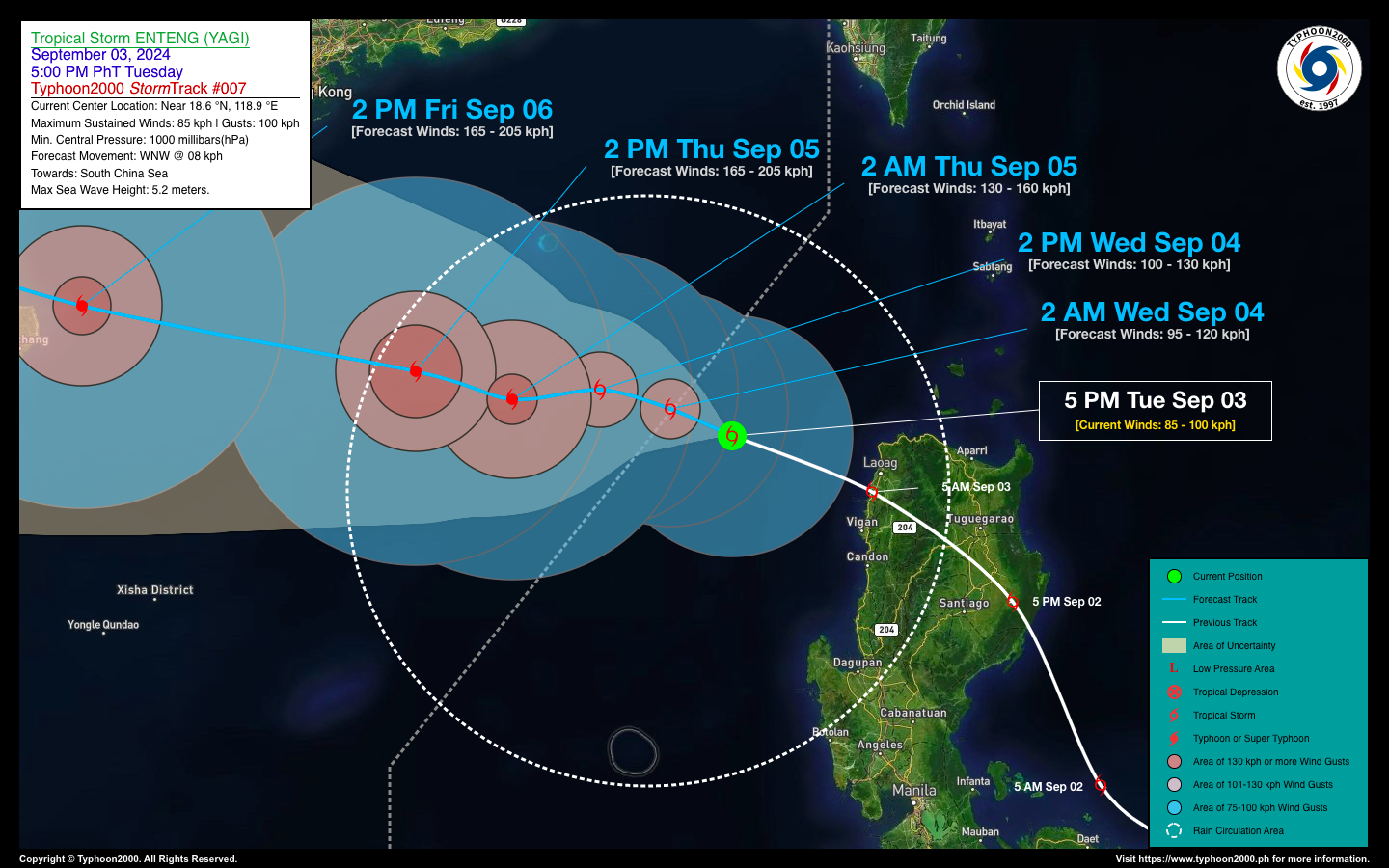
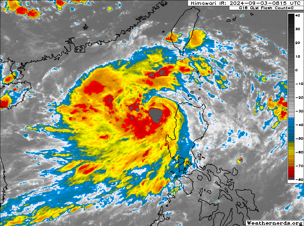
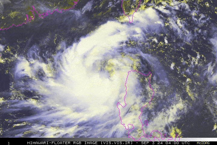
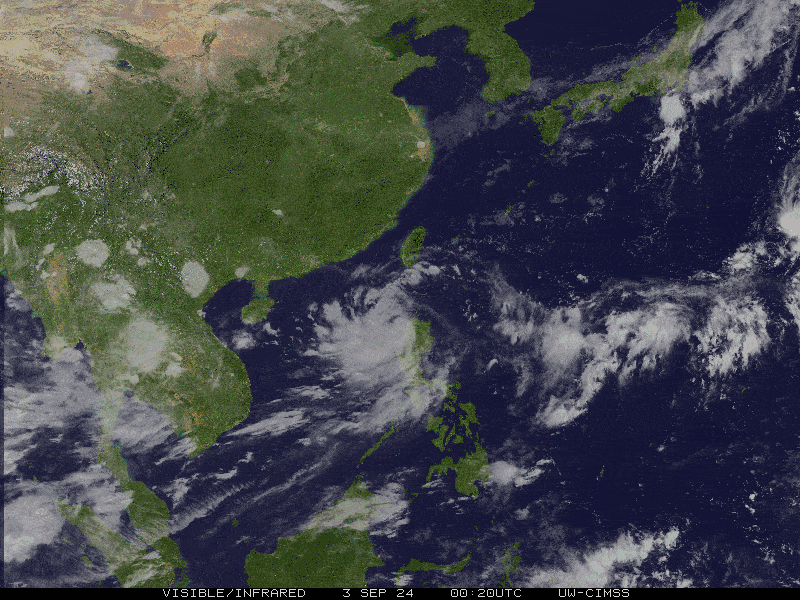
| Current Status & Outlook | Tropical Storm ENTENG (YAGI) has strengthened while gradually slowing down over the West Philippine Sea in the past six hours. Its eastern outer rainbands will continue to bring intermittent rain and gusty winds across La Union, Ilocos Sur, and Ilocos Norte.
48-hr Outlook: TS ENTENG is expected to move west to west-northwest at a slow pace, gradually gaining strength throughout the forecast period. It is anticipated to exit the Philippine Area of Responsibility (PAR) by tomorrow morning. ENTENG is projected to reach typhoon classification by Thursday, September 5, as it continues toward Hainan Island and the Leizhou Peninsula in Southern China. The circulation of TS ENTENG, its trough, and the enhanced Southwest Monsoon (Habagat) will continue to bring occasional rains and gusty winds across the western sections of Luzon including NCR, Occidental Mindoro and Lubang Island tonight & tomorrow. Residents are advised to take all necessary precautions against flash floods, landslides, and lahars associated with these conditions. |
| Where is ENTENG (YAGI)? | As of 5:00 PM today, Sept 03…0900 GMT:
|
| How strong is it? | Maximum Sustained Winds (1-min avg): 85 kph near the center…Gustiness: 100 kph. |
| Past Movement (06 hrs) | Northwest @ 06 kph, towards the West Philippine Sea. |
| Potential Philippine Major Landfall Area(s) |
|
| What Philippine areas will be directly affected? | Heavy to Extreme Rainfall (50 mm to >100 mm expected for 24 hrs):
Damaging Winds (gusts of more than 100 km/hr expected):
|
| Potential Storm Surge/Coastal Flooding Areas+ |
+Waves of 3 meters in height are expected in storm surge-prone areas, particularly in coastal areas where the Tropical Cyclone is headed. Kindly visit the PAGASA Storm Surge Updates for more details. |
| 3-Day Forecast Outlook Summary** |
**Important Note: Please be reminded that the Forecast Outlook changes every 6 hours, and the Day 2 and 3 Forecast Track have an average error of 100 and 250 km respectively… while the wind speed forecast error, averages 35 km/hr per day. Therefore, a turn to the left or right of its future track and changes in its wind speed must be anticipated from time to time. |
| Other Storm’s Meteorological Information |
|
| Disclaimer: Information based on data collected by Typhoon2000 (T2k) shall not be taken as official data. Weather information broadcasted and distributed by PAGASA remains as official data. Typhoon2000 (T2k) shall not be responsible for the private use and reliance of its weather information. | |
Issued by: David Michael V. Padua for Typhoon2000 (T2k)
Typhoon2000 (T2K) Integrated Multi-Agency Tracks
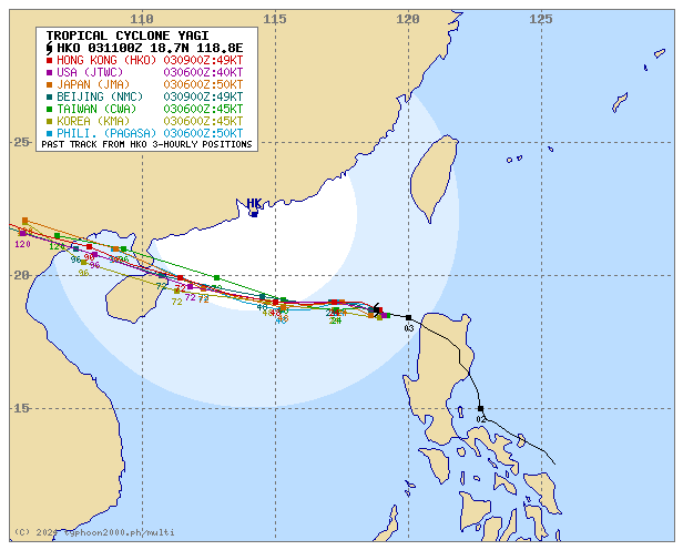
For more info visit: (http://www.typhoon2000.ph/multi/?name=YAGI)
PAGASA TROPICAL CYCLONE WIND SIGNAL
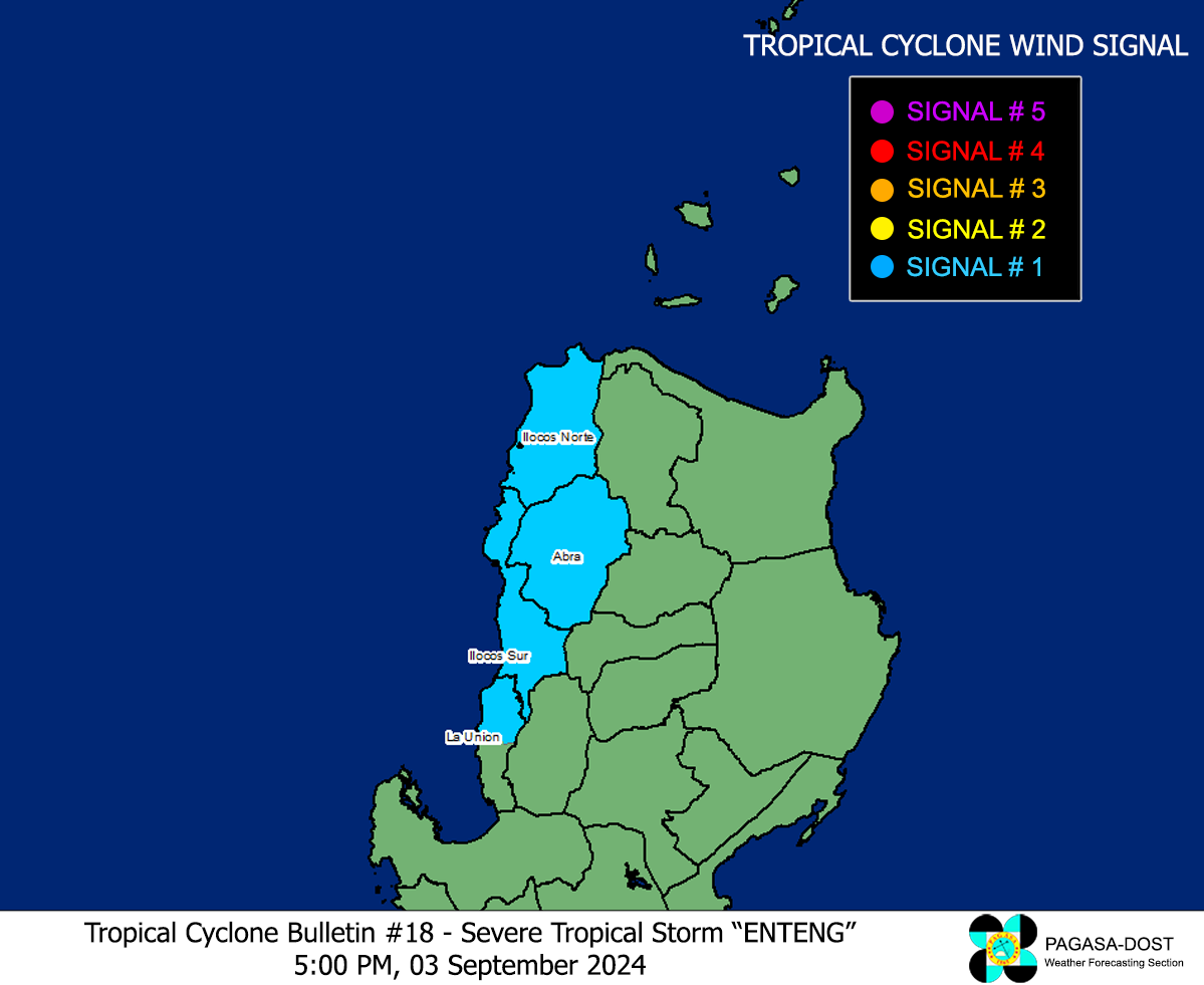
Image/Screenshot Source: DOST-PAGASA (https://www.pagasa.dost.gov.ph/tropical-cyclone/severe-weather-bulletin)


