
TROPICAL STORM ENTENG (YAGI) ADVISORY NO. 03Issued at: 2:00 AM PhT (18:00 GMT) Monday, 02 Sept 2024
Next update: 8:00 AM PhT (00:00 GMT) Monday, 02 Sept 2024 |
|
|---|---|
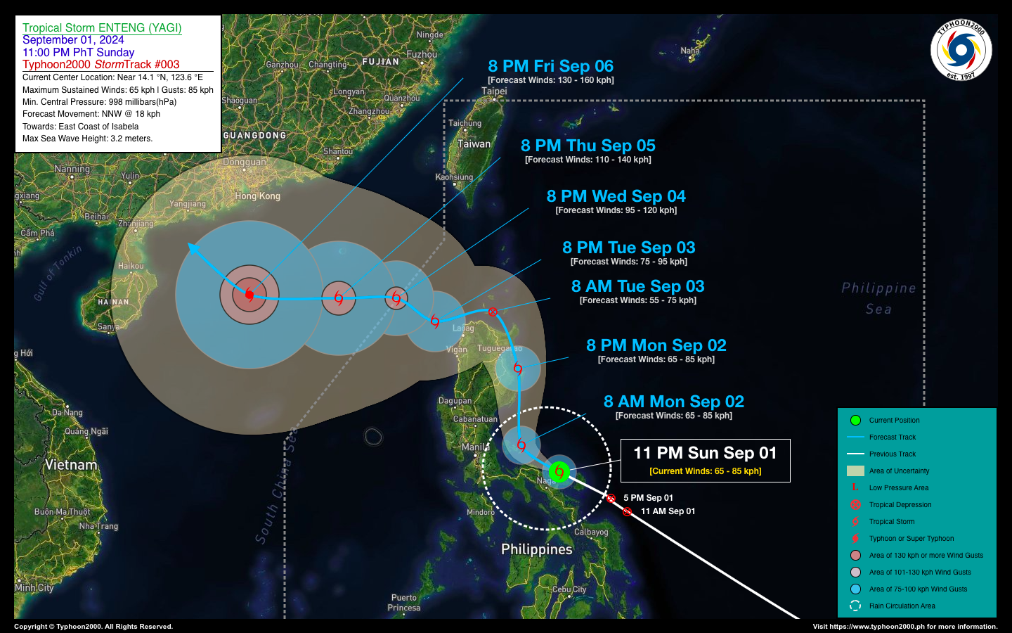
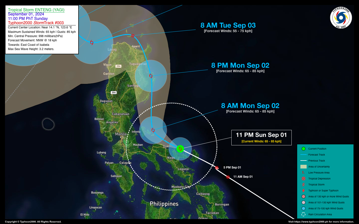
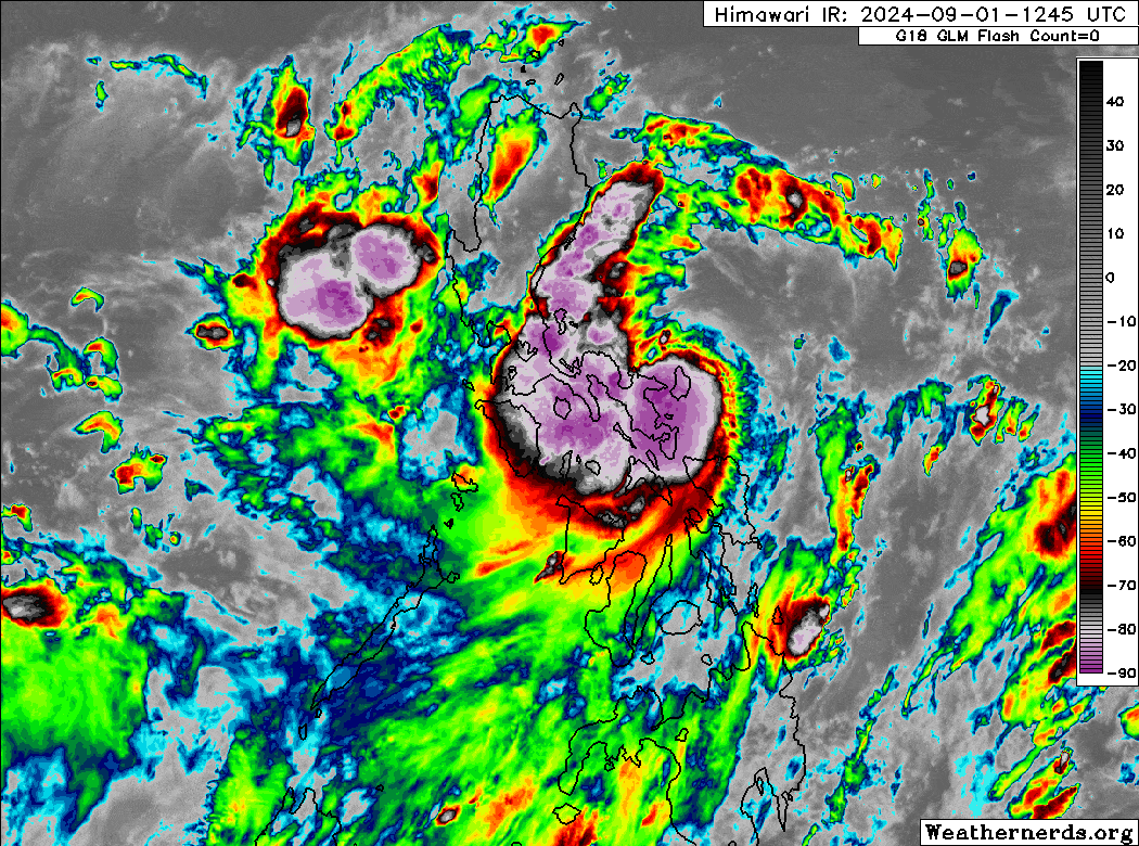
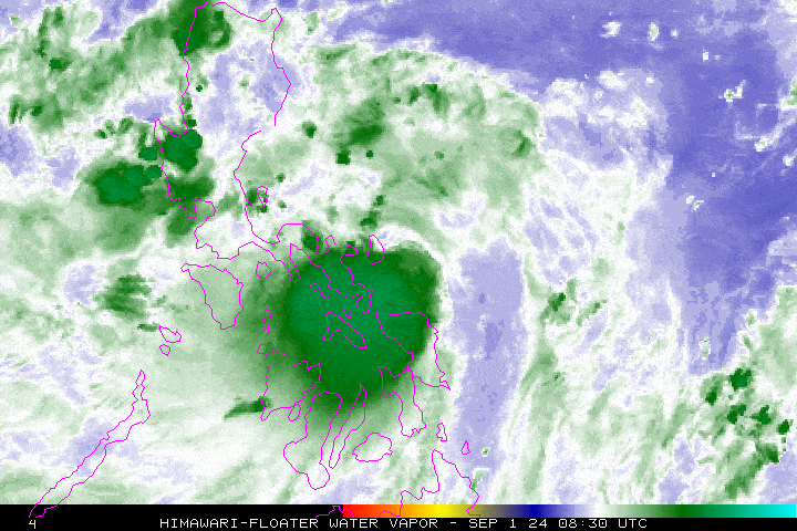
| Current Status & Outlook | Tropical Depression ENTENG (YAGI) has intensified into a Tropical Storm after rapidly crossing Catanduanes a few hours ago. It is now moving across the coastal areas of Garchitorena and Siruma in Camarines Sur. This storm is expected to bring gusty winds of up to 85 kph and a range of rainfall from light to torrential across the Bicol Region and Southern Quezon. Residents are urged to take all necessary precautions against flash floods and landslides.
48-hr Outlook: TS ENTENG is expected to pass over the coastal waters of Camarines Norte in the next few hours and will come close to the east of the Polillo Islands later this morning. By 8 PM tonight, ENTENG is forecasted to make landfall near Palanan, Isabela, and will traverse the rugged terrain of Northern Cagayan by early Tuesday morning (Sept 03), emerging in the Balintang Channel. The storm is projected to move westward across the coastal waters of Ilocos Norte by Tuesday evening. The circulation of TS ENTENG, its trough, and the enhanced Southwest Monsoon (Habagat) will bring moderate to intense rainfall and severe thunderstorms across Western Visayas, MiMaRoPa, the Sulu Archipelago, the rest of Luzon, including Metro Manila, today and tomorrow. Residents are advised to take all necessary precautions against flash floods, landslides, and lahars associated with these conditions. |
| Where is ENTENG (YAGI)? | As of 11:00 PM PhT last night, Sept 02…1500 GMT:
|
| How strong is it? | Maximum Sustained Winds (1-min avg): 65 kph near the center…Gustiness: 85 kph. |
| Past Movement (06 hrs) | West-Northwest @ 32 kph, towards Northern Aurora-Eastern Isabela Area. |
| Potential Philippine Major Landfall Area(s) |
|
| What Philippine areas will be directly affected? | Heavy to Extreme Rainfall (50 mm to >100 mm expected for 24 hrs):
Damaging Winds (gusts of more than 100 km/hr expected):
|
| Potential Storm Surge/Coastal Flooding Areas+ |
+Waves of 3 meters in height are expected in storm surge-prone areas, particularly in coastal areas where the Tropical Cyclone is headed. Kindly visit the PAGASA Storm Surge Updates for more details. |
| 3-Day Forecast Outlook Summary** |
**Important Note: Please be reminded that the Forecast Outlook changes every 6 hours, and the Day 2 and 3 Forecast Track have an average error of 100 and 250 km respectively… while the wind speed forecast error, averages 35 km/hr per day. Therefore, a turn to the left or right of its future track and changes in its wind speed must be anticipated from time to time. |
| Other Storm’s Meteorological Information |
|
| Disclaimer: Information based on data collected by Typhoon2000 (T2k) shall not be taken as official data. Weather information broadcasted and distributed by PAGASA remains as official data. Typhoon2000 (T2k) shall not be responsible for the private use and reliance of its weather information. | |
Issued by: David Michael V. Padua for Typhoon2000 (T2k)
Typhoon2000 (T2K) Integrated Multi-Agency Tracks
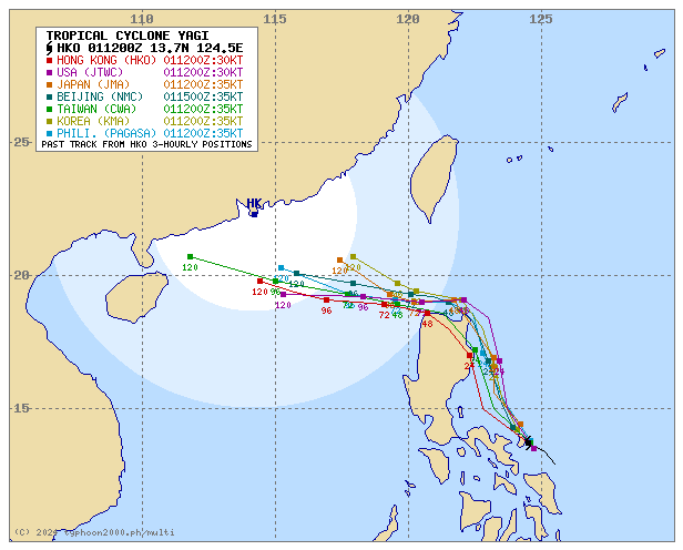
For more info visit: (http://www.typhoon2000.ph/multi/?name=YAGI)
PAGASA TROPICAL CYCLONE WIND SIGNAL
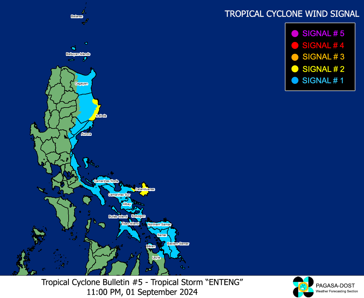
Image/Screenshot Source: DOST-PAGASA (https://www.pagasa.dost.gov.ph/tropical-cyclone/severe-weather-bulletin)


