
TROPICAL DEPRESSION ENTENG ADVISORY NO. 01Issued at: 2:00 PM PhT (06:00 GMT) Sunday, 01 Sept 2024
Next update: 8:00 PM PhT (12:00 GMT) Sunday, 01 Sept 2024 |
|
|---|---|
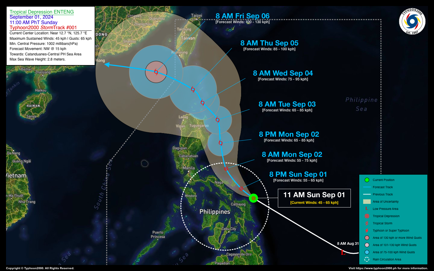
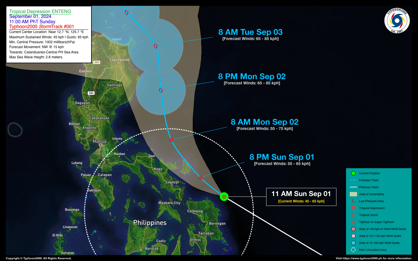
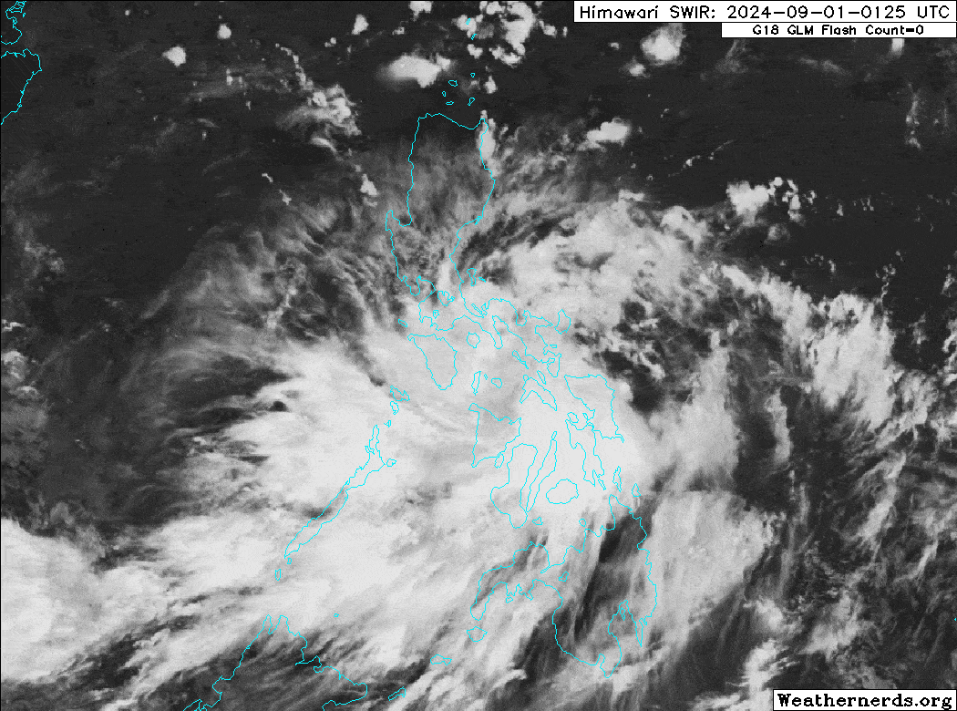
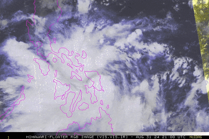
| Current Status & Outlook | Tropical Depression (TD) ENTENG newly-formed over the coastal waters of Northern Samar, accelerating rapidly towards Catanduanes. This system is forecast to bring moderate to heavy to at times torrential rains across Samar and Bicol Provinces today until tomorrow. Residents are advised to take all necessary precautions against flash floods and landslides. Meanwhile, PAGASA Wind Signal #01 has already been hoisted across these areas (see wind signal map below for more details)
48-hr Outlook: TD ENTENG is forecast to pass over or very close to Catanduanes later tonight or early tomorrow morning, as it turns more to the north at 15 km/hr. By 8 PM tomorrow (Sept 02), Enteng will become a Tropical Storm (TS) while passing along the coastal waters of Northern Aurora and Isabela. It will be along the coastal waters of Northern Cagayan on Tuesday morning, Sept 03 with little change in strength. The presence of TD ENTENG will enhance the Southwest Monsoon (Habagat) and bring moderate, heavy to intense rainfall with severe thunderstorms across the whole of Visayas, MiMaRoPa, Caraga, Sulu Archipelago, Metro Manila, & CaLaBaRZon today and tomorrow. Again, please take all necessary precautions against flashfloods and landslides including lahars that will be brought about by the monsoon. |
| Where is ENTENG? | As of 11:00 AM PhT today, Sept 01…0300 GMT:
|
| How strong is it? | Maximum Sustained Winds (1-min avg): 45 kph near the center…Gustiness: 65 kph. |
| Past Movement (06 hrs) | Northwest @ 29 kph, towards Catanduanes and the Central Philippine Sea. |
| Potential Philippine Major Landfall Area(s) |
|
| What Philippine areas will be directly affected? | Heavy to Extreme Rainfall (50 mm to >100 mm expected for 24 hrs):
Damaging Winds (gusts of more than 100 km/hr expected):
|
| Potential Storm Surge/Coastal Flooding Areas+ |
+Waves of 3 meters in height are expected in storm surge-prone areas, particularly in coastal areas where the Tropical Cyclone is headed. Kindly visit the PAGASA Storm Surge Updates for more details. |
| 3-Day Forecast Outlook Summary** |
**Important Note: Please be reminded that the Forecast Outlook changes every 6 hours, and the Day 2 and 3 Forecast Track have an average error of 100 and 250 km respectively… while the wind speed forecast error, averages 35 km/hr per day. Therefore, a turn to the left or right of its future track and changes in its wind speed must be anticipated from time to time. |
| Other Storm’s Meteorological Information |
|
| Disclaimer: Information based on data collected by Typhoon2000 (T2k) shall not be taken as official data. Weather information broadcasted and distributed by PAGASA remains as official data. Typhoon2000 (T2k) shall not be responsible for the private use and reliance of its weather information. | |
Issued by: David Michael V. Padua for Typhoon2000 (T2k)
Typhoon2000 (T2K) Integrated Multi-Agency Tracks
:: This section will be available once RSMC-JMA Upgrades this system into a Tropical Storm.
For more info visit: (http://www.typhoon2000.ph/multi/?name=)
PAGASA TROPICAL CYCLONE WIND SIGNAL
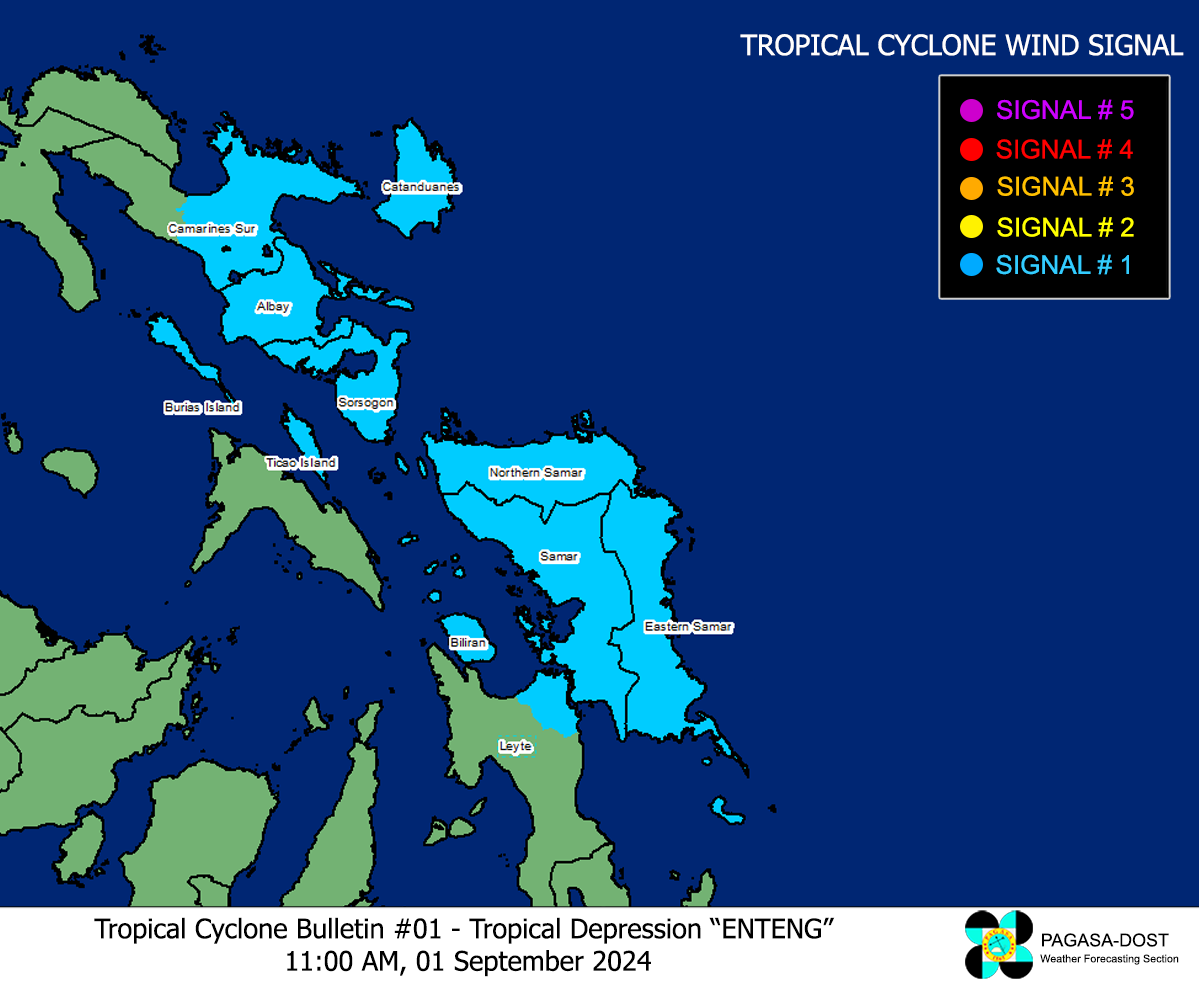
Image/Screenshot Source: DOST-PAGASA (https://www.pagasa.dost.gov.ph/tropical-cyclone/severe-weather-bulletin)


