
SEVERE TROPICAL STORM CRISING (WIPHA) ADVISORY NO. 05 [Final]Issued at: 2:00 PM PhT (06:00 GMT) Saturday, 19 Jul 2025
|
|
|---|---|
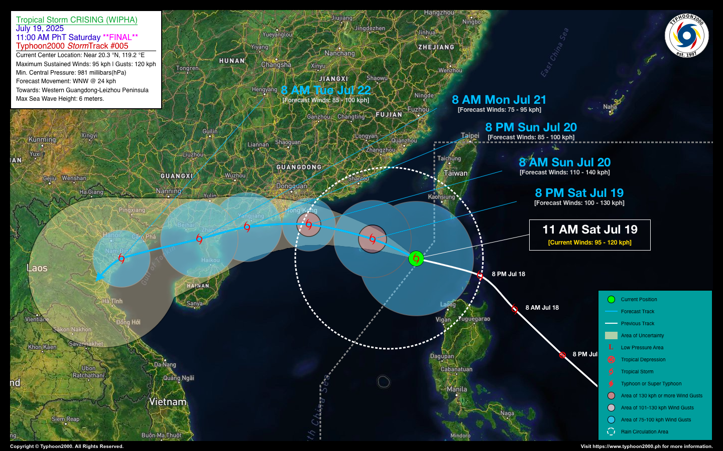
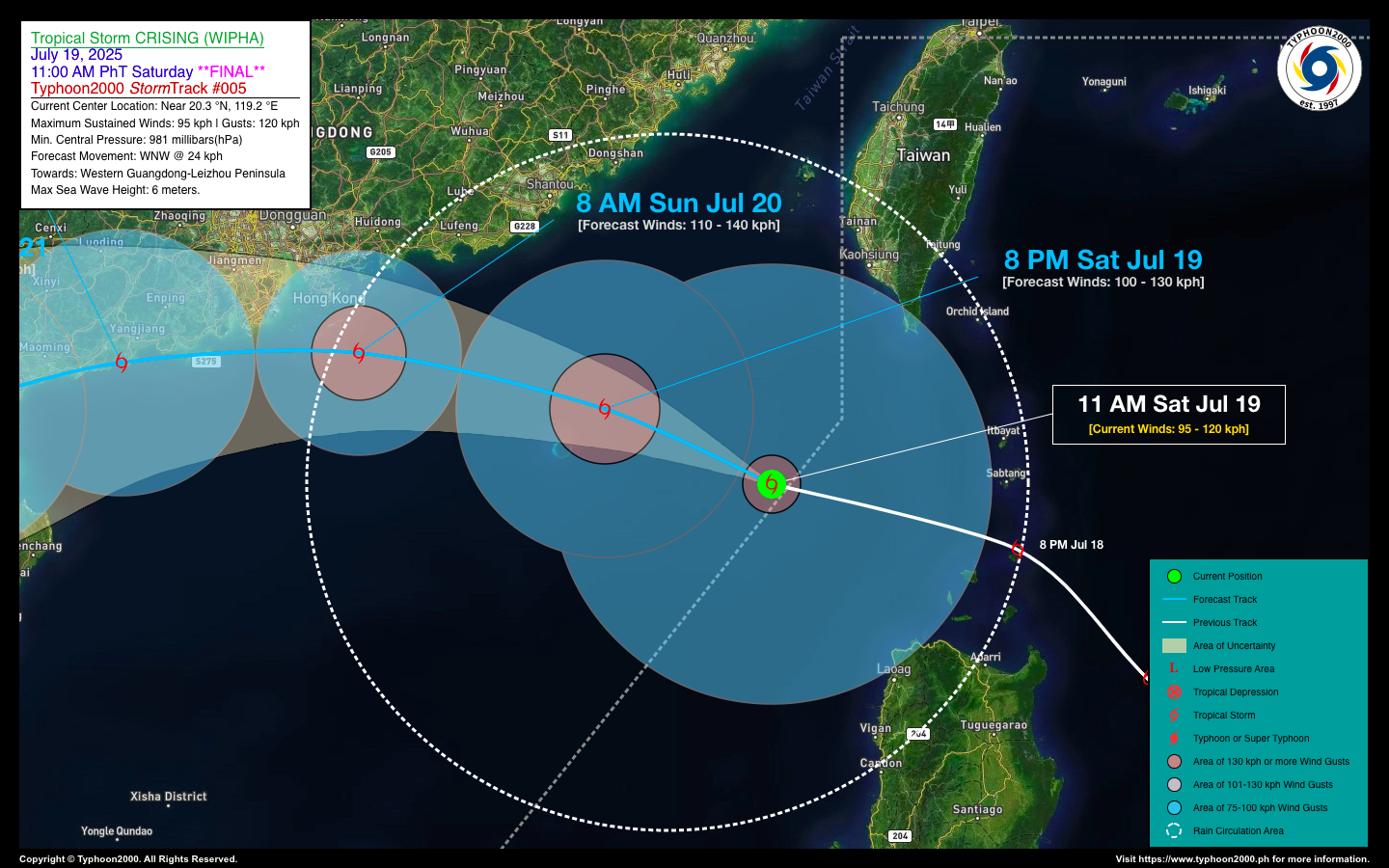
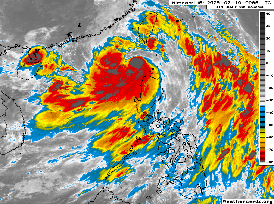
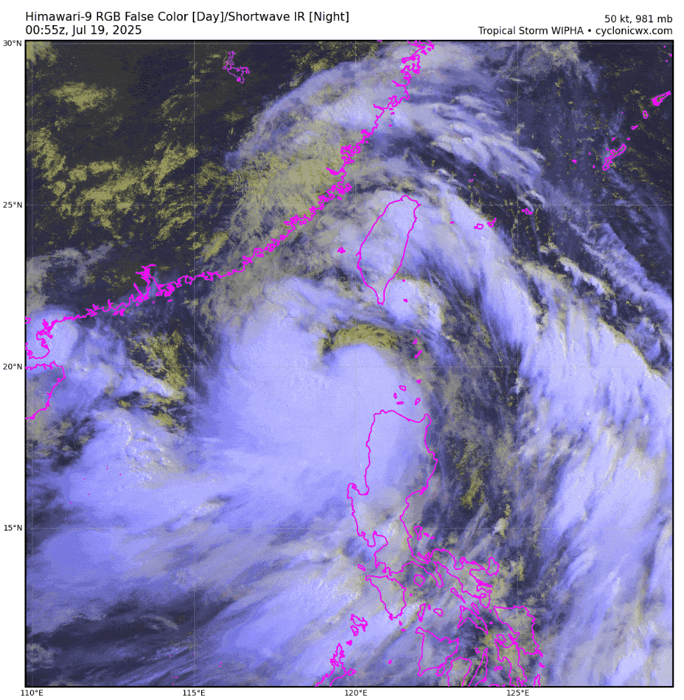
| Current Status & Outlook | CRISING (WIPHA) exited the Philippine Area of Responsibility (PAR) this morning and has since intensified into a Severe Tropical Storm over the South China Sea. It now poses a significant threat to Western Guangdong, particularly Hong Kong and Macao.
48-hr Outlook: STS CRISING is expected to pass near or directly over Hong Kong by Sunday afternoon, potentially reaching near-typhoon strength with maximum sustained winds of up to 110 kilometers per hour. It is forecast to make landfall over the Leizhou Peninsula on Monday morning, July 21. The presence of CRISING will continue to enhance the Southwest Monsoon (Habagat), bringing occasional light to moderate, and at times heavy to torrential rains across the western sections of the country—including MIMAROPA, Western Visayas, and Western Luzon—today. |
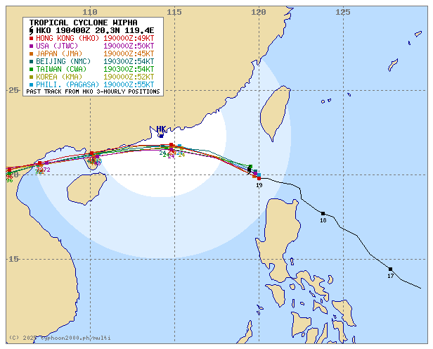
| Where is CRISING (WIPHA)? | As of 11:00 AM PhT today, Jul 19…0300 GMT:
|
| How strong is it? | Maximum Sustained Winds (1-min avg): 95 kph near the center…Gustiness: 120 kph. |
| Past Movement (06 hrs) | West-Northwest @ 19 kph, towards Southern China. |
| Potential Philippine Major Landfall Area(s) |
|
| What Philippine areas will be directly affected? | Heavy to Extreme Rainfall (50 mm to >100 mm expected for 24 hrs):
Damaging Winds (gusts of more than 100 km/hr expected):
|
| Potential Storm Surge/Coastal Flooding Areas+ |
+Waves of 1 to 2 meters in height are expected in storm surge-prone areas, particularly in coastal areas where the Tropical Cyclone is headed. Kindly visit the PAGASA Storm Surge Updates for more details. |
| 2-Day Forecast Outlook Summary** |
**Important Note: Please be reminded that the Forecast Outlook changes every 6 hours, and the Day 2 and 3 Forecast Track have an average error of 100 and 250 km respectively… while the wind speed forecast error, averages 35 km/hr per day. Therefore, a turn to the left or right of its future track and changes in its wind speed must be anticipated from time to time. |
| Other Storm’s Meteorological Information |
|
| Disclaimer: Information based on data collected by Typhoon2000 (T2k) shall not be taken as official data. Weather information broadcasted and distributed by PAGASA remains as official data. Typhoon2000 (T2k) shall not be responsible for the private use and reliance of its weather information. | |
Issued by: David Michael V. Padua for Typhoon2000 (T2k)
Typhoon2000 (T2K) Integrated Multi-Agency Tracks
For more info visit: (http://www.typhoon2000.ph/multi/?name=WIPHA)
PAGASA TROPICAL CYCLONE WIND SIGNAL

Image/Screenshot Source: DOST-PAGASA (https://www.pagasa.dost.gov.ph/tropical-cyclone/severe-weather-bulletin)


