
TROPICAL STORM CRISING (WIPHA) ADVISORY NO. 03Issued at: 11:00 AM PhT (03:00 GMT) Friday, 18 Jul 2025
Next update: 11:00 PM PhT (15:00 GMT) Friday, 18 Jul 2025 |
|
|---|---|
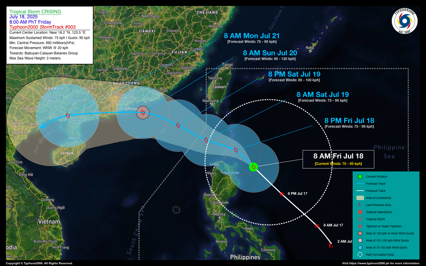
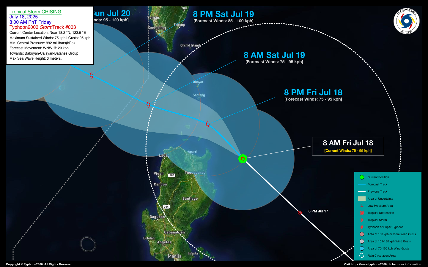
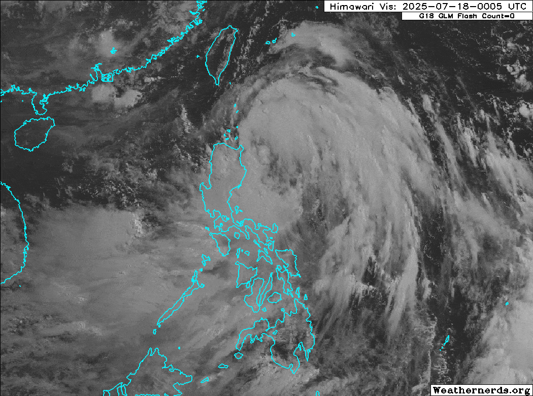
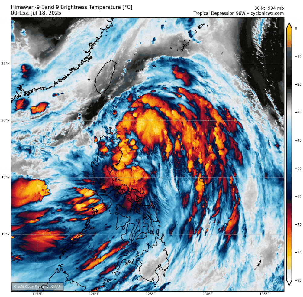
| Current Status & Outlook | CRISING (WIPHA) has intensified into a Tropical Storm (TS) as it accelerates northwestward, approaching the northern coastline of Cagayan. It is forecast to pass over the Balintang Channel later tonight, bringing impacts to the smaller islands of the Babuyan Group and Batanes. Residents in flood- and landslide-prone areas of Northern Luzon are advised to stay alert for possible heavy to torrential rainfall associated with the system.
48-hr Outlook: TS CRISING is forecast to exit the northwestern boundary of the Philippine Area of Responsibility (PAR) by tomorrow morning (July 19), and may further intensify into a Severe Tropical Storm as it moves very close to Hong Kong by Sunday morning or afternoon (July 20). The presence of CRISING will enhance the Southwest Monsoon (Habagat), bringing occasional light to moderate, and at times heavy to torrential rains across the western sections of the country—including MIMAROPA, Western Mindanao, the Visayas, and Western Luzon—today and continuing through the weekend. |
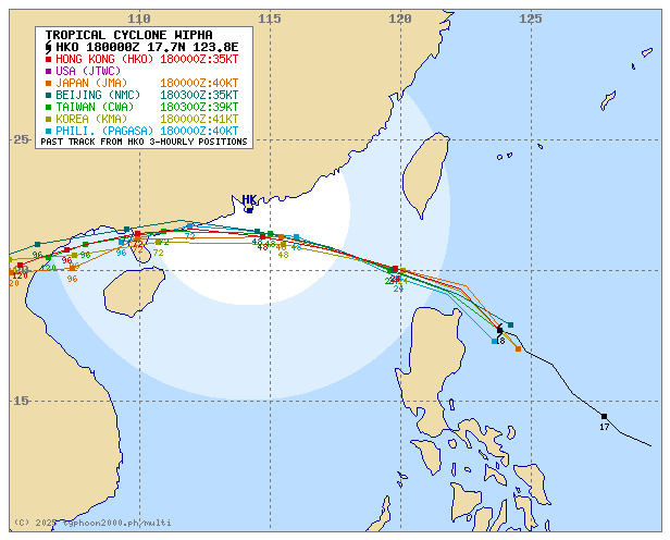
| Where is CRISING (WIPHA)? | As of 8:00 AM PhT today, Jul 18…0000 GMT:
|
| How strong is it? | Maximum Sustained Winds (1-min avg): 75 kph near the center…Gustiness: 85 kph. |
| Past Movement (06 hrs) | Northwest @ 31 kph, towards Babuyan-Calayan-Southern Batanes Area. |
| Potential Philippine Major Landfall Area(s) |
|
| What Philippine areas will be directly affected? | Heavy to Extreme Rainfall (50 mm to >100 mm expected for 24 hrs):
Damaging Winds (gusts of more than 100 km/hr expected):
|
| Potential Storm Surge/Coastal Flooding Areas+ |
+Waves of 1 to 2 meters in height are expected in storm surge-prone areas, particularly in coastal areas where the Tropical Cyclone is headed. Kindly visit the PAGASA Storm Surge Updates for more details. |
| 3-Day Forecast Outlook Summary** |
**Important Note: Please be reminded that the Forecast Outlook changes every 6 hours, and the Day 2 and 3 Forecast Track have an average error of 100 and 250 km respectively… while the wind speed forecast error, averages 35 km/hr per day. Therefore, a turn to the left or right of its future track and changes in its wind speed must be anticipated from time to time. |
| Other Storm’s Meteorological Information |
|
| Disclaimer: Information based on data collected by Typhoon2000 (T2k) shall not be taken as official data. Weather information broadcasted and distributed by PAGASA remains as official data. Typhoon2000 (T2k) shall not be responsible for the private use and reliance of its weather information. | |
Issued by: David Michael V. Padua for Typhoon2000 (T2k)
Typhoon2000 (T2K) Integrated Multi-Agency Tracks
For more info visit: (http://www.typhoon2000.ph/multi/?name=WIPHA)
PAGASA TROPICAL CYCLONE WIND SIGNAL
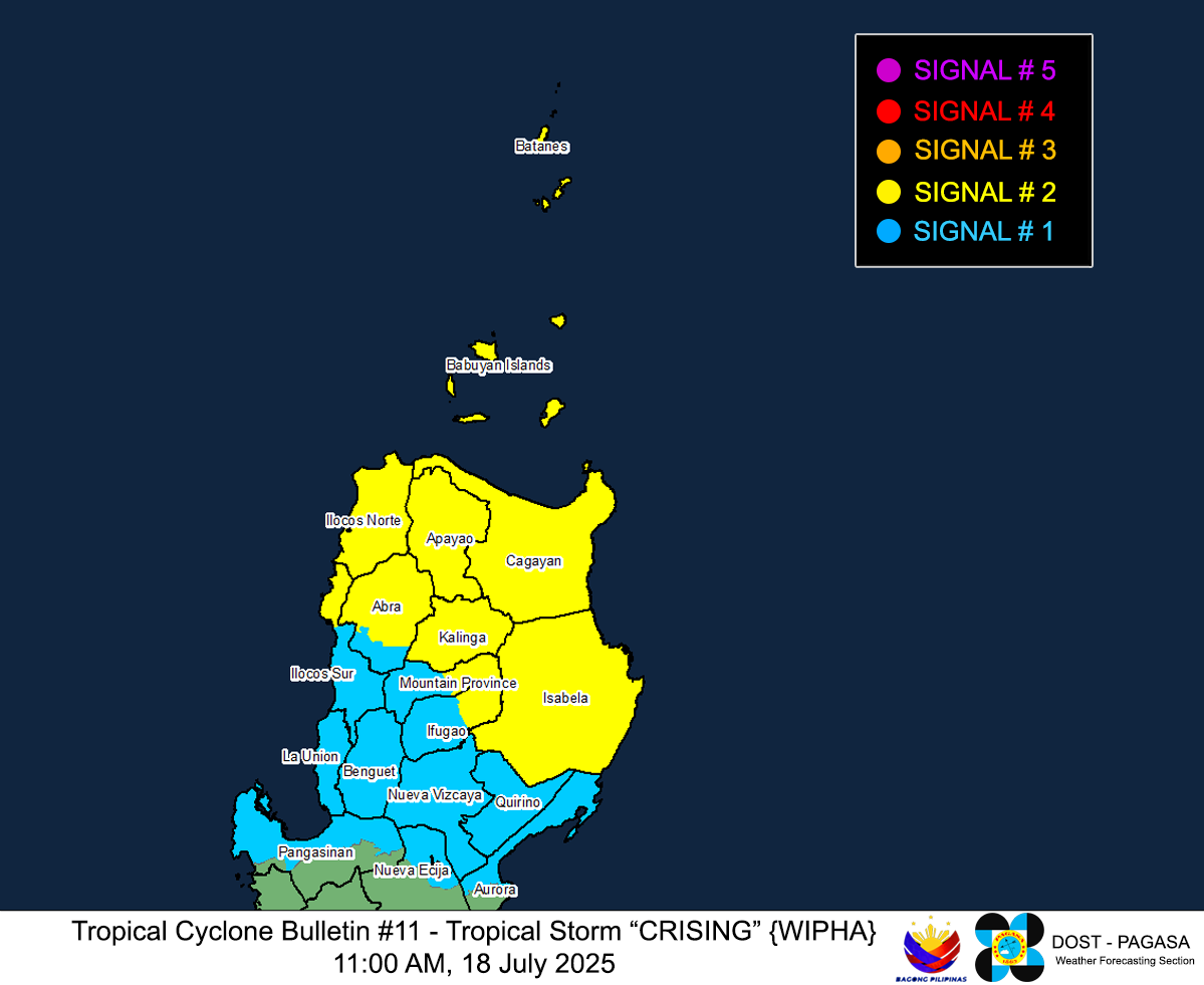
Image/Screenshot Source: DOST-PAGASA (https://www.pagasa.dost.gov.ph/tropical-cyclone/severe-weather-bulletin)


