
TROPICAL DEPRESSION CRISING ADVISORY NO. 01Issued at: 1:00 PM PhT (05:00 GMT) Thursday, 17 Jul 2025
Next update: 10:00 PM PhT (14:00 GMT) Thursday, 17 Jul 2025 |
|
|---|---|
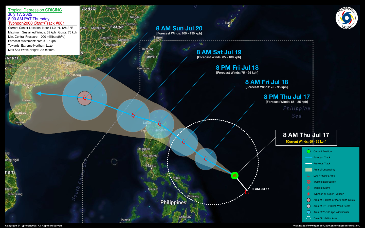
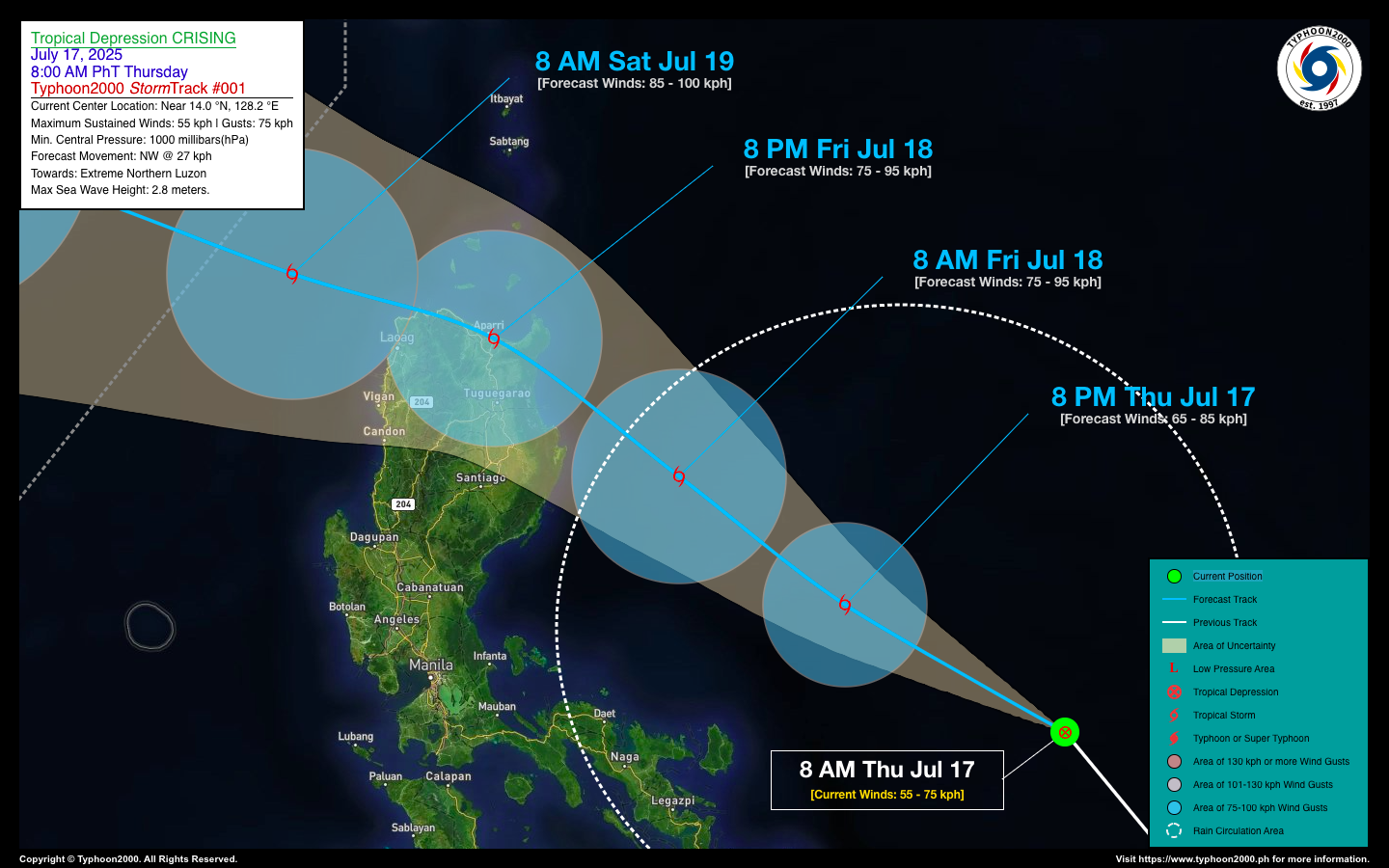
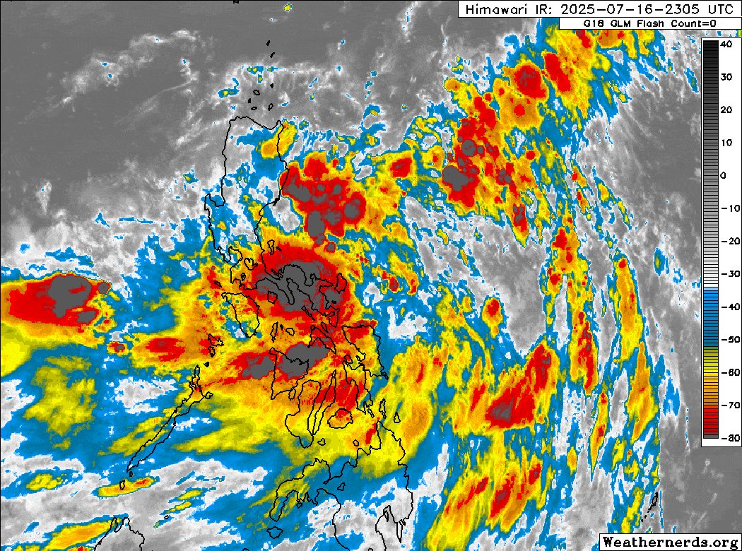
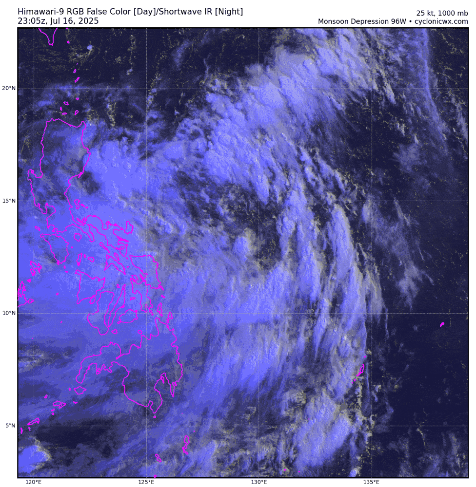
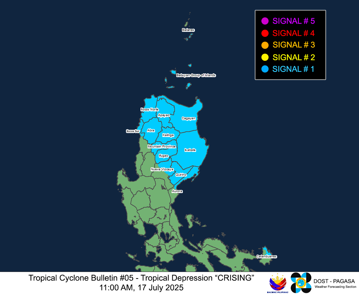
| Current Status & Outlook | The large Monsoon Depression 96W over the Central Philippine Sea, east of Bicol Region has reached its criteria of a Tropical Depression. It is now known locally as “CRISING”, the 3rd Philippine Tropical Cyclone of the 2025 Season. Residents living along flood and landslide prone areas of Northern Luzon and Bicol Region should stay alert for possible heavy to torrential rains that will be generated by this cyclone.
48-hr Outlook: Tropical Depression CRISING is forecast to accelerate west-northwestward towards Extreme Northern Luzon, with a possible landfall over Northern Cagayan by late tomorrow afternoon or evening (Jul 18), and is likely to become a Tropical Storm within the next 12 to 24 hours. Then by tomorrow evening, CRISING will traverse the northern portion of Ilocos Norte, before it moves out into the West Philippine Sea on Saturday morning (Jul 19). The presence of TS CRISING will enhance the Southwest Monsoon (Habagat), bringing occasional light to moderate to at times heavy, intense to torrential rainfall across the western sections of country (MiMaRoPa, Western Mindanao, Visayas, and Western Luzon today and through the weekend. |
| Where is Pre-PEPITO (MAN-YI)? | As of 8:00 AM PhT today, Jul 17…0000 GMT:
|
| How strong is it? | Maximum Sustained Winds (1-min avg): 55 kph near the center…Gustiness: 75 kph. |
| Past Movement (06 hrs) | Northwest @ 31 kph, towards Extreme Northern Luzon. |
| Potential Philippine Major Landfall Area(s) |
|
| What Philippine areas will be directly affected? | Heavy to Extreme Rainfall (50 mm to >100 mm expected for 24 hrs):
Damaging Winds (gusts of more than 100 km/hr expected):
|
| Potential Storm Surge/Coastal Flooding Areas+ |
+Waves of more than 3 meters in height are expected in storm surge-prone areas, particularly in coastal areas where the Tropical Cyclone is headed. Kindly visit the PAGASA Storm Surge Updates for more details. |
| 3-Day Forecast Outlook Summary** |
**Important Note: Please be reminded that the Forecast Outlook changes every 6 hours, and the Day 2 and 3 Forecast Track have an average error of 100 and 250 km respectively… while the wind speed forecast error, averages 35 km/hr per day. Therefore, a turn to the left or right of its future track and changes in its wind speed must be anticipated from time to time. |
| Other Storm’s Meteorological Information |
|
| Disclaimer: Information based on data collected by Typhoon2000 (T2k) shall not be taken as official data. Weather information broadcasted and distributed by PAGASA remains as official data. Typhoon2000 (T2k) shall not be responsible for the private use and reliance of its weather information. | |
Issued by: David Michael V. Padua for Typhoon2000 (T2k)
PAGASA TROPICAL CYCLONE WIND SIGNAL
Image/Screenshot Source: DOST-PAGASA (https://www.pagasa.dost.gov.ph/tropical-cyclone/severe-weather-bulletin)


