
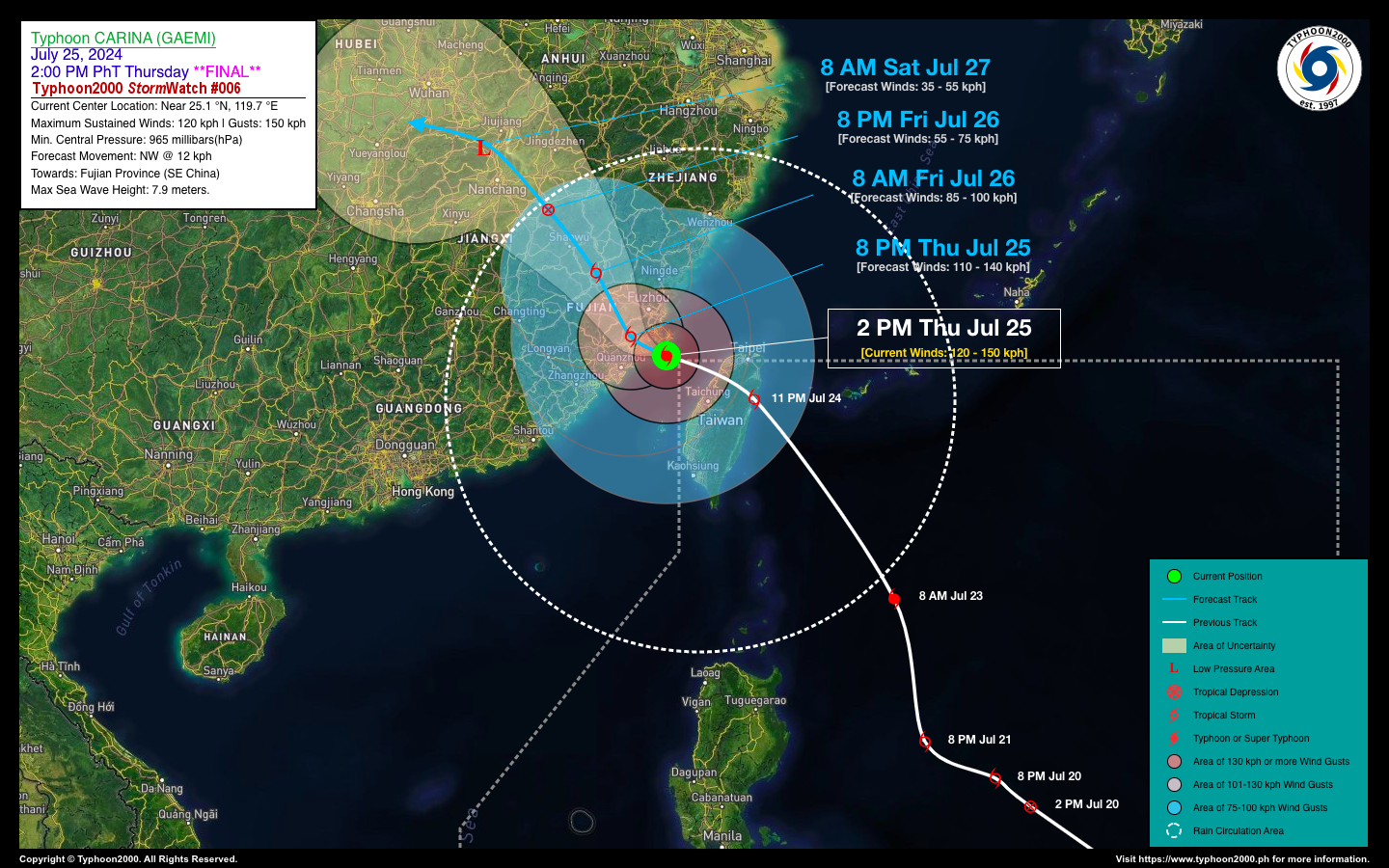
TYPHOON CARINA (GAEMI) STORMWATCH NO. 06 [Final]Issued at: 4:00 PM PhT (08:00 GMT) Thursday, 25 Jul 2024
|
|
|---|---|
| Current Status and Outlook |
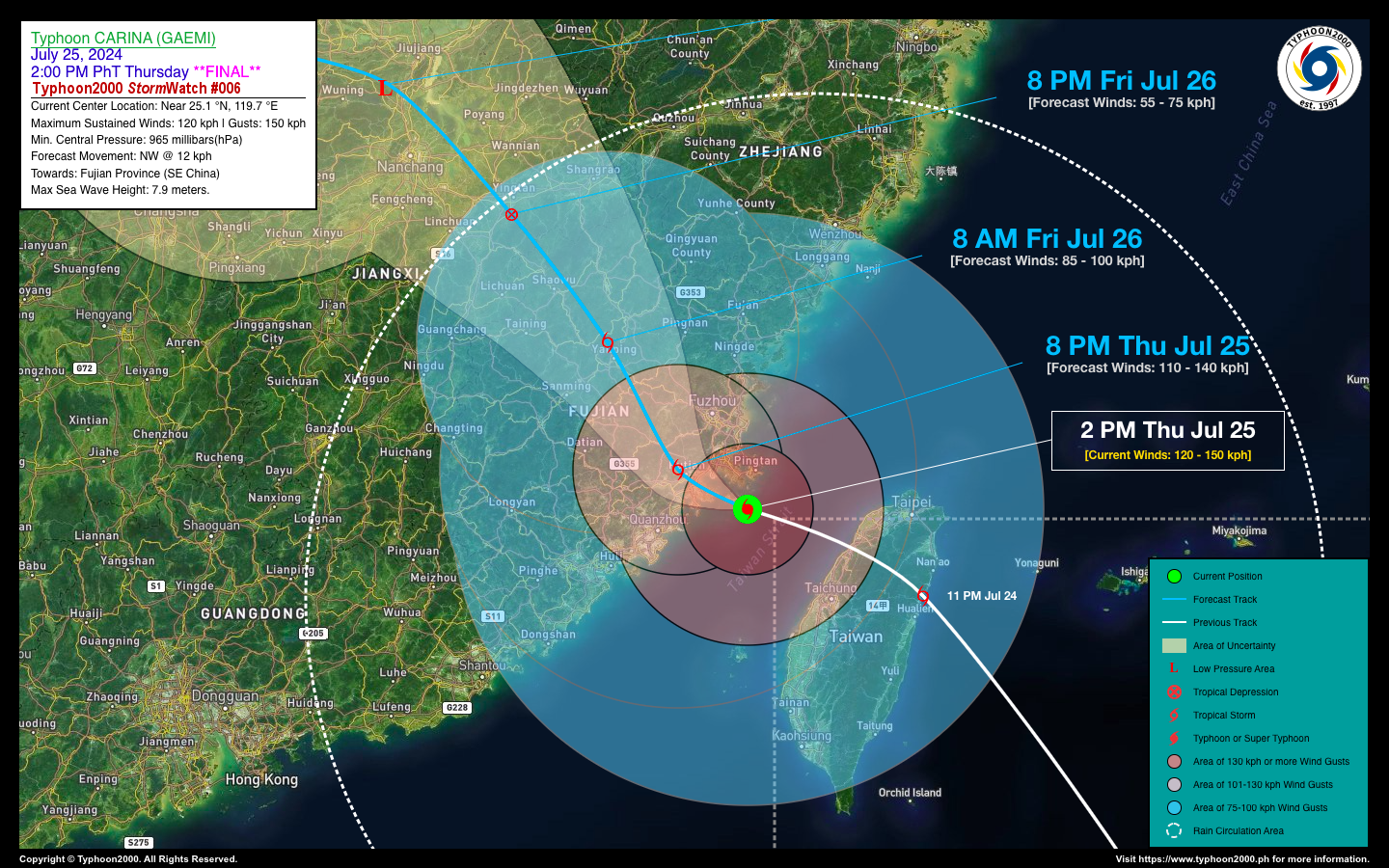
Typhoon CARINA (GAEMI) is expected to make its final landfall over Southeastern China, near Fujian Province, within the next few hours. This comes after it exited the Philippine Area of Responsibility (PAR) this morning. Over the past 24 hours, Carina’s core made landfall in Northeastern Taiwan, specifically along Yilan County, around 11:30 PM last night. It then traversed northern Taiwan, exiting along the western coast of Hsinchu City this morning. Heavy to intense rainfall and typhoon-force winds continue to affect these areas, including Taiwan, which lies within the eastern portion of Carina’s large circulation. Typhoon Carina is forecast to weaken to a Tropical Depression by Saturday morning (July 27th) as it dissipates over Jiangxi Province in the next 36 hours. |
| Where is CARINA (GAEMI)? | As of 2:00 PM PhT today, July 25…0600 GMT:
|
| How strong is it? | Maximum Sustained Winds (1-min avg): 120 kph near the center…Gustiness: 150 kph. |
| Past Movement (06 hrs) | NNW @ 15 kph, towards Northern Taiwan |
| Forecast Highlights |
|
| This StormWatch is valid for the next 24 hours.
Information based on data collected by Typhoon2000 (T2k) shall not be taken as official data. Weather information broadcasted and distributed by PAGASA remains as official data. Typhoon2000 (T2k) shall not be responsible for the private use and reliance of its weather information. |
|
Typhoon2000 (T2K) Integrated Multi-Agency Tracks
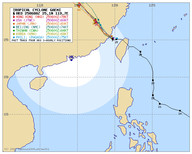
For more info visit: (http://www.typhoon2000.ph/multi/?name=GAEMI)
PAGASA TROPICAL CYCLONE WIND SIGNAL
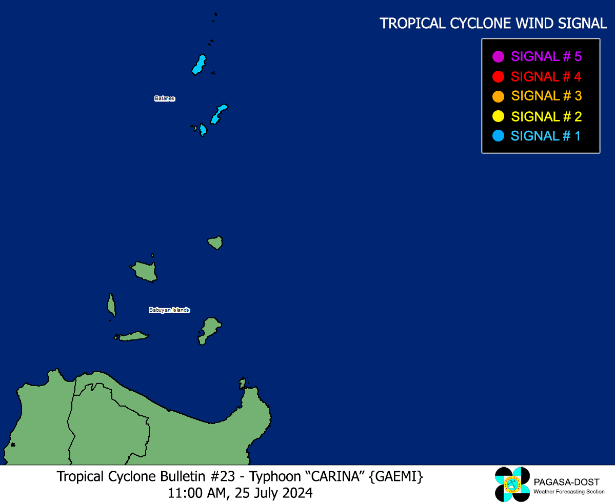
Image/Screenshot Source: DOST-PAGASA (https://bagong.pagasa.dost.gov.ph/tropical-cyclone/severe-weather-bulletin)
Issued by: David Michael V. Padua for Typhoon2000 (T2K)


