
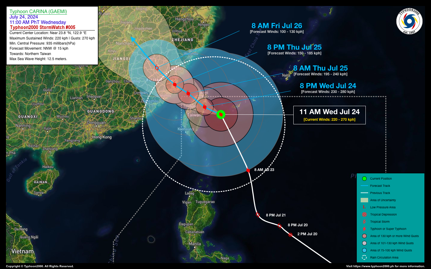
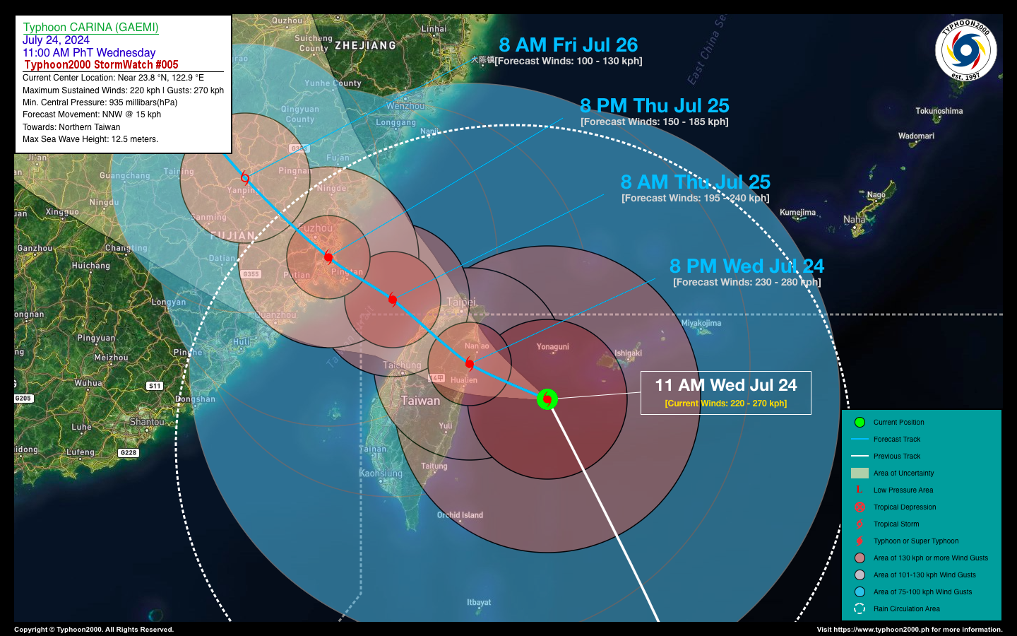
TYPHOON CARINA (GAEMI) STORMWATCH NO. 05Issued at: 2:00 PM PhT (06:00 GMT) Wednesday, 24 Jul 2024
Next update: 2:00 PM PhT (06:00 GMT) Thursday, 25 Jul 2024 |
|
|---|---|
| Current Status and Outlook |
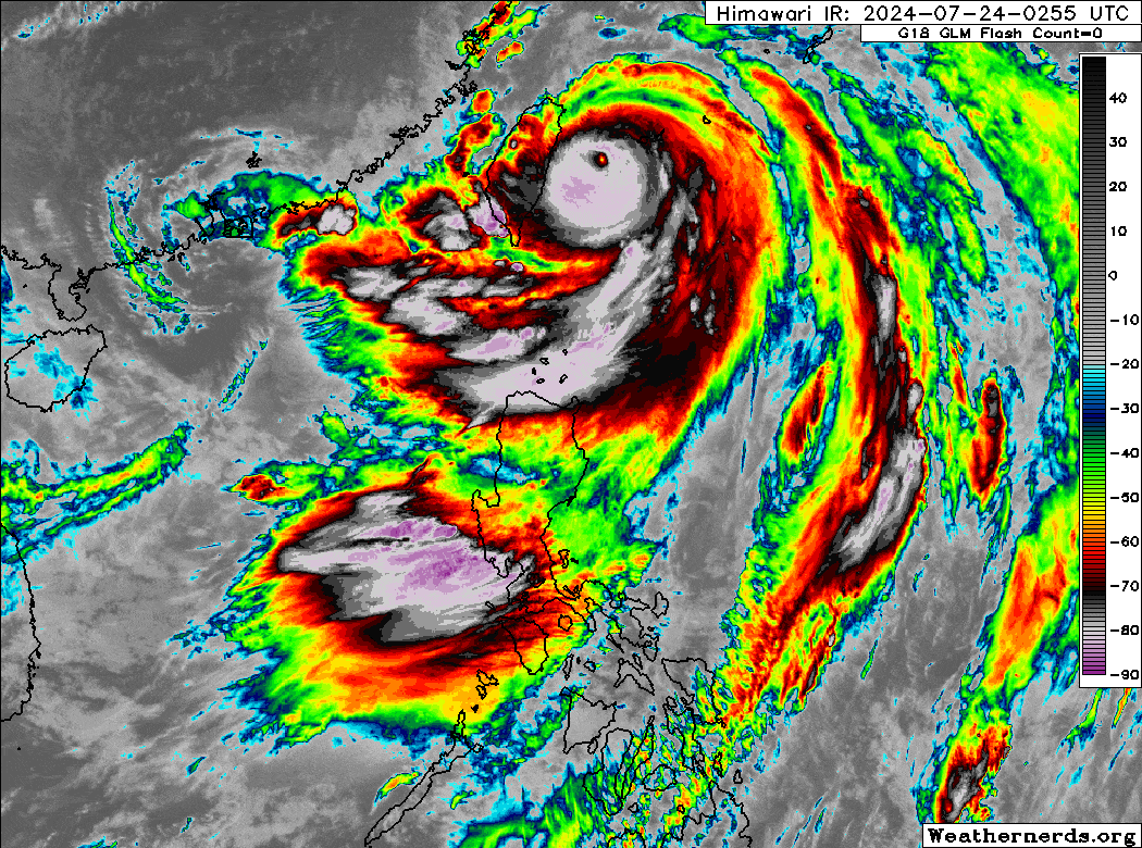
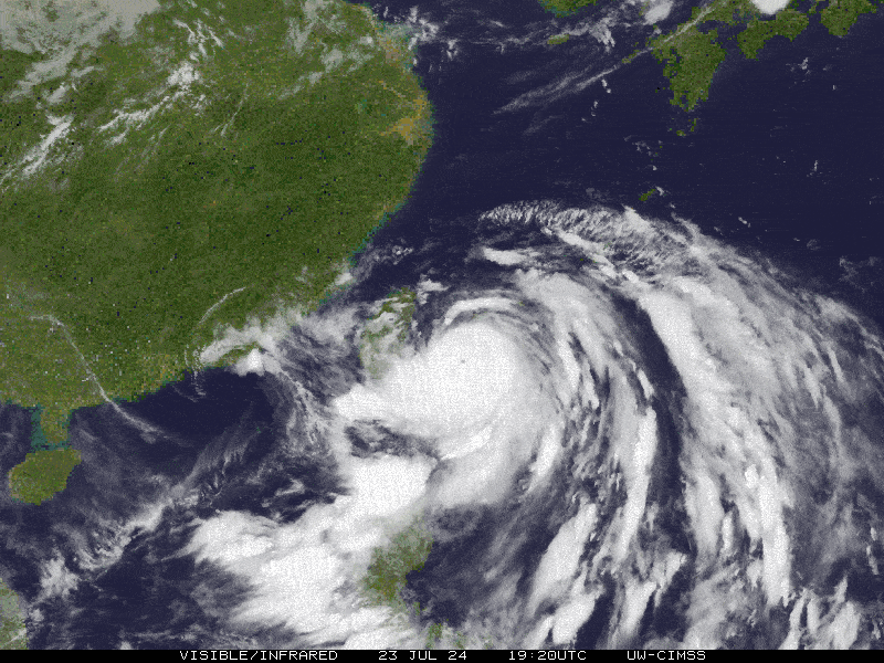
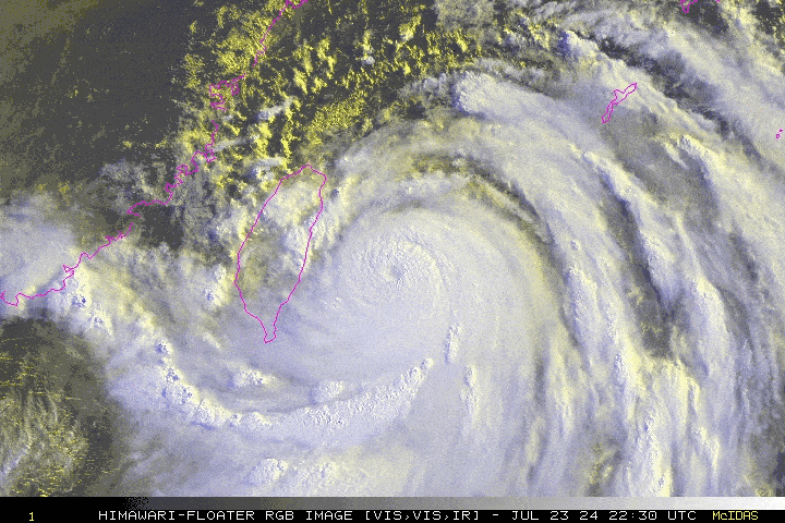
Typhoon CARINA (GAEMI) is rapidly intensifying as it bears down on Taiwan. New data suggests the storm’s center may make landfall over or near Hualien County earlier than expected, possibly between 4 PM and 6 PM today. Its expansive circulation is likely to blanket the entire island nation tonight, bringing violent winds and intense rainfall. Over the next 24 to 36 hours, Typhoon Carina is forecast to emerge over the Taiwan Strait early tomorrow morning before making its final landfall over Fujian Province by tomorrow afternoon. The typhoon is expected to weaken progressively during these back-to-back landfalls. By Friday morning, July 26th, it will likely be a dissipating tropical storm as it moves across Fujian and Jiangxi Provinces. |
| Where is CARINA (GAEMI)? | As of 11:00 AM PhT today, July 24…0300 GMT:
|
| How strong is it? | Maximum Sustained Winds (1-min avg): 220 kph near the center…Gustiness: 270 kph. |
| Past Movement (06 hrs) | NNW @ 15 kph, towards Northern Taiwan |
| Forecast Highlights |
|
| This StormWatch is valid for the next 24 hours.
Information based on data collected by Typhoon2000 (T2k) shall not be taken as official data. Weather information broadcasted and distributed by PAGASA remains as official data. Typhoon2000 (T2k) shall not be responsible for the private use and reliance of its weather information. |
|
Typhoon2000 (T2K) Integrated Multi-Agency Tracks
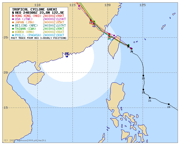
For more info visit: (http://www.typhoon2000.ph/multi/?name=GAEMI)
PAGASA TROPICAL CYCLONE WIND SIGNAL
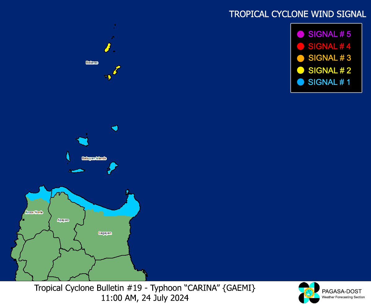
Image/Screenshot Source: DOST-PAGASA (https://bagong.pagasa.dost.gov.ph/tropical-cyclone/severe-weather-bulletin)
Issued by: David Michael V. Padua for Typhoon2000 (T2K)


