
SEVERE TROPICAL STORM CARINA (GAEMI) STORMWATCH NO. 03Issued at: 12:00 AM PhT (16:00 GMT) Monday, 22 Jul 2024
Next update: 12:00 AM PhT (16:00 GMT) Tuesday, 23 Jul 2024 |
|
|---|---|
| Current Status and Outlook |
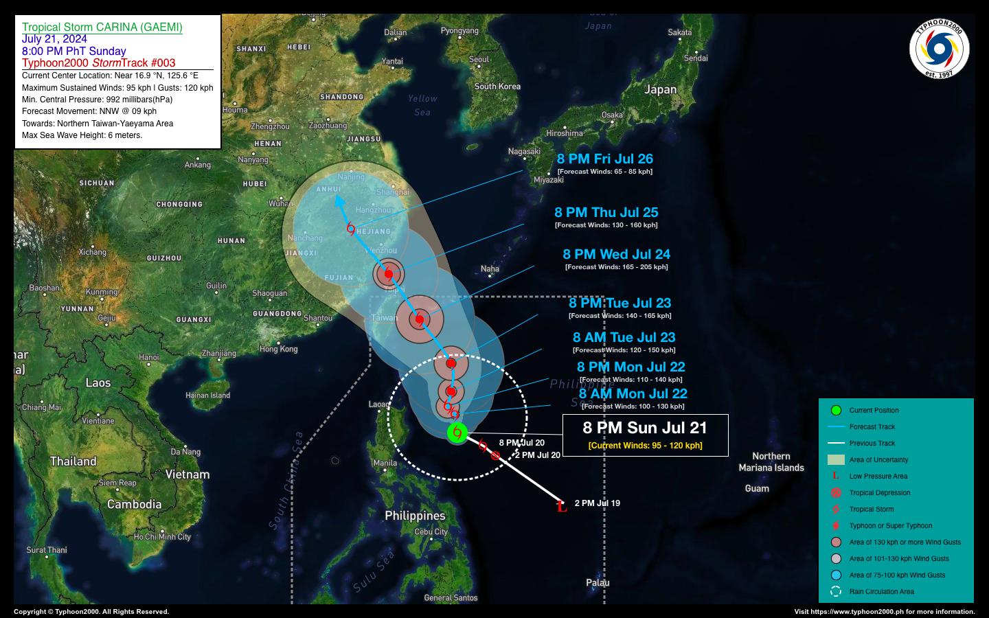
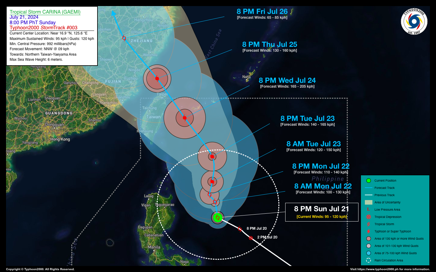
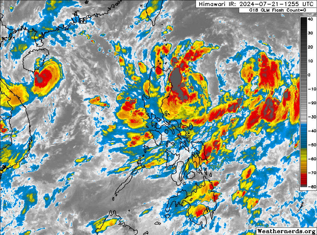
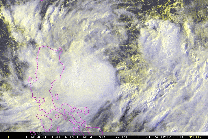
CARINA (GAEMI) strengthens into a Severe Tropical Storm (STS), while remaining almost stationary over the northwestern edge of the Central Philippine Sea during the past 12 hours. Its westernmost outer rainbands are now spreading across Cagayan Valley. Over the next 24 to 36 hours, STS CARINA will start to move northward across the North Philippine Sea, and could become a Typhoon with projected winds of 120 kph on Tuesday morning (July 23). |
| Where is CARINA (GAEMI)? | As of 8:00 PM PhT last night, July 21…1200 GMT:
|
| How strong is it? | Maximum Sustained Winds (1-min avg): 95 kph near the center…Gustiness: 120 kph. |
| Past Movement (06 hrs) | Northwest @ 03 kph (Quasi-Stationary), over the Central Philippine Sea |
| Forecast Highlights |
|
| This StormWatch is valid for the next 24 hours.
Information based on data collected by Typhoon2000 (T2k) shall not be taken as official data. Weather information broadcasted and distributed by PAGASA remains as official data. Typhoon2000 (T2k) shall not be responsible for the private use and reliance of its weather information. |
|
Typhoon2000 (T2K) Integrated Multi-Agency Tracks
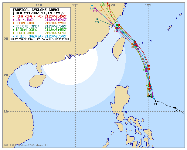
For more info visit: (http://www.typhoon2000.ph/multi/?name=GAEMI)
PAGASA TROPICAL CYCLONE WIND SIGNAL
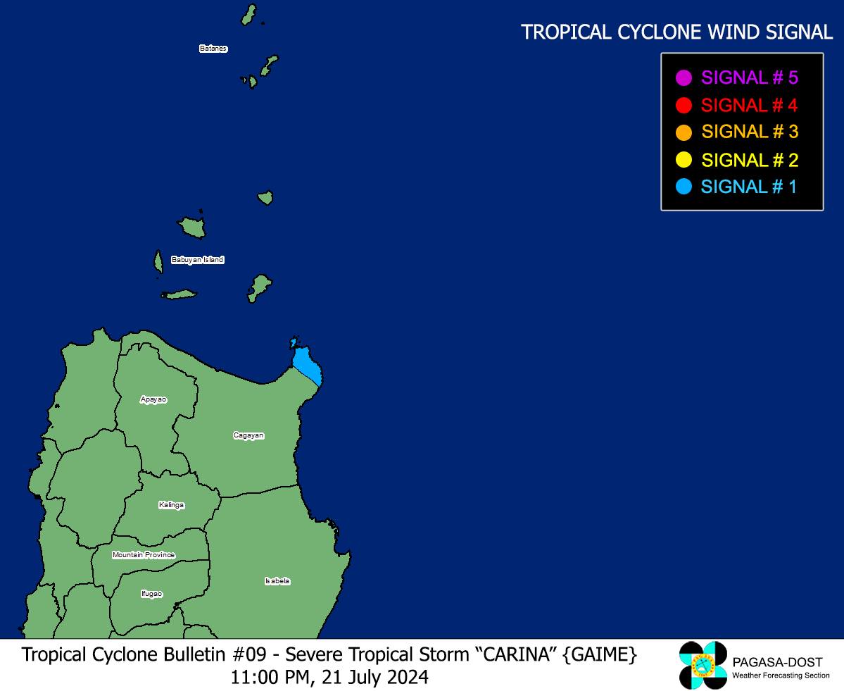
Image/Screenshot Source: DOST-PAGASA (https://bagong.pagasa.dost.gov.ph/tropical-cyclone/severe-weather-bulletin)
Issued by: David Michael V. Padua for Typhoon2000 (T2K)


