
TROPICAL STORM CARINA (GAEMI) STORMWATCH NO. 02Issued at: 12:00 AM PhT (16:00 GMT) Sunday, 21 Jul 2024
Next update: 12:00 AM PhT (16:00 GMT) Monday, 22 Jul 2024 |
|
|---|---|
| Current Status and Outlook |
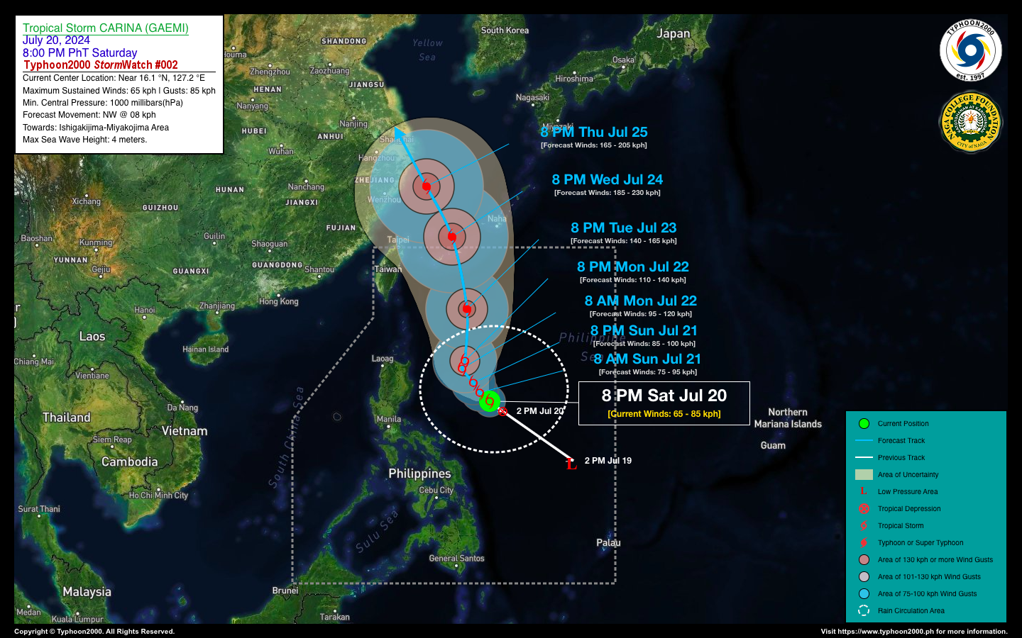
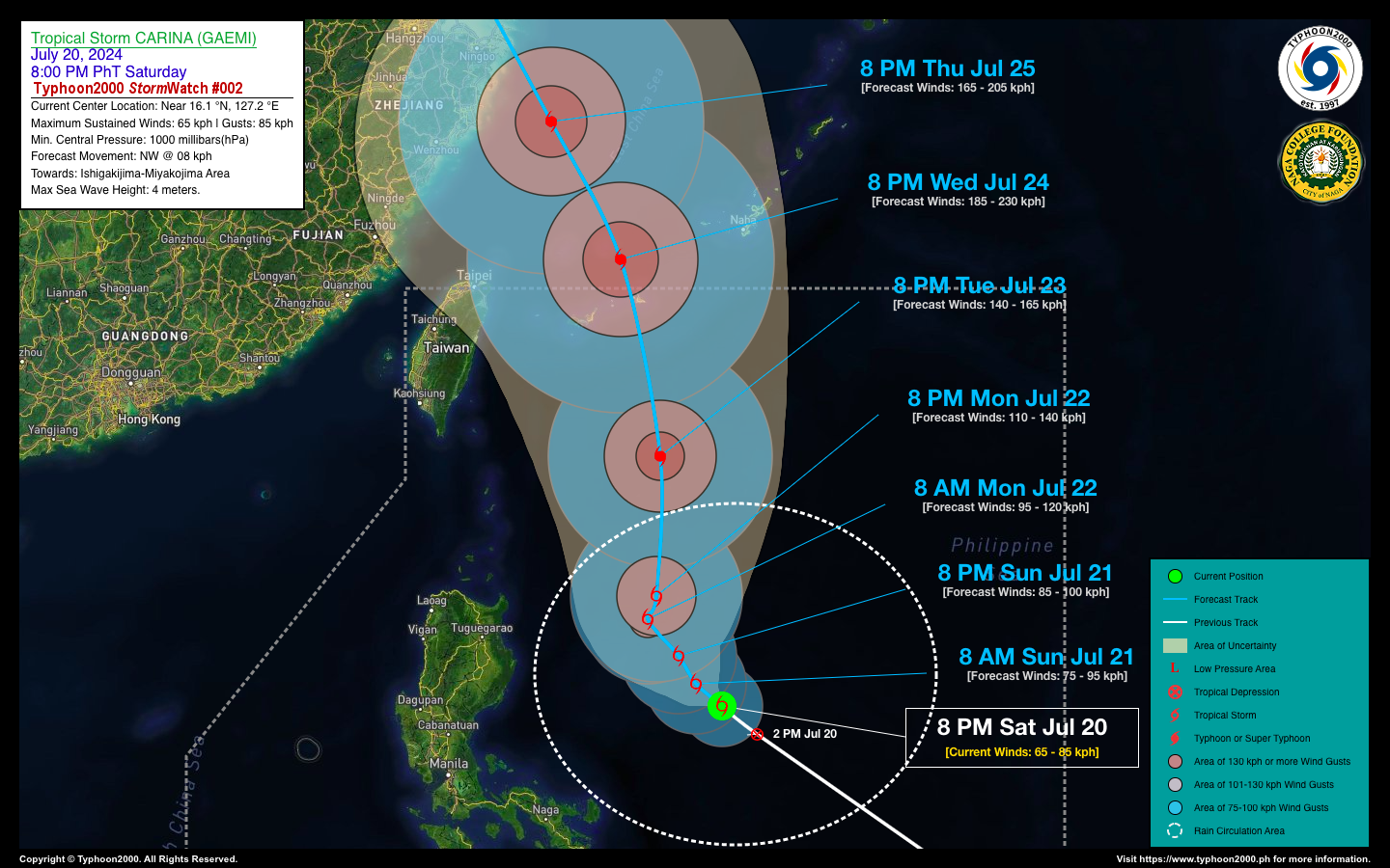
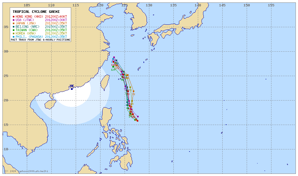
CARINA (GAEMI) has intensified into a Tropical Storm (TS) as it maintains its northwesterly track across the Philippine Sea. This system is likely to gain more strength as it moves towards Taiwan-Ishigakijima-Miyakojima Area. Meanwhile, TD BUTCHOY is already outside of the Philippine Area of Responsibility (PAR). This depression is no longer a threat to the country, and is forecast to track towards Hainan Island in Southern China. |
| Where is CARINA (GAEMI)? | As of 8:00 PM PhT last night, July 20…1200 GMT:
|
| How strong is it? | Maximum Sustained Winds (1-min avg): 65 kph near the center…Gustiness: 85 kph. |
| Past Movement (06 hrs) | Northwest @ 18 kph, towards the North Philippine Sea |
| Forecast Highlights |
|
| This StormWatch is valid for the next 24 hours.
Information based on data collected by Typhoon2000 (T2k) shall not be taken as official data. Weather information broadcasted and distributed by PAGASA remains as official data. Typhoon2000 (T2k) shall not be responsible for the private use and reliance of its weather information. |
|
Typhoon2000 (T2K) Integrated Multi-Agency Tracks
For more info visit: (http://www.typhoon2000.ph/multi/?name=GAEMI)
Issued by: David Michael V. Padua for Typhoon2000 (T2K)


