
TROPICAL DEPRESSION CARINA STORMWATCH NO. 01Issued at: 12:00 AM PhT (16:00 GMT) Saturday, 20 Jul 2024
Next update: 12:00 AM PhT (16:00 GMT) Sunday, 21 Jul 2024 |
|
|---|---|
| Current Status and Outlook |
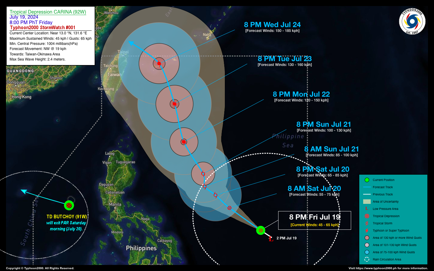
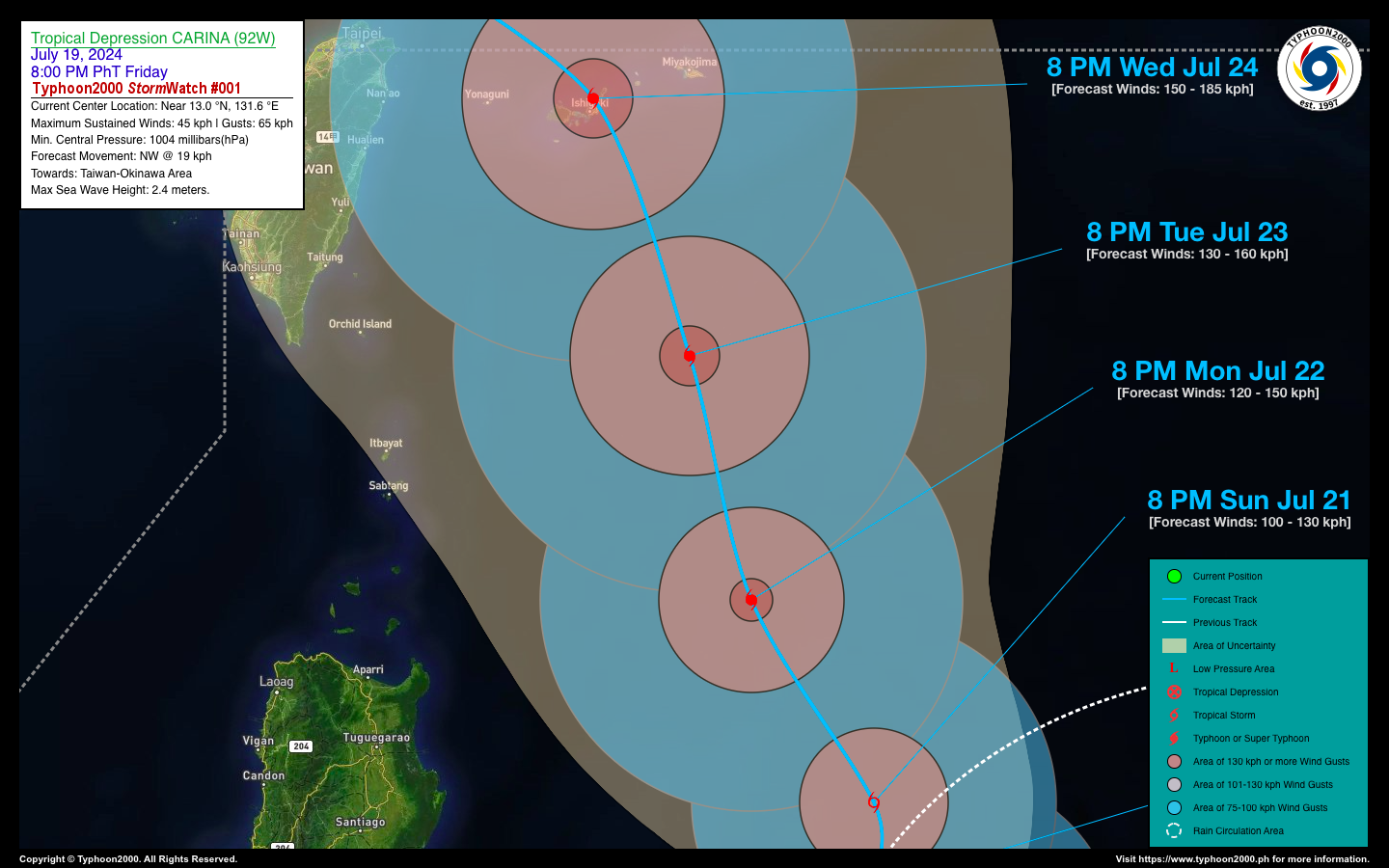
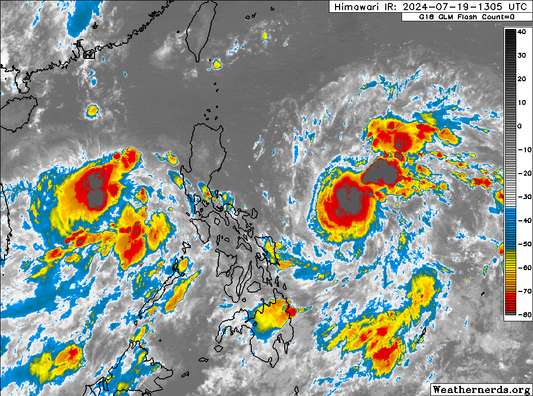
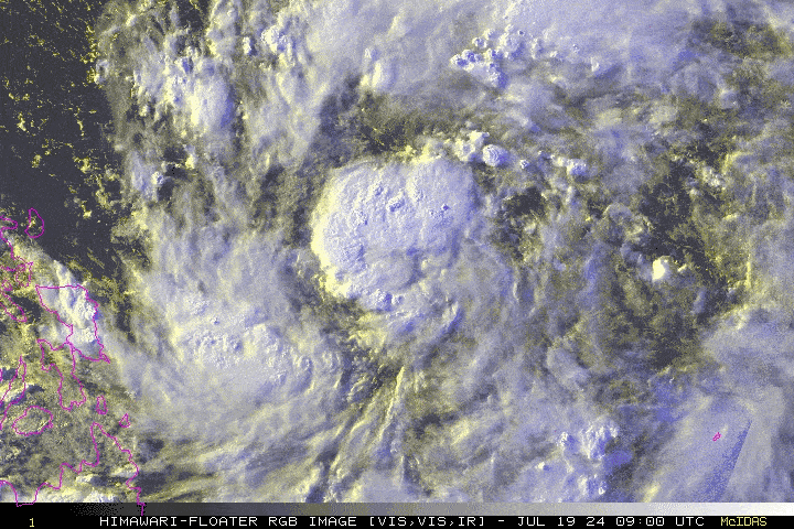
The broad Tropical Disturbance (LPA) 92W over the Central Philippine Sea, east of Bicol Region – has rapidly developed into a Tropical Depression (TD). It is now locally named by DOST-PAGASA as “CARINA”. Initial 5-day forecast shows the system rapidly becoming a full-blown Typhoon on July 22-24 (Mon-Wed) as it passes well to the east of Extreme Northern Luzon, in the general direction of Taiwan-Okinawa Area. The forecast of CARINA remains uncertain and any shift on the track could still happen. Meanwhile, LPA 91W located over the West Philippine Sea has also developed into a TD and was named locally as “BUTCHOY”. However, since this system will exit the western border of the Philippine Area of Responsibility (PAR) later this morning, no storm watches or advisories will be issued by Typhoon2000. Please refer to DOST_PAGASA for the official bulletins on both of these cyclones. |
| Where is CARINA? | As of 8:00 PM PhT last night, July 19…1200 GMT:
|
| How strong is it? | Maximum Sustained Winds (1-min avg): 45 kph near the center…Gustiness: 65 kph. |
| Past Movement (06 hrs) | West-Northwest @ 17 kph, towards the North Philippine Sea |
| Forecast Highlights |
|
| This StormWatch is valid for the next 24 hours.
Information based on data collected by Typhoon2000 (T2k) shall not be taken as official data. Weather information broadcasted and distributed by PAGASA remains as official data. Typhoon2000 (T2k) shall not be responsible for the private use and reliance of its weather information. |
|
Issued by: David Michael V. Padua for Typhoon2000 (T2K)


