
SUPER TYPHOON BISING (SURIGAE) ADVISORY NO. 05Issued at: 7:00 AM PhT (23:00 GMT) Sunday, 18 April 2021
Next update: 7:00 PM PhT (11:00 GMT) Sunday, 18 April 2021 |
|
|---|---|
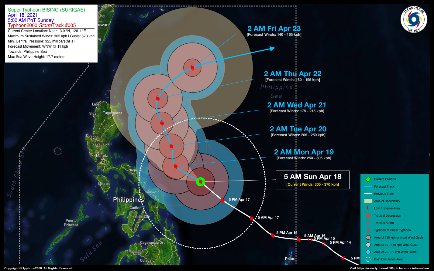
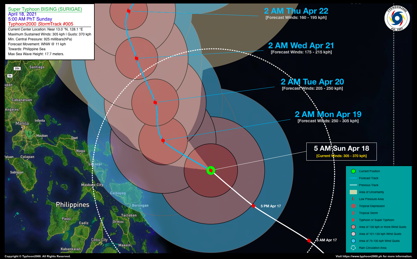
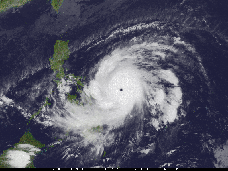
| Current Status & Outlook | Super Typhoon BISING (SURIGAE) is now an extremely catastrophic category 5 system after rapidly intensifying over the past 12 hours, making it the most powerful typhoon ever formed in the month of April in the Western Pacific Ocean – since the start of the operational Dvorak Analysis in the 1980s. It has now 1-min. sustained winds of 305 km/hr (based on the JTWC data).
This typhoon is expected to bring occasional rains with severe thunderstorms and gusty winds across Samar and Bicol Provinces today and tomorrow. 24-hr Outlook: STY BISING (SURIGAE) is forecast to pass well to the east of Catanduanes, more or less 220 km away from the island province by 2:00 AM early tomorrow morning. It is expected to move west-northwestward across the western portion of the Central Philippine Sea at a decreased forward speed of 11 km/hr. This cyclone will therefore weaken to minimal Super Typhoon strength within the next 12 to 24 hours as it undergoes an Eyewall Replacement Cycle (ERC). |
| Where is BISING (SURIGAE)? | As of 5:00 AM PhT today, April 18…2100 GMT:
|
| How strong is it? | Maximum Sustained Winds (1-min avg): 305 kph near the center…Gustiness: 370 kph. |
| Past Movement (06 hrs) | Northwest @ 19 kph, across the Philippine Sea |
| Potential Philippine Landfall Area(s) |
|
| What Philippine areas will be directly affected? | Heavy to Extreme Rainfall (50 mm to >100 mm expected for 24 hrs):
Damaging Winds (gusts of more than 100 km/hr expected):
|
| Potential Storm Surge/Coastal Flooding Areas+ |
+Waves of 3 to 5 meters in height is expected in storm surge-prone areas, particularly in coastal areas on where the Tropical Cyclone is headed. Kindly visit the PAGASA Storm Surge Updates for more details. |
| 3-Day Forecast Outlook Summary** |
**Important Note: Please be reminded that the Forecast Outlook changes every 6 hours, and the Day 2 and 3 Forecast Track have an average error of 100 and 250 km respectively… while the wind speed forecast error, averages 35 km/hr per day. Therefore, a turn to the left or right of its future track and changes in its wind speed must be anticipated from time to time. |
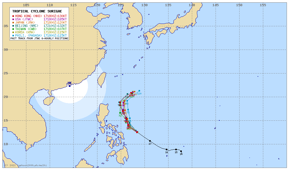
| Other Storm’s Meteorological Information |
|
| Information based on data collected by Typhoon2000 (T2k) shall not be taken as official data. Weather information broadcasted and distributed by PAGASA remains as official data. Typhoon2000 (T2k) shall not be responsible for the private use and reliance of its weather information. | |
Issued by: David Michael V. Padua for Typhoon2000 (T2K)
Typhoon2000 (T2K) Integrated Multi-Agency Tracks
 For more info: http://www.typhoon2000.ph/multi/?name=SURIGAE
PAGASA TROPICAL CYCLONE WIND SIGNAL
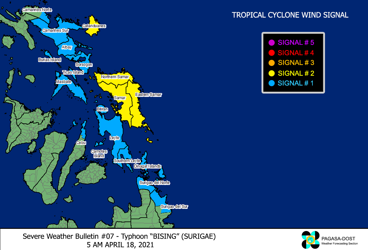
Image/Screenshot Source: DOST-PAGASA (https://pubfiles.pagasa.dost.gov.ph/tamss/weather/signals_bising.png)


