
SUPER TYPHOON BISING (SURIGAE) ADVISORY NO. 04Issued at: 7:00 PM PhT (11:00 GMT) Saturday, 17 April 2021
Next update: 7:00 AM PhT (23:00 GMT) Sunday, 18 April 2021 |
|
|---|---|
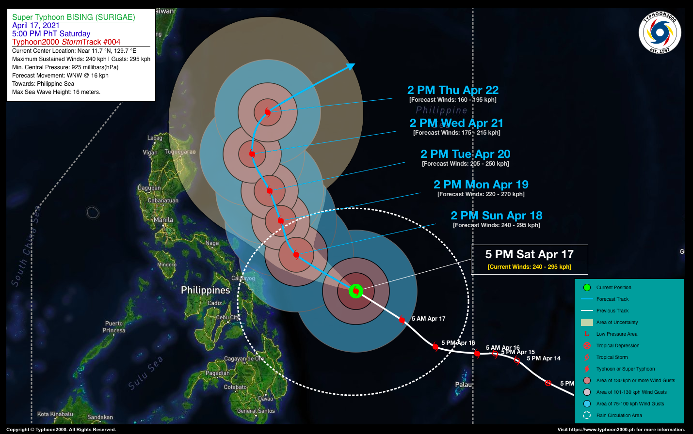
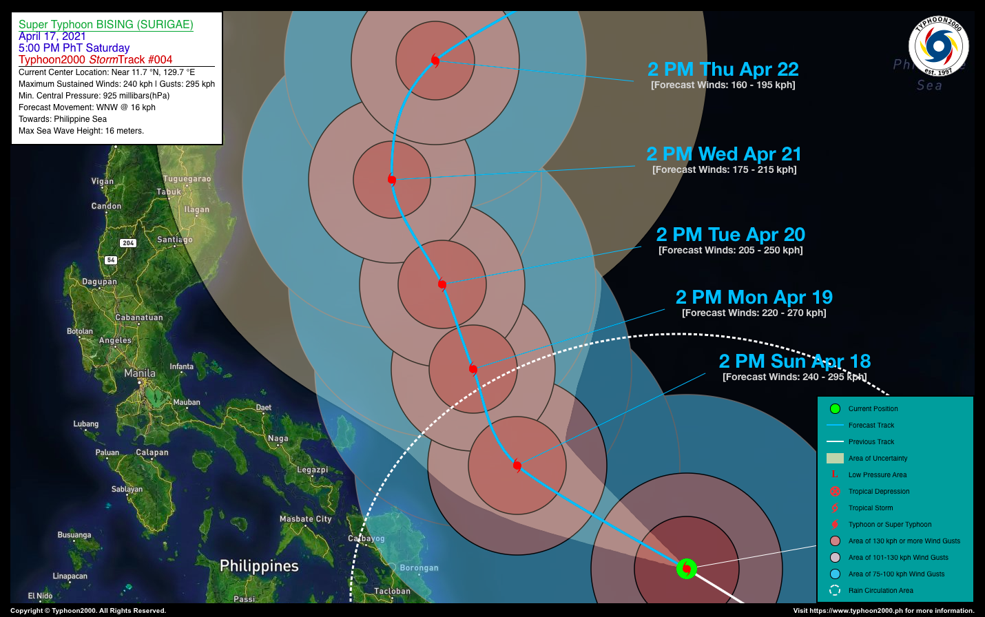
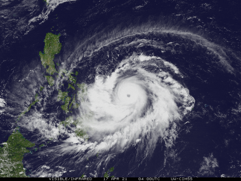
| Current Status & Outlook | BISING (SURIGAE) has reached Super Typhoon classification while accelerating more northwestward across the Philippine Sea during the past 12 hours. This typhoon is expected to bring occasional rains with severe thunderstorms and gusty winds across Samar and Bicol Provinces beginning tomorrow, Sunday through Monday evening (Apr 18-19).
24-hr Outlook: STY BISING (SURIGAE) is forecast to resume moving west-northwestward across the southwestern portion of the Central Philippine Sea at a decreased forward speed of 16 km/hr. This cyclone is forecast to maintain its Super Typhoon strength for the next 12 to 24 hours due to favorable oceanic and atmospheric conditions. |
| Where is BISING (SURIGAE)? | As of 5:00 PM PhT today, April 17…0900 GMT:
|
| How strong is it? | Maximum Sustained Winds (1-min avg): 240 kph near the center…Gustiness: 295 kph. |
| Past Movement (06 hrs) | Northwest @ 22 kph, across the Philippine Sea |
| Potential Philippine Landfall Area(s) |
|
| What Philippine areas will be directly affected? | Heavy to Extreme Rainfall (50 mm to >100 mm expected for 24 hrs):
Damaging Winds (gusts of more than 100 km/hr expected):
|
| Potential Storm Surge/Coastal Flooding Areas+ |
+Waves of 3 to 5 meters in height is expected in storm surge-prone areas, particularly in coastal areas on where the Tropical Cyclone is headed. Kindly visit the PAGASA Storm Surge Updates for more details. |
| 3-Day Forecast Outlook Summary** |
**Important Note: Please be reminded that the Forecast Outlook changes every 6 hours, and the Day 2 and 3 Forecast Track have an average error of 100 and 250 km respectively… while the wind speed forecast error, averages 35 km/hr per day. Therefore, a turn to the left or right of its future track and changes in its wind speed must be anticipated from time to time. |
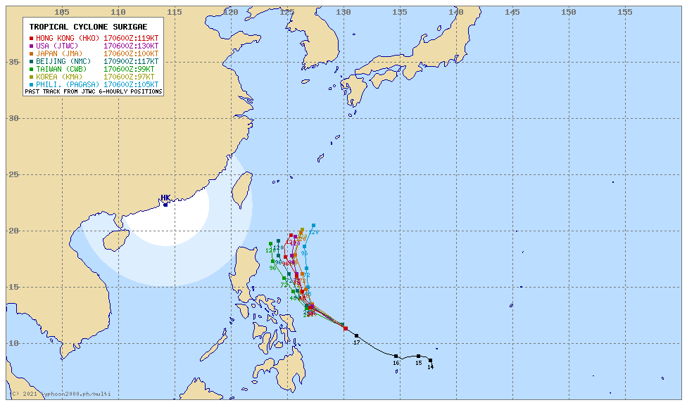
| Other Storm’s Meteorological Information |
|
| Information based on data collected by Typhoon2000 (T2k) shall not be taken as official data. Weather information broadcasted and distributed by PAGASA remains as official data. Typhoon2000 (T2k) shall not be responsible for the private use and reliance of its weather information. | |
Issued by: David Michael V. Padua for Typhoon2000 (T2K)
Typhoon2000 (T2K) Integrated Multi-Agency Tracks
 For more info: http://www.typhoon2000.ph/multi/?name=SURIGAE
PAGASA TROPICAL CYCLONE WIND SIGNAL
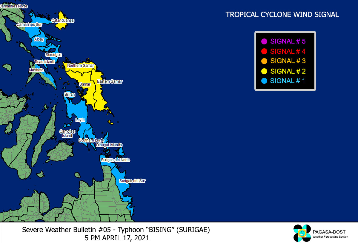
Image/Screenshot Source: DOST-PAGASA (https://pubfiles.pagasa.dost.gov.ph/tamss/weather/signals_bising.png)


