
TYPHOON AGHON (EWINIAR) ADVISORY NO. 10Issued at: 8:00 AM PhT (00:00 GMT) Tuesday, 28 May 2024
Next update: 8:00 PM PhT (12:00 GMT) Tuesday, 28 May 2024 |
|
|---|---|
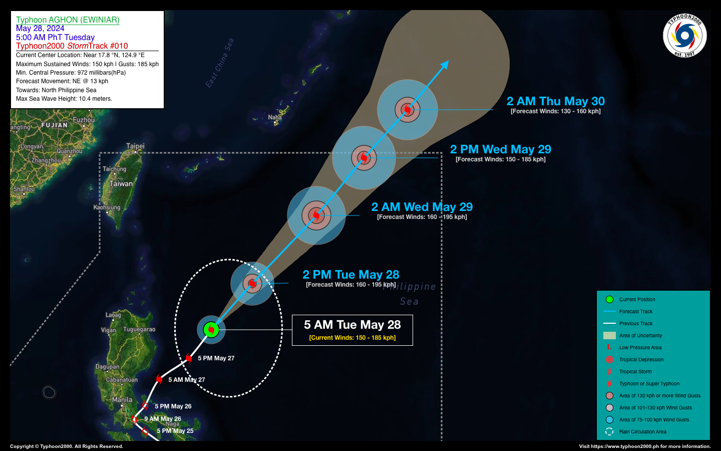
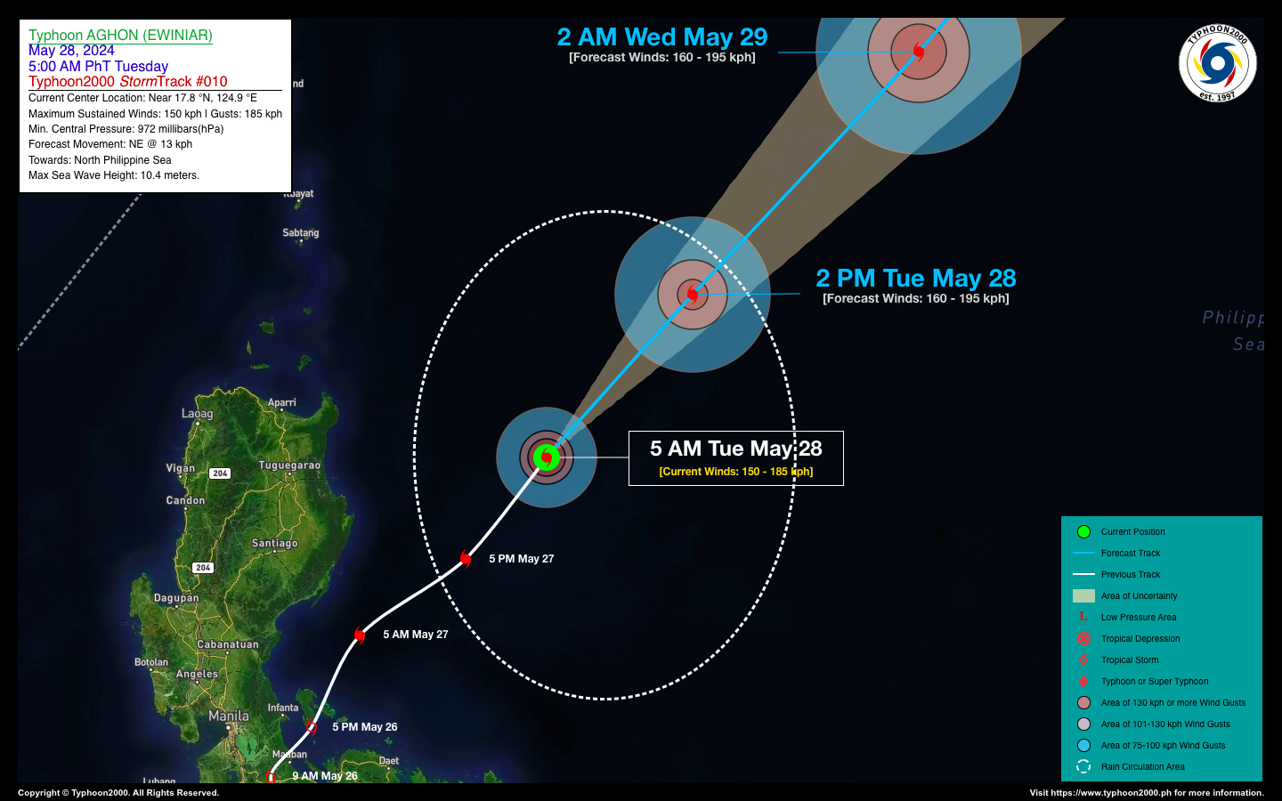
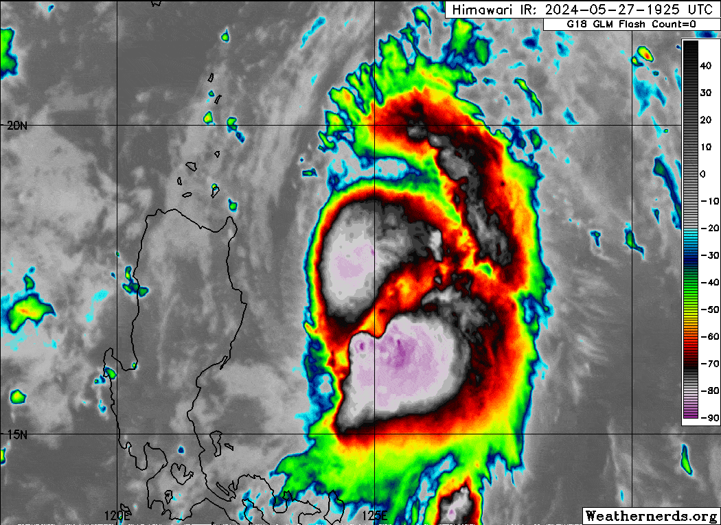
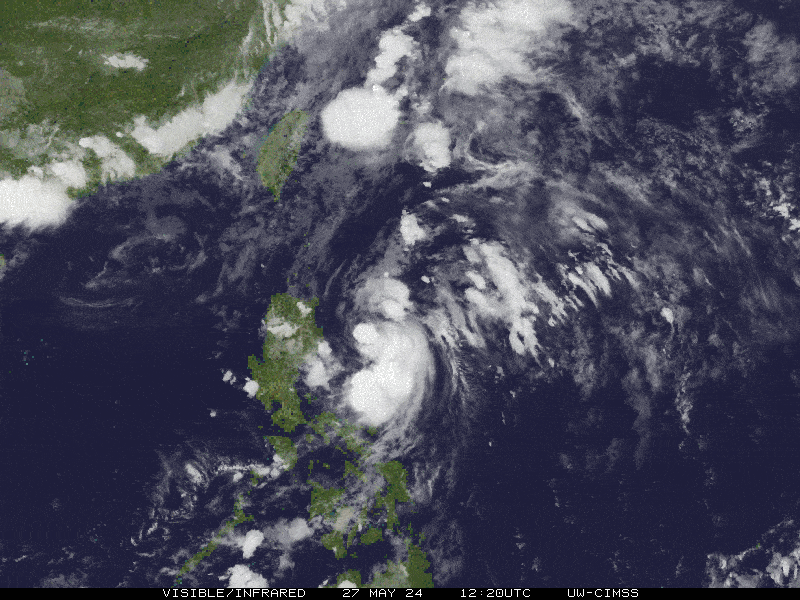
| Current Status & Outlook | Typhoon AGHON (EWINIAR) has weakened to a Category 1 storm. It’s slowly moving northeast across the North Philippine Sea and is expected to exit the Philippine Area of Responsibility (PAR) by tomorrow afternoon.
Good News: The typhoon’s circulation is no longer affecting the Philippines, and all PAGASA Tropical Cyclone Wind Signals have been lifted. However, caution is advised for those traveling on ships in the North Philippine Sea due to rough seas. 48-hr Outlook: AGHON is forecast to regain Category 2 strength with winds of 160 kph within the next 24 hours as it accelerates northeast. By Wednesday afternoon, the typhoon will exit the PAR and move towards the sea south of Japan. By Thursday morning, AGHON will begin to weaken and transition into an extratropical cyclone, traveling northeast at 40 kph. |
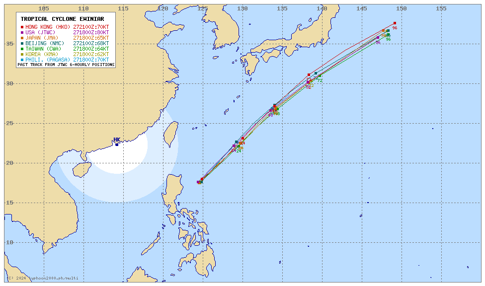
| Where is AGHON (EWINIAR)? | As of 5:00 AM PhT today, May 28…21:00 GMT:
|
| How strong is it? | Maximum Sustained Winds (1-min avg): 150 kph near the center…Gustiness: 185 kph. |
| Past Movement (06 hrs) | Northeast @ 13 kph, towards the North Philippine Sea. |
| Potential Philippine Major Landfall Area(s) |
|
| What Philippine areas will be directly affected? | Heavy to Extreme Rainfall (50 mm to >100 mm expected for 24 hrs):
Damaging Winds (gusts of more than 100 km/hr expected):
|
| Potential Storm Surge/Coastal Flooding Areas+ |
+Waves of 3 meters in height are expected in storm surge-prone areas, particularly in coastal areas where the Tropical Cyclone is headed. Kindly visit the PAGASA Storm Surge Updates for more details. |
| 2-Day Forecast Outlook Summary** |
**Important Note: Please be reminded that the Forecast Outlook changes every 6 hours, and the Day 2 and 3 Forecast Track have an average error of 100 and 250 km respectively… while the wind speed forecast error, averages 35 km/hr per day. Therefore, a turn to the left or right of its future track and changes in its wind speed must be anticipated from time to time. |
| Other Storm’s Meteorological Information |
|
| Disclaimer: Information based on data collected by Typhoon2000 (T2k) shall not be taken as official data. Weather information broadcasted and distributed by PAGASA remains as official data. Typhoon2000 (T2k) shall not be responsible for the private use and reliance of its weather information. | |
Issued by: David Michael V. Padua for Typhoon2000 (T2k)
Typhoon2000 (T2K) Integrated Multi-Agency Tracks
For more info visit: (http://www.typhoon2000.ph/multi/?name=EWINIAR)
PAGASA TROPICAL CYCLONE WIND SIGNAL
Now lifted.
Image/Screenshot Source: DOST-PAGASA (https://bagong.pagasa.dost.gov.ph/tropical-cyclone/severe-weather-bulletin)


