
TYPHOON AGHON (EWINIAR) ADVISORY NO. 08Issued at: 8:00 AM PhT (00:00 GMT) Monday, 27 May 2024
Next update: 8:00 PM PhT (12:00 GMT) Monday, 27 May 2024 |
|
|---|---|
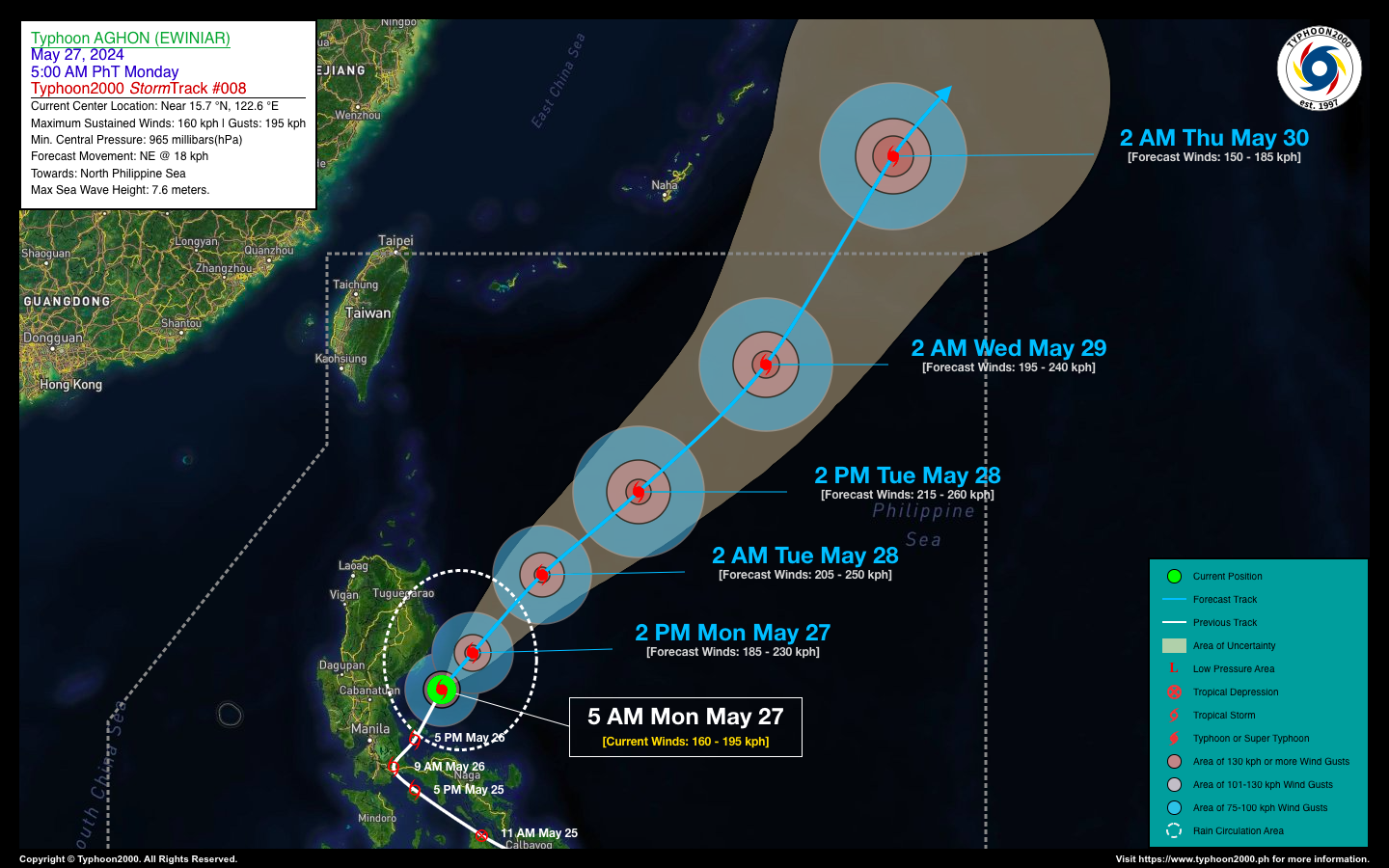
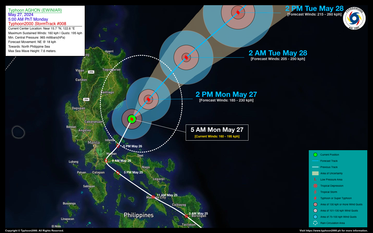
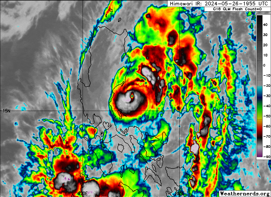
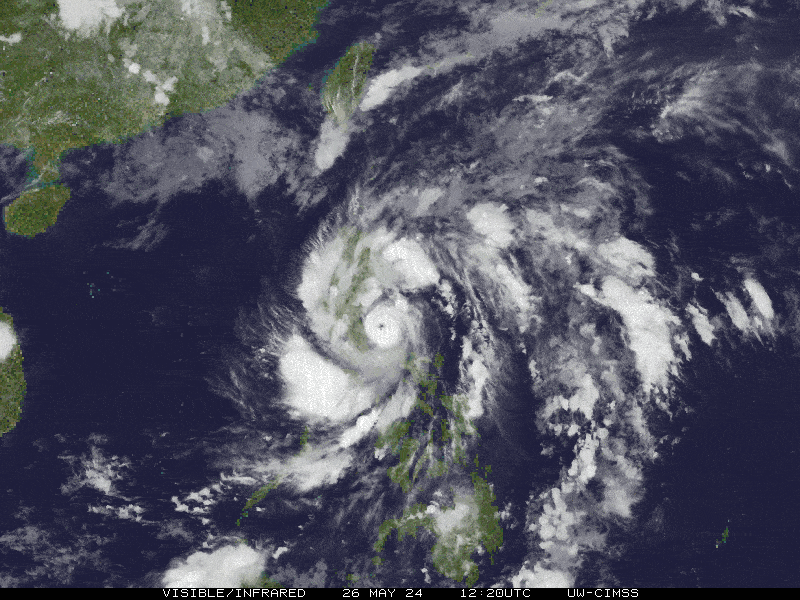
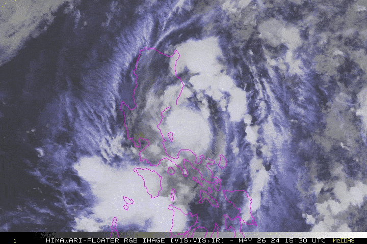
| Current Status & Outlook | AGHON (EWINIAR) has intensified rapidly into a small Category 2 Typhoon. While moving slowly northeastward across the Philippine Sea east of Aurora, it no longer poses a direct threat to the Philippines. However, high sea waves of 2 to 3 meters will persist along the typhoon’s circulation.
48-hr Outlook: Typhoon AGHON is expected to strengthen further as it travels over warm ocean waters (increased Oceanic Heat Content). It will accelerate northeastward across the North Philippine Sea by tomorrow morning. By Wednesday morning (May 29th), Aghon is forecast to continue moving northeast at 30 kph while slightly weakening as it approaches the northeastern edge of the Philippine Area of Responsibility (PAR). Even though Typhoon AGHON itself is moving away, its outer rainbands will bring cloudy skies with occasional light to moderate rain, including periods of heavy showers, squalls, and possibly even intense downpours and severe thunderstorms to the eastern parts of Central and Northern Luzon today. Residents in these areas are advised to take necessary precautions against potential flooding, landslides, and lahars. |
| Where is AGHON (EWINIAR)? | As of 5:00 AM PhT today, May 27…21:00 GMT:
|
| How strong is it? | Maximum Sustained Winds (1-min avg): 160 kph near the center…Gustiness: 195 kph. |
| Past Movement (06 hrs) | North-Northeast @ 10 kph, towards the North Philippine Sea. |
| Potential Philippine Major Landfall Area(s) |
|
| What Philippine areas will be directly affected? | Heavy to Extreme Rainfall (50 mm to >100 mm expected for 24 hrs):
Damaging Winds (gusts of more than 100 km/hr expected):
|
| Potential Storm Surge/Coastal Flooding Areas+ |
+Waves of 3 meters in height are expected in storm surge-prone areas, particularly in coastal areas where the Tropical Cyclone is headed. Kindly visit the PAGASA Storm Surge Updates for more details. |
| 3-Day Forecast Outlook Summary** |
**Important Note: Please be reminded that the Forecast Outlook changes every 6 hours, and the Day 2 and 3 Forecast Track have an average error of 100 and 250 km respectively… while the wind speed forecast error, averages 35 km/hr per day. Therefore, a turn to the left or right of its future track and changes in its wind speed must be anticipated from time to time. |
| Other Storm’s Meteorological Information |
|
| Disclaimer: Information based on data collected by Typhoon2000 (T2k) shall not be taken as official data. Weather information broadcasted and distributed by PAGASA remains as official data. Typhoon2000 (T2k) shall not be responsible for the private use and reliance of its weather information. | |
Issued by: David Michael V. Padua for Typhoon2000 (T2k)
Typhoon2000 (T2K) Integrated Multi-Agency Tracks
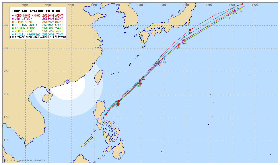
For more info visit: (http://www.typhoon2000.ph/multi/?name=EWINIAR)
PAGASA TROPICAL CYCLONE WIND SIGNAL
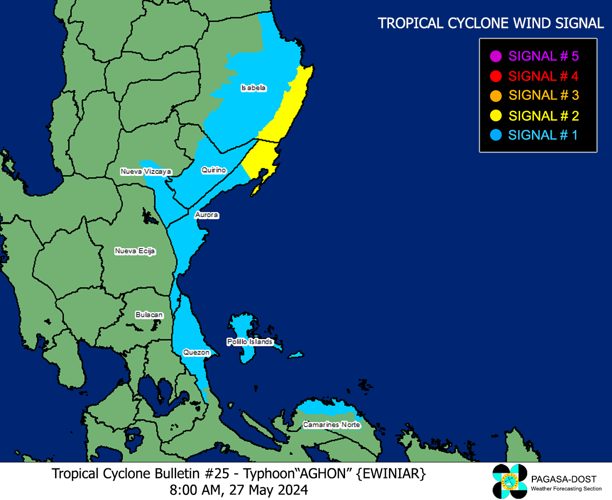
Image/Screenshot Source: DOST-PAGASA (https://bagong.pagasa.dost.gov.ph/tropical-cyclone/severe-weather-bulletin)


