
TROPICAL STORM AGHON (EWINIAR) ADVISORY NO. 06Issued at: 10:00 AM PhT (02:00 GMT) Sunday, 26 May 2024
Next update: 4:00 PM PhT (08:00 GMT) Sunday, 26 May 2024 |
|
|---|---|
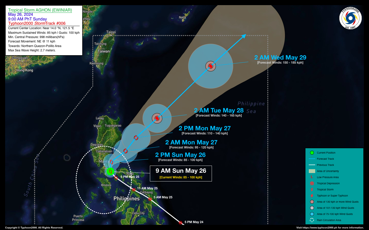
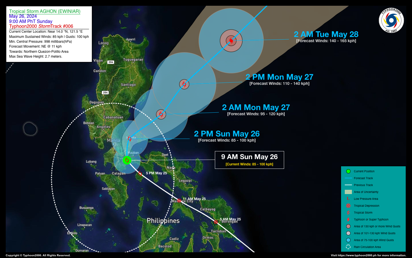
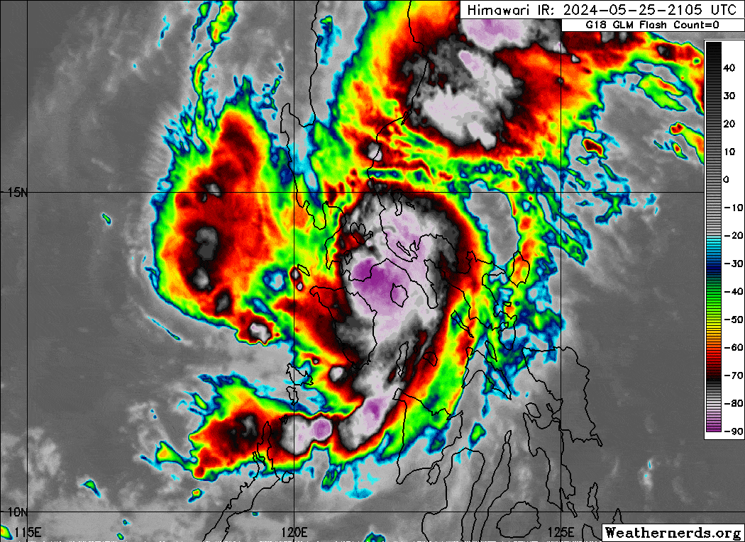
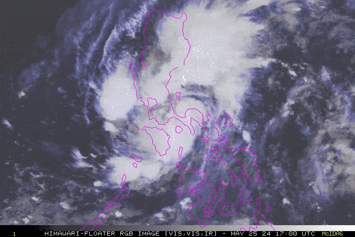
| Current Status & Outlook | Tropical Storm AGHON (01W) made landfall near Lucena City early this morning (around 5-6 AM) after intensifying overnight. For the past few hours, the storm has remained nearly stationary near Mount Banahaw in Quezon Province. Residents in this area should brace for continued strong winds, heavy to intense rainfall, and severe thunderstorms near the storm’s center. The Japan Meteorological Agency (JMA) has assigned the international name “EWINIAR” to this system.
48-hr Outlook: AGHON is expected to slowly move north-northeastward across Quezon. By later this afternoon, the storm will likely be near Infanta, Quezon. Later tonight, the center is forecast to emerge over Polillo Strait before passing over the Polillo Islands. As AGHON accelerates northeastward over the Philippine Sea on Monday morning, it will rapidly intensify into a Severe Tropical Storm (STS), moving further away from Luzon. By Tuesday morning, May 28th, AGHON is expected to reach typhoon strength with winds of 140 kph as it races across the North Philippine Sea towards the waters south of Japan. The circulation of TS AGHON and its Trough will continue to bring occasional moderate to heavy rain, gusty winds, with possible intense downpours and severe thunderstorms, across Southern and Central Luzon including Metro Manila, Mindoro, Romblon, Camarines Norte, and Marinduque today & tomorrow. Residents are advised to take all necessary precautions against floods, landslides, and lahars associated with this tropical cyclone. |
| Where is AGHON (EWINIAR)? | As of 9:00 AM PhT today, May 26…0100 GMT:
|
| How strong is it? | Maximum Sustained Winds (1-min avg): 85 kph near the center…Gustiness: 100 kph. |
| Past Movement (06 hrs) | Northwest @ 08 kph, towards Northern Quezon-Polillo Area. |
| Potential Philippine Major Landfall Area(s) |
|
| What Philippine areas will be directly affected? | Heavy to Extreme Rainfall (50 mm to >100 mm expected for 24 hrs):
Damaging Winds (gusts of more than 100 km/hr expected):
|
| Potential Storm Surge/Coastal Flooding Areas+ |
+Waves of 3 meters in height are expected in storm surge-prone areas, particularly in coastal areas where the Tropical Cyclone is headed. Kindly visit the PAGASA Storm Surge Updates for more details. |
| 3-Day Forecast Outlook Summary** |
**Important Note: Please be reminded that the Forecast Outlook changes every 6 hours, and the Day 2 and 3 Forecast Track have an average error of 100 and 250 km respectively… while the wind speed forecast error, averages 35 km/hr per day. Therefore, a turn to the left or right of its future track and changes in its wind speed must be anticipated from time to time. |
| Other Storm’s Meteorological Information |
|
| Disclaimer: Information based on data collected by Typhoon2000 (T2k) shall not be taken as official data. Weather information broadcasted and distributed by PAGASA remains as official data. Typhoon2000 (T2k) shall not be responsible for the private use and reliance of its weather information. | |
Issued by: David Michael V. Padua for Typhoon2000 (T2k)
Typhoon2000 (T2K) Integrated Multi-Agency Tracks
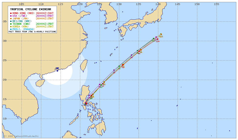
For more info visit: (http://www.typhoon2000.ph/multi/?name=EWINIAR)
PAGASA TROPICAL CYCLONE WIND SIGNAL
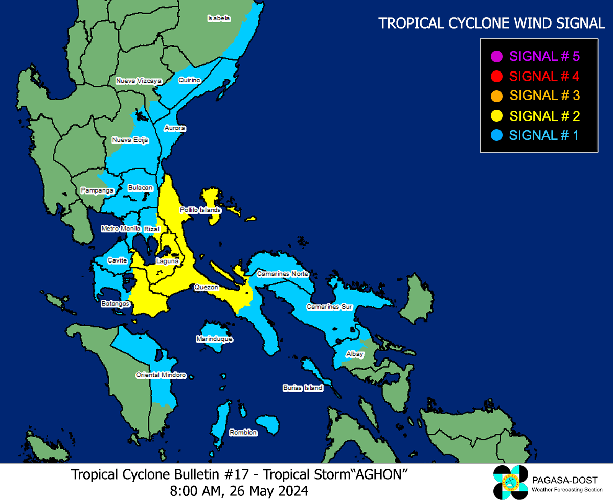
Image/Screenshot Source: DOST-PAGASA (https://bagong.pagasa.dost.gov.ph/tropical-cyclone/severe-weather-bulletin)


