
TROPICAL DEPRESSION AGHON (01W) ADVISORY NO. 05Issued at: 8:00 PM PhT (12:00 GMT) Saturday, 25 May 2024
Next update: 8:00 AM PhT (00:00 GMT) Sunday, 26 May 2024 |
|
|---|---|
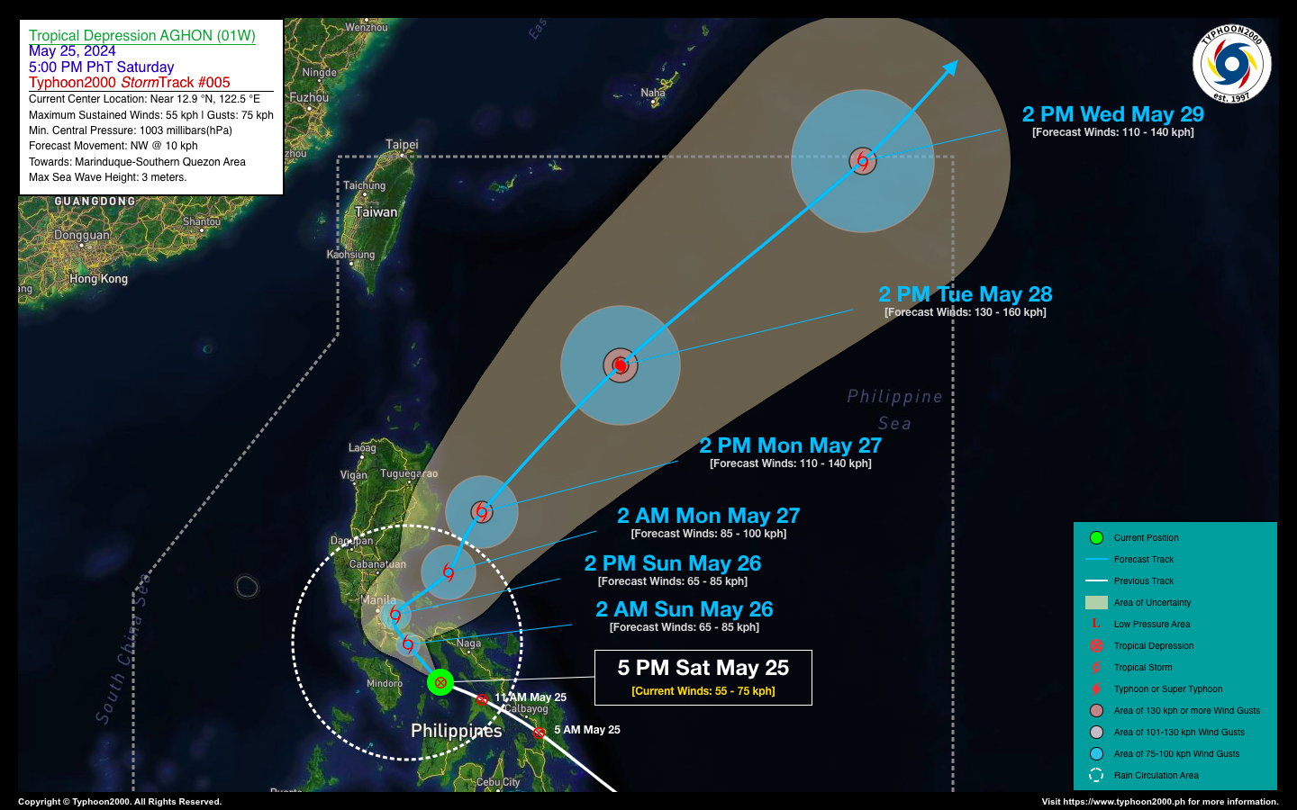
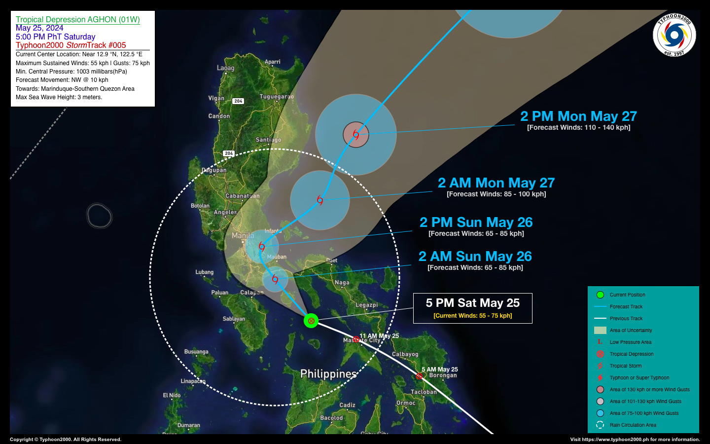
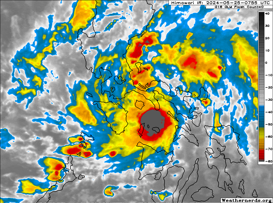
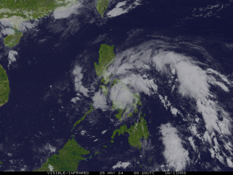
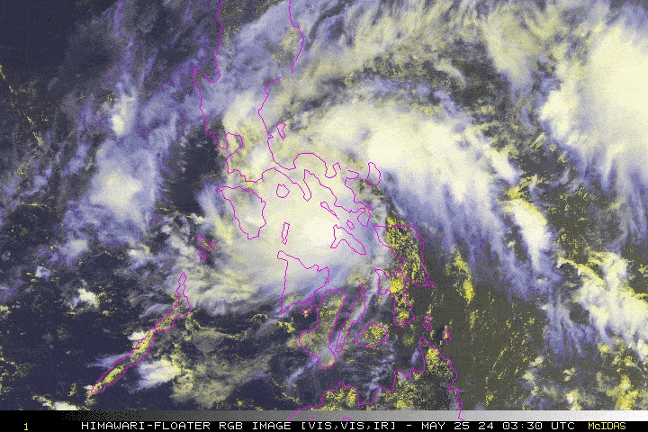
| Current Status & Outlook | Tropical Depression AGHON (01W) has maintained its strength as it approaches Marinduque and Southern Quezon. Its core will bring heavy to intense rainfall, gusty winds, and severe thunderstorms across the Southern Tagalog Provinces tonight and tomorrow. Residents in these areas are urged to take all necessary precautions as the depression approaches.
48-hr Outlook: AGHON is expected to become a tropical storm just before making landfall along the Lucena-Pagbilao area early tomorrow morning. It will then traverse the eastern side of Mount Banahaw and Tayabas, Quezon, moving slowly north-northwest around mid-morning tomorrow. By tomorrow afternoon, AGHON will cross Eastern Laguna, passing through the towns of Santa Cruz, Kalayaan, Paete, Pangil, Siniloan, and Santa Maria, before turning northeastward across Infanta, Quezon, late tomorrow afternoon. By tomorrow evening, the depression will emerge over Polillo Strait, passing over the Polillo Island Group, and will start to accelerate and intensify while traversing the Philippine Sea. On Monday afternoon (May 27), AGHON will be well over the Philippine Sea, accelerating further to the east of Isabela as a Severe Tropical Storm. The broad circulation of TD AGHON and its Trough will continue to bring occasional moderate to heavy rain, with possible intense downpours and severe thunderstorms, across Southern and Central Luzon including Metro Manila, Mindoro, Romblon, Camarines Norte, and Marinduque tonight & tomorrow. Residents are advised to take all necessary precautions against floods, landslides, and lahars associated with this tropical cyclone. |
| Where is AGHON (01W)? | As of 5:00 PM PhT today, May 25…0900 GMT:
|
| How strong is it? | Maximum Sustained Winds (1-min avg): 55 kph near the center…Gustiness: 75 kph. |
| Past Movement (06 hrs) | West-Northwest @ 20 kph, towards Marinduque-Southern Quezon Area. |
| Potential Philippine Major Landfall Area(s) |
|
| What Philippine areas will be directly affected? | Heavy to Extreme Rainfall (50 mm to >100 mm expected for 24 hrs):
Damaging Winds (gusts of more than 100 km/hr expected):
|
| Potential Storm Surge/Coastal Flooding Areas+ |
+Waves of 3 meters in height are expected in storm surge-prone areas, particularly in coastal areas where the Tropical Cyclone is headed. Kindly visit the PAGASA Storm Surge Updates for more details. |
| 3-Day Forecast Outlook Summary** |
**Important Note: Please be reminded that the Forecast Outlook changes every 6 hours, and the Day 2 and 3 Forecast Track have an average error of 100 and 250 km respectively… while the wind speed forecast error, averages 35 km/hr per day. Therefore, a turn to the left or right of its future track and changes in its wind speed must be anticipated from time to time. |
| Other Storm’s Meteorological Information |
|
| Disclaimer: Information based on data collected by Typhoon2000 (T2k) shall not be taken as official data. Weather information broadcasted and distributed by PAGASA remains as official data. Typhoon2000 (T2k) shall not be responsible for the private use and reliance of its weather information. | |
Issued by: David Michael V. Padua for Typhoon2000 (T2k)
Typhoon2000 (T2K) Integrated Multi-Agency Tracks
:: This section will be available once RSMC-JMA Upgrades this system into a Tropical Storm.
For more info visit: (http://www.typhoon2000.ph/multi/?name=)
PAGASA TROPICAL CYCLONE WIND SIGNAL
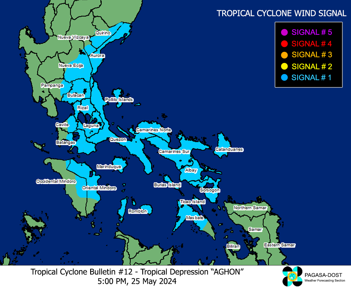
Image/Screenshot Source: DOST-PAGASA (https://bagong.pagasa.dost.gov.ph/tropical-cyclone/severe-weather-bulletin)


