
TROPICAL DEPRESSION AGHON (93W) ADVISORY NO. 01Issued at: 8:00 AM PhT (00:00 GMT) Friday, 24 May 2024
Next update: 8:00 PM PhT (12:00 GMT) Friday, 24 May 2024 |
|
|---|---|
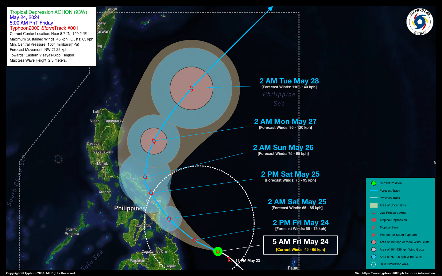
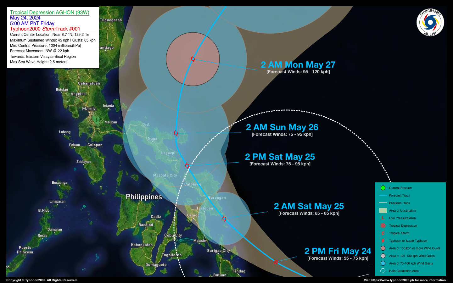
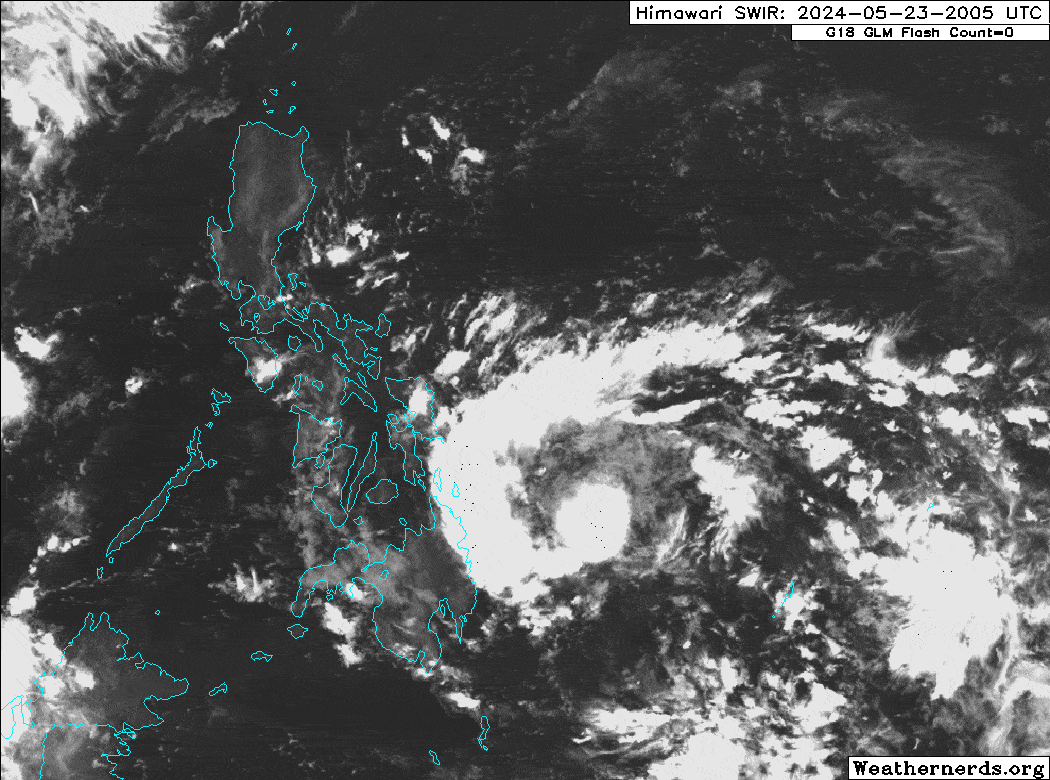
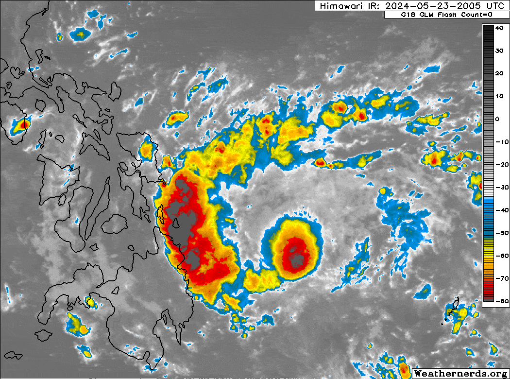
| Current Status & Outlook | Tropical Depression (TD) AGHON [93W] newly-formed over the South Philippine Sea, east of Surigao Del Sur, becomes the first Tropical Cyclone of 2024. This depression is expected to bring intense rainfall and thunderstorms with life-threatening floods and landslides upon its passage over Samar and Bicol Region within the next 24 to 48 hours. Residents are advised to take all necessary precautions on the arrival of this system.
48-hr Outlook: TD AGHON is forecast to become a Tropical Storm (TS) and make landfall over Eastern Samar tomorrow morning, and then traverse the area through noontime, then tomorrow afternoon it emerge over the coastal waters of Northern Samar and Eastern Sorsogon. AGHON will slow down slightly as it turns NNW making another landfall over Catanduanes during the early morning hours of Sunday (May 26). The forecast strength of this cyclone will be at minimal Tropical Storm (TS) during its passage over these areas or could even weaken to a TD due to land interaction. Meanwhile, TD AGHON’s circulation will bring moderate, heavy to intense rainfall with severe thunderstorms across Eastern Visayas and Eastern Mindanao today, extending across Bicol Region and Southern Quezon tomorrow. Again, please take all necessary precautions against floods and landslides including lahars that will be brought about by this tropical cyclone. |
| Where is AGHON (93W)? | As of 5:00 AM PhT today, May 24…2100 GMT:
|
| How strong is it? | Maximum Sustained Winds (1-min avg): 45 kph near the center…Gustiness: 65 kph. |
| Past Movement (06 hrs) | West-Northwest @ 24 kph, towards Eastern Visayas-Bicol Region Area. |
| Potential Philippine Major Landfall Area(s) |
|
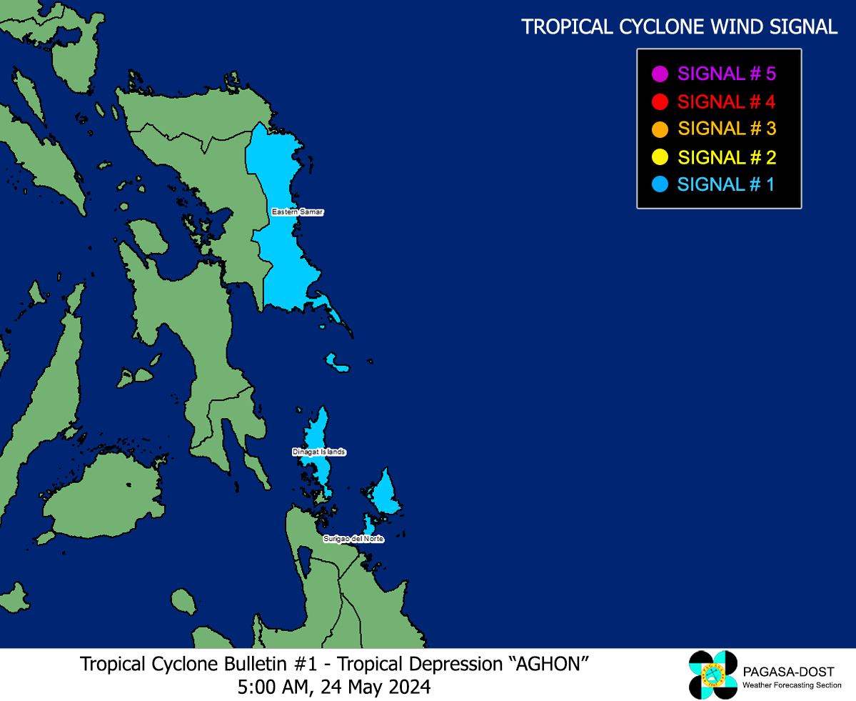
| What Philippine areas will be directly affected? | Heavy to Extreme Rainfall (50 mm to >100 mm expected for 24 hrs):
Damaging Winds (gusts of more than 100 km/hr expected):
|
| Potential Storm Surge/Coastal Flooding Areas+ |
+Waves of 3 meters in height are expected in storm surge-prone areas, particularly in coastal areas where the Tropical Cyclone is headed. Kindly visit the PAGASA Storm Surge Updates for more details. |
| 3-Day Forecast Outlook Summary** |
**Important Note: Please be reminded that the Forecast Outlook changes every 6 hours, and the Day 2 and 3 Forecast Track have an average error of 100 and 250 km respectively… while the wind speed forecast error, averages 35 km/hr per day. Therefore, a turn to the left or right of its future track and changes in its wind speed must be anticipated from time to time. |
| Other Storm’s Meteorological Information |
|
| Disclaimer: Information based on data collected by Typhoon2000 (T2k) shall not be taken as official data. Weather information broadcasted and distributed by PAGASA remains as official data. Typhoon2000 (T2k) shall not be responsible for the private use and reliance of its weather information. | |
Issued by: David Michael V. Padua for Typhoon2000 (T2k)
Typhoon2000 (T2K) Integrated Multi-Agency Tracks
:: This section will be available once RSMC-JMA Upgrades this system into a Tropical Storm.
For more info visit: (http://www.typhoon2000.ph/multi/?name=)
PAGASA TROPICAL CYCLONE WIND SIGNAL
Image/Screenshot Source: DOST-PAGASA (https://bagong.pagasa.dost.gov.ph/tropical-cyclone/severe-weather-bulletin)


